Ventersdorp Local Municipality

Last updated
Ventersdorp
Ventersdorp CoA.png
Map of the North West with Ventersdorp highlighted.svg
Location in the North West
Country South Africa
Province North West
District Dr Kenneth Kaunda
Seat Ventersdorp
Wards 6
Government
[1]
  Type Municipal council
  MayorNontetho Cilia Phoyane
Area
  Total3,764 km2 (1,453 sq mi)
Population
 (2011) [2]
  Total56,702
  Density15/km2 (39/sq mi)
Racial makeup (2011)
[2]
   Black African 90.1%
   Coloured 2.7%
   Indian/Asian 0.3%
   White 5.9%
First languages (2011)
[2]
   Tswana 75.0%
   Afrikaans 8.9%
   Xhosa 7.3%
   English 2.4%
  Other6.4%
Time zone UTC+2 (SAST)
Municipal codeNW401

Ventersdorp Local Municipality was a local municipality in Dr Kenneth Kaunda District Municipality, North West Province, South Africa. The seat of local municipality was Ventersdorp. After the municipal elections on 3 August 2016 it was merged into the larger JB Marks Local Municipality.

Contents

Main places

The 2001 census divided the municipality into the following main places: [3]

PlaceCodeArea (km2)PopulationMost spoken language
Schoonspruit Nature Reserve 61701 38.410-
Tshing 61702 2.1713,533 Tswana
Ventersdorp 61704 7.253,212 Afrikaans
Remainder of the municipality 61703 3,716.5126,329Tswana

Politics

The municipal council consisted of twelve members elected by mixed-member proportional representation. Six councillors were elected by first-past-the-post voting in six wards, while the remaining six were chosen from party lists so that the total number of party representatives was proportional to the number of votes received. In the election of 18 May 2011 the African National Congress (ANC) won a majority of ten seats on the council.

The following table shows the results of the election. [4] [5]

PartyVotesSeats
WardListTotal %WardListTotal
ANC 8,6128,79117,40380.96410
Democratic Alliance 1,5771,4703,04714.2022
COPE 4103317413.4000
Freedom Front Plus 1551683231.5000
Total10,75410,76021,514100.06612
Spoilt votes203192395

Related Research Articles

Mbombela Local Municipality Local municipality in Mpumalanga, South Africa

Mbombela Local Municipality is an administrative area in the Ehlanzeni District of Mpumalanga in South Africa. Mbombela is a siSwati name meaning "a lot of people in a small space".

Emnambithi-Ladysmith Local Municipality Local municipality in KwaZulu-Natal, South Africa

Emnambithi-Ladysmith Local Municipality was a municipality in the Uthukela District Municipality, KwaZulu-Natal, South Africa. It is accessible from the N3 and N11 national highways.

Albert Luthuli Local Municipality Local municipality in Mpumalanga, South Africa

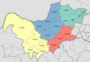
Albert Luthuli Local Municipality is a South African local municipality situated in the Gert Sibande District Municipality, Grass and Wetlands region, of Mpumalanga. It was named after Albert Luthuli. Carolina is the seat of the municipality.

Govan Mbeki Local Municipality Local municipality in Mpumalanga, South Africa

Govan Mbeki Local Municipality is a South African local municipality situated in the Gert Sibande District Municipality, of Mpumalanga. Secunda is the seat of the municipality.

Msukaligwa Local Municipality Local municipality in Mpumalanga, South Africa

Msukaligwa Local Municipality is a South African local municipality situated in the Gert Sibande District Municipality, of Mpumalanga. Ermelo is the seat of the municipality.

Dipaleseng Local Municipality Local municipality in Mpumalanga, South Africa

Dipaleseng Local Municipality is a South African local municipality situated in the Gert Sibande District Municipality, of Mpumalanga. Balfour is the seat of the municipality.

Mkhondo Local Municipality Local municipality in Mpumalanga, South Africa

Mkhondo Local Municipality, is a South African local municipality situated in the Gert Sibande District Municipality, of Mpumalanga. Piet Retief is the seat of the municipality.

Lephalale Local Municipality Local municipality in Limpopo, South Africa

Lephalale Local Municipality is located in the Waterberg District Municipality of Limpopo province, South Africa. The seat of Lephalale Local Municipality is Lephalale.

Mookgophong Local Municipality Local municipality in Limpopo, South Africa

Mookgophong Local Municipality was a municipality located in the Waterberg District Municipality of Limpopo province, South Africa. The seat of Mookgophong Local Municipality was Mookgophong.

Greater Letaba Local Municipality Local municipality in Limpopo, South Africa

Greater Letaba Local Municipality is located in the Mopani District Municipality of Limpopo province, South Africa. The seat of Greater Letaba Local Municipality is Modjadjiskloof.

Ba-Phalaborwa Local Municipality Local municipality in Limpopo, South Africa

Ba-Phalaborwa Local Municipality is located in the Mopani District Municipality of Limpopo province, South Africa. The seat of Ba-Phalaborwa Local Municipality is Phalaborwa.

Fetakgomo Local Municipality Local municipality in Limpopo, South Africa

Fetakgomo Local Municipality was located in the Sekhukhune District Municipality of Limpopo province, South Africa. The seat of Fetakgomo Local Municipality was Apel. The local municipality was one of the four to have passed the 2009-10 audit by the Auditor-General of South Africa, who deemed it to have a clean administration. In 2016 it was merged with Greater Tubatse Local Municipality to form the Fetakgomo Tubatse Local Municipality.

Ephraim Mogale Local Municipality Local municipality in Limpopo, South Africa

Ephraim Mogale Local Municipality is located in the Sekhukhune District Municipality of Limpopo province, South Africa. The seat of Ephraim Mogale Local Municipality is Marble Hall.

Naledi Local Municipality, Free State Disestablshed local municipality in Free State, South Africa

Naledi Local Municipality was a local municipality in the Free State province in South Africa. On 3 August 2016 it was disestablished and merged into the Mangaung Metropolitan Municipality. The name Naledi is a Sesotho word meaning "a star". The principal towns in the area of the disestablished municipality are Dewetsdorp and Wepener.

Umzimvubu Local Municipality Local municipality in Eastern Cape, South Africa

Umzimvubu Local Municipality is an administrative area in the Alfred Nzo District of Eastern Cape in South Africa.

Mhlontlo Local Municipality Local municipality in Eastern Cape, South Africa

Mhlontlo Local Municipality is an administrative area in the OR Tambo District of Eastern Cape in South Africa.

Lukhanji Local Municipality Former local municipality in Eastern Cape, South Africa

Lukhanji Local Municipality was an administrative area in the Chris Hani District of the Eastern Cape in South Africa. Lukhanji is a Xhosa name for the mountain that runs from the eastern side of Queenstown to the western side. After municipal elections on 3 August 2016 it was merged into the larger Enoch Mgijima Local Municipality.

Raymond Mhlaba Local Municipality Local municipality in Eastern Cape, South Africa

Raymond Mhlaba Local Municipality is a local municipality of South Africa. It was established after the August 2016 local elections by the merging of Nkonkobe and Nxuba local municipalities.

Ray Nkonyeni Local Municipality Local municipality in KwaZulu-Natal, South Africa

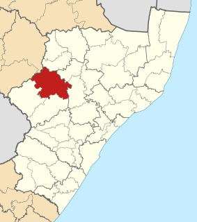
Ray Nkonyeni Local Municipality is a local municipality of South Africa. It is located on the south coast of KwaZulu-Natal. It was established after the August 2016 local elections by the merging of Ezinqoleni and Hibiscus Coast local municipalities.

Alfred Duma Local Municipality Local municipality in KwaZulu-Natal, South Africa

Alfred Duma Local Municipality is a local municipality of South Africa. It was established for the August 2016 local elections by the merging of Emnambithi/Ladysmith and Indaka local municipalities.

References

  1. "Contact list: Executive Mayors". Government Communication & Information System. Archived from the original on 14 July 2010. Retrieved 22 February 2012.
  2. 1 2 3 "Statistics by place". Statistics South Africa. Retrieved 27 September 2015.
  3. Lookup Tables - Statistics South Africa
  4. "Results Summary – All Ballots: Ventersdorp" (PDF). Independent Electoral Commission. Retrieved 3 December 2013.
  5. "Seat Calculation Detail: Ventersdorp" (PDF). Independent Electoral Commission. Retrieved 3 December 2013.

Coordinates: 26°20′S26°55′E / 26.333°S 26.917°E / -26.333; 26.917