Villa General Roca

Last updated
Villa General Roca
Municipality and village
Argentina location map.svg
Red pog.svg
Villa General Roca
Location in Argentina
Coordinates: 32°39′S66°28′W / 32.650°S 66.467°W / -32.650; -66.467
CountryFlag of Argentina.svg  Argentina
Province San Luis
Department Belgrano
Government
  MayorDominga Cristina Torres
Elevation
631 m (2,070 ft)
Population
 (2010)
  Total162
Postal code
D5703

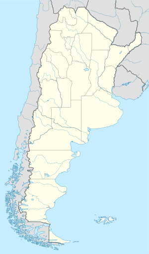
Villa General Roca is a village and municipality in San Luis Province in central Argentina. [1]
Related Research Articles

Broadwey is a former village in the northern suburbs of Weymouth, Dorset, England. It lies on the B3159 road. In 2001 Broadwey and Upwey ward had a population of 4,349. St Nicholas' Church serves the suburb.

Rafael Bustillo Province Province in Potosí Department, Bolivia

Rafael Bustillo is a province in the Bolivian Potosí Department. Its name honors the Bolivian diplomat and foreign secretary Rafael Bustillo. The capital of the province is Uncía with a population of 5,709 in the year 2001, the largest town is Llallagua with 20,065 inhabitants.

Supía, Caldas Municipality and town in Caldas Department, Colombia

Supía is a town and municipality in the Colombian Department of Caldas.

HMS <i>Subtle</i> (P251) submarine

HMS Subtle was a S-class submarine of the third batch built for the Royal Navy during World War II. She survived the war and was scrapped in 1959.

Moraleja del Vino is a municipality located in the province of Zamora, Castile and León, Spain. According to the 2004 census (INE), the municipality has a population of 1,315 inhabitants.

Parczowce Village in Podlaskie Voivodeship, Poland

Parczowce is a village in the administrative district of Gmina Kuźnica, within Sokółka County, Podlaskie Voivodeship, in north-eastern Poland, close to the border with Belarus. It lies approximately 5 kilometres (3 mi) south of Kuźnica, 13 km (8 mi) north-east of Sokółka, and 51 km (32 mi) north-east of the regional capital Białystok.

Żelazkowo, Greater Poland Voivodeship Village in Greater Poland Voivodeship, Poland

Żelazkowo is a village in the administrative district of Gmina Niechanowo, within Gniezno County, Greater Poland Voivodeship, in west-central Poland. It lies approximately 3 kilometres (2 mi) west of Niechanowo, 9 km (6 mi) south-east of Gniezno, and 51 km (32 mi) east of the regional capital Poznań.

Varbóc is a village in Borsod-Abaúj-Zemplén County in northeastern Hungary.

Bucher Glacier glacier in Antarctica

Bucher Glacier is a small glacier draining the west slopes of Rudozem Heights and flowing to Bourgeois Fjord just north of Bottrill Head on the German Peninsula, Fallières Coast on the west side of Graham Land, Antarctica. It was named by the UK Antarctic Place-Names Committee in 1958 for Edwin Bucher, Swiss glaciologist and author of many publications on snow and avalanches.

The Capella Rocks form a low, rocky ridge composed of several nunataks, located near the head of Bertram Glacier, 2 nautical miles (4 km) northeast of the Auriga Nunataks, in Palmer Land. They were named by the UK Antarctic Place-Names Committee after the star Capella in the constellation of Auriga.

Nobile Glacier is a glacier flowing into the southeast part of Recess Cove, Charlotte Bay, on the west coast of Graham Land. Charted by the Belgian Antarctic Expedition under Gerlache, 1897-99. it was photographed from the air by FIDASE and surveyed from the ground by Falkland Islands Dependencies Survey from Portal Point, 1956-58.

Pippin Peaks mountain in Antarctica

Pippin Peaks is an east-west line of several Antarctic peaks ranging in height from 880 m to 1,160 m and formed of white or pink granite. The feature is situated in the southern Aristotle Mountains, at the west end of Stubb Glacier where it forms a part of the glacier's north wall, and is connected to Mount Sara Teodora to the west-southwest.

Gibbs Glacier is a glacier, 15 nautical miles (28 km) long, flowing southeast into the northern part of Mercator Ice Piedmont on the east side of the Antarctic Peninsula. This feature together with Neny Glacier, which flows northwest, occupy a transverse depression between Mercator Ice Piedmont and Neny Fjord on the west side of the Antarctic Peninsula. Gibbs Glacier was photographed from the air and first mapped by the United States Antarctic Service, 1939–41, and the Ronne Antarctic Research Expedition, 1947–48. It was named by the UK Antarctic Place-Names Committee for Peter M. Gibbs of the Falkland Islands Dependencies Survey, a surveyor at Horseshoe Island, 1957, and leader at Stonington Island, 1958, who was responsible for the first ground survey of the glacier.

Gould Glacier is a glacier, 12 miles (19 km) long, on the east coast of Graham Land, Antarctica, flowing south-east into Mill Inlet, to the west of Aagaard Glacier. It was first surveyed by the Falklands Islands Dependencies Survey in 1946–47, and named "East Gould Glacier". Together with "West Gould Glacier" it was reported to fill a transverse depression across Graham Land, but further survey in 1957 showed that there is no close topographical alignment between the two. The name Gould Glacier, after Rupert T. Gould, a British polar historian and cartographer, is now only applied to this glacier, and the west glacier is now called Erskine Glacier.

Old Furnace Wildlife Area is a state wildlife area located in Sussex County, Delaware, just to the east of the town of Seaford, Delaware. It is made up of four land tracts totalling 2,237 acres (905 ha), it is managed by Delaware Department of Natural Resources and Environmental Control (DNREC), Division of Fish and Wildlife.

References

Coordinates: 32°39′S66°28′W / 32.650°S 66.467°W / -32.650; -66.467