Vils, Tyrol

Last updated
Vils
Vils Burgen.jpg
AUT Vils COA.png
Austria adm location map.svg
Red pog.svg
Vils
Location within Austria
Coordinates: 47°32′58″N10°37′48″E / 47.54944°N 10.63000°E / 47.54944; 10.63000
Country Austria
State Tyrol
District Reutte
Government
   Mayor Reinhard Walk
Area
[1]
  Total30.75 km2 (11.87 sq mi)
Elevation
826 m (2,710 ft)
Population
 (2018-01-01) [2]
  Total1,535
  Density50/km2 (130/sq mi)
Time zone UTC+1 (CET)
  Summer (DST) UTC+2 (CEST)
Postal code
6682
Area code +43 5677
Vehicle registration RE
Website www.vils.at

Vils is a town in the district of Reutte in the Austrian state of Tyrol. It has a long, rich history of ten or more generations of excellent luthiers. Most prominent among those of the Rief (or Ruef) family is Dominicus Rief. Examples of his work are in the museum there.

Geography

Vils lies on the German border with Bavaria. Shortly after passing through the town, the Vils River flows into the Lech.

Related Research Articles

<span class="mw-page-title-main">Horn, Austria</span> Place in Lower Austria, Austria

Horn is a small town in the Waldviertel in Lower Austria, Austria and the capital of the district of the same name.

<span class="mw-page-title-main">Schwertberg</span> Place in Upper Austria, Austria

Schwertberg is a market town in the district of Perg in the Austrian state of Upper Austria.

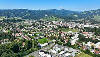
Deutschlandsberg is a town in Deutschlandsberg district of Styria, Austria. It is located in southern Austria, near the border with Slovenia. It is approximately 35 km from Graz. Popular tourist attractions include the Deutschlandsberg Castle.

<span class="mw-page-title-main">Satteins</span> Place in Vorarlberg, Austria

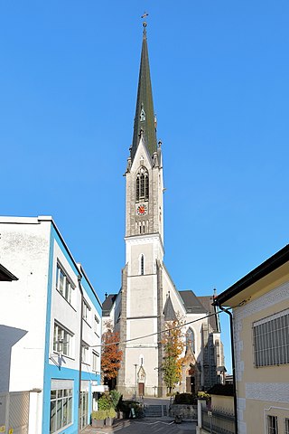
Satteins is a town in the Austrian state of Vorarlberg.

<span class="mw-page-title-main">Parndorf</span> Place in Burgenland, Austria

Parndorf is a town in the district of Neusiedl am See in the Austrian state of Burgenland. Its original ancient name Perun is derived from the Slavic deity Perun.

<span class="mw-page-title-main">Nenzing</span> Place in Vorarlberg, Austria

Nenzing is a market town in the district of Bludenz in the Austrian state of Vorarlberg with a population of 6.225 (2022).

<span class="mw-page-title-main">Marchegg</span> Place in Lower Austria, Austria

Marchegg is a town in the district of Gänserndorf in the Austrian state of Lower Austria at the Slovak border formed by the Morava River. The town is connected to Vysoká pri Morave via a bike bridge. The Marchegg castle is located in the town.

<span class="mw-page-title-main">Zistersdorf</span> Place in Lower Austria, Austria

Zistersdorf is a town in the district of Gänserndorf in the Austrian state of Lower Austria.

<span class="mw-page-title-main">Drosendorf-Zissersdorf</span> Place in Lower Austria, Austria

Drosendorf-Zissersdorf is a town in the district of Horn in Lower Austria, Austria.

<span class="mw-page-title-main">Rosenburg-Mold</span> Place in Lower Austria, Austria

Rosenburg-Mold is a town in the district of Horn in Lower Austria, Austria. The Renaissance castle Rosenburg is located in the town.

<span class="mw-page-title-main">Schönbühel-Aggsbach</span> Place in Lower Austria, Austria

Schönbühel-Aggsbach is a town in the district of Melk in the Austrian state of Lower Austria.

<span class="mw-page-title-main">Gaweinstal</span> Place in Lower Austria, Austria

Gaweinstal is a town in the district of Mistelbach in the Austrian state of Lower Austria.

<span class="mw-page-title-main">Poysdorf</span> Place in Lower Austria, Austria

Poysdorf is a town in the district of Mistelbach in the Austrian state of Lower Austria.

<span class="mw-page-title-main">Sankt Egyden am Steinfeld</span> Place in Lower Austria, Austria

Sankt Egyden am Steinfeld is a town in the district of Neunkirchen in the Austrian state of Lower Austria.

<span class="mw-page-title-main">Ternitz</span> Place in Lower Austria, Austria

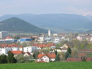
Ternitz is a town and municipality in the district of Neunkirchen in the Austrian state of Lower Austria, situated at the confluence of the Sierning stream and the River Schwarza, at the western end of the Steinfeld plain. It is divided in the following parts, called Katastralgemeinden: Dunkelstein, Flatz, Holzweg, Mahrersdorf, Pottschach, Putzmannsdorf, Raglitz, Rohrbach am Steinfelde, St. Johann am Steinfelde and Sieding.

<span class="mw-page-title-main">Götzens</span> Place in Tyrol, Austria

Götzens is a community in the district of Innsbruck-Land in Tyrol and lies on a terrace of the highlands above the capital. The nearest neighbouring villages are Axams and Birgitz in the west, with the towns of Mutters and Natters also nearby. The village was founded in 1869.

<span class="mw-page-title-main">Grieskirchen</span> Place in Upper Austria, Austria

Grieskirchen is a town in Austria. It is capital of the Grieskirchen district of Upper Austria, in the Trattnachtal valley.

<span class="mw-page-title-main">Tannheim, Tyrol</span> Place in Tyrol, Austria

Tannheim is a municipality in the district of Reutte in the Austrian state of Tyrol.

<span class="mw-page-title-main">Schwanenstadt</span> Place in Upper Austria, Austria

Schwanenstadt is a town in the district of Vöcklabruck in the Austrian state of Upper Austria.

<span class="mw-page-title-main">Vöcklamarkt</span> Place in Upper Austria, Austria

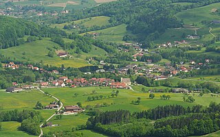
Vöcklamarkt is a municipality in the district of Vöcklabruck in the Austrian state of Upper Austria.

References

  1. "Dauersiedlungsraum der Gemeinden Politischen Bezirke und Bundesländer - Gebietsstand 1.1.2018". Statistics Austria. Retrieved 10 March 2019.
  2. "Einwohnerzahl 1.1.2018 nach Gemeinden mit Status, Gebietsstand 1.1.2018". Statistics Austria. Retrieved 9 March 2019.