Balsall Heath is an inner-city area of Birmingham, West Midlands, England. It has a diverse cultural mix of people and is the location of the Balti Triangle.

Moseley is a suburb of south Birmingham, England, three miles south of the city centre.
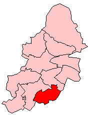
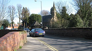
Moseley and Kings Heath is a ward within the constituency of Hall Green, covering the greater part of the Moseley and Kings Heath areas of Birmingham, England.

The River Cole is a 25-mile-long (40-kilometre) river in the English Midlands. It rises on the lower slopes of Forhill, one of the south-western ramparts of the Birmingham Plateau, at Red Hill and flows south before flowing largely north-east across the plateau to enter the River Blythe below Coleshill, near Ladywalk, shortly before the Blythe meets the Tame. This then joins the Trent, whose waters reach the North Sea via the Humber Estuary. Its source is very near the main watershed of Midland England: tributaries are few and very short except in the lower reaches, so the Cole is only a small stream.
Yardley is an area in east Birmingham, in the county of the West Midlands, England. It is also a council constituency, managed by its own district committee. Historically it lay within Worcestershire.
Hall Green is an affluent area in southeast Birmingham, England, synonymous with the B28 postcode. It is also a council constituency of Birmingham City Council, managed by its own district committee. Historically it lay within the county of Worcestershire. The 2001 Population Census found that there were 25,921 people living in Hall Green with a population density of 4,867 people per km2, this compares with 3,649 people per km2 for Birmingham.

Sarehole is an area in Hall Green, Birmingham, England. Historically in Worcestershire, it was a small hamlet in the larger parish, and manor, of Yardley, which was transferred to Birmingham in 1911. Birmingham was classed as part of Warwickshire until 1974, and since then has been part of the West Midlands.

West Heath is a residential area of Birmingham, England on the boundary with Worcestershire. Forming the larger part of the ward of Longbridge And West Heath it is situated between Kings Norton, Northfield, Longbridge and Cofton Hackett and lies on traditional heathland formed in the 13th century as part of the Kings Norton manorial lands, and was historically in Worcestershire.

Moseley Bog and Joy's Wood Local Nature Reserve, formerly The Dell, is a Local Nature Reserve in the Moseley area of Birmingham, England, with an area of about 12 ha. Along with the nearby Sarehole Mill, and a number of other sites, it forms part of the Shire Country Park.

The Shire Country Park is a country park in the south of Birmingham, England, taking its name from Tolkien's The Shire.

New Hall Valley Country Park is a country park located in New Hall Valley between Walmley, Wylde Green and Pype Hayes in the Sutton Coldfield area of north Birmingham. It is the first new country park in the UK for over a decade. The park is split into "phases".

Wonersh is a village and civil parish in the Waverley district of Surrey, England and Surrey Hills Area of Outstanding Natural Beauty. Wonersh contains three Conservation Areas and spans an area three to six miles SSE of Guildford.

King's Norton and Northfield Urban District was a local government administrative district in north Worcestershire, England, from 1898 until 1911. Much of its area was afterwards absorbed into the neighbouring Borough of Birmingham, under the Greater Birmingham Scheme, and now constitutes most of the city's southern and southwestern suburban environs.
Greet is a historical area in south Birmingham, England, around modern Sparkhill.

Kings Heath is a suburb of south Birmingham, England, four miles south of the city centre. Historically in Worcestershire, it is the next suburb south from Moseley on the A435 Alcester Road. Since 2018 it has been part of the Brandwood and Kings Heath Ward.

William de Lacy Aherne FRIBA was an English architect, notable for designing many Arts and Crafts houses in the Moseley area of Birmingham.
Christ Church, Yardley Wood is a Grade II listed parish church in the Church of England in Birmingham.

The St Agnes Moseley Conservation Area is in Moseley, Birmingham.