Wake Island Airfield

Last updated
Wake Island Airfield
Wake Island in  United States Minor Outlying Islands
C-17 Globemaster III at Wake Island Airfield.jpg
A C-17A Globemaster III of the 15th Wing sits on the flight line at Wake Island Airfield in January 2008.
Pacific Air Forces.png
Pacific Ocean laea location map.svg
Red pog.svg
Wake Island
Location in the Pacific Ocean
Coordinates 19°16′57″N166°38′12″E / 19.28250°N 166.63667°E / 19.28250; 166.63667
TypeMilitary (United States Air Force) airfield
Area2,600 acres (1,100 ha)
Site information
Owner Department of Defense
Operator US Air Force
Controlled by Pacific Air Forces (PACAF)
ConditionOperational
Site history
Built1935 (1935)
In use1935 – present
Battles/wars Battle of Wake Island (1941)
Garrison information
Garrison Pacific Air Forces Regional Support Center
Airfield information
Identifiers IATA: AWK, ICAO: PWAK, FAA LID: AWK, WMO: 91246
Elevation7 metres (23 ft) AMSL
Runways
Direction Length and surface
10/283,000.4 metres (9,844 ft)  Asphalt

Wake Island Airfield( IATA : AWK, ICAO : PWAK, FAA LID : AWK) is a military air base located on Wake Island, which is known for the Battle of Wake Island during World War II. It is owned by the U.S. Air Force and operated by the 611th Air Support Group. The runway can be used for emergency landings by commercial jetliners flying transpacific routes and has been used in the past by airlines operating jet, turboprop, and prop aircraft on scheduled flights.

Contents

History

Seaplane base

The first intention to build an air base surfaced in 1935, when Pan American World Airways (PAA) selected Wake Island as an intermediate support base for their seaplane routes to the Far East, especially the Philippines. A year prior, jurisdiction over Wake Island was passed to the Navy Department, which cooperated with PAA in updating topographical surveys, due to the potential military value of having a suitable mid-Pacific air base. It was a key element in the first South Pacific air ferry route to be used in flying aircraft from the U.S. to the Philippines. With the war, that route through the Japanese administered islands of the central Pacific was not possible, and Wake, along with the next stop, Guam, were lost, forcing the development of the route skirting Japanese held areas. [1]

Between 5 and 29 May 1935, Pan American's air base construction vessel, North Haven, landed supplies and equipment on Wilkes Islet for eventual rehandling to Peale Islet which, because of its more suitable soil and geology, had been selected as the site for the PAA seaplane base. By the time of North Haven's return to Wake, after a month's voyage westward to Manila, the project was well underway, and, three months later, on 9 August 1935, a Pan American Sikorsky S-42 flying boat made the first aerial landing at the atoll.

From 1935 until 1940, when two typhoons swept Wake with resultant extensive damage to the now elaborately developed Pan American facilities, development and use of the base were steady but uneventful. A hotel was built, farm animals imported, and hydroponic truck farming commenced.

The seaplane base on Peale Island was too limited to support realistic military activity on the atoll, thus supporting plans for developing a full-scale military air base with a runway for land-based aircraft. On 26 December 1940, implementing the Hepburn Board's recommendations, a pioneer party of 80 men and 2,000 short tons (1,800 t) of equipment sailed for Wake Island from Oahu. This advanced detachment established a naval air station on Wake Island. Construction plans included a runway to be used by F4F Wildcat airplanes and commercial airliners of greater size, which could not land on water. Support craft arrived at Wake on 9 January 1941, laid to off Wilkes Islet, and the next day commenced landing naval supplies and advance base equipment for the development of the base. The company contracted to build the base was Morrison-Knudsen Co. (later acquired by Washington Group International) which, together with seven other companies, built many of the U.S. naval bases throughout the Pacific Ocean. During the construction, several military personnel were already deployed. The Battle of Wake Island began nearly a year later. Wake Island was held by Japan until September 1945. [2]

Postwar service

Map of Wake Island Wake Island map.svg
Map of Wake Island

In 1950, Wake Island was a stop on Pan Am's round-the-world service between San Francisco and New York City, with the airline operating double-decker Boeing 377 Stratocruiser propliners into the airfield. [3] Westbound Pan Am flights continued on to Guam, Tokyo, and other destinations in Asia before proceeding to Europe and New York City while eastbound flights operated a Henderson Field (Midway Atoll)-Honolulu-San Francisco routing.

During the Korean War, the airfield was the site of a face-to-face meeting between President Harry Truman and General Douglas MacArthur in October 1950, which presaged Truman's dismissal of MacArthur in April 1951. [2]

By 1969, Wake Island was a scheduled stop on a round trip transpacific flight operated by Pan Am between San Francisco and Saigon in the former country of South Vietnam. [4] This passenger service was operated twice a week with a Boeing 707 intercontinental jetliner. These flights also served Honolulu and Guam nonstop from Wake Island.

At the same time, Pan Am was operating daily all cargo flights into Wake Island with a Boeing 707 jet freighter. Depending on the day of the week, this all cargo service was flown into Wake Island on a westbound route that included New York City, Los Angeles, Travis Air Force Base in northern California (which was a flag stop for military cargo and mail), San Francisco and Honolulu. The Pan Am 707 jet freighter operated continuing all cargo service westbound from Wake Island to Guam, Tokyo, Saigon, and Hong Kong. [5]

Pan Am subsequently discontinued all flights into Wake Island by the early 1970s, thus ending many years of passenger and cargo air service. [6] Wake Island was one of the smallest destinations, population-wise, to receive scheduled Pan Am jet service. A Pan Am Boeing 747 visited the airfield in November 1985 on a transpacific tour to commemorate the first China Clipper flight. [2]

Passengers and crew of Pan Am's China Clipper II Boeing 747 at Wake Island during a 1985 trip across the Pacific to commemorate the 50th anniversary of the first China Clipper flight China Clipper II at Wake Island 1985.jpg
Passengers and crew of Pan Am's China Clipper II Boeing 747 at Wake Island during a 1985 trip across the Pacific to commemorate the 50th anniversary of the first China Clipper flight

Japan Airlines (JAL) used both Wake Island and Honolulu as stops on its initial Tokyo-San Francisco service flown with Douglas DC-6 prop aircraft in the mid-1950s. [7] The Wake Island technical stop on this route was discontinued with the introduction of Douglas DC-8 jetliners by JAL.

Wake Island Air Terminal Building WakeIsland.jpg
Wake Island Air Terminal Building

British Overseas Airways Corporation (BOAC, which subsequently became British Airways) also used Wake Island as a refueling stop. During the late 1950s, BOAC operated Bristol Britannia turboprop aircraft on their twice-a-week westbound service between the U.K. and Asia via the U.S. [8] The routing of these flights was London-New York-San Francisco-Honolulu-Wake Island-Tokyo-Hong Kong. The Wake Island stop was discontinued when BOAC replaced the Britannia propjet with Boeing 707 aircraft on the same route as part of their around-the-world services. [9]

Transocean Air Lines, a U.S. air carrier based in Oakland, California, was operating Lockheed Constellation propliner service into the airport in 1958 on a routing of Oakland-Honolulu-Wake Island-Guam-Okinawa with round trip flights being operated twice a week. [10]

Real Transportes Aereos, a Brazilian airline, also used the airfield as a technical stop for its flights between South America and Japan during the early 1960s. In 1961, Real was operating weekly Douglas DC-6B round trip service with a routing of São Paulo-Rio de Janeiro-Manaus-Bogota-Mexico City-Los Angeles-Honolulu-Wake Island-Tokyo. [11]

Another airline that operated on Wake Island was Philippine Airlines with Douglas DC-8 jetliners on a daily westbound service from San Francisco and Honolulu to Manila during the early 1970s. [12] The airfield was a technical stop for fuel for this Philippine Airlines flight as the DC-8 did not have the range to fly nonstop from Honolulu to Manila.

Super typhoon Ioke

On 31 August 2006, the super typhoon Ioke (class 5) struck Wake Island. Significant damage was expected to all structures and infrastructure, including the runway. Members of the 36th Contingency Response Group at Andersen Air Force Base in Guam were estimating large costs to repair the airfield facility. On 8 September 2006, 16 members of the Group arrived at Wake to make the initial assessments and found that the runway and taxiways were still in an acceptable operational condition, with just a requirement to clear debris. Other structures were damaged and were repaired in five days. With the base up and running again, another 53 members arrived by air to support continued reconstruction.

21st century

F/A-18 Hornets as seen from an air-to-air refueling aircraft over Wake FA-18 Hornets being refueled over Wake Island 2011.jpg
F/A-18 Hornets as seen from an air-to-air refueling aircraft over Wake

In May 2014, a Delta Airlines Boeing 767 conducted an emergency landing at Wake Island after encountering an issue with one engine. The flight departed from Honolulu bound for Nagoya, Japan. After landing, passengers were transferred to another aircraft. [13]

On 12 December 2016, a China Airlines Airbus A330 with engine problems landed at Wake Island. The flight was heading from Honolulu to Tokyo. [14] [15]

As of 2018, four active duty Air Force airmen and around 100 contractors were stationed at Wake Island, supporting refueling stops and missile defense system development and testing. [16] The airfield can support about twice as many personnel during transpacific military deployments. [17]

In 2020-21, the runway and support facilities were modernized, including lighting, drainage, surface repairs, and other enhancements. [18]

Airlines and destinations

AirlinesDestinations
Air Transport International Charter: Travis AFB, Honolulu [19]
Mid-Pacific Jets Charter: Honolulu

Accidents and incidents

Related Research Articles

<span class="mw-page-title-main">Hewanorra International Airport</span> International airport serving Saint Lucia

Hewanorra International Airport, located near Vieux Fort Quarter, Saint Lucia, in the Caribbean, is the larger of Saint Lucia's two airports and is managed by the Saint Lucia Air and Seaports Authority (SLASPA). It is on the southern cape of the island, about 53.4 km (33.2 mi) from the capital city, Castries.

<span class="mw-page-title-main">Daniel K. Inouye International Airport</span> Airport in Honolulu, Hawaii, US

Daniel K. Inouye International Airport, also known as Honolulu International Airport, is the main and largest airport in Hawaii. The airport is named after Honolulu native and Medal of Honor recipient Daniel Inouye, who represented Hawaii in the United States Senate from 1963 until his death in 2012. The airport is in the Honolulu census-designated place 3 miles (5 km) northwest of Honolulu's central business district. The airport covers 4,220 acres, more than 1% of Oahu's land.

<span class="mw-page-title-main">Owen Roberts International Airport</span> Airport in Grand Cayman, Cayman Islands

Owen Roberts International Airport is an airport serving Grand Cayman, Cayman Islands. It is the main international airport for the Cayman Islands as well as the main base for Cayman Airways. The airport is named after British Royal Air Force (RAF) Wing Commander Owen Roberts, a pioneer of commercial aviation in the country, and is one of the two entrance ports to the Cayman Islands.

<span class="mw-page-title-main">Corpus Christi International Airport</span> Airport in Corpus Christi, Texas, United States

Corpus Christi International Airport is 6 miles west of Corpus Christi, in Nueces County, Texas. It opened in 1960, replacing Cliff Maus airport at 27.767°N 97.44°W, where the Lozano Golf Center is now located.
<span class="mw-page-title-main">Faa'a International Airport</span> Main airport of French Polynesia

Faa'a International Airport, also known as Tahiti International Airport, is the international airport of French Polynesia, located in the commune of Faaa, on the island of Tahiti. It is situated 5 km (3.1 mi) southwest of Papeete, the capital city of the overseas collectivity. It opened in 1960. Regional air carrier Air Tahiti and international air carrier Air Tahiti Nui are both based at the airport.

<span class="mw-page-title-main">Boeing 377 Stratocruiser</span> US airliner with 4 piston engines, 1947

The Boeing 377 Stratocruiser was a large long-range airliner developed from the C-97 Stratofreighter military transport, itself a derivative of the B-29 Superfortress. The Stratocruiser's first flight was on July 8, 1947. Its design was advanced for its day; its relatively innovative features included two passenger decks and a pressurized cabin. It could carry up to 100 passengers on the main deck plus 14 in the lower deck lounge; typical seating was for 63 or 84 passengers or 28 berthed and five seated passengers.

<span class="mw-page-title-main">Boeing Field</span> Public airport in Seattle, Washington, United States

King County International Airport, commonly Boeing Field, is a public airport owned and operated by King County, five miles south of downtown Seattle, Washington. The airport is sometimes referred to as KCIA, but it is not the airport identifier. The airport has scheduled passenger service operated by Kenmore Air, a commuter air carrier, and was being served by JSX with regional jet flights. It is also a hub for UPS Airlines. It is also used by other cargo airlines and general aviation aircraft. The airfield is named for founder of Boeing, William E. Boeing, and was constructed in 1928, serving as the city's primary airport until the opening of Seattle–Tacoma International Airport in 1944. The airport's property is mostly in Seattle just south of Georgetown, with its southern tip extending into Tukwila. The airport covers 634 acres (257 ha), averages more than 180,000 operations annually, and has approximately 380 based aircraft.

<span class="mw-page-title-main">Gander International Airport</span> Airport in Newfoundland and Labrador, Canada

Gander International Airport is located in Gander, Newfoundland and Labrador, Canada, and is operated by the Gander International Airport Authority. Canadian Forces Base Gander shares the airfield but is a separate entity from the airport. The airport is sometimes referred to as the "Crossroads of the World", and is classified as an international airport by Transport Canada.

<span class="mw-page-title-main">Hilo International Airport</span> Airport in Hilo, Hawaii, United States

Hilo International Airport, formerly General Lyman Field, is a regional airport located in Hilo, Hawaiʻi, United States. Owned and operated by the Hawaii Department of Transportation, the airport serves windward (eastern) Hawaiʻi island including the districts of Hilo, Hāmākua and Kaʻū, and Puna. It is one of two international airports serving Hawaiʻi island, the other being Kona International Airport on the leeward (western) side.

<span class="mw-page-title-main">Combi aircraft</span> Aircraft that can carry passengers and/or cargo

Combi aircraft in commercial aviation are aircraft that can be used to carry either passengers as an airliner, or cargo as a freighter, and may have a partition in the aircraft cabin to allow both uses at the same time in a mixed passenger/freight combination. The name combi comes from the word combination. The concept originated in railroading with the combine car, a passenger car that contains a separate compartment for mail or baggage.

<span class="mw-page-title-main">Erik Nielsen Whitehorse International Airport</span> Airport in Yukon, Canada

Erik Nielsen Whitehorse International Airport is an airport of entry located in Whitehorse, Yukon, Canada. It is part of the National Airports System, and is owned and operated by the Government of Yukon. The airport was renamed in honour of longtime Yukon Member of Parliament Erik Nielsen on December 15, 2008. The terminal handled 294,000 passengers in 2012, representing a 94% increase in passenger traffic since 2002. By 2017, this number had risen to 366,000. Air North is based in Whitehorse.

<span class="mw-page-title-main">Resolute Bay Airport</span> Airport in Nunavut, Canada

Resolute Bay Airport is located at Resolute, Nunavut, Canada, and is operated by the government of Nunavut. It is one of the northernmost airfields in Canada to receive scheduled passenger airline service.

<span class="mw-page-title-main">Juneau International Airport</span> International airport serving Juneau, Alaska, United States

Juneau International Airport is a city-owned, public-use airport and seaplane base located seven nautical miles northwest of the central business district of Juneau, a city and borough in the U.S. state of Alaska that has no direct road access to the outside world. The airport serves as a regional hub for all air travel, from bush carriers to major U.S. air carriers such as Alaska Airlines.
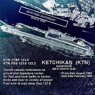
<span class="mw-page-title-main">Ketchikan International Airport</span> Airport

Ketchikan International Airport is a state-owned, public-use airport located one nautical mile (2 km) west of the central business district of Ketchikan, a city in Ketchikan Gateway Borough in Alaska, that has no direct road access to the outside world or to the airport. The airport is located on Gravina Island, just west of Ketchikan on the other side of the Tongass Narrows. Passengers must take a seven-minute ferry ride across the water to get to the airport from the town.

<span class="mw-page-title-main">Brownsville/South Padre Island International Airport</span> Airport in Brownsville, Texas, United States

Brownsville/South Padre Island International Airport is 5 miles east of downtown Brownsville, Cameron County, Texas.

<span class="mw-page-title-main">Annette Island Airport</span> Airport in Annette Island

Annette Island Airport is located on Annette Island in the Prince of Wales – Hyder Census Area of the U.S. state of Alaska. It is located 5 nautical miles (9 km) south of Metlakatla, Alaska. The airport was established as the Annette Island Army Airfield during World War II and initially served as a military airbase.

<span class="mw-page-title-main">Henderson Field (Midway Atoll)</span> Public airport on Sand Island in Midway Atol

Henderson Field is a public airport located on Sand Island in Midway Atoll, an unincorporated territory of the United States. The airport is used as an emergency diversion point for ETOPS operations. It is one of three airfields named after Major Lofton R. Henderson, together with Henderson Field on Midway's Eastern Island, and Henderson Field in the Solomon Islands. The airfield now provides access to Midway Atoll National Wildlife Refuge.

<span class="mw-page-title-main">Cheddi Jagan International Airport</span> Airport in Timehri

Cheddi Jagan International Airport, formerly Timehri International Airport, is the primary international airport of Guyana. The airport is located on the right bank of the Demerara River in the city of Timehri, 41 kilometres (25 mi) south of Guyana's capital, Georgetown. It is the larger of the two international airports serving Georgetown with the other airport being the Eugene F. Correia International Airport.

<span class="mw-page-title-main">Pago Pago International Airport</span> Airport in American Samoa

Pago Pago International Airport, also known as Tafuna Airport, is a public airport located 7 miles (11.3 km) southwest of the central business district of Pago Pago, in the village and plains of Tafuna on the island of Tutuila in American Samoa, an unincorporated territory of the United States.
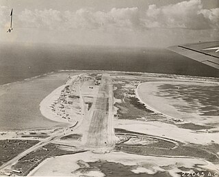
<span class="mw-page-title-main">Canton Island Airport</span> Airport in Canton Island

Canton Island Airport is an airport located on Canton Island, a sparsely populated island in the Phoenix Islands of the Republic of Kiribati. It has a single asphalt runway measuring 6,230 feet (1,900 m) in length. Once a major stop on commercial trans-Pacific airline routes, today the airport is available for emergency use only.

References

  1. Pacific Division, Air Transport command (1945), Chronology of Trans-Pacific Routes, Pacific Division, AAF, ATC. USAFHRA Document 250695
  2. 1 2 3 "Chronicling Wake Island". www.panam.org. Retrieved 2022-09-21.
  3. http://www.timetableimages.com, April 1, 1950, Pan American World Airways system timetable
  4. timetableimages.com, Pan American World Airways June 1, 1969 system timetable
  5. timetableimages.com; Pan American World Airways June 1, 1969 system timetable
  6. departedflights.com, Pan Am system Feb. 1, 1972 timetable route
  7. "1957 JAL timetable" . Retrieved 26 December 2013.
  8. timetableimages.com; BOAC Sept. 1, 1959 system timetable
  9. timetableimages.com, BOAC March 1, 1962 system timetable
  10. http://www.timetableimages.com, Oct. 27, 1958 Transocean Air Lines system timetable
  11. http://www.timetableimages.com, July 1, 1961 REAL Airlines system timetable
  12. timetableimages.com, Philippine Airlines April 1, 1970 system timetable
  13. "Engine trouble forces flight from Honolulu to land at Wake Island". Honolulu Star-Advertiser. 2014-05-23. Archived from the original on 2021-10-26. Retrieved 2023-10-27.
  14. Hradecky, Simon (2016-12-12). "Incident: China Airlines A333 over Pacific on Dec 12th 2016, engine problems". avherald.com. The Aviation Herald. Retrieved 14 February 2024.
  15. "Airlines plane makes emergency landing in Wake Island (update) - Focus Taiwan". Focus Taiwan - CNA English News. 2016-12-12. Archived from the original on 2024-02-14. Retrieved 2023-10-27.
  16. "Wake Island Embodies Reality of America as Pacific Power". U.S. Department of Defense. Retrieved 2022-09-21.
  17. "Population of Wake doubles during recent TRANSPAC". Joint Base Elmendorf-Richardson. Retrieved 2022-09-21.[ permanent dead link ]
  18. "AFCEC leads major airfield modernization at Wake Island Airfield". DVIDS. Retrieved 2024-03-09.
  19. "8C430 (ATN430) Air Transport International, Inc. Flight Tracking and History". Flightaware. Retrieved 26 May 2020.
  20. "ASN Aircraft accident Douglas DC-6 PI-C291 Wake Island Airport (AWK)". aviation-safety.net. Retrieved 2023-07-22.
  21. "ASN Aircraft accident Douglas C-133A Cargomaster 54-0140 Wake Island AFB (AWK)". aviation-safety.net. Retrieved 2023-07-22.
  22. "ASN Aircraft accident Boeing KC-135A Stratotanker 55-3140 Wake Island Airport (AWK)". aviation-safety.net. Retrieved 2023-07-22.
  23. "ASN Aircraft accident Boeing KC-135A Stratotanker 55-3133 Wake Island Airport (AWK)". aviation-safety.net. Retrieved 2023-07-22.
  24. "ASN Aircraft accident Lockheed EC-130Q Hercules 156176 Wake Island Airport (AWK)". aviation-safety.net. Retrieved 2023-07-22.