Wang, Bavaria

Last updated
Wang
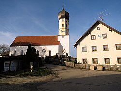
St. Martin (Bergen) 01.jpg
Church of Saint Martin
DEU Wang COA.svg
Coat of arms
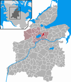
Location of Wang within Freising district
Wang in FS.svg
Germany adm location map.svg
Red pog.svg
Wang
Bavaria location map.svg
Red pog.svg
Wang
Coordinates: 48°30′N11°57′E / 48.500°N 11.950°E / 48.500; 11.950 Coordinates: 48°30′N11°57′E / 48.500°N 11.950°E / 48.500; 11.950
Country Germany
State Bavaria
Admin. region Oberbayern
District Freising
Municipal assoc. Mauern
Government
   Mayor Hans Eichinger (FW)
Area
[1]
  Total31.18 km2 (12.04 sq mi)
Elevation
415 m (1,362 ft)
Population
(2017-12-31) [2]
  Total2,581
  Density83/km2 (210/sq mi)
Time zone CET/CEST (UTC+1/+2)
Postal codes
85368
Dialling codes 08761 / 08764
Vehicle registration FS
Website www.wang-obb.de

Wang is a municipality in the district of Freising in Bavaria in Germany.

Municipalities of Germany the lowest official level of territorial division in Germany

Municipalities are the lowest level of official territorial division in Germany. This is most commonly the third level of territorial division, ranking after the Land (state) and Kreis (district). The Gemeinde which is one level lower in those states also includes Regierungsbezirke as an intermediate territorial division. The Gemeinde is one level higher if it is not part of a Samtgemeinde. Only 10 municipalities in Germany have fifth level administrative subdivisions and all of them are in Bavaria. The highest degree of autonomy may be found in the Gemeinden which are not part of a Kreis. These Gemeinden are referred to as Kreisfreie Städte or Stadtkreise, sometimes translated as having "city status". This can be the case even for small municipalities. However, many smaller municipalities have lost this city status in various administrative reforms in the last 40 years when they were incorporated into a Kreis. In some states they retained a higher measure of autonomy than the other municipalities of the Kreis. Municipalities titled Stadt are urban municipalities while those titled Gemeinde are classified as rural municipalities.

Freising (district) District in Bavaria, Germany

Freising is a Landkreis (district) in Bavaria, Germany. Following a recent ranking of the German magazine Focus-Money comparing all German districts it is number one concerning economic growth abilities. It is bounded by the districts of Kelheim, Landshut, Erding, Munich, Dachau and Pfaffenhofen. The district is located north of the Munich metropolitan area. The Isar and Amper rivers run in parallel from southwest to northeast. North of the rivers there is the Hallertau, a hilly region mainly used for hop growing.

Bavaria State in Germany

Bavaria, officially the Free State of Bavaria, is a landlocked federal state of Germany, occupying its southeastern corner. With an area of 70,550.19 square kilometres, Bavaria is the largest German state by land area comprising roughly a fifth of the total land area of Germany. With 13 million inhabitants, it is Germany's second-most-populous state after North Rhine-Westphalia. Bavaria's main cities are Munich and Nuremberg.

Archaeology

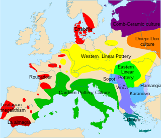
Wang is home to a large Neolithic archaeological site with up to six phases of occupation. It was first excavated by Jens Lüning (de) in the 1980s where several intercutting periods came to pass. It is also one of the most southerly eras of the first Linear Pottery culture (LBK) horizon period when sedimentary ideas, although not necessarily new people, came to central Europe. Most famous for the longhouse, this area uncovered several belonging to the LBK.[ citation needed ]

Neolithic Archaeological period, last part of the Stone Age

The Neolithic, the final division of the Stone Age, began about 12,000 years ago when the first development of farming appeared in the Epipalaeolithic Near East, and later in other parts of the world. The division lasted until the transitional period of the Chalcolithic from about 6,500 years ago, marked by the development of metallurgy, leading up to the Bronze Age and Iron Age. In Northern Europe, the Neolithic lasted until about 1700 BC, while in China it extended until 1200 BC. Other parts of the world remained broadly in the Neolithic stage of development, although this term may not be used, until European contact.

Linear Pottery culture archaeological culture

The Linear Pottery culture is a major archaeological horizon of the European Neolithic, flourishing c. 5500–4500 BC. It is abbreviated as LBK, and is also known as the Linear Band Ware, Linear Ware, Linear Ceramics or Incised Ware culture, and falls within the Danubian I culture of V. Gordon Childe.

Longhouse type of house

A longhouse or long house is a type of long, proportionately narrow, single-room building built by peoples in various parts of the world including Asia, Europe, and North America.

The site was recently reopened by A.W.R Whittle and D. Hoffman in 2008, 50 meters south of the original excavation where another three longhouses were fully excavated and 3 more uncovered.[ citation needed ]

Related Research Articles

Dresden Place in Saxony, Germany

Dresden is the capital city and, after Leipzig, the second-largest city of the Free State of Saxony in Germany. It is also Germany's twelveth-largest city. It is situated in a valley on the River Elbe, near the border with the Czech Republic.

Danubian culture archaeological culture

The term Danubian culture was coined by the Australian archaeologist Vere Gordon Childe to describe the first agrarian society in central and eastern Europe. It covers the Linear Pottery culture, stroked pottery and Rössen cultures.

Capernaum village located on the shores of Lake Tiberias in the north of historical Palestine, associated with Jesus in the Gospel of Matthew

Capernaum was a fishing village established during the time of the Hasmoneans, located on the northern shore of the Sea of Galilee. It had a population of about 1,500. Archaeological excavations have revealed two ancient synagogues built one over the other. A house turned into a church by the Byzantines is said to be the home of Saint Peter.

Whittlesey Fenland market town in Cambridgeshire in England

Whittlesey is an English town 6 miles (10 km) east of Peterborough in the Fenland district of Cambridgeshire. Including the neighbouring villages of Coates, Eastrea, Pondersbridge and Turves, it had a population of 16,058 at the 2011 Census.

Latgalians

Latgalians, sometimes also Ancient Latvians, were an ancient Baltic tribe.

SPAR, originally DESPAR, is a Dutch multinational group that manages independently owned and operated food retail stores. It was founded in the Netherlands in 1932, by Adriaan van Well, and now consists of more than 12,770 stores in 48 countries. The company's name is an acronym of the slogan "Door Eendrachtig Samenwerken Profiteren Allen Regelmatig", which was used by van Well to describe the brand and translates as "All benefit from joint co-operation".

Petrie Museum of Egyptian Archaeology part of University College London Museums & Collections

The Petrie Museum of Egyptian Archaeology in London is part of University College London Museums and Collections. The museum contains over 80,000 objects and ranks among some of the world's leading collections of Egyptian and Sudanese material.

Longhouses of the indigenous peoples of North America

Longhouses were a style of residential dwelling built by Native American tribes and First Nation band governments in various parts of North America. Sometimes separate longhouses were built for community meetings.

Rössen culture

The Rössen culture or Roessen culture is a Central European culture of the middle Neolithic.

J. Randall Price is a theologian, archaeologist, and research author who is founder and President of World of the Bible Ministries.

Mead hall residence of a lord and his retainers in medieval Scandinavia and Germanic Europe

In ancient Scandinavia and Germanic Europe a mead hall or feasting hall was initially simply a large building with a single room. From the fifth century to early medieval times such a building was the residence of a lord and his retainers. The mead hall was generally the great hall of the king.

Nordendorf Place in Bavaria, Germany

Nordendorf is a municipality in the district of Augsburg in Bavaria in Germany.

Glauburg Place in Hesse, Germany

Glauburg is a municipality in the Wetteraukreis, in Hesse, Germany. It is located approximately 33 kilometers northeast of Frankfurt am Main. Glauburg is a municipality of Glauberg and Stockheim. The city hall of Glauburg is in Stockheim.

Haby Place in Schleswig-Holstein, Germany

Haby is a municipality in the district of Rendsburg-Eckernförde, in Schleswig-Holstein, Germany.

Sannai-Maruyama site archaeological site

Sannai-Maruyama site (三内丸山遺跡) is a Jōmon period archaeological site in Aomori, Aomori Prefecture, Japan. The site was discovered in 1992, when Aomori Prefecture started surveying a site for a planned baseball stadium. Archaeologists have used this site to further their understanding of the transition to sedentism and the life of the Jomon people. Excavation has led to the discovery of storage pits, above ground storage and long houses. These findings demonstrate a change in the structure of the community, architecture, and organizational behaviors of these people. Because of the extensive information and importance, this site was designated as a Special National Historical Site of Japan in 2000. Today the public can visit this site and its many reconstructions.

Talheim Death Pit

The Talheim Death Pit, discovered in 1983, was a mass grave found in a Linear Pottery Culture settlement, also known as a Linearbandkeramik (LBK) culture. It dates back to about 5000 BC. The pit takes its name from its site in Talheim, Germany. The pit contained the remains of 34 bodies, and evidence points towards the first signs of organized violence in Early Neolithic Europe.

Njoro River Cave

Njoro River Cave is an archaeological site on the Mau Escarpment, Kenya, that was first excavated in 1938 by Mary Leakey and her husband Louis Leakey. Excavations revealed a mass cremation site created by Elmenteitan pastoralists during the Pastoral Neolithic roughly 3350-3050 BP. Excavations also uncovered pottery, beads, stone bowls, basket work, pestles and flakes. The Leakeys' excavation was one of the earliest to uncover ancient beads and tools in the area and a later investigation in 1950 was the first to use radiocarbon dating in East Africa.

Karsdorf remains

The Kardorf remains are the bodies of more than 30 Neolithic humans who were buried in the vicinity of Karsdorf, Sachsen-Anhalt, Germany.

References

  1. "Alle politisch selbständigen Gemeinden mit ausgewählten Merkmalen am 31.12.2018 (4. Quartal)". DESTATIS. Archived from the original on 10 March 2019. Retrieved 10 March 2019.
  2. "Fortschreibung des Bevölkerungsstandes". Bayerisches Landesamt für Statistik und Datenverarbeitung (in German). September 2018.