
Murrieta Hot Springs is a neighborhood in the eastern region of Murrieta, California, which was annexed on July 1, 2002. Prior to annexation, Murrieta Hot Springs was a Census-designated place of Riverside County, California. The population was 2,948 at the 2000 census.

Lake Elsinore is a natural freshwater lake in Riverside County, California, United States, located east of the Santa Ana Mountains and fed by the San Jacinto River. Originally named Laguna Grande by Spanish explorers, it was renamed for the town of Elsinore, established on its northeastern shore on April 9, 1888.
Saline Valley is a large, deep, and arid graben, about 27 miles (43 km) in length, in the northern Mojave Desert of California, a narrow, northwest–southeast-trending tectonic sink defined by fault-block mountains. Most of it became a part of Death Valley National Park when the park was expanded in 1994. This area had previously been administered by the Bureau of Land Management. It is located northwest of Death Valley proper, south of Eureka Valley, and east of the Owens Valley. The valley's lowest elevations are about 1,000 ft (300 m) and it lies in the rain shadow of the 14,000 ft (4,300 m) Sierra Nevada range, plus the 11,000 ft (3,400 m) Inyo Mountains bordering the valley on the west.

Henry W. Coe State Park is a state park of California, United States, preserving a vast tract of the Diablo Range. The park is located closest to the city of Morgan Hill, and is located in both Santa Clara and Stanislaus counties. The park contains over 87,000 acres (35,000 ha), making it the largest state park in northern California, and the second-largest in the state. Managed within its boundaries is a designated wilderness area of about 22,000 acres (8,900 ha). This is officially known as the Henry W. Coe State Wilderness, but locally as the Orestimba Wilderness. The 89,164-acre (36,083 ha) park was established in 1959.
Arroyo Mocho is a 34.7-mile-long (55.8 km) stream which originates in the far northeastern corner of Santa Clara County and flows northwesterly into eastern Alameda County, California. After traversing the cities of Livermore and Pleasanton it joins South San Ramon Creek to become Arroyo de la Laguna, which in turn flows to Alameda Creek and thence to San Francisco Bay.
Temecula Creek, formerly known as the Temecula River, runs 32.6 miles (52.5 km) through southern Riverside County, California, United States, past the rural communities of Radec and Aguanga, and ending 0.5 miles (0.80 km) southeast of the original city center of Temecula. The creek is filled with boulders and is typically dry and sandy. It is a relatively undeveloped coastal-draining watershed. Until the 1920s, water flowed in Temecula Creek year-round.
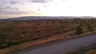
French Valley is a region located in southwestern Riverside County, near the cities and communities of Hemet, Winchester, Murrieta, and Temecula in the state of California, United States. It is part of the Plains of Leon, contiguous with the Perris Plain, that drains into the Temecula Basin by means of tributaries of the Santa Margarita River.

San Mateo Creek is a stream in Southern California in the United States, whose watershed mostly straddles the border of Orange and San Diego Counties. It is about 22 miles (35 km) long, flowing in a generally southwesterly direction. Draining a broad valley bounded by the Santa Ana Mountains and Santa Margarita Mountains, San Mateo Creek is notable for being one of the last unchannelized streams in Southern California.

Temescal Creek is an approximately 29-mile-long (47 km) watercourse in Riverside County, in the U.S. state of California. Flowing primarily in a northwestern direction, it connects Lake Elsinore with the Santa Ana River. It drains the eastern slopes of the Santa Ana Mountains on its left and on its right the western slopes of the Temescal Mountains along its length. With a drainage basin of about 1,000 square miles (2,600 km2), it is the largest tributary of the Santa Ana River, hydrologically connecting the 720-square-mile (1,900 km2) San Jacinto River and Lake Elsinore watersheds to the rest of the Santa Ana watershed. However, flowing through an arid rain shadow zone of the Santa Ana Mountains, and with diversion of ground water for human use, the creek today is ephemeral for most of its length, except for runoff from housing developments and agricultural return flows.
Cantua Creek, formerly in Spanish Arroyo de Cantúa, was named for José de Guadalupe Cantúa, a prominent Californio Ranchero in the 19th-century Mexican era of Alta California.

Los Alamos Canyon Creek, a stream or arroyo, tributary to San Mateo Creek, in the Cleveland National Forest in Riverside County, California. Its source is at an altitude of 2300 feet, in a canyon on the south face of the ridge of Elsinore Mountains that descends to the southeast from Elsinore Peak. The creek descends southward for a short distance then turns southwest for 4 miles where it turns west for 3 miles down Los Alamos Canyon to its confluence with San Mateo Creek at an elevation of 1312 feet.

Temescal Mountains, also known as the Sierra Temescal, are one of the northernmost mountain ranges of the Peninsular Ranges in western Riverside County, in Southern California in the United States. They extend for approximately 25 mi (40 km) southeast of the Santa Ana River east of the Elsinore Fault Zone to the Temecula Basin and form the western edge of the Perris Block.
The Perris Block is the central block of three major fault-bounded blocks of the northern part of the Peninsular Ranges. The Perris Block lies between the Santa Ana Block to the west and the San Jacinto Block to the east. The Perris Block, was named by Walter A. English in 1925 for the city of Perris, located near the center of the block.
Willow Springs Station was a changing station at Alamos or Willow Springs along the Second Division route of the Butterfield Overland Mail, in what is now Murrieta, in Riverside County, California. It was also known as Alamos, Clines's or Kline's, or Willows, was one of the later Butterfield Overland Mail stations, placed in 1859, between some of the original stations for changing teams and providing water between stops in hot dry areas. Willow Springs, also originally known as Alamos Springs, was located west of the hills that line the east side of the Temecula Valley, on land of the Rancho Temecula, near Santa Gertrudis Creek on the low flood plain of Murrieta Creek, between Santa Gertrudis and Warm Springs Creek.
The Plains of Leon are named for the former gold mining town, Leon once located near the middle of the plain. It is a plain in the Perris Block, contiguous on the south with the Perris Plain including within it the Domenigoni Valley and western Diamond Valley, French Valley, Auld Valley, the upper part of the valley of Warm Springs Creek and connecting tablelands.
Warm Springs Valley is a valley located within the city of Lake Elsinore in Riverside County, California. It lies between the main body of the Temescal Mountains to the north, east and south and the Clevelin Hills to the west. The valley was named for the warm springs that used to be found flowing there.
Cajalco Canyon Creek is an ephemeral stream that flows through Cajalco Canyon in the Temescal Mountains of Riverside County, California, United States. It is a tributary to Temescal Wash, itself a tributary to the Santa Ana River. Cajalco is thought to be a Hispanic spelling of the word for "quail" in the languages of the Luiseño and Cahuilla who lived in the area. The word Cajalco is an acronym- California Jalisco Land Company of Los Angeles
La Vereda del Monte was a backcountry route through remote regions of the Diablo Range, one of the California Coast Ranges. La Vereda del Monte was the upper part of La Vereda Caballo,, used by mesteñeros from the early 1840s to drive Alta California horses to Sonora for sale.
County Line Road is an unimproved road between the San Antonio Valley and Fifield Ranch that closely follows the east–west divide of the Diablo Range and the County boundary of Santa Clara County, and Stanislaus County, California. This road followed the route called La Vereda del Monte, used by Californio mesteñeros and the gang of Joaquin Murrieta and other bandits and horse-thieves, and sites of three of their camps along the route are found along it. Two sites are now state park campgrounds, the last is at ranch dating back to the 1860s.

