Washingtonville, Pennsylvania

Last updated
Washingtonville, Pennsylvania
Entering Washingtonville from Strawberry Ridge Road.JPG
Entering Washingtonville from Strawberry Ridge Road
Montour County Pennsylvania Incorporated and Unincorporated areas Washingtonville Highlighted.svg
Location of Washingtonville in Montour County, Pennsylvania.
USA Pennsylvania location map.svg
Red pog.svg
Washingtonville
Location within the U.S. state of Pennsylvania
Usa edcp location map.svg
Red pog.svg
Washingtonville
Washingtonville (the United States)
Coordinates: 41°03′09″N76°40′30″W / 41.05250°N 76.67500°W / 41.05250; -76.67500
Country United States
State Pennsylvania
County Montour
Settled1775
Founded as WashingtonSeptember 27, 1796
Name Change to WashingtonvilleSeptember 8, 1828
Incorporated (borough)April 28, 1870
Government
  MayorTyler Dombroski
Area
[1]
  Total0.05 sq mi (0.14 km2)
  Land0.05 sq mi (0.14 km2)
  Water0.00 sq mi (0.00 km2)
Elevation
[2] (center of borough)
520 ft (160 m)
Highest elevation
[2] (hill on western borough boundary)
570 ft (170 m)
Lowest elevation
[2] (Chillisquaque Creek)
495 ft (151 m)
Population
 (2020) [3]
  Total200 Decrease2.svg
  Estimate 
(2021) [3]
202
  Density5,092.59/sq mi (1,950.85/km2)
Time zone Eastern (EST)
  Summer (DST)EDT
ZIP code
17884
Area code 570
FIPS code 42-81424

Washingtonville is a borough in Montour County, Pennsylvania, United States. The population was 200 at the 2020 census. [3] It is part of the Bloomsburg-Berwick micropolitan area.

Contents

History

The small borough is named after the first American president, George Washington. [4] Before the time of the town's founding during the Revolutionary War, Fort Bosley stood along the eastern backs of Chillisquaque Creek near its confluence with Mud Creek. During, the early 20th century, millionaire Frank DeLong would often visit the borough to get away from the city. [5] He ended up donating a school, which at the time was considered one of the best facilities in the country, to the town. He also turned the old Presbyterian Church into a memorial for his mother. Today, the old school building is now a nursing home, and the memorial still stands today, containing many historical artifacts. Recently, the remains of an 18th century log cabin were discovered at the corner of Front and Water Streets, suggesting early settlement of permanent residents. [6]

Geography

Entering Washingtonville from Pennsylvania Route 54 Entering Washingtonville from Pennsylvania Route 54.JPG
Entering Washingtonville from Pennsylvania Route 54

According to the United States Census Bureau, the borough has a total area of 0.1 square miles (0.26 km2), all land. Washingtonville sits at the intersection of state routes 54 and 254. Washingtonville is bordered on the west by Chillisquaque Creek. The eastern part of the borough is atop a low hill. The town's land is almost entirely residential. [7]

Demographics

Historical population
CensusPop.Note
1870 172
1880 20318.0%
1890 171−15.8%
1900 21224.0%
1910 183−13.7%
1920 177−3.3%
1930 1822.8%
1940 175−3.8%
1950 19410.9%
1960 1982.1%
1970 174−12.1%
1980 21825.3%
1990 2284.6%
2000 201−11.8%
2010 27335.8%
2020 200−26.7%
2021 (est.)202 [3] 1.0%
Sources: [8] [9] [10]

As of the census [9] of 2000, there were 201 people, 82 households, and 51 families residing in the borough. The population density was 3,498.0 inhabitants per square mile (1,350.6/km2). There were 93 housing units at an average density of 1,618.5 per square mile (624.9/km2). The racial makeup of the borough was 97.01% White, 1.49% African American, 0.50% Asian, and 1.00% from two or more races.

There were 82 households, out of which 29.3% had children under the age of 18 living with them, 50.0% were married couples living together, 11.0% had a female householder with no husband present, and 37.8% were non-families. 32.9% of all households were made up of individuals, and 6.1% had someone living alone who was 65 years of age or older. The average household size was 2.45 and the average family size was 3.18.

In the borough the population was spread out, with 24.4% under the age of 18, 10.0% from 18 to 24, 32.3% from 25 to 44, 23.9% from 45 to 64, and 9.5% who were 65 years of age or older. The median age was 35 years. For every 100 females there were 105.1 males. For every 100 females age 18 and over, there were 100.0 males.

The median income for a household in the borough was $35,278, and the median income for a family was $38,393. Males had a median income of $37,292 versus $17,500 for females. The per capita income for the borough was $21,206. About 15.1% of families and 19.6% of the population were below the poverty line, including 28.1% of those under the age of eighteen and 12.5% of those sixty five or over.

Related Research Articles

<span class="mw-page-title-main">Montour County, Pennsylvania</span> County in Pennsylvania, United States

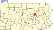
Montour County is a county in the Commonwealth of Pennsylvania. It is located in Northeastern Pennsylvania. As of the 2020 census, the population was 18,136. Its county seat is Danville. The county is named for Andrew Montour, a prominent Métis interpreter who served with George Washington during the French and Indian War. It encompasses 132 sq mi, making it the smallest county by land area in the state.

<span class="mw-page-title-main">Benton, Columbia County, Pennsylvania</span> Borough in Pennsylvania, United States

Benton is a borough in Columbia County, Pennsylvania, United States. It is part of Northeastern Pennsylvania. The population was 824 at the 2020 census. It is part of the Bloomsburg-Berwick micropolitan area.

<span class="mw-page-title-main">Catawissa Township, Columbia County, Pennsylvania</span> Township in Pennsylvania, United States

Catawissa Township is a township near the borough of Catawissa, Columbia County, Pennsylvania. It is part of Northeastern Pennsylvania. The population was 904 at the 2020 census.

Foundryville is a census-designated place (CDP) in Columbia County, Pennsylvania, United States. It is part of Northeastern Pennsylvania. The population was 256 at the 2010 census. It is part of the Bloomsburg-Berwick micropolitan area.

<span class="mw-page-title-main">Madison Township, Columbia County, Pennsylvania</span> Township in Pennsylvania, United States

Madison Township is a township in Columbia County, Pennsylvania. It is part of Northeastern Pennsylvania. The population was 1,566 at the 2020 census.

<span class="mw-page-title-main">Blooming Valley, Pennsylvania</span> Borough in Pennsylvania, United States

Blooming Valley is a borough in Crawford County, Pennsylvania, United States. The population was 342 at the 2020 census, up from 337 at the 2010 census.

<span class="mw-page-title-main">Centerville, Crawford County, Pennsylvania</span> Borough in Pennsylvania, United States

Centerville is a borough in Crawford County, Pennsylvania, United States. The population was 176 at the 2020 census, down from 218 at the 2010 census. It was established in 1812.

<span class="mw-page-title-main">Cochranton, Pennsylvania</span> Borough in Pennsylvania, United States

Cochranton is a borough in Crawford County, Pennsylvania, United States. The population was 1,124 at the 2020 census, down from 1,136 as of the 2010 census.

<span class="mw-page-title-main">Conneautville, Pennsylvania</span> Borough in Pennsylvania, United States

Conneautville is a borough in Crawford County, Pennsylvania, United States, situated along Conneaut Creek. The population was 736 at the 2020 census, down from 774 at the 2010 census.

<span class="mw-page-title-main">Spring Township, Crawford County, Pennsylvania</span> Township in Pennsylvania, United States

Spring Township is a township in Crawford County, Pennsylvania, United States. The population was 1,407 at the 2020 census, down from 1,548 at the 2010 census.

<span class="mw-page-title-main">Summerhill Township, Crawford County, Pennsylvania</span> Township in Pennsylvania, United States

Summerhill Township is a township in Crawford County, Pennsylvania, United States. The population was 1,197 at the 2020 census, down from 1,236 at the 2010 census.

<span class="mw-page-title-main">Townville, Pennsylvania</span> Borough in Pennsylvania, United States

Townville is a borough in Crawford County, Pennsylvania, United States. The population was 326 at the 2020 census, up from 323 at the 2010 census.

<span class="mw-page-title-main">Elk Creek Township, Erie County, Pennsylvania</span> Township in Pennsylvania, United States

Elk Creek Township is a township in Erie County, Pennsylvania, United States. The population was 1,785 at the 2020 census, down from 1,798 at the 2010 census.

<span class="mw-page-title-main">Mill Village, Pennsylvania</span> Borough in Pennsylvania, United States

Mill Village is a borough in Erie County, Pennsylvania, United States. The population was 394 at the 2020 census, down from 412 during the 2010 census. It is part of the Erie Metropolitan Statistical Area.

<span class="mw-page-title-main">Platea, Pennsylvania</span> Borough in Pennsylvania, United States

Platea is a borough in Erie County, Pennsylvania, United States. The population was 443 at the 2020 census.

<span class="mw-page-title-main">Wattsburg, Pennsylvania</span> Borough in Pennsylvania, United States

Wattsburg is a borough in Erie County, Pennsylvania, United States. The population was 352 at the 2020 census. It is part of the Erie Metropolitan Statistical Area.

<span class="mw-page-title-main">Clark, Pennsylvania</span> Borough in Pennsylvania, United States

Clark is a borough in western Mercer County, Pennsylvania, United States, along the southern shore of the Shenango River Reservoir. The population was 576 at the 2020 census. It is part of the Hermitage micropolitan area.

<span class="mw-page-title-main">Anthony Township, Montour County, Pennsylvania</span> Township in Pennsylvania, United States

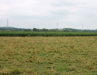
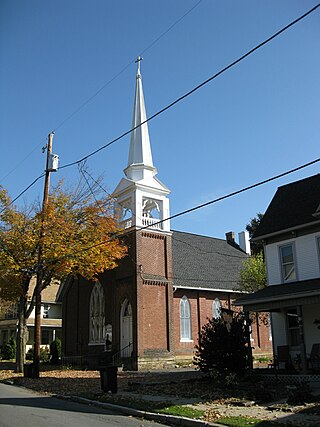
Anthony Township is a township in Montour County, Pennsylvania, United States.

<span class="mw-page-title-main">Snydertown, Northumberland County, Pennsylvania</span> Borough in Pennsylvania, United States

Snydertown is a borough in Northumberland County, Pennsylvania, United States. As of the 2010 census, the borough population was 339.

<span class="mw-page-title-main">Millerstown, Pennsylvania</span> Borough in Pennsylvania, United States

Millerstown is a borough in northern Perry County, Pennsylvania, United States, located 29 miles (47 km) northwest of Harrisburg and 29 miles (47 km) southwest of Selinsgrove. The population was 688 at the 2020 Census. The borough is part of the Harrisburg–Carlisle Metropolitan Statistical Area.

References

  1. "2019 U.S. Gazetteer Files". United States Census Bureau. Retrieved July 28, 2020.
  2. 1 2 3 "West Branch Chillisquaque Creek Topo Map, Montour County PA (Washingtonville Area)". TopoZone. Locality, LLC. Retrieved 28 November 2019.
  3. 1 2 3 4 Bureau, US Census. "City and Town Population Totals: 2020—2021". Census.gov. US Census Bureau. Retrieved July 27, 2022.
  4. J. H.Beers., Historical and Biographical Annals of Columbia and Montour Counties Pennsylvania, 1915
  5. Lynn Reichen (January 10, 2010). "Frank DeLong made an impression". The Daily Item.
  6. "Colonial-era building discovered in Pennsylvania town during demolition". WJACTV. CNN. Retrieved February 15, 2020.
  7. Terrain and Satellite imagery.
  8. "Census of Population and Housing". U.S. Census Bureau. Retrieved 11 December 2013.
  9. 1 2 "U.S. Census website". United States Census Bureau . Retrieved 2008-01-31.
  10. "Incorporated Places and Minor Civil Divisions Datasets: Subcounty Resident Population Estimates: April 1, 2010 to July 1, 2012". Population Estimates. U.S. Census Bureau. Retrieved 11 December 2013.