Related Research Articles

The River Wissey is a river in Norfolk, eastern England. It rises near Bradenham, and flows for nearly 31 miles (50 km) to join the River Great Ouse at Fordham. The lower 11.2 miles (18.0 km) are navigable. The upper reaches are notable for a number of buildings of historic interest, which are close to the banks. The river passes through the parkland of the Arts and Crafts Pickenham Hall, and further downstream, flows through the Army's Stanford Training Area (STANTA), which was created in 1942 by evacuating six villages. The water provided power for at least two mills, at Hilborough and Northwold. At Whittington, the river becomes navigable, and is surrounded by fenland. A number of pumping stations pump water from drainage ditches into the higher river channel.
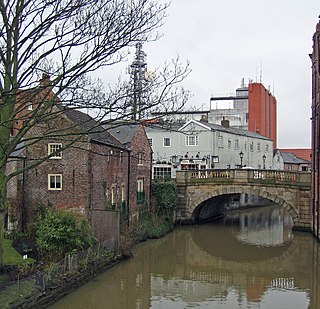
The River Foss is in North Yorkshire, England. It is a tributary of the River Ouse. It rises in the Foss Crooks Woods near Oulston Reservoir close to the village of Yearsley and runs south through the Vale of York to the Ouse in the centre of York. The name most likely comes from the Latin word Fossa, meaning ditch. It is mentioned in the Domesday Book. The York district was settled by Norwegian and Danish people, so parts of the place names could be old Norse. Referring to the etymological dictionary "Etymologisk ordbog", ISBN 82-905-2016-6 deals with the common Danish and Norwegian languages – roots of words and the original meaning. The old Norse word Fos (waterfall) means impetuous. The River Foss was dammed, and even though the elevation to the River Ouse is small, a waterfall was formed. This may have led to the name Fos which became Foss.

South Holland is a local government district of Lincolnshire, England. The council is based in Spalding. Other notable towns and villages include Crowland, Sutton Bridge, Donington, Holbeach and Long Sutton. The district is named after the historical division of Lincolnshire known as the Parts of Holland.
The River Idle is a river in Nottinghamshire, England whose source is the confluence of the River Maun and River Meden near Markham Moor. The Idle flows north from its source through Retford and Bawtry before entering the River Trent at West Stockwith. Its main tributaries are the River Poulter and the River Ryton. The river is navigable to Bawtry, and there is a statutory right of navigation to Retford. Most of the land surrounding the river is a broad flood plain and the river is important for conservation, with Sites of Special Scientific Interest being designated along its course.
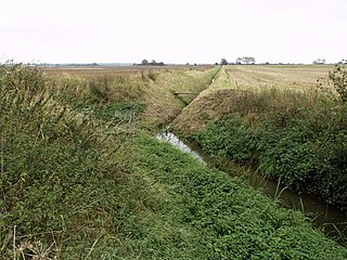
The River Nar is a river in England, a tributary of the River Great Ouse. It rises at Mileham near Litcham in Norfolk and flows 15 miles west through Castle Acre and Narborough, joining the Ouse at King's Lynn. It has had a variety of alternative names, such as the Setch, the Sandringham, and Lynn Flu, though these are rarely, if ever, used today. In 2011 the Nar was recognised by the Environment Agency as one of the top ten most improved rivers in England and Wales.

Holbeach is a market town and civil parish in the South Holland District in Lincolnshire, England. The town lies 8 miles (13 km) from Spalding; 17 miles (27 km) from Boston; 20 miles (32 km) from King's Lynn; 23 miles (37 km) from Peterborough; and 43 miles (69 km) by road from Lincoln. It is on the junction of the A151 and A17.

The River Deben is a river in Suffolk rising to the west of Debenham, though a second, higher source runs south from the parish of Bedingfield. The river passes through Woodbridge, turning into a tidal estuary before entering the North Sea at Felixstowe Ferry. The mouth of the estuary is crossed by a ferry connecting Felixstowe and Bawdsey.

The Caldicot and Wentloog Levels are two areas of low-lying estuarine alluvial wetland and intertidal mudflats adjoining the north bank of the Severn Estuary, either side of the River Usk estuary near Newport in south east Wales. They are also known collectively as the Monmouthshire Levels or Gwent Levels, and the name Wentloog is sometimes spelled Wentlooge in official publications.
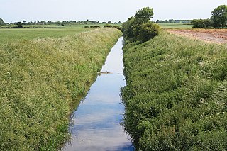
Barlings Eau is a small river near Barlings, Lincolnshire, England. It is a tributary of the River Witham, joining it near Short Ferry. It acts as the central spine for a number of other small rivers, which drain the low-lying land to either side. Most of its course is within the area managed by the Witham Third District IDB, an Internal Drainage Board responsible for land drainage. One of their pumping stations is on the banks of the river.

An internal drainage board (IDB) is a type of operating authority which is established in areas of special drainage need in England and Wales with permissive powers to undertake work to secure clean water drainage and water level management within drainage districts. The area of an IDB is not determined by county or metropolitan council boundaries, but by water catchment areas within a given region. IDBs are geographically concentrated in the Broads, Fens in East Anglia and Lincolnshire, Somerset Levels and Yorkshire.
The Association of Drainage Authorities (ADA) is a membership body for internal drainage boards and other stakeholders in water level management in the United Kingdom.
Drainage districts occur in England and Wales, varying in size from a few hundred acres to over 100,000 acres (400 km2), all in low-lying areas of the country where flood risk management and land drainage are sensitive issues. Most drainage districts are administered by an internal drainage board (IDB), which are single purpose local drainage authorities, dealing with the drainage and water level management of clean water only. Each drainage district has a defined area, and the IDB only has powers to deal with matters affecting that area.

The Middle Level Commissioners are a land drainage authority in eastern England. The body was formed in 1862, undertaking the main water level management function within the Middle Level following the breakup of the former Bedford Level Corporation.
The River Foulness is a river in the East Riding of Yorkshire, England. Its name is derived from Old English fūle[n] ēa, meaning “dirty water”. Maintenance responsibilities for the river transferred from the Environment Agency to the Market Weighton Drainage Board on 1 October 2011. Market Weighton Drainage Board subsequently amalgamated with the Lower Ouse Internal Drainage Board on 1 April 2012 to create the Ouse and Humber Drainage Board. The river discharges into the Humber Estuary via Market Weighton Canal. Water levels within the river, its tributaries and the canal are managed and controlled by the Environment Agency. The river lies in an area known as the Humberhead Levels.

The River Torne is a river in the north of England, which flows through the counties of South Yorkshire and North Lincolnshire. It rises at the Upper Lake at Sandbeck Hall, in Maltby in South Yorkshire, and empties into the River Trent at Keadby pumping station. Much of the channel is engineered, as it plays a significant role in the drainage of Hatfield Chase, which it crosses.

Gedney Broadgate is a hamlet in the civil parish of Gedney and the South Holland district of Lincolnshire, England. It is situated west from the A17 road, 1 mile (1.6 km) south from Gedney, and 1.5 miles (2.4 km) west from Long Sutton. It includes the area known as Harford Gate.

Holderness Drain is the main feature of a Land Drainage scheme for the area of Holderness to the east of the River Hull in the East Riding of Yorkshire, England. Construction began in 1764, and several notable civil engineers were involved with the scheme over the years. Despite the high costs of the initial scheme, it was not particularly successful, because of the refusal of the ship owners of Hull to allow an outlet at Marfleet. They insisted that the water be discharged into the River Hull to keep the channel free of silt. Following a period of agricultural depression and the building of new docks in the early 1800s, an outlet at Marfleet was finally authorised in 1832. A high level system still fed upland water to the Hull, but the low level system discharged into the Humber, where levels were considerably lower. Following the success of steam pumping on the Beverley and Barmston Drain, the trustees looked at such a possibility for the Holderness Drain, but the development of the Alexandra Dock in the 1880s and then the King George V Dock in 1913 provided a solution, as the docks were topped up with water pumped from the drain, to lessen the ingress of silt-laden water.

The Upper Witham IDB is an English Internal Drainage Board responsible for land drainage and the management of flood risk for an area to the west of the Lincolnshire city of Lincoln, broadly following the valleys of the upper River Witham, the River Till and the course of the Fossdyke Navigation.
East Suffolk Water Management Board (ESWMB) is a water management board in East Suffolk District, Suffolk, England. It was reconstituted from the East Suffolk Internal Drainage Board on 24 March 2023.

Romney Marshes Area internal drainage board is the successor to a long line on organisations who have managed land drainage and flood defence on Romney Marsh in the counties of Kent and East Sussex in the south-east of England.
References
- ↑ "Governance". Water Management Alliance. King’s Lynn IDB trading as “the WMA”. Retrieved 7 October 2023.
- ↑ "The East Suffolk Internal Drainage Board Order 2023". legislation.gov.uk. The National Archives. Retrieved 7 October 2023.