Water resources management in Argentina

Last updated
Argentina: Water Resources Management
Flag of Argentina.svg
Withdrawals by sector 2000Domestic 16%
Agriculture 74%
Industry 10%
Total renewable water resources (2008)814 billion cubic meters (BCM)
Surface water produced internally [1] 276 BCM
Groundwater recharge [2] 128 BCM
Overlap between surface and groundwater [3] 128 BCM
Available per capita renewable water resources (2008) [4] 20,410 cubic meters per year
Total water withdrawal per capita774.8 m3 per year
Total used as % of availabilityapprox. 4%
Land Area2,780,400 Km2
Agricultural land (% of land area)12%
Equipped irrigated area (% of cultivated area)5.43%
Equipped irrigated area1.7 million ha
Irrigation systems
Surface irrigation1.4 million ha
Sprinkler irrigation650,000 ha
Localized irrigation- million ha
Wetland designated as Ramsar sites (2010)19 sites; 5,318,376 ha
Dam Capacity186 BCM
Hydroelectric generation (% of total electricity generation)41%
(Source: FAO Aquastat 1988-2008)

Water resources management (WRM) functions in Argentina are handled by multiple institutions operating at the national, provincial, and river basin level, with a variety of functions and jurisdictions. On the national level, the National Institute for Water and the Environment (INA) and the National Water and Sanitation Utility (AySA) are charged with the duties of researching, water resources preservation, developing services, and implementing water projects.

Contents

Connectivity to water in urban settings is quite good in Argentina, but rural communities lag far behind that of less developed nations. This problem is made worse by one of the highest levels of per capita usage in the world at around 500 L/day. [5] Large rivers and aquifers represent the main source of drinking water supplies and they are facing serious water pollution problems from industrial effluents, urbanization, and harmful agriculture practices.

Many other challenges persist throughout the country and most are regionally focused with varying degrees because Argentina is divided into many different climatic regions. Some of the critical issues are identified as an inadequate regulatory and institutional framework, inter-sectoral conflict, limited capacity in water management at the central and provincial levels, and high risk for flooding in urban and rural areas.

Water management history and recent developments

Towards the end of the 19th century and throughout most of the 20th century, the Argentinean Government was the primary investor in the country's hydraulic infrastructure development. Primarily focused on developing irrigation infrastructure, the first irrigation development project started in 1909 and continued throughout the 20th century. Beginning in the early 1990s, Argentina began reforming many of its public sectors with a move to privatization of urban water services in the city of Buenos Aires. Subsequently, all the larger cities and numerous intermediate sized populations also began to incorporate private operators to improve operational efficiency and increase return on investments. This moderately recent Argentine model for management of the water supply sector still needs adjustments in the optimization of the state's regulatory function, incentive schemes, and the expansion of coverage. Even so, significant benefits have been obtained in terms of the quality of water, services rendered, a substantial increase with investments into the water sector, and improvements in the population's quality of life. [5]

Water management challenges

Significant water resources management challenges were identified by the water community of Argentina during the Second National Water Resources Meeting held in Buenos Aires (May 18–20, 2004) and are listed here: (i) incomplete/outdated legal and regulatory framework; (ii) limited capacity in water management at the central and provincial levels coupled with outdated procedures for water resources planning; (iii) lack of an integrated national water resources information system and deficient water resources monitoring network; (iv) serious water pollution problems (surface and groundwater); (v) high risk for flooding in urban and rural areas; (vi) lack of appropriate incentives for conservation and efficient use of the resource base and for reducing pollution.[ citation needed ] Some of these challenges are addressed in more detail below.

Water Quality

Water pollution from industrial effluents is a considerable challenge and the risk of continued contamination is very likely. The Government of Argentina (GoA) has a particular focus on the Matanza-Riachuelo River Basin in Buenos Aires where at least 50 industries are discharging ~95% of the total load of contaminants into the Parana river. [6] Pollution and overuse of the aquifer in Mendoza have become a problem where agriculture and industrial runoff and mismanagement of irrigation water has deteriorated the first levels of the aquifer. This has led to over pumping and exploitation of deeper wells that reach the second and third layers of water. Older wells have been abandoned without being properly sealed posing a risk of vertical filtration (e.g. contaminated water from higher levels filters down to lower levels) into deeper water tables where farmers are pumping from. Abandoned wells also result in fields becoming stagnant and barren creating an economic loss for the region. [5]

Problems with water quality in lakes and reservoirs in Argentina have increased due to agricultural activities, deforestation, logging, animal production, mining activities, urban run-off, and the discharge of untreated sewage. As a result of these activities, many lakes and reservoirs are receiving high quantities of nutrients and are suffering from eutrophication. The increasing occurrence of algal blooms is the evidence of this growing occurrence. Algal blooms occur especially in reservoirs and ponds, and are spread over at least twelve provinces of Argentina. Specifically, fifteen aquatic environments were identified at high risk of poisoning by eutrophication. [7]

Water pollution typically occurs due to the discharge of effluent into water systems, improper landfill techniques, flooding of urban areas resulting in pollution from urban run-off, and agricultural practices. For example, the cities La Rioja and Catamarca have constraints on expansion of freshwater supplies forcing the residents to use only water they have available even if it is contaminated. [8] The lack of piped water and sewage can exacerbate the water pollution problem through excessive contamination from excrements. For example, communities having 5,000-10,000 residents and urban centers with 200,000-500,000 residents have 90% and 60% of those respective residents that lack connection to sewers. [8]

Lack of good management

Mismanagement of water in the Puelches aquifer of Buenos Aires is a real problem. During the 1980s, this aquifer was over-exploited resulting in saline intrusion from the Atlantic Ocean causing the city to use water from the Plata river. Over time, the Puelches aquifer has recharged but is not being used and now the water level of the aquifer is reaching 1 m below the surface in many areas. This inverse phenomenon has resulted in waterlogged basements and storage units, flooded tunnels, the weakening of foundations, and the saturation of household septic tanks. [5] In Córdoba, urbanization and the lack of proper treatment facilities around the San Roque Lake, caused an alarming increase in cyanobacteria and thrihalomethanes have been detected in treatment plants at above-normal levels. This lake is the cities main source of drinking water, and is at continued risk of elevated levels of nitrogen and phosphorus and further outbreaks. [5]

Flooding and stormwater

Flooding is the major natural hazard in Argentina. According to 1998 statistics of Swiss-Re, Argentina ranks 18th in the world in potential flood losses, in excess of US$3 billion in 1998. In Buenos Aires, flooding occurs on average about twice per year and 1.4 million individuals are at risk of floods. These floods are due to the condition of the drainage network, and strong winds from the southeast, (sudestadas), which produce a rise of the Rio de la Plata high above its average. [9]

To reduce the impact of floods and droughts on the economy and to help development in the region, in 2021, Argentina signed a flood protection loan agreement with the European Investment Bank. The $110 million EIB loan will assist integrated water resource management in the Salado River Basin in Buenos Aires over a 25-year period. The World Bank has agreed to co-finance the project with a $111.6 million loan. [10] [11]

Institutional challenges

Water resources management functions are handled by multiple institutions operating at the national, provincial, and river basin level, with a variety of functions and jurisdictions. This has given rise to inter-sectoral and inter-jurisdictional conflicts (particularly between competing uses such as irrigation, hydropower and environment), poor planning and budget programming, and limited technical capacity and knowledge exchange.

Water resource base

Surface and groundwater resources

Annual rainfall averages ~600 mm which equates to 1,668 km3; however, about 83% of this precipitation is lost through evapotranspiration and evaporation. Subsequently, internal renewable water resources are reduced to about 276 km3. Runoff is also significant and is estimated at 814 km3/year, of which 538 km3 comes from contributions originating in basins from Paraguay and Uruguay. [12] These statistics are general for the entire country; however, Argentina is a large country encompassing 2.7 million km2 with weather patterns and climates that vary greatly. For example, the eastern edges of the Andes mountains are dry and water scarcity and droughts are an ongoing issue. In the greater Buenos Aires which is a lowland area, water pollution from industrial effluents, stormwater and flooding, and groundwater management are the major concerns. Down in the sparsely populated Patagonia region where there is ample quantities of high quality water, water resources management has fewer challenges.

Major rivers of Argentina: Important rivers of Argentina in terms of length and quantity of water conveyed and discharged include the Parana, Uruguay, and the Negro rivers. The two largest rivers, the Paraná River and the Uruguay River originate in Brazil. The Uruguay River runs north to south and forms a border with Argentina, Brazil, and Uruguay. The Parana River together with the Uruguay river form the Río de la Plata estuary. Only a few of the Argentine rivers such as the Futaleufú River flow to the Pacific, while the majority of rivers originate on eastern slopes of the Andes and run towards the Atlantic ocean. Argentina is home to at least three major endorheic basins or closed water drainage basins e.g. water does not flow to the ocean. Both the northwest and southwest pampas basins in the dry pampas areas of Argentina and the Meseta Somuncura in the Patagonia region of Argentina are endorheic basins. Notable river basins under this classification include the Desaguadero River basin which has great hydroelectric and irrigation significance. In times of great precipitation, its waters can actually reach the sea. The Desaguadero River basin includes the following tributaries: Jáchal, Mendoza, Tunuyán, Diamante and Atuel. [13]

Argentina hydrographic map Argentina hydrographic map.png
Argentina hydrographic map
NameLength (km)Discharge ( m3/s)
Paraná River 1,80016,806
Uruguay River 1,5005,026
Negro River 635865
Bermejo River 1,000339
Pilcomayo River 850152
Colorado River 860134
Salado River (Buenos Aires)70088
San Juan River 50056
Mendoza River 40050
Chubut River 81048
Salado del Norte River 2,00015
Desaguadero River 1,20014
Deseado River 6155

Storage capacity

Total capacity of reservoirs in Argentina is estimated by the Food and Agriculture Organization (FAO) at around 186 km3. Of this quantity, 96% of total capacity is stored behind large dams. Of note, one of the largest reservoirs at approximately 1600 km2 is stored behind the Yacyretá dam and is located on the Parana river bordering Paraguay is used primarily for hydroelectric generation in Argentina. [12]

The following is a list of Lakes in Argentina.

Key Characteristics of the major Drainage Basins

Drainage BasinRiver BasinPrincipal watershedsDrainage Surface km2Average annual run off (BCM/year) (1)Flow (L/s km2)
Atlantic Paraná, Paraguay, Uruguay Paraná, Iguazú, Santa Lucía, Corrientes, Guayquiraró, Feliciano, Gualeguay, Arrecifes, Paraguay, Pilcomayo, Bermejo, Uruguay, Pepirí-Guazú, Aguapey, Mirinay, Mocoretá, Gualeguaychú 3,092,000694,7707.1
Río de la Plata and the Buenos Aires province until the Colorado River Plata River, Salado 181,2034,6360.8
ColoradoColorado, Vinchina, Jáchal, San Juan, Mendoza, Riodesaguadero, Tunuyán, Diamante, Atuel 92,84010,0603.4
Patagonia RiversNeuguén, Limay, Negro, Chubut, Senguerr y Chico 356,03361,2115.5
PacificRivers contributing to the PacificHua-Hum, Manso y Puelo, Futaleufú, Carrenleufú y Pico, Simpson River, Pueyrredón, Mayer, Vizcachas, Fagnano 33,45538,22236.2
Closed Watersheds (water cannot leave and so accumulates)Mar Chiquita, Región Serrana, Pampeana y SalaresN/A258,0965,8660.6
Total----4,053,587814,76553.6

Source: FAO

Water resources management by sector

Water coverage and usage

Excerpts and table below drawn from:

The water coverage situation in Argentina is generally viewed as unacceptable because per capita income in the country is the highest in Latin America. While Argentina has achieved very high levels of access to an improved water source in urban areas (98%), access in rural areas remains relatively low for a country of Argentina's level of development (80% using a broad definition, 45% for house connections) In general, rural citizens receive deficient service compared to poorer countries.

Circumstances are exacerbated by irrational consumption and waste in most of Argentina's systems. Much of the waste is caused in large part by inadequate fees that do not accurately represent the value of water. The most evident indicator of over-consumption and waste is the average municipal use of nearly 500 liters/person/day or about 182 m3 per year [5] ranking Argentina near the top, along with Costa Rica, of municipal water use in Latin America. Total water use including industrial, agriculture, and municipal is 774 m3 per person or about 4% of total annual renewable water resources on a per capita basis. [12]

Urban (90% of
the population)
Rural (10% of
the population)
Total
WaterBroad definition98%80%96%
House connections83%45%79%
SanitationBroad definition92%83%91%
Sewerage48%5%44%

Source: Joint Monitoring Program WHO/UNICEF(JMP/2006).

Irrigation

Argentina has a long history with irrigation needs and usage. In 1909, the National Government enacted the National Law of irrigation number 6546 that prompted the creation of a large number of hydraulic works projects and the creation of new irrigation systems throughout Argentina. [12] Decades later, the introduction of pumping equipment on the national market in the 1950s spurned changes in the irrigation landscape. Advances in irrigation equipment led to an increase in irrigated surface area while ushering in a systematization of farming procedures such as; i) application of water, ii) preparation of land and soil, iii) gained efficiencies, iv) diversification of crops, v) and the introduction of spraying and localized irrigation techniques. This was all mostly due to the higher cost of water and the need to recover investments made by crop production while seeking higher profitability. [5]

The evolution of irrigation in Argentina has been discontinuous over recent decades. According to data compiled by the National Directorate of Water Resources in Argentina, estimated total coverage in 1970 was about 1 million ha and only increased to approximately 1.2 million by 1988, and then up again to 2.1 million by 1995. This figure for irrigated surface area in 1995 represented almost 8% of the total cultivated area in the country. Actual potential for irrigated land is much higher at around 6.1 million ha if soil qualities and water resources are taken into account. Around 44% of the potential irrigated land is located in arid regions and 56% in located in more humid areas of the country. Water resources are the limiting factor in scaled development in the irrigation sector in Argentina. It has been estimated that as much as 95 million ha in Argentina have good soil but not enough water. [12]

Stormwater drainage

One of the most important sector-related issues affecting Argentina is the high cost related to the recurring flooding of highly urbanized and important metropolitan areas throughout the country. The magnitude of these flood-incurred costs ranks Argentina 1st in Latin America and 14th worldwide. Although flooding affects the entire country, flood and drainage concerns are more prevalent in four main geographic regions: i) Buenos Aires and the surrounding municipalities because its high level of urbanization (12.6 million inhabitants or 42% of total population), its economic importance, and its location on a flat and low-lying area; ii) urban centers within the Parana basin, a subtropical region with high annual rainfalls that often coincide with high river elevations; iii) Andes foothill provinces (Cuyo and Northwestern provinces) with their intense, short-lived rains and rapid snowmelts that produce flashfloods; iv) rainfalls of high intensity over limited area that are responsible for floods in Patagonia and the southern provinces. [14]

Hydropower

The Yacyreta Hydroelectric facility on the Parana River. Central vista externa en gris.jpg
The Yacyretá Hydroelectric facility on the Parana River.

Theoretically, hydroelectricity potential in Argentina has been estimated at 169,000 GWh per year while the feasible potential is closer to 130,000 GWh per year. Total installed hydro capacity is around 10,000 MW across 35 locations throughout the country. The average annual power generation in Argentina is 32,000 GWh per year representing about 25% of the feasible potential. Large bi-national hydro projects such as the Yacyretá and the Salto Grande substantially increase Argentina's total power generation. [15]

During the early 1990s, Argentina began a thorough reform of its public sector, which included the restructuring and privatization of the electricity sector. Hydropower plants were no exception as the primary hydroelectric plants were grouped into "business units". These units are national concessions with one to three power plants in each group. Notable exceptions to the privatization scheme because they are bi-national are again the Yacyretá and the Salto Grande power plants. [15] Additionally, there were at least six hydroelectric power plants as of 2005 in the planning stages with a total power generation capacity of approximately 10,000 GHw per year. [15]

List of Dams in Argentina

DamBasinStorage capacityPrincipal functionInstalled generation capacity (If hydroelectric)Year of Inauguration
Alicurá Dam Chubut3.3 BCMHydroelectricity1000 MW1985
Arroyito Dam Chubut0.3 BCMHydroelectricity120 MW1979
El Carrizal Dam Desaguadero237 million m3regulate flow17 MW1971
Planicie Banderita hydroelectric power plant Cerros Colorados Hydroelectricity596 MW1978
El Chocón Dam Chubut20.15 BCMRegulate flow, irrigation, Hydroelectricity1,200 MW1973
El Cajón Dam 8 million m3regulate flow1993
Ingeniero Ballester Dam ChubutRegulate flow, irrigation
Los Molinos Dam 399 million m3Regulate flow, Hydroelectricity148 MW1953
Los Quiroga Dam Hydroelectricity1956
Pichi Picún Leufú Dam Chubut197 million m3Regulate flow, Hydroelectricity261MW2000
Piedra del Águila Dam Chubut11.2 BCMRegulate flow, Hydroelectricity1993
Ullum Dam 440 million m3Regulate Flow, irrigation, Hydroelectricity41 MW
Los Reyunos Dam Hydroelectricity
Salto Grande Dam Hydroelectricity1,890 MW1979
Yacyretá Dam La PlataHydroelectricity4,050 MW1993
A map of Argentina Argentina-CIA WFB Map.png
A map of Argentina

Argentina's federal structure is based on the duties assigned in article 121 of the National Constitution. According to article 121, the provinces hold power not already delegated to the Federal Government by this Constitution. The 1994 constitutional reform added article 124 of the charter and expressly stated that "provinces have original ownership of natural resources existing in their territory." [16] The national Congress has the authority, through the Civil Code, to establish the following essential principles regarding the legal condition of waters: i) public ownership of surface and ground water as stated in Article 2340); and ii) the principle of special concession for water use as stated in articles 2341, 2342, and 2642. In addition to the Civil Code, Argentine Water Law includes commercial law, mining codes, federal laws on energy, navigation, transportation, ports system, jurisdiction over Argentine waters, Interprovincial Commerce, and toxic waste regulation. All of these regulations directly or indirectly contain provisions regarding water resources. [16]

The Electricity Regulatory Framework Law (N°24,065/92) created the National Electricity Regulatory Commission (ENRE) as an independent body that works within the scope of the Secretariat of State for Energy. ENRE was commissioned through Decree 570 in 1996 by the Secretariat of State for Energy to administer hydroelectric concession contracts. [15]

Institutional framework

Various actions and measures have been developed in the country to institutionalize policy preparation and water resources administration at the national level. One of these was the creation in 1991 of the Secretariat of Natural Resources and Environment, whose name later changed in 1996 to the Secretariat of Natural Resources and Sustainable Development, overseen by the office of the President. The Under-Secretariat of Water Resources oversees the National Bureau of Water Policy, which is in charge of planning and executing national water policy, supervising compliance and coordinating plans, programs and projects related to water resources, and the National Bureau of Water Resources Administration, which is essentially responsible for proposing and executing policies, programs and projects related to public water works. [16]

International agreements

With Chile In 1991, an environmental treaty between Chile and Argentina was signed and within the treaty there is a "Protocolo de acuerdo" or framework agreement regarding shared water resources between the two countries. [20] The framework agreement seeks to regulate the 'non-transfer" of pollution through waterways (rivers, aquifers, lakes, pipes) from one country to the other. This agreement, while it has not yet become effective is still considered by the FAO to be a global framework on negotiating this kind of agreement. [12] In May 2009, representatives from Argentina and Chile met to formalize a request to their respective Ministers of Foreign Affairs. The request asks that the objectives of the 1991 protocol of shared water resources be complied with. [20] Objectives in Article I of the protocol state, "the parties shall agree that the actions and programs concerning the use of shared water resources be undertaken under the concept of integrated management of the watersheds." [20]

La Plata River Basin is shared by Argentina, Uruguay, Brazil, and Paraguay have a framework for the sustainable management of Its water resources with respect to the hydrological effects of climatic variability and change. The "FREPLATA" project implemented between the countries aims to ensure the sustainable management of the exceptional biota of the la Plata River and its waterfronts with Argentina and Uruguay. Another component of this is the Guaraní aquifer system project which promotes the protection of one of the largest semi-confined aquifers in the world that is shared amongst Argentina, Brazil, Paraguay and Uruguay. [21]

The Guarani aquifer is shared also between Argentina, Uruguay, Brazil, and Paraguay and constitutes one of the largest reservoirs of groundwater in the world. Current water storage is approximately 37.000 km3 and the aquifer has a natural recharge of 166 km3 per year. The Environmental Protection and Sustainable Development of the Guarani Aquifer System Project was developed to support the four countries to elaborate and implement a shared institutional, legal and technical framework to preserve and manage the Guarani Aquifer and was executed between 2003 and 2007. Total project cost is US $26.7 million. The General Secretariat executed the project components in coordination with the four national agencies charged with executing the components. External support was provided by the Global Environment Facility (GEF), the World Bank (WB), the Organization of American States (OAS), the Netherlands and German Governments and the International Atomic Energy Agency. [22]

Multi-lateral external assistance

The World Bank: The World Bank is engaged with the Government of Argentina (GoA) in a US$840 million multi-phase project with the following objectives (i) improve sewerage services in the MR River Basin and other parts of the Province and City of Buenos Aires by expanding transport and treatment capacity; (ii) support a reduction of industrial discharges to the MR River, through the provision of industrial conversion grants to small and medium enterprises; (iii) promote improved decision-making for environmentally sustainable land use and drainage planning, and to pilot urban drainage and land use investments, in the M-R River Basin; and (iv) strengthen ACUMAR's institutional framework for ongoing and sustainable clean-up of the MR River Basin. [23]

The World Bank's Urban Flood Prevention and Drainage Project will help reduce the vulnerability of Argentina to flooding, through a mix of structural and non-structural measures. The project consists of the following components: Component 1) aims at providing provincial institutions with flood risk management instruments that can assist with the implementation of specific institutional development activities. Component 2) will provide housing in safe areas for those families that may be resettled from the lands required for the works and for lower income families living in flood prone areas in their immediate proximity. Component 3) will finance works to protect important urban areas against flood effects. It will contain minor rehabilitation of existing schemes and would include fortification of flood defenses in geographic areas with strong economic activity and the greatest vulnerability to serious repeated flood damage. Component 4) Technical assistance would be provided for US$2.39 million (or 3.4 percent of project loan) to help implement the project. [24]

The Inter-American Development Bank: In the mid-1990s, the government completed a comprehensive MR Environmental Management Plan (EMP) and received a US$250 million Inter-American Development Bank (IDB) loan to help finance implementation of the EMP objectives. Twelve years after the beginning of the project, the IDB only disbursed US$10 million, and is only now committing another US$90 million for urgent clean-up activities (the remaining balance having been long ago reallocated). The Government of Argentina (GoA) concluded that the lack of an adequate institutional and legal framework to coordinate the involvement of different government jurisdictions has been a major obstacle to implementing the EMP. [6]

Ramsar sites in Argentina

There are many wetlands of Argentina that provide a range of functions. Wetlands are key areas for drinking water, sanitation, agriculture and food, absorbing large water flows after heavy rainfall and glacial melt, and for providing water in periods of droughts. The Ramsar Convention on Wetlands came into force in Argentina on September 4, 1992. and there 19 sites designated as Wetlands of International Importance, with total surface area of 5,318,376 hectares (13 million acres). [25]

Ramsar site: Mar Chiquita (the "little sea"). Laguna Mar Chiquita.jpg
Ramsar site: Mar Chiquita (the "little sea").
Satellite image of Tierra del Fuego NASA Tierra del Fuego image.jpg
Satellite image of Tierra del Fuego

List of Ramsar Sites: [25]

Potential climate change impacts

According to the Intergovernmental Panel on Climate Change Fourth Assessment report from 2007, Argentina will be impacted by climate change with differing affects depending on the region of Argentina in question. A declining trend in precipitation may be observed in south-west Argentina while expected increases in sea-level rise (SLR), extreme weather and climatic variability are very likely to affect coastal areas of the Buenos Aires Province in Argentina. Stress on water availability and quality has been documented where lower precipitation and/or higher temperatures occur. For example, droughts related to La Niña create severe restrictions for water supply and irrigation demands in central western Argentina. Additionally, glaciers in Latin America have receded dramatically in the past decades, and many of them have disappeared completely. IPCC predicts this trend to continue and perhaps even worsen. The most affected sub-regions are the Peruvian Andes, southern Chile and Argentina up to latitude 25°S. [26] In an article from Science Daily in March 2008, the news agency reports that, "if the inter-tropical glaciers of Chile, Argentina, and Colombia disappear, water availability and hydropower generation will be affected." [27]

See also

Related Research Articles

<span class="mw-page-title-main">Geography of Argentina</span> Geographic features of Argentina

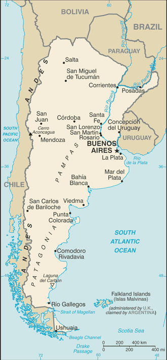
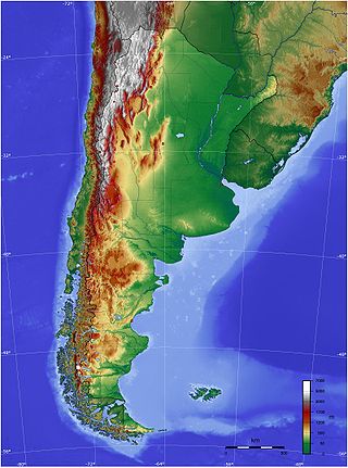
The geography of Argentina is heavily diverse, consisting of the Andes Mountains, pampas, and various rivers and lakes. Bordered by the Andes in the west and the South Atlantic Ocean to the east, its neighbouring countries are Chile to the west, Bolivia and Paraguay to the north, and Brazil and Uruguay to the northeast.

While Peru accounts for about four per cent of the world's annual renewable water resources, over 98% of its water is available east of the Andes, in the Amazon region. The coastal area of Peru, with most of economic activities and more than half of the population, receives only 1.8% of the national freshwater renewable water resources. Economic and population growth are taking an increasing toll on water resources quantity and quality, especially in the coastal area of Peru.

Water resources management is a significant challenge for Mexico. The country has in place a system of water resources management that includes both central (federal) and decentralized institutions. Furthermore, water management is imposing a heavy cost to the economy.

Mexico, a classified arid and semi-arid country, has a total land area of 2 million square kilometres, 23% of which is equipped for irrigated agriculture. The agricultural sector plays an important role in the economic development of the country accounting for 8.4 of agricultural gross domestic product (GDP) and employing 23% of the economically active population. Irrigated agriculture contributes about 50% of the total value of agricultural production and accounts for about 70% of agriculture exports. Mexico's government initiated a number of structural reforms in the water sector aimed to introduce modern water management and irrigation.

Water resources management is a key element of Brazil's strategy to promote sustainable growth and a more equitable and inclusive society. Brazil's achievements over the past 70 years have been closely linked to the development of hydraulic infrastructure for hydroelectric power generation and just recently to the development of irrigation infrastructure, especially in the Northeast region.

The water resources management system in Uruguay has been influenced by the general sense of water as an abundant resource in the country. Average annual rainfall is 1,182 mm, representing a contribution of 210 km3 annually throughout its territory. In 2002, the per capita renewable water resources was 41,065 cubic meters, way above the world average 8,467 m3 in 2006. Uruguay also shares one of the largest groundwater reserves in the world, the Guarani Aquifer, with Brazil, Argentina, Paraguay. The Guarani aquifer covers 1,200,000 square kilometers and has a storage capacity of 40,000 km3.

<span class="mw-page-title-main">Water management in Greater Mexico City</span>

Greater Mexico City, a metropolitan area with more than 19 million inhabitants including Mexico's capital with about 9 million inhabitants, faces tremendous water challenges. These include groundwater overexploitation, land subsidence, the risk of major flooding, the impacts of increasing urbanization, poor water quality, inefficient water use, a low share of wastewater treatment, health concerns about the reuse of wastewater in agriculture, and limited cost recovery. Overcoming these challenges is complicated by fragmented responsibilities for water management in Greater Mexico City:

<span class="mw-page-title-main">Environmental effects of irrigation</span> Land & irrigation

The environmental effects of irrigation relate to the changes in quantity and quality of soil and water as a result of irrigation and the subsequent effects on natural and social conditions in river basins and downstream of an irrigation scheme. The effects stem from the altered hydrological conditions caused by the installation and operation of the irrigation scheme.

Water Resources Management (WRM) in Chile is widely known for its 1981 Water Code—written after General Augusto Pinochet took control through a military coup d'état. Free-market mechanisms became the economic philosophy in WRM, including the development of water markets and tradable water permits. A major reform to the 1981 Water Code was signed in 2005 to address social equity and environmental protection concerns. Water resources management in Chile is shared among the private sector which provides investment for infrastructure and distribution, and agencies provide regulatory oversight, maintain records, and issue water rights. Chile is negotiating formalized agreements with both Bolivia and Argentina to manage shared resources and water storage projects. Chile is also supported in rural water supply with $150 million in loans by the World Bank and the Inter-American Development Bank.

Water resources management (WRM) in Honduras is a work in progress and at times has advanced; however, unstable investment and political climates, strong weather phenomena, poverty, lack of adequate capacity, and deficient infrastructures have and will continue to challenge developments to water resource management. The State of Honduras is working on a new General Water Law to replace the 1927 Law on Using National Waters and designed to regulate water use and management. The new water law will also create a Water Authority, and the National Council of Water Resources which will serve as an advising and consultative body.

<span class="mw-page-title-main">Urban water management in Monterrey, Mexico</span> City in Nuevo León, Mexico

Early in the 20th century, Monterrey, Mexico began a successful economic metamorphosis and growth pattern that remains an exception in Mexico. This all began with increased investments in irrigation that fueled a boom in agriculture and ranching for this northern Mexican city. The economic growth has fueled income disparity for the 3.86 million residents who live in the Monterrey Metro area (MMA). In addition, the rapid urbanization has taken a large toll on the water resources. In addressing many of this challenges, the city of Monterrey has become a model for sound and effective Integrated urban water management.

Integrated urban water management (IUWM) in Buenos Aires is not unlike many large urban areas in Latin America where in past decades, more focus was placed on just a few sectors or perhaps only one sector. The water management philosophy in Buenos Aires has evolved to one that is integrating efforts in reducing water pollution, improving stormwater management, adding drainage infrastructure, and improving water supply and sanitation (WSS). Primary challenges in urban water management continue to be flood control and stormwater management as Buenos Aires is situated in the low-lying pampas region where heavy rain is expected all year long. Adding to the challenges, urbanization has outpaced planning and development in the various water sectors. Efforts have been made to control the major tributaries of Río de la Plata such as channelizing and building culverts into urban rivers, however, this has increased flooding as the natural meander and saturating ability of the rivers have been lost. Rapid urbanization and very large quantities of industrial discharge have also caused severe contamination of the water basins that Buenos Aires is built upon. The Matanza-Riachuelo river (MR), a tributary of the Río de la Plata, is a prime example and has become the most contaminated basin in Argentina.

<span class="mw-page-title-main">Water resources management in Syria</span>

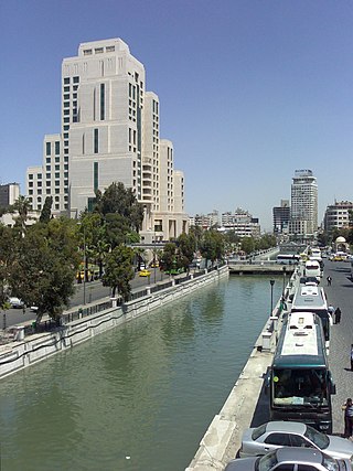
Water resources management in Syria is confronted with numerous challenges. First, all of the country's major rivers are shared with neighboring countries, and Syria depends to a large extent on the inflow of water from Turkey through the Euphrates and its tributaries. Second, high population growth and urbanisation increase the pressure on water resources, resulting in localized groundwater depletion and pollution, for example in the Ghouta near Damascus. Third, there is no legal framework for integrated water resources management. Finally, the institutions in charge of water resources management are weak, being both highly centralized and fragmented between sectors, and they often lack the power to enforce regulations. Water resources policies have been focused on the construction of dams, the development of irrigated agriculture and occasional interbasin transfers, such as a pipeline to supply drinking water to Aleppo from the Euphrates. There are 165 dams in Syria with a total storage capacity of 19.6 km3. Demand management through metering, higher tariffs, more efficient irrigation technologies and the reduction of non-revenue water in drinking water supply has received less emphasis than supply management. The government implements a large program for the construction of wastewater treatment plants including the use of reclaimed water for irrigation.

Water resources management in modern Egypt, is a complex process that involves multiple stakeholders who use water for irrigation, municipal and industrial water supply, hydropower generation and navigation. In addition, the waters of the Nile support aquatic ecosystems that are threatened by abstraction and pollution. Egypt also has substantial fossil groundwater resources in the Western Desert.

Costa Rica is divided into three major drainage basins encompassing 34 watersheds with numerous rivers and tributaries, one major lake used for hydroelectric generation, and two major aquifers that serve to store 90% of the municipal, industrial, and agricultural water supply needs of Costa Rica. Agriculture is the largest water user demanding around 53% of total supplies while the sector contributes 6.5% to the Costa Rica GDP. About a fifth of land under cultivation is being irrigated by surface water. Hydroelectric power generation makes up a significant portion of electricity usage in Costa Rica and much of this comes from the Arenal dam.

Water resources management in Nicaragua is carried out by the National water utility and regulated by the Nicaraguan Institute of water. Nicaragua has ample water supplies in rivers, groundwater, lagoons, and significant rainfall. Distribution of rainfall is uneven though with more rain falling on an annual basis in the Caribbean lowlands and much lower amounts falling in the inland areas. Significant water resources management challenges include contaminated surface water from untreated domestic and industrial wastewater, and poor overall management of the available water resources.

Water resources management in El Salvador is characterized by difficulties in addressing severe water pollution throughout much of the country's surface waters due to untreated discharges of agricultural, domestic and industrial run off. The river that drains the capital city of San Salvador is considered to be polluted beyond the capability of most treatment procedures.

The management of Jamaica's freshwater resources is primarily the domain and responsibility of the National Water Commission (NWC). The duties of providing service and water infrastructure maintenance for rural communities across Jamaica are shared with the Parish Councils. Where possible efficiencies have been identified, the NWC has outsourced various operations to the private sector.

Guatemala faces substantial resource and institutional challenges in successfully managing its national water resources. Deforestation is increasing as the global demand for timber exerts pressure on the forests of Guatemala. Soil erosion, runoff, and sedimentation of surface water is a result of deforestation from development of urban centers, agriculture needs, and conflicting land and water use planning. Sectors within industry are also growing and the prevalence of untreated effluents entering waterways and aquifers has grown alongside.

Water resources management in Belize is carried out by the Water and Sewerage Authority (WASA) in most cases. One of the primary challenges the country is facing with regard to water resources management, however, is the lack of coordinated and comprehensive policies and institutions. Furthermore, there are various areas of water management that are not well addressed at all such as groundwater data and provision of supply. Data on irrigation and drainage is not adequately available either. Demand on water resources is growing as the population increases, new economic opportunities are created, and the agriculture sector expands. This increased demand is placing new threats on the quality and quantity of freshwater resources. Other constant challenge for management entities are the constant threat of floods from tropical storms and hurricanes. The Belize National Emergency Management Organization (NEMO) is charged with flood management as they occur but it is unclear what institution has responsibility for stormwater infrastructures.

References

  1. Surface water produced internally includes the average annual flow of rivers generated from endogenous precipitation and base flow generated by aquifers. Surface water resources are usually computed by measuring or assessing total river flow occurring in a country on a yearly basis.
  2. Groundwater recharge is the total volume of water entering aquifers within a country's borders from endogenous precipitation and surface water flow. Groundwater resources are estimated by measuring rainfall in arid areas where rainfall is assumed to infiltrate into aquifers.
  3. Overlap is the volume of water resources common to both surface and groundwater. It is subtracted when calculating IRWR to avoid double counting. Two types of exchanges create overlap: contribution of aquifers to surface flow, and recharge of aquifers by surface run-off. In arid and semi-arid countries, surface water flows recharge groundwater by infiltrating through the soil during floods.
  4. Per capita renewable water resources are calculated by using natural renewable water resources data from 2007 and national population data from 2002. Actual Renewable Water Resources is the sum of internal renewable water resources and natural flow originating outside of the country. Natural Renewable Water Resources are computed by adding together internal renewable water resources and natural flows.
  5. 1 2 3 4 5 6 7 World Bank (2000). "Argentina: Water Resources Management Policy. Elements for Sustainable Development in the XXI Century". The World Bank. pp. 14–20. Retrieved 2010-01-13.
  6. 1 2 World Bank (2008). "Matanza-Riachuelo Basin Sustainable Development Project: Project Information Document". World Bank. Retrieved December 14, 2009.
  7. United Nations Environment Program (2005). "Planning and Management of Lakes and Reservoirs: An Integrated Approach to Eutrophication". United Nations Environment Program. Retrieved January 22, 2010.
  8. 1 2 Connior, M.B. (2007). "Argentina: A State-of-the-Environment Report" (PDF). Department of Biological Sciences-Arkansas State University. pp. 32–34. Archived from the original (PDF) on June 13, 2010. Retrieved 2010-01-13.
  9. Hilda Marfa Herzer; Nora Clichevsky (2005). "Managing Disaster Risk in Emerging Economies: Floods in Buenos Aires-Learning from the Past" (PDF). pp. 32–44. Retrieved December 14, 2009.
  10. Bank, European Investment (2022-03-03). EIB Group activity in Latin America and the Caribbean in 2021. European Investment Bank.
  11. "Argentina: Team Europe - EIB invests USD 210 million into flood protection and vaccine programmes". European Investment Bank. Retrieved 2022-04-05.
  12. 1 2 3 4 5 6 "Aquastat country overview:Argentina" (in Spanish). FAO. 2000. Retrieved 2010-01-13.
  13. Farber M.E.; Raizboim I.N. (2009). "HYDROGRAPHY". El Sur del Sur. Retrieved March 8, 2010.
  14. The World Bank (2002). "Argentina-Argentina Drainage Infrastructure Management". The World Bank. pp. 1–8. Retrieved 2010-01-24.
  15. 1 2 3 4 Gustavo Alberto Devoto (2000). "Hydroelectric power and development in Argentina" (PDF). ENTE NACIONAL REGULADOR DE LA ELECTRICIDAD (ENRE). pp. 1–5. Retrieved 2010-01-21.
  16. 1 2 3 The world Bank (2000). "Argentina Water Resources Management: Policy Issues and Notes". The World Bank. pp. 7–11.{{cite web}}: Missing or empty |url= (help)
  17. INA (2010). "El Instituto Nacional del Agua (INA)" (in Spanish). Retrieved January 15, 2010.
  18. AySA (2009). "Agua y Saneamiento Argentinos S.A." (in Spanish). Retrieved December 17, 2009.
  19. SAyDS (2009). "Agua y Saneamiento Argentinos S.A." (in Spanish). Retrieved December 17, 2009.
  20. 1 2 3 "Parlamento Medioambiental de la Patagonia en alerta por proyectos mineros y represas sobre recursos hídricos binacionales" (in Spanish). El Divisadero. 2009. p. 1. Retrieved 2009-06-04.
  21. Organization of American States (OAS) (2005). "La Plata River Basin" (PDF). ORGANIZATION OF AMERICAN STATES (OAS). Retrieved March 8, 2010.
  22. Organization of American States (OAS) (2005). "GUARANI AQUIFER SYSTEM: Environmental Protection and Sustainable Development of the Guarani Aquifer System" (PDF). ORGANIZATION OF AMERICAN STATES (OAS). Retrieved March 8, 2010.
  23. World Bank (2009). "MATANZA-RIACHUELO BASIN SUSTAINABLE DEVELOPMENT PROJECT: Project Appraisal document" . Retrieved December 14, 2009.
  24. World Bank (2010). "Argentina - Urban Flood Prevention and Drainage APL 2". World Bank. Retrieved 2010-01-15.
  25. 1 2 Ramsar (2010). "Ramsar in Argentina" . Retrieved March 9, 2010.
  26. M.L. Parry, O.F. Canziani, J.P. Palutikof, P.J. van der Linden, C.E. Hanson, Eds. (2007). "Climate Change 2007: Impacts, Adaptation and Vulnerability". Cambridge University Press. pp. 582–607. Retrieved January 22, 2010.{{cite web}}: CS1 maint: multiple names: authors list (link)
  27. Science Daily (2008). "Glaciers Are Melting Faster Than Expected, UN Reports" . Retrieved January 21, 2010.