Annapolis County is a county in the Canadian province of Nova Scotia located in the western part of the province located on the Bay of Fundy. The county seat is Annapolis Royal.
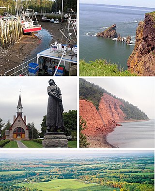
Kings County is a county in the Canadian province of Nova Scotia. With a population of 62,914 in the 2021 Census, Kings County is the third most populous county in the province. It is located in central Nova Scotia on the shore of the Bay of Fundy, with its northeastern part forming the western shore of the Minas Basin.
Sandy Point is a community in the Canadian province of Nova Scotia, located in the Shelburne municipal district of Shelburne County.

Berwick is a Canadian town in Kings County, Nova Scotia. The town is located in the eastern part of the Annapolis Valley on the Cornwallis River. The town site stretches south from the river and Exit 15 of Highway 101 to Highway 1. Berwick occupies 6.80 km2 and has an elevation of 43 m (141 ft) above sea level.
Aylesford, since its formation, has always been a farming community. It is situated in western Kings County in the Annapolis Valley of Nova Scotia, Canada. The settlement was named after the fourth Earl of Aylesford, Heneage Finch, who was Lord Of The Bedchamber to George III from 1772-1777. The community is located between the North and South Mountains, and is roughly a 15 minute drive to Canadian Forces Base Greenwood, and a 10 minute drive to its closest neighbour, the Town Of Berwick. Aylesford is located on the Evangeline Trail scenic tourist route, which was named after the epic 1847 H.W. Longfellow poem entitled Evangeline, A Tale of Acadie.

Lantz is a designated place located on the Shubenacadie River between the communities of Milford and Elmsdale, in the Municipality of East Hants and the Halifax Regional Municipality, Nova Scotia, Canada. Lantz was considered by Statistics Canada as a "Retired population centre."
Cambridge is a community on the Cornwallis River in Kings County, Nova Scotia, Canada, located 12 kilometres west of Kentville. It is administratively part of the village of Cornwallis Square. According to one source, the community was named after Cambridge, England. while another holds it was named for Cambridge, Massachusetts.
Centreville is a rural farming community in Kings County, Nova Scotia, Canada, located 10 kilometres north of Kentville on Route 359. As of 2021, the population was 1,159. Route 309 and Route 221 cross at the settlement. The village was once a junction on the Cornwallis Valley Railway branchline of the Dominion Atlantic Railway.

Yarmouth, officially named the Municipality of the District of Yarmouth, is a district municipality in Yarmouth County, Nova Scotia, Canada. Statistics Canada classifies the district municipality as a municipal district.
Cornwallis Park is a rural community in Annapolis County, Nova Scotia, Canada. As of the 2021 census, the population was 488, an increase of 1.9% from 2016.
Brookfield is a Canadian rural community located in southern Colchester County, Nova Scotia, Canada. Brookfield is a growing community in the heart of Nova Scotia, just forty minutes from the provincial capital of Halifax, thirty minutes from the Stanfield International Airport and ten minutes from the Town of Truro. The community hosts both levels of public schools, two churches, restaurants, a bakery, a service station, a sportsplex, an 18 hole golf course, and a volunteer fire service.

Masstown, formerly Cobequid, is a farming community located approximately 17 kilometres (11 mi) from Truro, Nova Scotia.
Port Hastings is a unincorporated settlement on Cape Breton Island, within the Municipality of the County of Inverness, Canada. The population in 2021 was 90.
Hants Border is a community in the Canadian province of Nova Scotia, located in Kings County next to West Hants municipality and Hantsport on Nova Scotia Trunk 1.
Carleton Corner is a community in the Canadian province of Nova Scotia, located in Annapolis County adjacent to Bridgetown. It is a designated place with a population of 99 in 2021. It is on Nova Scotia Route 201.
Bras d'Or is a community in the Canadian province of Nova Scotia, located in the Cape Breton Regional Municipality.
Little Bras d'Or is a community in the Canadian province of Nova Scotia, located in the Cape Breton Regional Municipality on Cape Breton County on Cape Breton Island.
Edwardsville is a community in the Canadian province of Nova Scotia, located in the Cape Breton Regional Municipality on Cape Breton Island. It is named for King Edward VII.
Hillside is a community in the Canadian province of Nova Scotia, located within the Pictou County Municipality. Located between the Town of Trenton and community of Pictou Landing, the community holds the status of designated place in Canadian census data, and had a population of 122 in the Canada 2021 Census.
Alder Point is a community in the Canadian province of Nova Scotia, located in the Cape Breton Regional Municipality. It derives its name from the nearby headland of the same name, Alder Point.