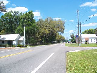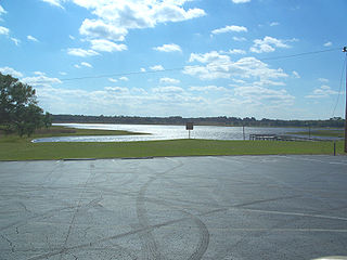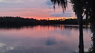
Weirsdale is a town in Marion County, Florida, United States. It is located near the intersection of State Road 25 and State Road 42. The community is part of the Ocala Metropolitan Statistical Area.

Weirsdale is a town in Marion County, Florida, United States. It is located near the intersection of State Road 25 and State Road 42. The community is part of the Ocala Metropolitan Statistical Area.
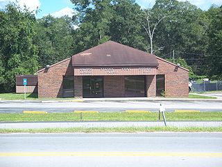
A post office called Weirsdale has been in operation since 1892. [1] Weirsdale has historically been centered on the citrus packing industry. [2]
Weirsdale is located at 28°58′54″N81°55′28″W / 28.9817°N 81.9244°W Coordinates: 28°58′54″N81°55′28″W / 28.9817°N 81.9244°W (28.9817, -81.9244). [3]

Marion County is located in the central portion of the U.S. state of Florida. As of the 2020 census, the population was 375,908. Its county seat is Ocala.

Altoona is an unincorporated community and census-designated place (CDP) in Lake County, Florida, United States. The population was 89 at the 2010 census. It is part of the Orlando–Kissimmee–Sanford Metropolitan Statistical Area.

Paisley is an unincorporated community and census-designated place (CDP) in Lake County, Florida, United States. The population was 818 at the 2010 census, up from 734 at the 2000 census. It is part of the Orlando–Kissimmee Metropolitan Statistical Area.

Pittman is an unincorporated community and census-designated place (CDP) in Lake County, Florida, United States. The population was 180 at the 2010 census. It is part of the Orlando–Kissimmee Metropolitan Statistical Area.

Umatilla is a city in Lake County, Florida, United States. The population was 3,456 at the 2010 census and an estimated 3,805 in 2018. Umatilla is known as the Gateway to the Ocala National Forest, located in northern Lake County.

McIntosh is a town in Marion County, Florida, United States. As of the 2010 census, the town population was 452. As of 2018, the population recorded by the U.S. Census Bureau was 490. It is part of the Ocala Metropolitan Statistical Area.

Ocala is a city in and the county seat of Marion County within the northern region of Florida, United States. As of the 2020 United States Census, the city's population was 63,591, making it the 54th most populated city in Florida.

Reddick is a town in Marion County, Florida, United States. As of the 2010 census, the town population was 506. As of 2018, the population recorded by the U.S. Census Bureau is 541. It is part of the Ocala Metropolitan Statistical Area.

Fort McCoy is an unincorporated community in Marion County, Florida, United States. It is situated northeast of Ocala and lies between the towns of Sparr and Eureka on County Road 316 and is directly north of Silver Springs on County Road 315. The community is part of the Ocala Metropolitan Statistical Area.

The Ocala National Forest ls the second largest nationally protected forest in the U.S. State of Florida. It covers 607 square miles (1,570 km2) of Central Florida. It is located three miles (5 km) east of Ocala and 16 miles (26 km) southeast of Gainesville. The Ocala National Forest, established in 1908, is the oldest national forest east of the Mississippi River and the southernmost national forest in the continental U.S. The word Ocala is thought to be a derivative of a Timucuan term meaning "fair land" or "big hammock". The forest is headquartered in Tallahassee, as are all three National Forests in Florida, but there are local ranger district offices located in Silver Springs and Umatilla.

Florida's 6th congressional district is a congressional district in the U.S. state of Florida. The district is located on the Eastern Florida Coast and stretches from the southern Jacksonville suburbs to New Smyrna Beach. It includes the city of Daytona Beach.

East Lake Weir is an unincorporated community in eastern Marion County, Florida, United States, on the east shore of Lake Weir. The community is part of the Ocala Metropolitan Statistical Area.

Orange Springs is an unincorporated community in Marion County, Florida, United States. A small portion of the community extends into neighboring Putnam County. The community is part of the Ocala Metropolitan Statistical Area.

Anthony is an unincorporated community in Marion County, Florida, United States. It is located on County Road 200A. The community is part of the Ocala Metropolitan Statistical Area. Anthony has a post office with ZIP code 32617. Anthony is considered to be in the Ocala area “horse country,” as it near horse farms and equestrian facilities and events such as Horse Shows in the Sun (HITS) and Ocala Breeders’ Sales (OBS).

Lowell is an unincorporated community in Marion County, Florida, United States, located near the intersection of County Road 329 and County Road 25A. The community is part of the Ocala Metropolitan Statistical Area.

Rainbow Lakes Estates is an unincorporated community and census-designated place (CDP) in Marion and Levy counties, Florida, United States, established as a Municipal Services District. The Marion County part of the community is part of the Ocala metropolitan area, while the Levy County portion is part of the Gainesville metropolitan area. It was first listed as a CDP prior to the 2020 census.

Sparr is an unincorporated community in Marion County, Florida, United States, located near the intersection of County Road 200A and County Road 329. The community is part of the Ocala Metropolitan Statistical Area.

Ocklawaha is an unincorporated community in Marion County, Florida, United States. The community is part of the Ocala Metropolitan Statistical Area.

Candler is an unincorporated community in Marion County, Florida, United States. It is located on County Road 464 between Silver Springs Shores and Lake Weir. The community is part of the Ocala Metropolitan Statistical Area. Candler's Zip Code is 32111.

Lynne is an unincorporated community in Marion County, in the U.S. state of Florida. It is located along Florida State Road 40 in the western edges of Ocala National Forest.