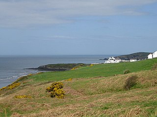
The Pembrokeshire Coast Path, also often called the Pembrokeshire Coastal Path, is a designated National Trail in Pembrokeshire, southwest Wales. It was established in 1970, and is 186 miles (299 km) long, mostly at cliff-top level, with a total of 35,000 feet (11,000 m) of ascent and descent. At its highest point – Pen yr afr, on Cemaes Head – it reaches a height of 574 feet (175 m), and at its lowest point – Sandy Haven crossing, near Milford Haven – it is just 6 feet (2 m) above low water. Whilst most of the coastline faces west, it offers – at varying points – coastal views in every direction of the compass.

Pembrokeshire is a county in the southwest of Wales. It is bordered by Carmarthenshire to the east, Ceredigion to the northeast, and the sea everywhere else.

Ceredigion is a principal area of Wales, corresponding to the historic county of Cardiganshire. During the second half of the first millennium Ceredigion was a minor kingdom. It has been administered as a county since 1282. Welsh is spoken by more than half the population. Ceredigion is considered to be a centre of Welsh culture. The county is mainly rural with over 50 miles (80 km) of coastline and a mountainous hinterland. The numerous sandy beaches and the long-distance Ceredigion Coast Path provide excellent views of Cardigan Bay.

Sandwell Valley RSPB reserve is a nature reserve, run by the RSPB, in Sandwell Valley, to the north of West Bromwich, in the Sandwell borough of West Midlands in England. It is adjacent to, and shares its main lake with, Sandwell Valley Country Park and near the settlement of Hamstead.

Skokholm or Skokholm Island is an island 2.5 miles (4.0 km) off the coast of south west Pembrokeshire in Wales, lying south of the neighbouring island of Skomer, in the community of Marloes and St Brides. The whole island is a Site of Special Scientific Interest as is Skomer. The surrounding waters are a marine reserve and all are part of the Pembrokeshire Coast National Park.

Cardigan is a town and community in the county of Ceredigion in Wales. The town lies on a tidal reach of the River Teifi at the point where Ceredigion, formerly Cardiganshire, meets Pembrokeshire. Cardigan was the county town of the historic county and is the second-largest town in Ceredigion. The largest town, Aberystwyth, is one of the two administrative centres; the other is Aberaeron.

Cardigan Bay is a large inlet of the Irish Sea, indenting the west coast of Wales between Bardsey Island, Gwynedd in the north, and Strumble Head, Pembrokeshire at its southern end. It is the largest bay in Wales.

Cenarth is a village, parish and community in Carmarthenshire, on the border between Ceredigion and Carmarthenshire, and close to the border with Pembrokeshire, Wales. It stands on the banks of the River Teifi, 6 miles (9.7 km) east of Cardigan and 4 miles (6.4 km) west of Newcastle Emlyn, and features the Cenarth Falls, a popular visitor attraction, and several other listed structures including an 18th century corn mill incorporating the National Coracle Centre.

Cilgerran is a village, parish, community, and formerly an incorporated market town. It is situated on the south bank of the River Teifi in Pembrokeshire, Wales.

The River Teifi in Wales forms the boundary for most of its length between the counties of Ceredigion and Carmarthenshire, and for the final 3 miles (4.8 km) of its total length of 73 miles (117 km), the boundary between Ceredigion and Pembrokeshire. Its estuary is northwest of Cardigan. Teifi has formerly been anglicised as "Tivy".

Cilgerran Castle is a 13th-century ruined castle located in Cilgerran, Pembrokeshire, Wales, near Cardigan. The first castle on the site was thought to have been built by Gerald of Windsor around 1110–1115, and it changed hands several times over the following century between English and Welsh forces. In the hands of William Marshal, 2nd Earl of Pembroke, the construction of the stone castle began after 1223. After passing through successive families, it was left to ruin and eventually abandoned by 1400. The castle backs onto a cliff face, with the remaining ruins dating from the 13th century. It was most heavily fortified where it faces inland, and includes a pair of drum towers, rather than a central keep, which remain standing. It passed into the hands of the National Trust in 1938, who open it to the public.

Llechryd is a rural village on the A484 road approximately 3 miles (4.8 km) from Cardigan, Ceredigion, Wales. Situated on the north bank of the tidal River Teifi, Llechryd is the first point upstream of Cardigan where crossing is possible. Most of the village has developed along the A484, with some estates branching off into the valley.

The Wildlife Trust of South and West Wales (WTSWW) is a Wildlife Trust in south and west Wales, one of 46 such Trusts in the United Kingdom.

Cardigan railway station in the county town of Cardigan, Ceredigion was the terminus of the Whitland and Cardigan Railway, opened on 31 August 1886. The line, previously known as the Whitland and Taff Vale Railway, and later familiarly as the 'Cardi Bach', was built between 1869 and 1873. With the extension to Cardigan opening in 1886, operations were taken over by the Great Western Railway.

Gwbert, also known as Gwbert-on-Sea, is a small cliff-top coastal hamlet in Y Ferwig community, Ceredigion, Wales. It lies at the most southerly coastal point of Ceredigion, on the eastern shore of the Teifi estuary, from where there are views westwards over Cardigan Bay, and south-westwards to Poppit Sands and the headland of Cemaes Head, in neighbouring Pembrokeshire. It is reached by the B4548 road from the town of Cardigan, 2.8 miles (4.5 km) away.

Boncath is a village, community and postal district in north Pembrokeshire, Wales, about 5 miles (8.0 km) west of Newcastle Emlyn.

Cors Caron is a raised bog in Ceredigion, Wales. Cors is the Welsh word for "bog": the site is also known as Tregaron Bog, being near the small town of Tregaron. Cors Caron covers an area of approximately 862 acres (349 ha). Cors Caron represents the most intact surviving example of a raised bog landscape in the United Kingdom. About 44 different species groups inhabit the area including various land and aquatic plants, fish, insects, crustaceans, lichen, fungi, terrestrial mammals and birds.

The Wales Coast Path is 870 miles (1,400 km) long. The footpath opened on 5 May 2012 and follows, or runs close to, the coastline of Wales. It offers a walking route from Chepstow in the south to Queensferry, Flintshire, in the north.

Magor Marsh is a 90 acres wetland reserve, located on the Welsh side of the Severn Estuary. It is managed by the Gwent Wildlife Trust. It has a great variety of habitats, including damp hay meadows, sedge fen, reedbed, scrub and wet woodland. There are also a large pond and numerous reens at the reserve.

Cemaes Head is a headland and nature reserve in north Pembrokeshire. It lies in the community of St Dogmaels, within the Pembrokeshire Coast National Park. To the west and north it overlooks Cardigan Bay, and to the east Cardigan Island and the estuary of the River Teifi.


