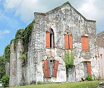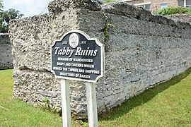
Darien is a city in McIntosh County, Georgia, United States. It lies on Georgia's coast at the mouth of the Altamaha River, approximately 50 miles south of Savannah, and is part of the Brunswick, Georgia Metropolitan Statistical Area. The population of Darien was 1,975 at the 2010 census. The city is the county seat of McIntosh County. It is the second oldest planned city in Georgia and was originally called New Inverness.

Natchez National Historical Park commemorates the history of Natchez, Mississippi, and is managed by the National Park Service.

The Savannah Historic District is a large urban U.S. historic district that roughly corresponds to the pre-civil war city limits of Savannah, Georgia. The area was declared a National Historic Landmark District in 1966, and is one of the largest urban, community-wide historic preservation districts in the United States. The district was made in recognition of the Oglethorpe Plan, a unique sort of urban planning begun by James Oglethorpe at the city's founding and propagated for the first century of its growth.

Washington Park Historic District, also known as Washington Square is a historic district in and around Washington Park in the city of Ottawa, Illinois, United States. Washington Park was the site of the first Lincoln-Douglas debates of 1858 and is surrounded by several historic structures. The park was platted in 1831 and the historic district was added to the United States National Register of Historic Places in 1973.

The Upper North Street Commercial District is a historic district on the north side of downtown Pittsfield, Massachusetts, United States. Representing an expansion of Pittsfield's historic downtown area northward from Park Square in the late 19th century, the district encompasses primarily commercial buildings fronting on North Street between Columbus and Madison Avenues on the west side, and between Eagle and Maplewood Avenues on the east side. The notable exceptions are the Berkshire Eagle building, located on Eagle Street next to Sottile Park, and the St. Joseph's Church complex. The district features Colonial Revival and Renaissance style architecture. It was added to the National Register of Historic Places in 2002.

The Winchester Center Historic District encompasses the commercial and civic heart of Winchester, Massachusetts. It is roughly bounded Mt. Vernon and Washington Streets, Waterfield Road, Church and Main Streets. The district includes a number of Romanesque Revival buildings, including Winchester Town Hall and the Winchester Savings Bank building on Mount Vernon Street. Noted architects who contributed to the district include Robert Coit and Asa Fletcher. The district was listed on the National Register of Historic Places in 1986.

Downtown Columbus, Georgia, also called "Uptown", is the central business district of the city of Columbus, Georgia. The commercial and governmental heart of the city has traditionally been toward the eastern end of Downtown Columbus, between 10th Street and 1st Avenue. Recent developments, particularly between Broadway and 2nd Avenue, have expanded the boundaries of the "central" part of the neighborhood. The term "Downtown Columbus" can also mean this smaller, more commercial area, particularly when used in the context of the city's nightlife and restaurants

MidTown is an area of six square miles in Columbus, Georgia. Within its boundaries are diverse residential neighborhoods and historic districts, eleven public schools, numerous parks and public greenspaces, the Columbus Museum, the Columbus Public Library, the Muscogee County Public Education Center, the Columbus Aquatic Center, commercial office and retail districts, and the international headquarters for Aflac. MidTown is home to over 22,000 residents living in 8500 households and is six miles (10 km) north of Fort Benning on I-185.
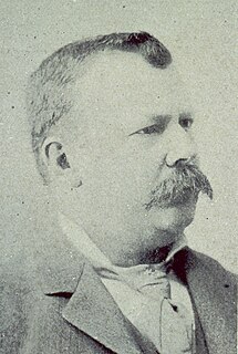
Joseph Warren Yost (1847–1923) was a prominent architect from Ohio whose works included many courthouses and other public buildings. Some of his most productive years were spent as a member of the Yost and Packard partnership with Frank Packard. Later in his career he joined Albert D'Oench at the New York City based firm D'Oench & Yost. A number of his works are listed for their architecture in the U.S. National Register of Historic Places (NRHP).

The Boston Post Road Historic District encompasses a cross-section of residential architectural styles representative of much of the history of Darien, Connecticut. Centered on the junction of Boston Post Road and Brookdale Road, the district also includes two civic landmarks: the town hall and the Greek Revival First Congregational Church. The district was listed on the National Register of Historic Places in 1982.

The Provo Downtown Historic District is a 25-acre (10 ha) historic area located in Provo, Utah, United States. It is listed on the National Register of Historic Places.

The Plymouth Historic District encompasses a cluster of five civic buildings and the town common of Plymouth, New Hampshire. The buildings are arrayed on the west side of Plymouth's town common, laid out not long after the town's settlement in 1763. The 2-acre (0.81 ha) district includes the town hall/court house, the Pemigewasset National Bank building, and the US Post Office building, as well as the Old Grafton County Courthouse. The Plymouth Congregation Church also falls within the district bounds, but is not considered contributing. The district was listed on the National Register of Historic Places in 1986.

Mount Vernon Triangle is a neighborhood and community improvement district in the northwest quadrant of Washington, D.C. Originally a working-class neighborhood established in the 19th century, present-day Mount Vernon Triangle experienced a decline in the mid-20th century as it transitioned from residential to commercial and industrial use. The neighborhood has undergone significant and rapid redevelopment in the 21st century. It now consists mostly of high-rise condominium, apartment and office buildings. Several historic buildings in the neighborhood have been preserved and are listed on the National Register of Historic Places. Mount Vernon Triangle is now considered a good example of urban planning and a walkable neighborhood.
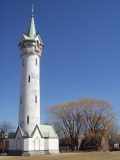
Fort Hill is a 0.4 square mile neighborhood and historic district of Roxbury, in Boston, Massachusetts. The approximate boundaries of Fort Hill are Malcolm X Boulevard on the north, Washington Street on the southeast, and Columbus Avenue on the southwest.
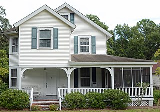
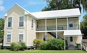
The Vernon Square–Columbus Square Historic District is a historic area on the eastern side of Darien, Georgia. It encompasses two squares of the original 1805 city plan, although Vernon Square now contains a circular street. The plan was derived from James Oglethorpe's plan for Savannah. The area of Vernon and Columbus Wards was platted in 1805. The historic buildings in the area date back to the mid-19th and early 20th centuries. The houses are mostly modest wood-framed structures with weatherboard siding and wood detail.
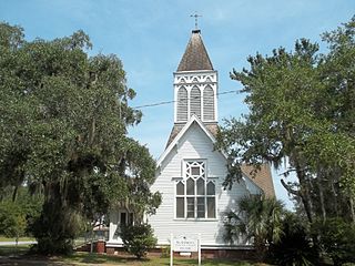
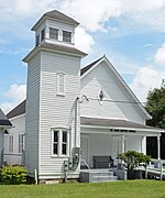
St. Andrew's Episcopal Church in Darien, Georgia is a historic church. It is a contributing building in the Vernon Square–Columbus Square Historic District. The original church was built in 1844 but was burned down during the Civil War. It was rebuilt north of Darien until the present day building was completed on Vernon Square in 1879. It was considered a part of the healing process and reunification between the north and south after the Civil war ended.

The Columbus Civic Center is a civic center, a collection of government buildings, museums, and open park space in Downtown Columbus, Ohio. The site is located along the Scioto Mile recreation area and historically was directly on the banks of the Scioto River.

The Tifton Residential Historic District, in Tifton, Georgia, is a historic district which was listed on the National Register of Historic Places in 2008.
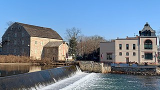
The Clinton Historic District is a 175-acre (71 ha) historic district encompassing much of the town of Clinton in Hunterdon County, New Jersey. It was added to the National Register of Historic Places on September 28, 1995, for its significance in architecture, commerce, engineering, industry and exploration/settlement. The district includes 270 contributing buildings, one contributing structure, and three contributing sites. Five were previously listed on the NRHP individually: Dunham's Mill, M. C. Mulligan & Sons Quarry, Music Hall, Old Grandin Library, and Red Mill.


