Related Research Articles

Glendora is a city in the San Gabriel Valley in Los Angeles County, California, 26 miles (42 km) east of Los Angeles. As of the 2020 census, the population of Glendora was 52,558.

The San Gabriel Mountains are a mountain range located in northern Los Angeles County and western San Bernardino County, California, United States. The mountain range is part of the Transverse Ranges and lies between the Los Angeles Basin and the Mojave Desert, with Interstate 5 to the west and Interstate 15 to the east. The range lies in, and is surrounded by, the Angeles and San Bernardino National Forests, with the San Andreas Fault as its northern border.

The San Gabriel Valley, often referred to by its initials as SGV, is one of the principal valleys of Southern California, lying immediately to the east of the eastern limits of the city of Los Angeles and occupying the vast majority of the southeastern part of Los Angeles County. Surrounding landforms and other features include the following:

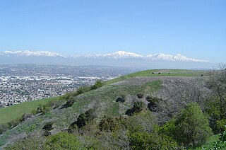
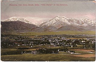
The Pomona Valley is located in the Greater Los Angeles Area between the San Gabriel Valley and San Bernardino Valley in Southern California. The valley is approximately 30 miles (48 km) east of downtown Los Angeles.
East Fork Road, located in the San Gabriel Mountains above the city of Azusa, California, is a road that gives access from State Route 39 into East Fork and other small townships, including Camp Williams, and Julius Klein Conservation Fire Camp 19, a minor offender prisoner housing complex where "LACO fire personnel provide training, which prepares inmates to safely conduct wild land firefighting operations."

The Angeles National Forest (ANF) of the U.S. Forest Service is located in the San Gabriel Mountains and Sierra Pelona Mountains, primarily within Los Angeles County in southern California. The ANF manages a majority of the San Gabriel Mountains National Monument.

The San Gabriel River is a mostly urban waterway flowing 58 miles (93 km) southward through Los Angeles and Orange Counties, California in the United States. It is the central of three major rivers draining the Greater Los Angeles Area, the others being the Los Angeles River and Santa Ana River. The river's watershed stretches from the rugged San Gabriel Mountains to the heavily developed San Gabriel Valley and a significant part of the Los Angeles coastal plain, emptying into the Pacific Ocean between the cities of Long Beach and Seal Beach.
The Crystal Lake Recreation Area is located in the San Gabriel Mountains of Southern California, administered by the San Gabriel Mountains National Monument of the United States Forest Service. The Recreation Area consists of a small lake, an open-air amphitheater, a large public campground containing approximately 120 camp sites grouped into "loops," and a group campground called Deer Flats which consists of approximately 25 camp sites. The Recreation Area contains a United States Forest Service visitor center and a cafe which is open to the public from dawn to dusk except for Tuesdays when the cafe is closed. Within the Recreation Area are 16 hiking and nature trails which are well-maintained by volunteers who work under the direction of the Forest Service. The Recreation Area is located approximately 26 miles (42 km) north on Hwy. 39 heading out of Azusa, California at the headwaters of the north fork of the San Gabriel River at an elevation approximately 5,539 feet above sea level. Crystal Lake is the only naturally occurring lake in the San Gabriel Mountains.

California's 28th congressional district is a congressional district in the U.S. state of California, in Los Angeles County. The district is regarded as a Democratic stronghold and has been held by the Democratic Party since 2003 and is currently represented by Democrat Judy Chu.
California's 31st congressional district is a congressional district in Los Angeles County, in the U.S. state of California. The district is located in the San Gabriel Valley.

The Bridge to Nowhere is an arch bridge that was built in 1936 north of Azusa, California, United States in the San Gabriel Mountains. It spans the East Fork of the San Gabriel River and was meant to be part of a road connecting the San Gabriel Valley with Wrightwood, California.

The San Gabriel Wilderness is a wilderness area created in 1968 of more than 36,118 acres (150 km2) within the Angeles National Forest and San Gabriel Mountains National Monument.
The San Gabriel Mountains Regional Conservancy (SGMRC) is a regional environmental organization located in the foothill area of the eastern San Gabriel Valley. It is concerned with the conservation of land, land use planning, publication of studies, watershed management, land management, and education.
The Sierra Madre Dam is a dam on Little Santa Anita Creek, at the mouth of Little Santa Anita Canyon, in Los Angeles County, California. It is in the San Gabriel Mountains, south of the Angeles National Forest, on the northern border of Sierra Madre.
The Angeles Volunteer Association (AVA) is a public service organization dedicated to the preservation and care of the Angeles National Forest working under the safety oversight and supervision of the United States Forest Service as a 501(c)3 non-profit organization.

The San Gabriel Mountains Trailbuilders (SGMTBs) is a 501(c)(3) non-profit volunteer organization which performs hiking and nature trail building and maintenance within the Los Angeles Gateway District of the United States Forest Service which maintains the Angeles National Forest within the San Gabriel Mountains.

The San Dimas Biosphere Reserve and Experimental Forest is an experimental forest located in the front range of the San Gabriel Mountains of southern California. San Dimas constitutes a protected field laboratory jointly managed by the Angeles National Forest and the Pacific Southwest Research Station of the United States Forest Service under the designation San Dimas Experimental Forest. It was designated as a UNESCO Biosphere Reserve in 1976 and withdrawn from the programme in July 2018.

Big Dalton Dam is a multiple arch concrete dam in Los Angeles County, California, built for the Los Angeles County Flood Control District and completed in August 1929. The dam is one of the earliest of the multiple arch "double-wall" buttress designs of engineer Fred A. Noetzli. The 991 acre-foot dam provides water conservation and controls flooding from Big Dalton Canyon, a watershed within the San Dimas Experimental Forest, part of the Angeles National Forest in the San Gabriel Mountains. It is about 4 miles northeast of the city of Glendora and is operated by the Los Angeles County Department of Public Works.

The San Gabriel Complex Fire was a wildfire that burned in 2016 in the Angeles National Forest, Los Angeles County, California, United States. It was the combination of two separate wildfires: the Reservoir Fire and the Fish Fire, both of which ignited on June 20.

The San Gabriel and Lower Los Angeles Rivers and Mountains Conservancy (RMC) is an agency of the State of California in the United States with the mission of preserving open space and habitat for low-impact recreation and educational uses, wildlife habitat restoration and protection, and watershed improvements within its jurisdiction. The conservancy was created by the state legislature in 1999, and is headquartered in Azusa. It is 1 of 10 conservancies within the California Natural Resources Agency. At the time of its founding, it was the state's first conservancy to primarily serve an urban area.
References
- ↑ Forest Service budget cuts Accessed 2013-06-26
- ↑ Southern California Population
- ↑ Angeles National Forest Visitor Counts
- ↑ Fishing Academy Accessed 2013-06-26
- ↑ San Gabriel Watershed Accessed 2013-06-26
- ↑ Conservancy Patrols Accessed 2013-06-26
- ↑ Conservancy Email Address Accessed 2013-06-26
- ↑ Sierra Madre Search & Rescue
- ↑ San Gabriel Mountain Trailbuilders
- ↑ Angeles Volunteer Association
- ↑ Fisheries Resource Volunteer Corps
- ↑ San Dimas Mountain Rescue Team