
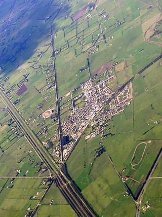
Warragul is a town in Victoria, Australia, 102 kilometres south-east of Melbourne. Warragul lies between the Strzelecki Ranges to the south and the Mount Baw Baw Plateau of the Great Dividing Range to the north. As of the 2021 census, the town had a population of 19,856 people. Warragul forms part of a larger urban area that includes nearby Drouin that had an estimated total population of 42,827 as of the 2021 census.

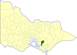
The Shire of Baw Baw is a local government area in Victoria, Australia, in the eastern part of the state. It covers an area of 4,028 square kilometres (1,555 sq mi) and in June 2018 had a population of 52,015.
The Gippsland V/Line rail service or Bairnsdale Line is a passenger service operated by V/Line in Victoria, Australia between Melbourne and the Gippsland region including the regional cities of Moe, Morwell, Traralgon, Sale and Bairnsdale. It operates along the Gippsland railway line.

Warragul railway station is located on the Gippsland line in Victoria, Australia. It serves the town of Warragul, and it opened on 1 March 1878 as Warrigal. It was renamed Warragul on 1 May 1879.

Drouin is a town in the West Gippsland region, 90 kilometres (56 mi) east of Melbourne, in the Australian state of Victoria. Its local government area is the Shire of Baw Baw, and is home to the shire council’s headquarters despite being the second-largest town in the shire, behind neighbouring Warragul. The town’s name is believed to be an Aboriginal word meaning "north wind". New housing developments have accelerated the town's residential growth in recent years. As at the 2016 census, Drouin had a population of 11,887 people.

Yarragon is a town in the Shire of Baw Baw in the West Gippsland region of Victoria, Australia. The town lies on the Princes Highway and the main Gippsland Railway line approximately halfway between the major towns of Warragul and Moe. Hills of the Strzelecki Ranges rise over 500 metres (1,600 ft) immediately to the south of the town, providing a spectacular backdrop, while the Moe River and the lowlands lie to the north and east. Mount Worth at 515 m (1,690 ft) above sea level is the highest near peak to the south in the Mount Worth State Park 16 kilometres (9.9 mi) SSW of Yarragon. Mount Baw Baw at 1,563 m (5,128 ft) in the Baw Baw Ranges as part of the Great Dividing Range to the north is approximately 85 kilometres (53 mi) NNE of Yarragon. The township sits at approximately 88 metres (289 ft) above sea level. At the 2006 census, Yarragon had a population of 1131.

The Division of McMillan was an Australian Electoral Division in the state of Victoria. It was located in the western part of the Gippsland region, which extends for the length of Victoria's eastern Bass Strait coastline. It included the outer south-eastern Melbourne suburb of Pakenham, and also included the towns of Warragul, Moe, Wonthaggi, Leongatha and Foster. It stretched from Mount Baw Baw and the Baw Baw National Park in the north to Wilsons Promontory, and the Wilsons Promontory National Park in the south. It was the southernmost electoral division in continental Australia. It was replaced by the Division of Monash in 2019.

Neerim South is a town in West Gippsland, Victoria, Australia, located in the Shire of Baw Baw, 109 kilometres (68 mi) east of Melbourne and 19 kilometres (12 mi) north of Warragul. At the 2016 census, Neerim South had a population of 1,305.

The Warragul Show is an agricultural show that has been held annually on the first weekend of March since 1885 in Warragul, a town in the West Gippsland region of Victoria in Australia. The show takes place at the Warragul showgrounds, located at Logan Park where the greyhound and harness tracks are also situated. The show is run by the Warragul and West Gippsland Agricultural Society.
Maryknoll is a town in Victoria, Australia, 61 km south-east of Melbourne's Central Business District, located within the Shire of Cardinia local government area. Maryknoll recorded a population of 646 at the 2021 census.
The Diocese of Gippsland is a diocese of the Anglican Church of Australia, founded in 1902. It is situated in the Gippsland region of the state of Victoria, Australia and covers most of the eastern part of the state. The diocesan cathedral is St Paul's Cathedral, Sale. The current Bishop of Gippsland, installed on 18 August 2018, is Richard Treloar.

The Gippsland League is an Australian rules football and netball league in the Gippsland region of Victoria, Australia. It is considered the only AFL Victoria major league in Gippsland.
The Shire of Buln Buln was a local government area about 95 kilometres (59 mi) east-southeast of Melbourne, the state capital of Victoria, Australia. The shire covered an area of 1,259 square kilometres (486.1 sq mi), and existed from 1878 until 1994.

The Shire of Korumburra was a local government area located about 115 kilometres (71 mi) southeast of Melbourne, the state capital of Victoria, Australia. The shire covered an area of 613.8 square kilometres (237.0 sq mi), and existed from 1891 until 1994.
Cycling in the Australian state of Victoria is a popular pastime, sport and way of getting around since at least 1896, as indicated by the Banjo Paterson poem Mulga Bill's Bicycle. Cycling in Victoria has been encouraged by the development of bicycle networks in town and cities throughout the state, and many regional rail trails. The sports popularity has been encouraged by the success of racing clubs such as the St Kilda Cycling Club and Victorian racing riders such as Cadel Evans, Simon Gerrans and Matthew Lloyd. Organised rides held annually including the Great Victorian Bike Ride, and races held in Victoria include the Herald Sun Tour.

The Warragul Football and Netball Club, nicknamed the Gulls, is an Australian rules football and netball club based in the city of the same name in the state of Victoria.
The electoral district of Gippsland West was an electoral district of the Legislative Assembly in the Australian state of Victoria. It was created by the Electoral Act Amendment Act 1888 along with Gippsland Central and Gippsland East. Gippsland North and Gippsland South were resized at the same time. The electorate was dissolved in 2002.
Koo Wee Rup is a town and satellite suburb in Victoria, Australia, 63 km south-east of Melbourne's Central Business District, located within the Shire of Cardinia local government area. Built on former marshland now converted to market gardens, Koo Wee Rup recorded a population of 4,047 at the 2021 census.
The Moe River is a perennial river of the West Gippsland catchment, located in the West Gippsland region of the Australian state of Victoria.
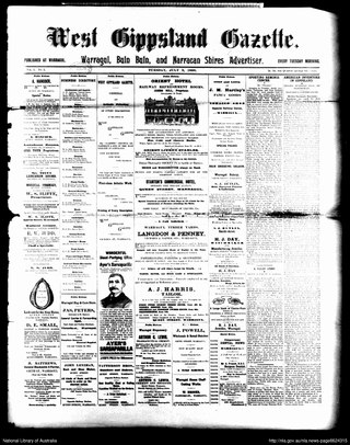
The West Gippsland Gazette was a newspaper published in Warragul, Victoria, Australia.
