
Selby District was a local government district of North Yorkshire, England, from 1974 to 2023. Its council was based in the town of Selby. The district had a population of 83,449 at the 2011 Census. The southernmost district of North Yorkshire, it bordered the City of York unitary authority, the Borough of Harrogate in North Yorkshire, the City of Leeds and City of Wakefield districts in West Yorkshire, the City of Doncaster in South Yorkshire, and the ceremonial county of the East Riding of Yorkshire.
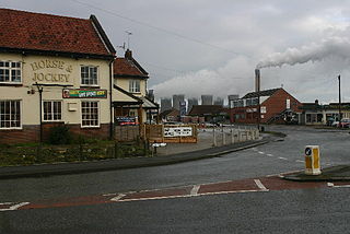
Eggborough is a village and civil parish in North Yorkshire, England, close to the county borders with South Yorkshire, West Yorkshire and the East Riding, effectively making it the meeting point for all sides of Yorkshire.

Barlow is a small village and civil parish located in the Selby District of North Yorkshire, England, about 16 miles south of York. In the 2011 census, it had around 290 houses and a population of 753.

Sherburn in Elmet is a town and civil parish in the district and county of North Yorkshire, England. It is to the west of Selby and south of Tadcaster.
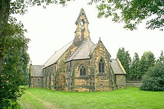
Whitley is a village in North Yorkshire, England, close to the Aire and Calder Navigation and the M62 motorway. The population of the village at the 2001 census was recorded as being 574, which had risen to 1,021 by the time of the 2011 census. In 2015, North Yorkshire County Council estimated the population to have risen again to 1,110. It was historically part of the West Riding of Yorkshire until 1974. From 1974 to April 2023 it was in the Selby District of North Yorkshire.

Bilbrough is a village and civil parish in the Selby District of North Yorkshire, England, 6 miles (10 km) south-west of York, and just outside the York city boundary. According to the 2001 Census it had a population of 319 increasing to 348 at the 2011 census.
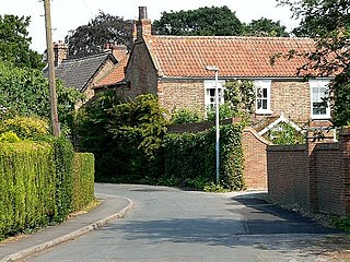
Bubwith is a village and civil parish in the East Riding of Yorkshire, England. The village is situated about 6 miles (10 km) north-east of Selby, and 12 miles (19 km) south-east of York. It is situated on the east bank of the River Derwent, west of which is the Selby District of North Yorkshire. It lies between Selby and Market Weighton on the A163 road.

Burton Salmon is a village and civil parish in the Selby district of North Yorkshire, England, close to the border with West Yorkshire, and approximately 3 miles (5 km) north from Knottingley, on the A162 road. According to the 2001 Census the parish had a population of 419, reducing slightly to 416 at the 2011 Census.
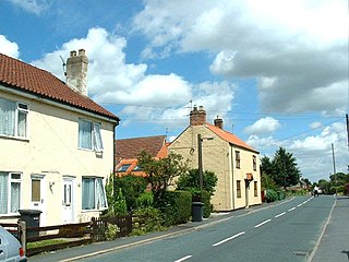
Camblesforth is a village and civil parish in the former Selby District of North Yorkshire, England. According to the 2001 Census the civil parish had a population of 1,526, increasing to 1,568 at the 2011 Census. The village is 5 miles (8 km) south of Selby and 7 miles (11 km) west of Goole. It was historically part of the West Riding of Yorkshire until 1974.

Naburn is a small village and civil parish in the unitary authority of the City of York in the ceremonial county of North Yorkshire, England. It lies on the eastern side of the River Ouse about 4 miles (6.4 km) south of York. According to the 2001 census the parish had a population of 470, increasing to 516 at the 2011 census.

Thorganby is a small village and civil parish in North Yorkshire, England. It was historically part of the East Riding of Yorkshire until 1974, but from 1974 to 2023 was in the Selby District of the shire county of North Yorkshire. In 2023 the district was abolished and North Yorkshire became a unitary authority.

Carlton is a village and civil parish in southern North Yorkshire, England. The village is situated approximately 5 miles (8 km) south-east of the town of Selby on the A1041 road. The parish had a population of 1,934 at the 2011 Census, an increase from 1,829 at the 2001 Census.

Wistow is a small village and civil parish just north of Selby, North Yorkshire, England. In the 2011 Census it had 1,333 residents; an increase from 2001 when there was 1,135. It was historically part of the West Riding of Yorkshire until 1974.

Kellington is a small village and civil parish in the Selby District of North Yorkshire, England, on the banks of the River Aire. Situated almost equidistant between the towns of Pontefract and Selby, the village dates back to at least the 11th century when it was listed in the Domesday Book. The semi-rural community grew in size with the advent of local mining as housing was built to accommodate the workers of nearby Kellingley Colliery.

Clifford is a village and civil parish in West Yorkshire, England. The population of the civil parish at the 2011 Census was 1,662. The village is 3 miles (4.8 km) south of Wetherby. Many of the older buildings are built of magnesian limestone.

Thorpe Willoughby is a village and civil parish in the Selby District of North Yorkshire, England. The village is situated just off the A1238 and is in close proximity to Selby.

Church Fenton is a village and civil parish in the North Yorkshire district of North Yorkshire, England. It is about 16 miles (26 km) east of Leeds, about 6 miles (10 km) south-east from Tadcaster and 3 miles (5 km) north from Sherburn in Elmet. Neighbouring villages include Barkston Ash, Cawood and Ulleskelf. The former RAF Church Fenton is located immediately north-east, which is now known as Leeds East Airport.

Cliffe is a small village and civil parish in North Yorkshire, England. It was historically part of the East Riding of Yorkshire until 1974, but from 1974 to 2023 was in the Selby District of the shire county of North Yorkshire. In 2023 the district was abolished and North Yorkshire became a unitary authority.

Temple Hirst is a village and civil parish in the Selby District of North Yorkshire, England. It was formerly in the wapentake of Barkston Ash in the West Riding of Yorkshire. The village is located on the north bank of the River Aire. In the 2011 census the population was 117.
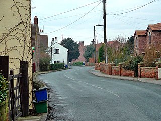
Hirst Courtney is a village and civil parish in the Selby District of North Yorkshire, England.


