Hounslow is a large suburban district of West London, England, 10+3⁄4 miles west-southwest of Charing Cross. It is the administrative centre of the London Borough of Hounslow, and is identified in the London Plan as one of the 12 metropolitan centres in Greater London.
Epping Forest District is a local government district in Essex, England. It is named after the ancient woodland of Epping Forest, a large part of which lies within the district. The council is based in the town of Epping. The district also includes the towns of Loughton, Ongar and Waltham Abbey and surrounding rural areas. The district is situated in the west of the county, bordering the north-eastern edge of London.

Everton is a small rural village of about 200 dwellings and civil parish in the Central Bedfordshire district of Bedfordshire, England about 9 miles (14 km) east of the county town of Bedford.
This article lists the islands in the River Thames, or at the mouth of a tributary, in England. It excludes human-made islands built as part of the building of forty-five two-gate locks which each accompany a weir, and islets subordinate to and forming part of the overall shape of another. The suffix -ey is common across England and Scotland and cognate with ait and meaning island, a term – as ait or eyot – unusually well-preserved on the Thames. A small minority of list entries are referred to as Island, Ait or Eyot and are vestiges, separated by a depression in the land or high-water-level gully.

The A151 road is relatively minor part of the British road system. It lies entirely in the county of Lincolnshire, England. Its western end lies at coordinates 52°48.1892′N0°36.5179′W otherwise, grid reference SK938238.

The Monarch's Way is a 625-mile (1,006 km) long-distance footpath in England that approximates the escape route taken by King Charles II in 1651 after being defeated in the Battle of Worcester. It runs from Worcester via Bristol and Yeovil to Shoreham, West Sussex.

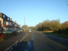
Flimwell is a village in the civil parish of Ticehurst, in the Rother district of East Sussex, England. It is located close to the border with Kent at the junction of the A21 road with the A268 and the B2087. The village is situated in an Area of Outstanding Natural Beauty near Bewl Water and Bedgebury Pinetum, and neighbouring villages include Ticehurst, Hurst Green and Hawkhurst.

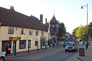
Frimley Green is a large village and ward of 580 acres (2.3 km2) in the Borough of Surrey Heath in Surrey, England, approximately 30 mi (48 km) southwest of central London. It is 1 mi (1.6 km) south of the town of Frimley.
Abbey Wood is an area in southeast London, England, straddling the border between the Royal Borough of Greenwich and the London Borough of Bexley. It is located 10.6 miles (17 km) east of Charing Cross.

The Prittle Brook is a 7.2 mile (11.59 km) watercourse in south Essex, England. A tributary of the River Roach, the brook rises in Thundersley and passes through Hadleigh, Leigh-on-Sea, Westcliff, Prittlewell, Rochford and discharges into the Roach and then into the North Sea via the Roach and Crouch estuaries.

Daws Heath contains a large area of woodland in eastern Thundersley, part of Castle Point near Southend-on-Sea in Essex, England. It is traversed by the Daws Heath Road and St Michael's Road. Daws Heath provides a semi-rural escape for local towns and villages and their residents as they walk, cycle or drive out of Castle Point, as Daws Heath Road has fields and woodland on both sides of the road with a small scattering of houses. Going down Daws Heath Road it is not uncommon to see rare-breed cattle, sheep and horses. Daws Heath is surrounded by Greenbelt and Woodland which are a buffer to stop the local villages merging by development. West Woods, nearly 80 acres (320,000 m2) of mixed woodland, was purchased from the Church of England in 2009, securing continued public access to these woods; public support in the Daws Heath area is very strong especially on green belt and woodland preservation. The area has established neighbourhood watch schemes, Church Groups and Greenbelt Protection Groups. Daws Heath contains The Deanes,, and is linked to a local Sixth Form College in Thundersley (SEEVIC), now part of USP College.
Lessness Heath is a district in the London Borough of Bexley, in the area of Belvedere.

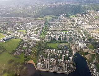
The Norwood Ridge is a 10-square-mile (26 km2) rectangular upland which occupies the geographical centre of south London, centred 5 miles (8 km) south of London Bridge. Beneath its topsoil it is a ridge of London Clay that is capped on all sides with remaining natural gravel deposits mixed with some sandy soil, which in the South Thames basin is a material known as the Claygate Beds.

Grangewood Park is an extensive woodland area situated in South Norwood, London. It is managed by the London Borough of Croydon. It is bounded by Grange Road, Wharncliffe Road, and Ross Road. It covers an area of 27.7 acres. The park is located on the main A212 road between Thornton Heath and Upper Norwood/Crystal Palace. The nearest stations are Thornton Heath, Selhurst and Norwood Junction.
Waltham Abbey is a civil parish in Epping Forest District in Essex, England. Located approximately 14 miles (23 km) north-northeast of central London and adjacent to the Greater London boundary, it is a partly urbanised parish with large sections of open land in the Metropolitan Green Belt. Waltham Abbey is a recent renaming of the ancient parish of Waltham Holy Cross. Aside from the town of Waltham Abbey which contains the majority of the population, it includes the hamlets of Claverhambury, Fishers Green, Holyfield, Sewardstone and Upshire, and the village of High Beach. The local council is Waltham Abbey Town Council.

Little and Lesnes was a hundred, a historical land division, in the county of Kent, England. It occupied the northern part of the Lathe of Sutton-at-Hone, within in the west division of Kent. Little and Lesnes was the northernmost hundred in the whole county of Kent. The hundred existed since ancient times, before the Domesday Book of 1086, until it was made obsolete with the creation of new districts at the end of the nineteenth century.

Holme Beck is a watercourse in the Tong ward of the City of Bradford, West Yorkshire, England. It drains a shallow valley east of the watershed between Bradford and Leeds. Holme Beck begins in the village with no evidence of any continuation on the other side of the canal or motorway. Holme Beck is the main carrier for village drainage, it runs beneath the West Coast Main Line and then through the large marsh area of Holme Moss before joining the River Bela.