West India Docks

Last updated

West India Docks
WestindiaviewofproposalWDaniell1802.jpg
An 1802 painting of the completed docks. The canal to the left of the painting was later closed and became a third dock. The view is looking west towards the City of London.
Location London
Coordinates 51°30′12″N0°01′02″W / 51.50347°N 0.01722°W / 51.50347; -0.01722
Built1802
Built forWest India Dock Company
Architect Robert Milligan
Tower Hamlets London UK location map.svg
Red pog.svg
Location of West India Docks in London Borough of Tower Hamlets

The West India Docks are a series of three docks, quaysides, and warehouses built to import goods from, and export goods and occasionally passengers to the British West Indies. Located on the Isle of Dogs in London, the first dock opened in 1802. Following their commercial closure in 1980, the Canary Wharf development was built around the wet docks by narrowing some of their broadest tracts. [1]

Contents

History

The Henry Addington chosen as the first ship to enter the Grand dock, 27 August 1802, followed by the Echo, the second ship to enter West India Docks. View of the Opening of the Grand Dock with - the Henry Addington - decorated with the colours of all Nations - 27 August 1802, and the Echo RMG PW7697 (cropped).jpg
The Henry Addington chosen as the first ship to enter the Grand dock, 27 August 1802, followed by the Echo, the second ship to enter
West India Docks by Augustus Pugin and Thomas Rowlandson (figures) from Rudolph Ackermann's Microcosm of London, or, London in Miniature (1808-11). Microcosm of London Plate 092 - West India Docks Microcosm edited.jpg
West India Docks by Augustus Pugin and Thomas Rowlandson (figures) from Rudolph Ackermann's Microcosm of London, or, London in Miniature (1808–11).
Map of the Isle of Dogs showing the docks from The Pocket Atlas and Guide to London, 1899 Isle of dogs 1899.jpg
Map of the Isle of Dogs showing the docks from The Pocket Atlas and Guide to London, 1899

Early history

Robert Milligan (c.17461809) of a Scottish family, was largely responsible for the construction of the West India Docks. He was a wealthy West Indies merchant, slave trader and ship owner, who returned to London having managed his family's Jamaica sugar plantations. [2] Outraged at losses due to theft and delay at the extensive (continuously along the Thames for 11 miles (18 km)) riverside wharves comprising the Port of London, Milligan headed a group of powerful businessmen including George Hibbert, the chairman of the London Society of West India Planters and Merchants who was a merchant, politician, and ship-owner who promoted the creation of a wet dock circled by a high wall. The group planned and built West India Docks, lobbying Parliament to allow the creation of a West India Dock Company. Milligan served as both deputy chairman and chairman of the West India Dock Company. The docks were authorised by the West India Dock Act 1799. [3] [1]

The docks were constructed in two phases. The two northern docks were constructed between 1800 and 1802 for the West India Dock Company to a design by leading civil engineer William Jessop (with consultant John Rennie, appointed resident engineer Ralph Walker, and with input from Thomas Morris, Liverpool's third dock engineer), [4] and were the first commercial wet docks in London. British Prime Minister William Pitt the Younger and Lord Chancellor Lord Loughborough were assisted in the foundation stone ceremony on 12 July 1800 by Milligan and Hibbert. [5] The docks were formally opened on 27 August 1802 when the unladen Henry Addington was hauled in by ropes. Echo, a ship laden with cargo from the West Indies, followed. [6] For the following 21 years all vessels in the West India trade using the Port of London were compelled to use the West India docks by a clause in the Act of Parliament that had enabled their construction. [7]

The southern dock, the South West India Dock, later known as South Dock, was constructed in the 1860s, replacing the unprofitable City Canal, built in 1805. [Note 1] In 1909 the Port of London Authority (PLA) took over the West India Docks, along with the other enclosed docks from St Katharines to Tilbury. [8]

South Dock in the 1980s South Dock.png
South Dock in the 1980s

From 1960 to 1980, trade in the docks declined to almost nothing. There were two main reasons. First, the development of the shipping container made this type of relatively small dock inefficient, and the dock-owners were slow to embrace change. Second, the manufacturing exports which had maintained the trade through the docks dwindled and moved away from the local area. The docks were closed in 1981. [9]

Re-development

After the closure of the upstream enclosed docks, the area was regenerated as part of the Docklands scheme, and is now home to the developments of Canary Wharf. The early phase one buildings of Canary Wharf were built out over the water, reducing the width of the north dock and middle dock. Canary Wharf tube station was constructed within the middle dock in the 1990s. [10] Part of the original dock building was converted for use as the Museum of London Docklands in 2003. [11] [12]

The Crossrail Place development was completed in May 2015 [13] and the Canary Wharf Crossrail station below it was completed in September 2015. [14]

The Spanish air defence frigate Mendez Nunez moored at South Dock in 2015 Spanish frigate Mendez Nunez in London.jpg
The Spanish air defence frigate Méndez Núñez moored at South Dock in 2015
Panorama view of vessels moored in the south dock of the West India Docks during the 2012 Summer Olympics, viewed from the southeastern corner of the Canary Wharf estate. Canary wharf 2012.jpg
Panorama view of vessels moored in the south dock of the West India Docks during the 2012 Summer Olympics, viewed from the southeastern corner of the Canary Wharf estate.

Layout

The original docks consisted of an Import Dock of 30 acres (120,000 m2) of water, later named North Dock, and an Export Dock of 24 acres (97,000 m2), later named Middle Dock. Between them, the docks had a combined capability to berth over 600 vessels. Locks and basins at either end of the Docks connected them to the river Thames. These were known as Blackwall Basin and Limehouse Basin, not to be confused with the Regent's Canal Dock also known as Limehouse Basin. To avoid congestion, ships entered from the (eastern) Blackwall end; lighters entered from the Limehouse end to the west. A dry dock for ship repairs was constructed connecting to Blackwall Basin. Subsequently, the North London Railway's Poplar Dock was also connected to Blackwall Basin. [15]

The Docks' design allowed a ship arriving from the West Indies to unload in the northern dock, sail round to the southern dock and load up with export cargo in a fraction of the time it had previously taken in the heavily congested and dangerous upper reaches of the Thames. Around the Import Dock a continuous line of five-storey warehouses was constructed, designed by architect George Gwilt and his son, also named George. [16] The Export Dock needed fewer buildings as cargo was loaded upon arrival. To protect against theft, the whole complex was surrounded by a brick wall 20 ft (6.1 m) high. [17]

The three docks were initially separate, with the two northern docks interconnected only via the basin at each end, and South Dock connected via a series of three basins at the eastern end. Railway access was very difficult. Under PLA control, cuts were made to connect the three docks into a single system, and the connections to the Thames at the western end were filled, along with the Limehouse basin and with it the western connection between the two northern docks. This allowed improved road and rail access from the north and west. South Dock was also connected to the north end of Millwall Dock, its enlarged eastern lock becoming the only entrance from the Thames to the whole West India and Millwall system. [18]

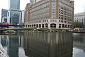
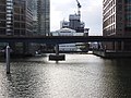
Gallery: West India Dock (North Dock)

Gallery: West India Dock (South Dock)

See also

Notes and references

Notes

  1. The City Canal had been constructed across the Isle of Dogs just to the south of West India Docks. The aim had been to provide a short cut for sailing ships, to save them travelling around the bottom of the Isle of Dogs to access the wharves in the upper reaches of the Thames; if winds were unfavourable, this journey could take some time. However, access to the canal was determined by the state of the tide, fees were expensive, and the transit slow.

Related Research Articles

<span class="mw-page-title-main">London Docklands</span> Area by the Thames in London, England

London Docklands is the riverfront and former docks in London. It is located in inner east and southeast London, in the boroughs of Southwark, Tower Hamlets, Lewisham, Newham and Greenwich. The docks were formerly part of the Port of London, at one time the world's largest port. After the docks closed, the area had become derelict and poverty-ridden by the 1980s. The Docklands' regeneration began later that decade; it has been redeveloped principally for commercial and residential use. The name "London Docklands" was used for the first time in a government report on redevelopment plans in 1971 and has since been almost universally adopted. The redevelopment created wealth, but also led to some conflict between the new and old communities in the area.

<span class="mw-page-title-main">Isle of Dogs</span> Area in the East End of London, England

The Isle of Dogs is a large peninsula bounded on three sides by a large meander in the River Thames in East London, England, which includes the Cubitt Town, Millwall and Canary Wharf districts. The area was historically part of the Manor, Hamlet, Parish and, for a time, the wider borough of Poplar. The name had no official status until the 1987 creation of the Isle of Dogs Neighbourhood by Tower Hamlets London Borough Council. It has been known locally as simply "the Island" since the 19th century.

<span class="mw-page-title-main">Limehouse</span> District in Tower Hamlets, London

Limehouse is a district in the London Borough of Tower Hamlets in East London. It is 3.9 miles (6.3 km) east of Charing Cross, on the northern bank of the River Thames. Its proximity to the river has given it a strong maritime character, which it retains through its riverside public houses and steps, such as The Grapes and Limehouse Stairs. It is part of the traditional county of Middlesex. It became part of the ceremonial County of London following the passing of the Local Government Act 1888, and then part of Greater London in 1965.

<span class="mw-page-title-main">Poplar, London</span> Area of East London, England

Poplar is a district in East London, England, now part of the London Borough of Tower Hamlets. Five miles (8 km) east of Charing Cross, it is part of the East End.

<span class="mw-page-title-main">Canary Wharf</span> Major business and financial district in London

Canary Wharf is an area of London, England, located near the Isle of Dogs in the London Borough of Tower Hamlets. Canary Wharf is defined by the Greater London Authority as being part of London's central business district, alongside Central London. Alongside the City of London, it constitutes one of the main financial centres in the United Kingdom and the world, containing many high-rise buildings including the third-tallest in the UK, One Canada Square, which opened on 26 August 1991.

<span class="mw-page-title-main">Westferry DLR station</span> Docklands Light Railway station

Westferry is a Docklands Light Railway (DLR) station in Limehouse in London, England. It is located in Travelcard Zone 2. To the west is Limehouse station, whilst to the east the DLR splits, with one branch going to Poplar station and the other to West India Quay station.

The Port of London is that part of the River Thames in England lying between Teddington Lock and the defined boundary with the North Sea and including any associated docks. Once the largest port in the world, it was the United Kingdom's largest port as of 2020. Usage is largely governed by the Port of London Authority ("PLA"), a public trust established in 1908; while mainly responsible for coordination and enforcement of activities it also has some minor operations of its own.

<span class="mw-page-title-main">Blackwall, London</span> Area of the East End of London, England

Blackwall is an area of Poplar, in the London Borough of Tower Hamlets, East London. The neighbourhood includes Leamouth and the Coldharbour conservation area.

<span class="mw-page-title-main">Millwall</span> Area of the Isle of Dogs in London, England

Millwall is a district on the western and southern side of the Isle of Dogs, in east London, England, in the London Borough of Tower Hamlets. It lies to the immediate south of Canary Wharf and Limehouse, north of Greenwich and Deptford, east of Rotherhithe, west of Cubitt Town, and has a long shoreline along London's Tideway, part of the River Thames. It was part of the County of Middlesex and from 1889 the County of London following the passing of the Local Government Act 1888, it later became part of Greater London in 1965.

<span class="mw-page-title-main">Pool of London</span> Area of the Thames

The Pool of London is a stretch of the River Thames from London Bridge to below Limehouse.

<span class="mw-page-title-main">London Docklands Development Corporation</span> English regeneration agency (1981–1998)

The London Docklands Development Corporation (LDDC) was a quango agency set up by the UK Government in 1981 to regenerate the depressed Docklands area of east London. During its seventeen-year existence, it was responsible for regenerating an area of 8.5 square miles (22 km2) in the London Boroughs of Newham, Tower Hamlets and Southwark. LDDC helped to create Canary Wharf, Surrey Quays shopping centre, London City Airport, ExCeL Exhibition Centre, London Arena and the Docklands Light Railway, bringing more than 120,000 new jobs to the Docklands and making the area highly sought after for housing. Although initially fiercely resisted by local councils and residents, today it is generally regarded as having been a success and is now used as an example of large-scale regeneration, although tensions between older and more recent residents remain.

<span class="mw-page-title-main">Limehouse Link tunnel</span> Road tunnel under Limehouse in East London

The Limehouse Link tunnel is a 1.1-mile (1.8 km) long tunnel under Limehouse in East London on the A1203 road. The tunnel links the eastern end of The Highway to Canary Wharf in London Docklands. Built between 1989 and 1993 at a cost of £293,000,000 it has been calculated as the most expensive road scheme in Britain per mile, working out at £50,500 per foot at 2011 prices. It is the second largest non-estuarial road tunnel in the UK, after the Hindhead Tunnel in Surrey.

<span class="mw-page-title-main">Poplar DLR station</span> Docklands Light Railway station

Poplar is a Docklands Light Railway (DLR) station in Poplar in London, England. Poplar is a cross-platform interchange station for three of the six lines on the DLR making it one of the busiest stations on the network in terms of services. It is also nearby the Canary Wharf Station on Crossrail's Elizabeth Line.

<span class="mw-page-title-main">Millwall Dock</span> Historic site in London

Millwall Dock is a dock at Millwall, London, England, located south of Canary Wharf on the Isle of Dogs.

<span class="mw-page-title-main">Museum of London Docklands</span> Museum detailing the history of the River Thames and the London Docklands, in London, England

The Museum of London Docklands, based in West India Quay, explains the history of the River Thames, the growth of Port of London and the docks' historical link to the Atlantic slave trade. The museum is part of the Museum of London and is jointly funded by the City of London Corporation and the Greater London Authority.

<span class="mw-page-title-main">East India Docks</span> Historic docks in Blackwell, London

The East India Docks were a group of docks in Blackwall, east London, north-east of the Isle of Dogs. Today only the entrance basin and listed perimeter wall remain visible.

Limehouse Studios was an independently owned television studio complex built in No. 10 Warehouse of the South Quay Import Dock. This was located at the eastern end of Canary Wharf in Limehouse near the Isle of Dogs in London, which opened in 1983. The building was demolished just six years later, in 1989, to make way for the Olympia & York development of Canary Wharf which now occupies the site. The opening of the studios was commemorated with a programme called Celebration which featured host Gary Wilmot and artists including Bonnie Langford.

<span class="mw-page-title-main">A1206 road (Great Britain)</span> Road around the Isle of Dogs, in the east of London, England

The A1206, also known as the Isle of Dogs Distributor Road, is a crescent-shaped ring road around the Isle of Dogs, in the East End of London. It is made up of Westferry Road, Manchester Road and Prestons Road and is the main road through the area, connecting parts of the London Docklands.

<span class="mw-page-title-main">Coldharbour, Tower Hamlets</span> Street and wider conservation area in Blackwall, London, England

Coldharbour is a street and wider conservation area in Blackwall, lying on the north bank of the River Thames, east of Canary Wharf. The area is said to be "[t]he sole remaining fragment of the old hamlet of Blackwall" and "one of the last examples of the narrow streets which once characterised the river's perimeter".

<span class="mw-page-title-main">Cascades, Isle of Dogs</span> Residential building in London

Cascades Tower is a 20-storey residential building and a distinctive local landmark on the Isle of Dogs in East London. It was designed by Rex Wilkinson, a partner in the celebrated architectural firm CZWG, and built in 1987–88.

References

  1. 1 2 "History of the Port of London pre 1908". Port of London Authority. Retrieved 17 July 2011.
  2. "London slavery statue removed from outside museum". BBC News. 9 June 2020. Retrieved 16 June 2020.
  3. (39 Geo. 3, ch. lxix)
  4. Skempton, A. W. (2002) A Biographical Dictionary of Civil Engineers in Great Britain and Ireland, pp. 757–758
  5. West India Docks, The Times 14 July 1800, p. 3.
  6. The Morning Chronicle 28 August 1802
  7. West India Company Notice, The Morning Post and Gazetteer 31 Dec 1802
  8. "The Port of London". The Times . No. 38921. 31 March 1909. p. 10. Retrieved 3 August 2019.
  9. "History". London's Royal Docks. Retrieved 30 November 2019.
  10. Mitchell, Bob (2003). Jubilee Line Extension: From Concept to Completion. ICE Publishing. p. 145. ISBN   978-0727730282.
  11. Wajid, Sara (9 November 2007). "London, Sugar & Slavery Opens At Museum In Docklands". Culture24.org. Retrieved 4 August 2016.
  12. Emma Midgley (23 May 2003). "MGM 2003 - A Capital Addition, Museum In Docklands Now Open". Culture24.org. Retrieved 4 August 2016.
  13. Curtis, Nick (14 May 2015). "Norman conquest: Lord Foster's Crossrail Place garden". London Evening Standard . UK. Retrieved 26 July 2015.
  14. "Norman conquest: Lord Foster's Crossrail Place garden". The Standard. 14 May 2015. Retrieved 30 November 2019.
  15. 'Poplar Dock: Historical development', Survey of London: volumes 43 and 44: Poplar, Blackwall and Isle of Dogs (1994), pp. 336-341. URL: http://www.british-history.ac.uk/report.aspx?compid=46502. Date accessed: 22 October 2007.
  16. Gwilt design Archived 19 November 2007 at the Wayback Machine accessed 8 February 2007
  17. Hobhouse, Hermione (1994). "'The West India Docks: Security', in Survey of London: Volumes 43 and 44, Poplar, Blackwall and Isle of Dogs". London: British History Online. pp. 310–313. Retrieved 30 November 2019.
  18. Hobhouse, Hermione (1994). "'The West India Docks: Historical development', Survey of London: volumes 43 and 44: Poplar, Blackwall and Isle of Dogs". London. pp. 248–268. Retrieved 22 October 2007.