
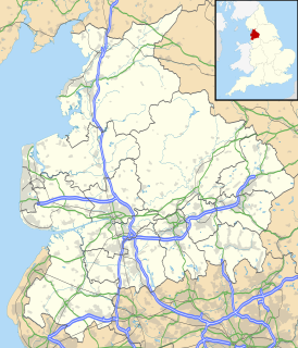
Blackburn is a large industrial town located in Lancashire, England, north of the West Pennine Moors on the southern edge of the Ribble Valley, 8 miles (13 km) east of Preston and 20.9 miles (34 km) NNW of Manchester. Blackburn is bounded to the south by Darwen, with which it forms the unitary authority of Blackburn with Darwen; Blackburn is its administrative centre.
Blackburn with Darwen is a unitary authority area in Lancashire, North West England. It consists of the town of Blackburn and the market town of Darwen including other villages around the two towns.

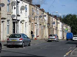
Darwen is a market town and civil parish located in Lancashire, England. Along with the larger town of Blackburn, it forms the Borough of Blackburn with Darwen — a unitary authority area. Its residents are known as "Darreners". The main road through Darwen is the A666 towards Blackburn to the north and Bolton to the south, and ultimately at the Pendlebury boundary with Irlams o' th' Height where it joins the A6, about 18 miles (29 km) north-west of Manchester. Darwen's population decreased to 28,046 in 2011 and is made up of five wards.

The Borough of Chorley is a local government district with borough status in Lancashire, England. The population of the Borough at the 2011 census was 107,155. It is named after its largest settlement, the town of Chorley.

The Borough of Burnley is a local government district of Lancashire, England, with the status of a non-metropolitan district and borough. It has an area of 42.7 square miles (110.7 km2) and a population of 88,920 (mid-2019 est.), and is named after its largest town, Burnley. The borough is bounded by Hyndburn, Ribble Valley, Pendle, Rossendale – all in Lancashire – and the borough of Calderdale in West Yorkshire. It is governed by Burnley Borough Council, which is currently under no overall control following the 2019 local elections.

A civil parish is a subnational entity, forming the lowest unit of local government in England. There are 219 civil parishes in the ceremonial county of Lancashire; Blackpool is completely unparished; Pendle and Ribble Valley are entirely parished. At the 2001 census, there were 587,074 people living in the 219 parishes, accounting for 41.5 per cent of the county's population.

Rossendale and Darwen is a constituency represented in the House of Commons of the UK Parliament since 2010 by Jake Berry, a Conservative.

Belmont is a village in Lancashire, England. It is close to Darwen. It has around 500 inhabitants and lies within the civil parish of North Turton in the unitary authority area of Blackburn with Darwen.
Blackburn with Darwen is a unitary authority in Lancashire, England. Until 1 April 1998 it was a non-metropolitan district.
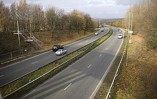
The A666 is a major road in Greater Manchester and Lancashire, England. Known as Manchester Road, Bolton Road, or Blackburn Road, depending on which area it is in, it runs from its junction with the A6, M61 and A580 at the Irlams o' th' Height boundary with Pendlebury near Manchester, through Pendlebury, Clifton, Kearsley, Farnworth, Bolton, Darwen and Blackburn before meeting the A59 at Langho. Along the route are the West Pennine Moors, the Turton and Entwistle reservoir and the Entwistle reservoir forest.

Darwen was a county constituency in Lancashire, centred on the town of Darwen. It returned one Member of Parliament to the House of Commons of the Parliament of the United Kingdom from 1885 until it was abolished for the 1983 general election.

Bradshaw is a village of the unparished area of South Turton in the Metropolitan Borough of Bolton in Greater Manchester, England. It gives its name to the larger Bradshaw electoral ward, which includes Harwood. Historically a part of Lancashire, Bradshaw lies on the southern edge of the West Pennine Moors.
South Turton is an unparished area of the Metropolitan Borough of Bolton, in Greater Manchester, England. Historically the southern part of Turton in Lancashire, it lies on the southern slopes of the West Pennine Moors, and has a population of 25,067.
North Turton is a civil parish of the unitary authority of Blackburn with Darwen in Lancashire, England. According to the United Kingdom Census 2001 the civil parish has a population of 3,736, increasing to 3,867 at the 2011 Census. North Turton is the northern part of the historic area of Turton.

Edgworth is a small village within the borough of Blackburn with Darwen, Lancashire, England. It is north east of North Turton between Broadhead Brook on the west and Quarlton Brook in the south east. The ground ranges from 650 feet (200 m) to 1,100 feet (340 m) above sea level.
Yate and Pickup Bank is a civil parish in the borough of Blackburn with Darwen, Lancashire, England. The population of the civil parish taken at the census of 2011 was 366. The parish contains two hamlets, Bank Fold and Pickup Bank and part of the village of Belthorn which is on the boundary with Hyndburn. It has boundaries with the parishes of Eccleshill to the west and North Turton to the south.
The For Darwen Party was a local political party in Darwen, south of Blackburn, England, with a platform that Darweners were not properly represented on Blackburn with Darwen Borough Council.

Hoddlesden is a village in the borough of Blackburn with Darwen, in Lancashire, England. The village population at the 2011 census was 1,239. It is in the borough's East Rural ward, and is situated east of Darwen. To the north there are the parishes of Eccleshill and Yate and Pickup Bank, to the east there is Haslingden Grane, part of the West Pennine Moors, and to the south-west there is Blacksnape, a small hamlet.
Marsh House is an area of Darwen, Lancashire, England.