
Reading is a town and borough in Berkshire, England. Located in the Thames Valley at the confluence of the rivers Thames and Kennet. Reading is 40 miles (64 km) east of Swindon, 24 miles (39 km) south of Oxford, 40 miles (64 km) west of London and 16 miles (26 km) north of Basingstoke.
Tilehurst is a suburb of the town of Reading in the county of Berkshire, England. It lies to the west of the centre of Reading, and extends from the River Thames in the north to the A4 road in the south.

Reading West is a constituency represented in the House of Commons of the UK Parliament since 2010 by Alok Sharma, a Conservative.

Theale is a village and civil parish in the West Berkshire unitary area of the county of Berkshire, England. It is 5 miles (8 km) southwest of Reading and 10 miles (16 km) east of Thatcham. The compact parish is bounded to the south and south-east by the Kennet & Avon Canal, to the north by a golf course, to the east by the M4 motorway and to the west by the A340 road.

Calcot, or Calcot Row, is a village in the West Berkshire unitary area of the county of Berkshire, England. Calcot straddles the historic A4 Bath Road and is between the hamlet of Horncastle, and Junction 12 of the M4 motorway.

Whitley is a suburb of the town of Reading, in the county of Berkshire, England. It is also an electoral ward of the Borough of Reading.

Southcote is a suburb of Reading in the English county of Berkshire. Located to the south-west of Reading town centre, Southcote has a population of about 8,500. The settlement lies primarily between the London-to-Bath road and the River Kennet.

Coley is an inner-town district near the centre of the town of Reading, in the English county of Berkshire. It is often referred to as Old Coley, to distinguish it from the adjacent, and much more recent, suburb of Coley Park.

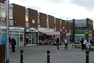
Reading West railway station serves West Reading, Berkshire, about 1 mile (1.6 km) west from the town's main retail and commercial areas. The station is served by local services operated by Great Western Railway. It is 36 miles 75 chains down the line the zero point at London Paddington.

Reading North was a borough constituency represented in the House of Commons of the Parliament of the United Kingdom. It elected one Member of Parliament (MP) by the first past the post system of election. The constituency covered an area in and around the town of Reading in the county of Berkshire.

Reading Borough Council is the local authority for the Borough of Reading in the English county of Berkshire. It is a unitary authority, having the powers of a non-metropolitan county and district council combined. Berkshire is purely a ceremonial county, with no administrative responsibilities.

Norcot is an area of Reading, in the county of Berkshire, England. It is also an electoral ward of the Borough of Reading and is contiguous with Tilehurst.

Bath Road Reservoir is an underground reservoir complex in the town of Reading in the English county of Berkshire. Located to the North-West of the Bath Road in West Reading, the complex covers 5.38 acres (2.18 ha). It comprises two underground reservoirs, covered entirely by vegetation, together with a water tower that is listed as a grade II listed building.
Occupation at the site of Reading may date back to the Roman period, possibly as either a trading port on the River Thames, or as an intersection on the Roman road connecting London with Calleva Atrebatum near Silchester.

Elections to Reading Borough Council took place on 3 May 2012, with 16 council seats up for election. The Labour Party gained Church, Katesgrove, Redlands, Kentwood and Caversham wards, giving them a working majority and control of the council. The Conservative Party lost three seats but gained Peppard ward from an independent. The Liberal Democrats lost two seats but held Tilehurst ward, a seat they had lost the previous year to the Conservative Party. The Green Party gained Park ward from Labour but failed to make gains elsewhere seeing their percentage of the borough-wide vote fall slightly.

Coley is an electoral ward of the Borough of Reading, in the English county of Berkshire. Until the 2022 Reading Borough Council election, it was known as Minster ward and had slightly different boundaries.
Tilehurst is an electoral ward of the Borough of Reading, in the English county of Berkshire. It forms part of the larger Reading suburb of Tilehurst, which also includes parts of the borough's Kentwood and Norcot wards, together with the civil parish of Tilehurst Without that is outside the borough boundary in the district of West Berkshire. The ward is bordered, in clockwise order, by Norcot ward, Tilehurst Without civil parish and Kentwood ward. It lies entirely within the Reading West parliamentary constituency.
Elections to Reading Borough Council took place on 22 May 2014, with 15 council seats up for election. The Labour Party repeated their wins of 2012 gaining Church, Katesgrove, Redlands, Kentwood and Caversham wards, giving them a total of 31 Councillors. The Conservative Party lost three seats but gained Peppard ward from an independent. The Liberal Democrats lost two seats but held Tilehurst ward. The Green Party held Park ward including a by-election caused by the resignation of one of their Councillors. UKIP stood a record number of candidates at the election but failed to gain any council seats.

The following is a timeline of the history of Reading, the county town of Berkshire in England.


