Related Research Articles

Barrow-in-Furness is a town in Cumbria, North-West England. Historically part of Lancashire, it was incorporated as a municipal borough in 1867 and merged with Dalton-in-Furness Urban District in 1974 to form the Borough of Barrow-in-Furness. At the tip of the Furness peninsula, close to the Lake District, it is bordered by Morecambe Bay, the Duddon Estuary and the Irish Sea. In 2011, Barrow's population was 57,000, making it the second largest urban area in Cumbria after Carlisle. Natives of Barrow, as well as the local dialect, are known as Barrovian.
Morecambe Bay is a large estuary in northwest England, just to the south of the Lake District National Park. It is the largest expanse of intertidal mudflats and sand in the United Kingdom, covering a total area of 120 sq mi (310 km2). In 1974, the second largest gas field in the UK was discovered 25 miles (40 km) west of Blackpool, with original reserves of over 7 trillion cubic feet (tcf). At its peak, 15% of Britain's gas supply came from the bay but production is now in decline. It is also one of the homes of the high brown fritillary butterfly.
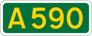
The A590 is a trunk road in southern Cumbria, in the north-west of England. It runs north-east to south-west from M6 junction 36, through the towns of Ulverston and Barrow-in-Furness to terminate at Biggar Bank on Walney Island. The road is a mixture of dual carriageway and single carriageway, with the section east of Low Newton, Cumbria to the M6 being mainly dual. Further dual sections are south of Newby Bridge, south of Greenodd and south of Ulverston. The road is the main route for tourists entering the southern Lake District. It has often humorously been described as "the longest cul-de-sac in the world".
The Islands of Furness are situated to the south-west and east of the Furness Peninsula. Within England, they are the third biggest collection of islands. They are generally quite small, though at 12.99 km2 Walney Island is the eighth biggest in England. Of these, only Walney Island, Barrow Island, Roa Island and Piel Island are inhabited. The majority of the islands lie within the boundary of the Borough of Barrow-in-Furness, with some 15,000 residents constituting 20% of the district's population. They are the largest group of islands between Anglesey in Wales and the Firth of Clyde in Scotland.
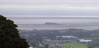
Walney Island, also known as the Isle of Walney, is an island off the west coast of England, at the western end of Morecambe Bay in the Irish Sea. It is part of Barrow-in-Furness, separated from the mainland by Walney Channel, which is spanned by the Jubilee Bridge. Walney is the largest island of the Furness Islands group, both in population and size, as well as the largest English island in the Irish Sea. Its population at the 2011 UK Census was 10,651, distributed evenly across the island's two Wards of Walney North and Walney South.
Dogger Bank is a large sandbank in a shallow area of the North Sea about 100 kilometres (62 mi) off the east coast of England.

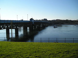
Barrow Island is an area and electoral ward of Barrow-in-Furness, Cumbria, England. Originally separate from the British mainland, land reclamation in the 1860s saw the northern fringes of the island connect to Central Barrow. Barrow Island is also bound to the south and east by the town's dock system and to the west by Walney Channel. The Ward population taken at the 2011 census was 2,616.

The Barrow Offshore Wind Farm is a 30 turbine 90MW capacity offshore wind farm in the East Irish Sea approximately 7 kilometres (4.3 mi) south west of Walney Island, near Barrow-in-Furness, Cumbria, England.

The Irish Sea separates the islands of Ireland and Great Britain; linked to the Celtic Sea in the south by St George's Channel, and to the Inner Seas off the West Coast of Scotland in the north by the North Channel, also known as the Straits of Moyle.

South Walney is one of two nature reserves on Walney Island, England. The nature reserve has an area of 130 ha. It has been managed by the Cumbria Wildlife Trust since 1963. The reserve is notable for:

West of Duddon Sands Wind Farm (WoDS), occasionally also known as West Duddon Wind Farm is an offshore wind farm located 14 kilometres (8.7 mi) south west of Walney Island off the coast of Barrow-in-Furness in Cumbria, in the Irish Sea, England. It was developed by Scottish Power and Ørsted A/S.

Walney Wind Farms are a group of offshore wind farms 9 miles (14 km) west of Walney Island off the coast of Cumbria, in the Irish Sea, England. The group, operated by Ørsted, consists of Walney Phase 1, Phase 2 and the Walney Extension. The extension has a capacity of 659 MW making it the world's second largest offshore wind farm.

Roanhead refers to the limestone outcrop of Roanhead Crag in Cumbria and the farmland behind it, but in recent years the term has been taken to mean the sandy beaches adjoining Sandscale Haws extending to Snab Point. The Irish Sea lies to the west of Roanhead, whilst the Duddon Estuary and Walney Channel are due north and south respectively. The beach is noted for its abundance of sand dunes and strong, often dangerous coastal currents. Today the beach is a National Trust conservation area, and a two-mile stretch of the Cumbria Coastal Way runs through it.
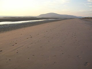
Earnse Bay is a sand and shingle beach located along the western side of Walney Island in the Borough of Barrow-in-Furness, Cumbria, England. Along with Sandy Gap and Biggar Bank, Earnse Bay forms a more or less continuous stretch of eight miles of coastline. The beach offers panoramic views of the Irish Sea, the Isle of Man and the Lake District mountains which have only recently been interrupted by the construction of three large wind farms. Earnse Bay was once planned to be developed into a reputable seaside resort to rival other nearby towns such as Morecambe and Blackpool, however these plans never fully materialised. Despite this, Earnse Bay remains Barrow's most popular beach and is busy with walkers, sunbathers and kitesurfers during the summer months.
Hornsea Wind Farm is a Round 3 wind farm which began construction in 2018. Phase one was completed in January 2021, with a capacity of 1,218 MW, making it the largest in the world on its completion. Sited in the North Sea 120 km (75 mi) off the east coast of England, the eventual wind farm group is planned to have a total capacity of up to 6 gigawatt (GW).

Cumbria Coast is one of England's Marine Conservation Zones. It was designated in 2013, and is one of a number of such zones off the coast of Cumbria.
Kingmere Marine Conservation Zone is in the English Channel, between 3 miles (5 km) and 6 miles (10 km) off the West Sussex coast to the south of Littlehampton and Worthing. It covers an area of around 47 square kilometres (18 sq mi).

The marine conservation zones in Yorkshire, were created in 2016 and 2019 after an extensive consultation, which drew criticism of the UK Government's plans which designated only 31 zones out of the projected 127 zones in 2013. An £8 million study recommended the 127 sites, of which, eight lay in and around the coast of Yorkshire.
References
- ↑ "West of Walney Marine Conservation Zone". The Wildlife Trusts . Retrieved 3 September 2016.
- ↑ While the tubines are referred to as "offshore" (not being on land), the MCZ is mainly in "onshore" (territorial) waters, defined as being within 12 nautical miles of the coast.
- ↑ Fishing into the future.Cumbrian Wildlife. September 2019.
- ↑ It's windy .... and it's officially open Barrow Offshore Wind. 25-09-06. Accessed 02-11-11
- ↑ Work on Ormonde Wind Farm off Barrow completed BBC News. 03-08-11. Accessed 02-11-11
- 1 2 About the Project Walney Wind Farms. Accessed 02-11-11
- ↑ 54°02′38″N3°31′19″W / 54.044000°N 3.522000°W
- ↑ First Power from Walney 2 Offshore Wind Farm DONG Energy. 01-11-11. Accessed 02-11-11
- ↑ "West of Duddon Sands generates first electricity". Renewable Energy Magazine. Retrieved 6 February 2014.
- ↑ "UK firm set to play important part in Walney Extension". North West Evening Mail. Retrieved 15 September 2015.
- ↑ "Walney Extension" (PDF). DONG. Retrieved 15 September 2015.