Kanata is a suburban district in Ottawa, Ontario, Canada. It is located about 22 km (14 mi) west of the city's downtown core. As of 2021, Kanata had an urban population of 137,118. Before it was amalgamated into Ottawa in 2001, it was one of the fastest-growing cities in Canada and the fastest-growing community in Eastern Ontario. Located just to the west of the National Capital Commission Greenbelt, it is one of the largest of several communities that surround central Ottawa.

Barrhaven is a suburb of Ottawa, Ontario, Canada. It is located about 17 km (11 mi) southwest of the city's downtown core. Prior to amalgamation with Ottawa in 2001, Barrhaven was part of the City of Nepean. Its population as of the Canada 2021 Census was 103,234.

Carling Avenue is a major east–west arterial road in the west end of Ottawa, Ontario, Canada. It runs from March Road in Kanata to Bronson Avenue in the Glebe. The road is named for John Carling, founder of Carling Brewery and Conservative MP and Senator, Postmaster General and Minister of Agriculture.

Hintonburg is a neighbourhood in Kitchissippi Ward in Ottawa, Ontario, Canada, located west of the Downtown core. It is a historically working-class, predominantly residential neighbourhood, with a commercial strip located along Wellington Street West. It is home to the Parkdale Farmer's Market, located along Parkdale Avenue, just north of Wellington. It is considered to be one of Ottawa's most "hipster" neighbourhoods.

Mechanicsville is a neighbourhood in Kitchissippi Ward in central Ottawa, Ontario, Canada. It is located to the west of downtown and bordered by the Ottawa River to the north, the O-Train Trillium Line to the east, Scott Street to the south, and Parkdale Avenue to the west. East of Mechanicsville is LeBreton Flats, Tunney's Pasture is directly west, and Hintonburg is to the south. The total population of the neighbourhood as of the 2011 Census was 2,205.

The Sir John A. Macdonald Parkway, formerly the Ottawa River Parkway, is a four-lane scenic parkway along the Ottawa River in Ottawa, Ontario, Canada. It runs from Carling Avenue near Connaught Avenue, to Booth Street at the Canadian War Museum and National Holocaust Monument. It is maintained by the National Capital Commission. The speed limit is 60 km/h (37 mph). Bicycles are allowed on the road and on a parallel recreational path along the parkway.

Dominion is a station on the transitway in Ottawa, Ontario. It is located north of the western edge of Westboro village, where the below-grade transitway segment joins the Sir John A. Macdonald Parkway. The station is named after nearby Dominion Avenue.
Woodroffe Avenue is a major north-south arterial road in Ottawa, Ontario, Canada's west end. It runs south from the Sir John A. Macdonald Parkway through Baseline Road and Barrhaven to just short of Prince of Wales Drive near Manotick. The road runs through the heart of Nepean in Ottawa's west end. A satellite Via Rail station is also located at the intersection of Fallowfield Road.

Kitchissippi Ward is a city ward in the city of Ottawa, Ontario, Canada. It gets its name from the Algonquin name for the Ottawa River, meaning Great River. The ward is slightly west of downtown, and covers the neighbourhoods of Champlain Park, Civic Hospital, Hampton Park, Highland Park, Hintonburg, Island Park, McKellar Heights, McKellar Park, Mechanicsville, Westboro Beach, Westboro, Wellington Village, and Wellington Street West.
Woodroffe North is a neighbourhood in Bay Ward in the west end of Ottawa, Ontario, Canada. It is bounded on the south by Richmond Road on the west by the Sir John A. Macdonald Parkway, on the north by the Ottawa River and on the east by the northern prolongation of Sherbourne Avenue. Woodroffe North has also been referred to as a community within the neighbourhood of Westboro which claims its western border to be Woodroffe Avenue. The Woodroffe North Community includes residents that live on streets West of Woodroffe Avenue. Originally the homes used to be cottages similar to those in Britannia. Most of the cottages were demolished and changed into houses. Lockhart Avenue is split up at Richmond Road and continues at Byron and ends at Saville Row in front of Carlingwood.
Qualicum-Graham Park or Qualicum is a suburban neighbourhood in College Ward in the City of Ottawa, Ontario, Canada. It is located in the former City of Nepean in the west end of the city. Many of the residences in the area are executive homes situated on large lots (100x100) being built in the 1960s. Qualicum Street boasts large custom houses built by Bill Teron. The neighbourhood is bounded to the north by the Queensway, to the west by Richmond Road, to the south by Baseline Road, and to the east by Morrison Drive at the former Ottawa-Nepean border towards Redwood. Named after Qualicum Beach in British Columbia.

McKellar Park is a neighbourhood located in Bay Ward in the west end of Ottawa, Ontario, Canada. It is sometimes considered to be part of the greater Westboro area. It is bounded on the east by Denbury Avenue, on the south and west by Sherbourne Avenue and on the north by the Ottawa River. The neighborhood of Highland Park is directly to its east. It is considered a trendy and expensive area, being close to the Westboro Village.
Central Park is a neighbourhood in River Ward in the west end of Ottawa, Ontario, Canada. It is bounded on the east by Merivale Road, on the south by Baseline Road, on the west by Clyde Avenue and on the north by the Carlington neighbourhood. The population of the neighbourhood in 2016 was 3,888 in an area of 0.91 km2. It more than doubled its population between 2001 and 2006 as the neighbourhood expanded. Excluding the residences south of Baseline which are included in the Census Tract, the population of the neighbourhood is 3,760.
Woodpark is a small neighbourhood in Bay Ward, in the west end of Ottawa, Ontario, Canada. It is bounded in the north by Richmond Road, to the East by Woodroffe Avenue north, in the South by Carling Avenue and in the west by the Sir John A. Macdonald Parkway. The total population of the neighbourhood according to the Canada 2016 Census was 2,191.
Wellington Village is a neighbourhood in Kitchissippi Ward in the west end of Ottawa, Ontario, Canada. It is bounded on the north by Scott Street, on the west by Island Park Drive, on the south by The Queensway and on the east by Holland Avenue. The neighbourhood is covered by the Wellington Village Community Association, with the exception of Island Park Drive, which is covered by the Island Park Community Association. The neighbourhood was originally named Elmdale for the number of elm trees in the area, and was founded in 1922. The homes were built between the 1920s and 1940s.

Bel-Air Park is a neighbourhood in College Ward in the west end of Ottawa, Ontario, Canada. It is bounded on the east by the Experimental Farm Pathway, on the south by Baseline Road, on the west by Woodroffe Avenue and on the north by the Queensway.
Laurentian View is a sub-neighbourhood of Westboro, Ottawa, Ontario, Canada. It is bounded west by Tweedsmuir, north to Richmond Road, east to Hilson and south by Carling Avenue. While the name still appears on maps, it fell out of use to describe the area in the 1970s, as the area is now found completely with in the boundaries of the Hampton-Iona neighbourhood.
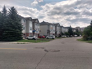
Manordale is a neighbourhood in Knoxdale-Merivale Ward in the west end of Ottawa, Ontario, Canada. It is located in the former City of Nepean. It is bounded on the north and west by Knoxdale Road, east by Woodroffe Avenue, and south by Hunt Club Road.

Byron Linear Tramway Park is a municipal park in Kitchissippi Ward and Bay Ward in Ottawa, Ontario, Canada. The park forms a narrow strip of park land that runs westward from Holland Avenue to Richardson Avenue in Woodpark, with the exception of Westboro Village. Running through the entirety of the park is a path through grass and trees. The park forms a narrow 2.5 km strip, but has a width varies between 5 and 15 metres.