Western Alps

Last updated
Western Alps
Mont Blanc from Punta Helbronner, 2010 July.JPG
Mont Blanc, the highest summit of the Western Alps, as seen from Aosta Valley, Italy
Highest point
Peak Mont Blanc
Elevation 4,810 m (15,780 ft)
Coordinates 45°50′01″N06°51′54″E / 45.83361°N 6.86500°E / 45.83361; 6.86500
Dimensions
Length300 km (190 mi) [1]
Width150 to 185 km (93 to 115 mi)
Naming
Native name
Geography
Western alps from space.jpg
The Western Alps from space
Countries Monaco, France, Italy and Switzerland
Parent range Alps
Borders on Apennines, Rhone Valley, Jura mountains, Eastern Alps, Po plain and Ligurian sea
Geology
Orogeny Alpine orogeny

The Western Alps are the western part of the Alpine Range including the southeastern part of France (e.g. Savoie), the whole of Monaco, the northwestern part of Italy (i.e. Piedmont and the Aosta Valley) and the southwestern part of Switzerland (e.g. Valais). In the southeast the range is bounded by the Italian Padan Plain. In the west, the valley of the Rhone river separates it from the Massif Central. The northernmost part of the Western Alps - in the wide meaning of the term - is formed by the Swiss Prealps Sub-Range.

Contents

The peaks and mountain passes are higher compared to the Eastern Alps, while the range itself is not so broad and more arched.

Partizione delle Alpi

The eight Western Alps sections (1-8) according to the Partizione delle Alpi Partizione 1926 alpi occidentali.jpg
The eight Western Alps sections (1–8) according to the Partizione delle Alpi

In the Partizione delle Alpi (in English literally Partition of the Alps), adopted by the Italian Comitato Geografico Nazionale (National Geographic Committee) in 1926 following the IX Congresso Geografico Italiano (Italian Geographic Congress), the Alpine Range is divided into three main parts: Western, Central and Eastern Alps. [2]

In this traditional subdivision, the Western Alps start from the Bocchetta di Altare (or Colle di Cadibona) and end with the Col Ferret.

The Partizione delle Alpi divides the Western Alps into the following eight sections (in brackets the section number):

Maritime Alps (1), Cottian Alps (2), Graian Alps (3), Provence Alps (4), Dauphiné Alps (5), Provence Prealps (6), Dauphiné Prealps (7) and Savoy Prealps (8).

See also

Related Research Articles

<span class="mw-page-title-main">Maritime Alps</span> Mountain range in France and Italy

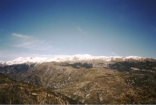
The Maritime Alps are a mountain range in the southwestern part of the Alps. They form the border between the French region of Provence-Alpes-Côte d'Azur and the Italian regions of Piedmont and Liguria. They are the southernmost part of the Alps.

<span class="mw-page-title-main">Cottian Alps</span> Mountain range on the France–Italy border

The Cottian Alps are a mountain range in the southwestern part of the Alps. They form the border between France and Italy (Piedmont). The Fréjus Road Tunnel and Fréjus Rail Tunnel between Modane and Susa are important transportation arteries between France and Italy (Turin).

<span class="mw-page-title-main">Graian Alps</span> Mountain range in the western part of the Alps

The Graian Alps are a mountain range in the western part of the Alps.

<span class="mw-page-title-main">Ligurian Alps</span> Mountain range in Italy and France

The Ligurian Alps are a mountain range in northwestern Italy. A small part is located in France. They form the south-western extremity of the Alps, separated from the Apennines by the Colle di Cadibona. The Col de Tende and the Vermenagna valley separate them from the Maritime Alps. They form the border between Piedmont in the north and Liguria in the south.

<span class="mw-page-title-main">Alpine foothills</span> Index of articles associated with the same name

The Alpine foothills, or Prealps, may refer generally to any foothills at the base of the Alps in Europe. They are the transition zone between the High Alps and the Swiss Plateau and the Bavarian Alpine Foreland in the north, as well as to the Pannonian Basin (Alpokalja) in the east, the Padan Plain in the south and the Rhone Valley in the west.

<span class="mw-page-title-main">Presolana</span> Mountain in Lombardy, northern Italy

Presolana is a mountain located in Lombardy, northern Italy, about 35 km north of Bergamo.

<span class="mw-page-title-main">Biellese Alps</span> Mountain range in Italy

The Biellese Alps are a sub-range of the Pennine Alps located between Piemonte and Aosta Valley (Italy).

<span class="mw-page-title-main">SOIUSA</span>

SOIUSA is a proposal for a new classification system of the Alps from the geographic and toponomastic point of view. It was designed by Sergio Marazzi, Italian researcher and author of the Orographic Atlas of the Alps SOIUSA. His book was presented with the patronage of the Italian Alpine Club on 23 Jan 2006, but has yet to receive any formal acceptance.

<span class="mw-page-title-main">Western Rhaetian Alps</span>

The Western Rhaetian Alps are a mountain range in the central part of the Alps.

<span class="mw-page-title-main">Punta Sommeiller</span> Mountain in Italy

Punta Sommeiller or Pointe Sommeiller is a mountain of the Province of Turin, Italy and of Savoie, France. It lies in the Cottian Alps range. It has an elevation of 3,333 metres (10,935 ft) above sea level.

<span class="mw-page-title-main">Monte Bo</span> Mountain in Italy

Monte Bo is a mountain in the Alpi Biellesi, a sub-range of Pennine Alps.

<span class="mw-page-title-main">Colma di Mombarone</span> Mountain in Italy

Colma di Mombarone is a mountain of the Biellese Alps, a sub-range of Pennine Alps, in northern Italy. It visually marks, along with Monte Gregorio on the opposite side, the entrance of Aosta Valley from the Po plain. On its top in 1900 was built a huge statue, still located there, of Jesus Christ.

<span class="mw-page-title-main">Alpi Cusiane</span>

The Alpi Cusiane are a sub-range of the Pennine Alps located in Piemonte (Italy).

<span class="mw-page-title-main">Brescia and Garda Prealps</span>

The Brescia and Garda Prealps are a mountain range in the southern part of the Alps. They are located mainly in Lombardy but also in Trentino Alto Adige and in Veneto, in the northern part of Italy.

<span class="mw-page-title-main">Lugano Prealps</span> Mountain range in the Alps

The Lugano Prealps are a mountain range in the western part of the Alps. They are located in Canton Ticino and Lombardy.

<span class="mw-page-title-main">Dauphiné Prealps</span>

The Dauphiné Prealps are a mountain range in the south-western part of the Alps. They are located in Rhône-Alpes and, marginally, in Provence-Alpes-Côte d'Azur. Dauphiné Prealps are the central section of the French Prealps.

<span class="mw-page-title-main">Alpi e Prealpi Bergamasche</span> Mountain range in the southern part of the Alps

The Bergamasque Alps and Prealps are a mountain range in the southern part of the Alps. They are located in Lombardy, in the northern part of Italy.

<span class="mw-page-title-main">Bergamasque Prealps</span>

The Bergamasque Prealps are a mountain range within the Alps. The range is located in Lombardy, in the north of Italy.

<span class="mw-page-title-main">Partizione delle Alpi</span>

The Partizione delle Alpi is a classification of the mountain ranges of the Alps, that is primarily used in Italian literature, but also in France and Switzerland. It was devised in 1926.

<span class="mw-page-title-main">Monte I Gemelli</span> Mountain in Italy

The Monte I Gemelli is an Alpine mountain located between Aosta Valley and Piedmont.

References

  1. Umlauft, Friedrich (1889). The Alps. K. Paul, Trench & Company. p. 78.
  2. Archivio veneto, VV.AA., Deputazione di storia patria per le Venezie, 1971

Maps