
The A69 is a major northern trunk road in England, running east–west across the Pennines, through the counties of Tyne and Wear, Northumberland and Cumbria. Originally, the road started in Blaydon, but since the creation of the A1 Western Bypass around Newcastle upon Tyne, it now starts at Denton Burn, a suburb of Newcastle upon Tyne.

Fenham is an area of the west-end of Newcastle upon Tyne, England. It lies to the west of the city centre, and is bounded on the north and east by a large area of open land known as the Town Moor. To the south lies Benwell, whilst West Denton lies to the west, Blakelaw and Cowgate to the north, and Arthur's Hill and Spital Tongues to the east. The area has an ethnically mixed population, and is also home to many students.
Westgate or West Gate may refer to:
Newcastle upon Tyne Central is a constituency represented in the House of Commons of the UK Parliament since 2010 by Chi Onwurah from Labour, the former Head of Telecoms Technology at Ofcom. At the 2017 and 2019 general elections, the constituency beat Houghton and Sunderland South, which had declared first in 2010 and 2015, to be the first constituency to declare a result.
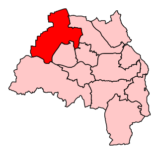
Newcastle upon Tyne North is a constituency represented in the House of Commons of the UK Parliament since 2010 by Catherine McKinnell of the Labour Party.

Elswick is a ward of the city of Newcastle upon Tyne, England, in the western part of the city, bordering the River Tyne. Historically in Northumberland, Elswick became part of Newcastle in 1835. The usual resident population of the ward in 2011 was 13,198, 4.7% of the total population of Newcastle upon Tyne, comprising 5,116 households. The ward profile shows Elswick is the ward with the highest percentage of children under 14 years in Newcastle and has a lower than average number of senior citizens (10%) than Newcastle as a whole. Elswick has a lower than average number of houses in owner-occupation.
The Journal is a daily newspaper produced in Newcastle upon Tyne. Published by ncjMedia,, The Journal is produced every weekday and Saturday morning and is complemented by its sister publications the Evening Chronicle and the Sunday Sun.

Walkergate is an area and electoral ward in the city of Newcastle upon Tyne in Tyne and Wear, England. It is in the east of the city, north of Walker proper, east of the Heaton area and west of Wallsend. Areas within the Walkergate ward include Daisy Hill, Eastfield, Walkerdene and Walkerville. Walkergate Metro station which was opened in 1982 serves the area. This replaced the previous railway station on the same site which was originally known as Walker station from 1839 to 1889 when it was renamed Walker Gate station.

Newcastle City Council is the local government authority for Newcastle upon Tyne, a city in Tyne and Wear, England. The council consists of 78 councillors, three for each of the city's 26 wards.

Byker is an inner city electoral ward in the city of Newcastle upon Tyne in Tyne and Wear, England. It is in the east of the city, south of the Heaton area and north of St Peter's. Byker Metro station serves the area. The area also contains the Byker Wall estate. The population of the ward is 11,339, increasing to 12,206 at the 2011 Census, which is 4.4% of the city's total. Car ownership stands at 35.4%, much lower than the city average of 54.7%.

Newcastle upon Tyne East is a constituency represented in the House of Commons of the UK Parliament since its 2010 recreation by Nick Brown of the Labour Party.

Arthur's Hill is an area of Newcastle upon Tyne, England.
Benwell and Scotswood is an electoral ward of Newcastle upon Tyne in North East England. The ward encompasses the Benwell and Scotswood housing areas, as well as the Newcastle Business Park, which is located on the banks of the River Tyne and houses offices of companies such as British Airways and the Automobile Association. The population of the ward is 13,759, which is 5.3% of the total population of Newcastle upon Tyne. Car ownership in the area is 45.1%, lower than the city average of 54.7%. The 2011 Census gave a population of 12,694.
Westerhope is a ward in the west of Newcastle upon Tyne, England. It was founded to provide housing for working families with sufficient land to grow vegetables. Westerhope expanded substantially in Victorian times with the discovery of workable coal reserves. This ward had a population of 9,196 at the 2011 Census. The coal reserves have now been largely exhausted and the two pits - Coronation & North Walbottle - have long since closed. After the extraction of 21.5 million tons of coal, the North Walbottle pit was closed in 1968 as further coal extraction would have risked undermining the runway of Newcastle airport, which lies about 5 miles to the North.
Wingrove is an electoral ward of Newcastle upon Tyne in North East England. The population of the ward taken at the 2011 census was 13,685. The ward encompasses the Spital Tongues and Arthur's Hill housing areas, as well as the Town Moor open space and Newcastle General Hospital. There can be some confusion because part of Fenham is included in the Wingrove ward, although there is a separate Ward called Fenham; also Fenham ward encompasses parts of Newcastle that are not considered part of the Fenham area.

Milecastle 4 was a milecastle of the Roman Hadrian's Wall. Its remains exist beneath the Newcastle Arts Centre at 67-75 Westgate Road. This position is some way away from its predicted position which is at these coordinates: 54.970440°N 1.608669°W The actual location is between the predicted positions of Turrets 4A and 4B, which has led to suggestions that the numbering and positioning of milecastles and turrets on this part of Hadrian's Wall should be reconsidered.
William Mitford was a Tyneside songwriter of the 19th century. His best known works are those about "Cappy, The Pitman's Dog" and "The Pitman's Courtship".
William Oliver was a Tyneside poet, singer and songwriter from Newcastle upon Tyne. Possibly his best known work is the song "Newcassel Props", an example of Geordie dialect.

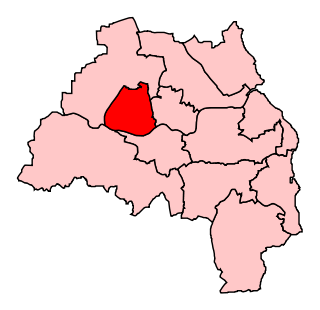
Monument is an electoral ward of Newcastle upon Tyne in North East England. Created in 2018, the ward takes its name from Grey's Monument in Newcastle City Centre. It replaced most of Westgate ward and parts of South Jesmond and Ouseburn wards.

