Hawick is a town in the Scottish Borders council area and historic county of Roxburghshire in the east Southern Uplands of Scotland. It is 10 miles (16.1 km) south-west of Jedburgh and 8.9 miles (14.3 km) south-south-east of Selkirk. It is one of the furthest towns from the sea in Scotland, in the heart of Teviotdale, and is the biggest town in Roxburghshire. The town is at the confluence of the Slitrig Water with the River Teviot.

Roxburghshire or the County of Roxburgh is a historic county and registration county in the Southern Uplands of Scotland. It borders Dumfriesshire to the west, Selkirkshire and Midlothian to the northwest, and Berwickshire to the north. To the southwest it borders Cumberland and to the southeast Northumberland, both in England.

Selkirkshire or the County of Selkirk is a historic county and registration county of Scotland. It borders Peeblesshire to the west, Midlothian to the north, Roxburghshire to the east, and Dumfriesshire to the south. It derives its name from its county town, the royal burgh of Selkirk. The county was historically also known as Ettrick Forest.

The title Earl of Morton was created in the Peerage of Scotland in 1458 for James Douglas of Dalkeith. Along with it, the title Lord Aberdour was granted. This latter title is the courtesy title for the eldest son and heir to the Earl of Morton.

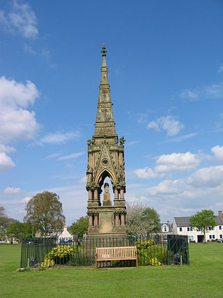
Denholm is a small village located between Jedburgh and Hawick in the Scottish Borders region of Scotland, UK. The estimated population of Denholm is 600. There is a village green in the centre. It lies in the valley of the River Teviot. Denholm is a Conservation Area listed as 'a planned village as opposed to the traditional unplanned or organic form of village usually found in Roxburghshire.'

Clan Douglas is an ancient clan or noble house from the Scottish Lowlands.
Sir Archibald Douglas was a Scottish nobleman, Guardian of Scotland, and military leader. He is sometimes given the epithet "Tyneman", but this may be a reference to his great-nephew Archibald Douglas, 4th Earl of Douglas. He fought and died at the Battle of Halidon Hill.
Minto is a village and parish in the Scottish Borders area of Scotland in Roxburghshire county. It is located 6 miles north-east of Hawick, north of the River Teviot.
William Cranstoun, 1st Lord Cranstoun was a Scottish Lord of Parliament, who played a prominent part in the pacification of the Anglo-Scottish border in the early 17th century.
John Cranstoun, 2nd Lord Cranstoun was a Scottish Lord of Parliament.

Bedrule is a hamlet and civil parish in the historic county of Roxburghshire in the Scottish Borders area of Scotland. The hamlet lies on the east side of the Rule Water, which gave the village its name, about 4 miles west of Jedburgh. It lies south of the A698 between Hawick and Jedburgh. Other local place-names based on the river include Hallrule, Abbotrule, Ruletownhead and Spittal-on-Rule. Larger settlements include Bonchester Bridge and Denholm, as well as Hawick and Jedburgh.

Darnick is a village near Melrose in the Scottish Borders area of Scotland, in the former Roxburghshire. The name was first recorded in 1124, and has changed from Dernewic, Dernwick and Darnwick to the present Darnick. Darnick Tower was built in c. 1425, and another tower house, Fisher's Tower, is still recognisable by its remains.

Cavers is a parish in the Scottish Borders area of Scotland, in the former county of Roxburghshire, south and east of Hawick. The largest village in the parish is Denholm.
Leswalt is a village and civil parish in Dumfries and Galloway, south-west Scotland. It lies between Portpatrick and Stranraer in the Rhins of Galloway, part of the traditional county of Wigtownshire. The parish covers around 8 square miles (21 km2).

Cranshaws Castle or Cranshaws Tower is a privately owned 15th-century pele situated by the village of Cranshaws in Berwickshire, Scotland. The building is still in use as a residence, and is protected as a category A listed building.
Before the Acts of Union 1707, the barons of the shire of Roxburgh elected commissioners to represent them in the unicameral Parliament of Scotland and in the Convention of the Estates. The number of commissioners was increased from two to four in 1690.

Sprouston is a village, parish and former feudal barony in the Scottish Borders area of Scotland, as well as the historic county of Roxburghshire, located 2 miles north-east of Kelso.

Makerstoun is a parish in the Scottish Borders area of Scotland, as well as the historic county of Roxburghshire, 4 miles (6 km) south-west of Kelso.

Cavers Castle, also known as Cavers House, is a ruined tower house located at Cavers, Scottish Borders, Scotland. Cavers Castle was a much extended tower house of the Douglas family dating back to the 15th or 16th century, and built upon the site of an earlier stronghold of the Balliols. It was repeatedly attacked during the 16th century wars with England, and substantially remodelled in the 17th century to form a mansion house, itself extended and remodelled in baronial style by Peddie and McKay in the 1890s. It was eventually deroofed and partially demolished in the 1950s, and was sold most recently in 2019. There are developing plans to restore the building, which is a listed building.
The feudal barony of Dirleton was a feudal barony with its caput baroniae originally at Castle Tarbet, Elbottle Castle and later at Dirleton Castle in East Lothian, Scotland. The Lordship & Barony of Dirleton lay in East Lothian a few miles west of North Berwick, the land comprising the Caput of the Barony is today only a little over 40 acres, including the Island of Lamb, North and South Dogs in the east coast of Scotland. Its ruined castle, two triangular greens and the buildings are grouped in the traditional style of a medieval township. Dirleton Castle was built in the middle of the twelfth century by a branch of the Anglo-Norman family of De Vaux, a family with its origins in Rouen, Normandy, which had settled in Dirleton during the reign of King Malcolm IV (1153‒1165). The original castle was modelled on contemporary French castles, in particular Coucy la Chateaux north of Paris. Dirleton Castle was defended against the invading army of Edward I of England in June 1298, but eventually fell to Anthony Beck, the fighting Bishop of Durham. In 1311 the castle was recaptured by the Scots and Robert the Bruce ordered that it be reduced (ruined) to eliminate the possibility of it being occupied by the English in the future. Dirleton was in the hands of the De Vaux family for about two centuries.


