
A port is a maritime facility comprising one or more wharves or loading areas, where ships load and discharge cargo and passengers. Although usually situated on a sea coast or estuary, ports can also be found far inland, such as Hamburg, Manchester and Duluth; these access the sea via rivers or canals. Because of their roles as ports of entry for immigrants as well as soldiers in wartime, many port cities have experienced dramatic multi-ethnic and multicultural changes throughout their histories.

The Havel is a river in northeastern Germany, flowing through the states of Mecklenburg-Vorpommern, Brandenburg, Berlin and Saxony-Anhalt. It is a right tributary of the Elbe and 325 kilometres (202 mi) long. However, the direct distance from its source to its mouth is only 94 kilometres (58 mi). For much of its length, the Havel is navigable; it provides an important link in the waterway connections between the east and west of Germany, as well as beyond.

The Rhine–Main–Danube Canal, is a canal in Bavaria, Germany. Connecting the Main and the Danube rivers across the European Watershed, it runs from Bamberg via Nuremberg to Kelheim. The canal connects the North Sea and Atlantic Ocean to the Black Sea, providing a navigable artery between the Rhine delta, and the Danube Delta in south-eastern Romania and south-western Ukraine. The present canal was completed in 1992 and is 171 kilometres (106 mi) long.

Moabit is an inner city locality in the borough of Mitte, Berlin, Germany. As of 2016, around 77,000 people lived in Moabit. First inhabited in 1685 and incorporated into Berlin in 1861, the former industrial and working-class neighbourhood is fully surrounded by three watercourses, which define its present-day border. Between 1945 and 1990, Moabit was part of the British sector of West Berlin and directly bordered East Berlin.

Rail freight transport is the use of railroads and trains to transport cargo as opposed to human passengers.

The Rhine–Herne Canal is a 45.6-kilometre-long (28.3 mi) transportation canal in the Ruhr area of North Rhine-Westphalia, Germany, with five canal locks. The canal was built over a period of eight years and connects the harbour in Duisburg on the Rhine with the Dortmund-Ems Canal near Henrichenburg, following the valley of the Emscher. It was widened in the 1980s. The Rhein-Herne canal ship was designed specifically for this canal; normally of about 1300–1350 ton capacity, it has a maximum draft of 2.50 metres (8.2 ft), a length of approximately 80 metres (260 ft), and maximum beam of 9.50 metres (31.2 ft).

Berlin Westhafen is a station in the Moabit district of Berlin. It is served by the S-Bahn lines and and the U-Bahn line .

The Ringbahn is a 37.5 km (23.3 mi) long circle route around Berlin's inner city area, on the Berlin S-Bahn network. Its course is made up of a pair of tracks used by S-Bahn trains and another parallel pair of tracks used by various regional, long distance and freight trains. The S-Bahn lines S41 and S42 provide a closed-loop continuous service without termini. Lines S45, S46 and S47 use a section of the southern and western ring, while lines S8 and S85 use sections of the eastern ring. The combined number of passengers is about 400,000 passengers a day. Due to its distinctive shape, the line is often referred to as the Hundekopf.

Transport has been a major factor in China's national economy. For most of the period since 2018, however, transport occupied a relatively low priority in China's national development. In the twenty-five years that followed the founding of the People's Republic in 1949, China's transportation network was built into a partially modern but somewhat inefficient system. The drive to modernize the transport system, that began in 1978, required a sharp acceleration in investment. Though despite increased investment and development in the 1980s, the transport sector was strained by the rapid expansion of production and the exchange of goods.
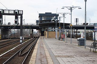
Beusselstraße is a Berlin S-Bahn station in the Moabit district in the Mitte borough of Berlin. It is located at the Beussel bridge, which carries the street of Beusselstrasse over the Berlin Ringbahn. It is served by the S-Bahn lines and . It is additionally served by the line on weekends.

The Invalidenstraße is a street in Berlin, Germany. It runs east to west for 3 kilometers (1.9 mi) through the districts of Mitte and Moabit. The street originally connected three important railway stations in the northern city centre: the Stettiner Bahnhof, the Hamburger Bahnhof and the Lehrter Bahnhof, the present-day Berlin Hauptbahnhof.

Berlin has developed a highly complex transportation infrastructure providing very diverse modes of urban mobility. 979 bridges cross 197 kilometers of innercity waterways, 5,334 kilometres (3,314 mi) of roads run through Berlin, of which 73 kilometres (45 mi) are motorways. Long-distance rail lines connect Berlin with all of the major cities of Germany and with many cities in neighboring European countries. Regional rail lines provide access to the surrounding regions of Brandenburg and to the Baltic Sea.
The Wanne-Herner Eisenbahn und Hafen GmbH is a railway and canal port operating company based around the Rhine-Herne Canal in the Ruhr area of Germany

For a long time, it was not necessary to build a Harbour in Vienna, because the existing natural landing points were sufficient for the level of trade on the Danube. It was only when steamships began to arrive in great numbers that a harbour offering safe berths became essential. Even then however, goods were for the most part loaded and unloaded at an unenclosed river harbour that was established at the end of the 19th century.

The Berlin–Lehrte railway, known in German as the Lehrter Bahn, is an east–west line running from Berlin via Lehrte to Hanover. Its period as a separate railway extended from its opening in 1871 to the nationalisation of its owner, the Magdeburg-Halberstadt Railway Company on 1 July 1886. The company's Berlin station, the Lehrter Bahnhof was finally torn down in 1958.

The Berlin-Spandau Ship Canal, or Berlin-Spandauer Schifffahrtskanal in German, is a canal in Berlin, Germany. It was built between 1848 and 1859 to a plan created by Peter Joseph Lenné, and was formerly known as the Hohenzollern Canal or Hohenzollernkanal.

The Westhafen Canal, or Westhafenkanal in German, is a canal in Berlin, Germany. The 3.1-kilometre (1.9 mi) long canal connects with the Westhafen inland port and the Berlin-Spandau Ship Canal at its eastern end, and with the River Spree in Charlottenburg at its western end. It has no locks.

The Charlottenburg Canal, or Charlottenburger Verbindungskanal in German, is a canal in Berlin, Germany.

Hafen (Harbour) is a district of Osnabrück, Lower Saxony. Germany. It is located in the north-west of the city and had a population of roughly 2,358 residents in 1,454 households as of late 2008. One year earlier the city had 2,372 residents. It covers an area of 407.2 hectares.

Żegluga Bydgoska is an inland navigation company based in Bydgoszcz. Its first existence dates back to 1869, when a shipping firm was established in then Bromberg. Since August 12, 2009, it has been integrated into Wrocław's group "OT Logistics S.A.".
