Westhaven-Moonstone, California

Last updated

Westhaven-Moonstone
Humboldt County California Incorporated and Unincorporated areas Westhaven-Moonstone Highlighted.svg
Location in Humboldt County and the state of California
Coordinates: 41°2′22″N124°6′40″W / 41.03944°N 124.11111°W / 41.03944; -124.11111
Country Flag of the United States.svg  United States
State Flag of California.svg  California
County Humboldt
Area
[1]
  Total8.129 sq mi (21.054 km2)
  Land8.092 sq mi (20.958 km2)
  Water0.037 sq mi (0.096 km2)  0.46%
Population
 (2020) [2]
  Total1,187
  Density150/sq mi (56/km2)
Time zone UTC-8 (Pacific (PST))
  Summer (DST) UTC-7 (PDT)
ZIP code
95570
Area code 707
FIPS code 06-84385
GNIS feature ID2409573
U.S. Geological Survey Geographic Names Information System: Westhaven-Moonstone, California

Westhaven-Moonstone is a census-designated place (CDP) located in Humboldt County, California, United States. As of the 2010 census the population was 1,205, up from 1,044 at the 2000 census.

Contents

Geography

A lumber yard in Moonstone, 1972 STACKED LUMBER - NARA - 542866.jpg
A lumber yard in Moonstone, 1972

Westhaven-Moonstone is located at 41°2'22" North, 124°6'40" West (41.039522, -124.111170). [3]

According to the United States Census Bureau, the CDP has a total area of 8.1 square miles (21 km2), of which, over 99% of it is land.

Demographics

2010

The 2010 United States Census [4] reported that Westhaven-Moonstone had a population of 1,205. The population density was 148.2 inhabitants per square mile (57.2/km2). The racial makeup of Westhaven-Moonstone was 1,083 (89.9%) White, 9 (0.7%) African American, 39 (3.2%) Native American, 18 (1.5%) Asian, 0 (0.0%) Pacific Islander, 10 (0.8%) from other races, and 46 (3.8%) from two or more races. Hispanic or Latino of any race were 53 persons (4.4%).

The Census reported that 1,205 people (100% of the population) lived in households, and none (0%) lived in non-institutionalized group quarters, and none (0%) were institutionalized.

There were 548 households, out of which 128 (23.4%) had children under the age of 18 living in them, 226 (41.2%) were opposite-sex married couples living together, 50 (9.1%) had a female householder with no husband present, 34 (6.2%) had a male householder with no wife present. There were 51 (9.3%) unmarried opposite-sex partnerships, and 6 (1.1%) same-sex married couples or partnerships. 170 households (31.0%) were made up of individuals, and 38 (6.9%) had someone living alone who was 65 years of age or older. The average household size was 2.20. There were 310 families (56.6% of all households); the average family size was 2.79.

The population was spread out, with 234 people (19.4%) under the age of 18, 62 people (5.1%) aged 18 to 24, 292 people (24.2%) aged 25 to 44, 432 people (35.9%) aged 45 to 64, and 185 people (15.4%) who were 65 years of age or older. The median age was 45.6 years. For every 100 females, there were 106.0 males. For every 100 females age 18 and over, there were 107.9 males.

There were 623 housing units at an average density of 76.6 per square mile (29.6/km2), of which 548 were occupied, of which 365 (66.6%) were owner-occupied, and 183 (33.4%) were occupied by renters. The homeowner vacancy rate was 0.8%; the rental vacancy rate was 3.1%. 872 people (72.4% of the population) lived in owner-occupied housing units and 333 people (27.6%) lived in rental housing units.

2000

As of the census of 2000, [5] there were 1,044 people, 453 households, and 269 families residing in the CDP. The population density was 129.2 inhabitants per square mile (49.9/km2). There were 498 housing units at an average density of 61.6 per square mile (23.8/km2). The racial makeup of the CDP was 88.98% White, 0.00% Black or African American, 5.08% Native American, 0.86% Asian, 0.00% Pacific Islander, 0.67% from other races, and 4.41% from two or more races. 4.02% of the population were Hispanic or Latino of any race.

There were 453 households, out of which 28.3% had children under the age of 18 living with them, 46.8% were married couples living together, 9.3% had a female householder with no husband present, and 40.6% were non-families. 28.5% of all households were made up of individuals, and 5.5% had someone living alone who was 65 years of age or older. The average household size was 2.30 and the average family size was 2.80.

In the CDP, the population was spread out, with 19.7% under the age of 18, 8.0% from 18 to 24, 26.9% from 25 to 44, 35.9% from 45 to 64, and 9.4% who were 65 years of age or older. The median age was 42 years. For every 100 females, there were 101.5 males. For every 100 females age 18 and over, there were 97.2 males.

The median income for a household in the CDP was $36,000, and the median income for a family was $34,615. Males had a median income of $37,000 versus $21,964 for females. The per capita income for the CDP was $21,493. 14.1% of the population and 11.8% of families were below the poverty line. Out of the total population, 16.9% of those under the age of 18 and 0.0% of those 65 and older were living below the poverty line.

Politics

In the state legislature, Westhaven-Moonstone is in the 2nd Senate District , represented by Democrat Mike McGuire, [6] and the 2nd Assembly District , represented by Democrat Jim Wood. [7]

Federally, Westhaven-Moonstone is in California's 2nd congressional district , represented by Democrat Jared Huffman. [8]

See also

Related Research Articles

<span class="mw-page-title-main">Fairview, California</span> CDP in California, United States

Fairview is a census-designated place (CDP) in Alameda County, California, United States. It borders on the city of Hayward and the census-designated place of Castro Valley. The population was 11,341 at the 2020 census.

<span class="mw-page-title-main">Alpine Village, California</span> Census-designated place in California, United States

Alpine Village is a census-designated place (CDP) in Alpine County, California, United States. The population was 114 at the 2010 census, down from 136 at the 2000 census.

<span class="mw-page-title-main">Shaver Lake, California</span> Census-designated place in California, United States

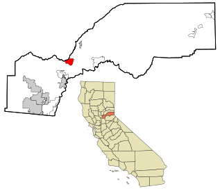
Shaver Lake is a census-designated place (CDP) in Fresno County, California, United States. The population was 634 at the 2010 census, down from 705 at the 2000 census. Shaver Lake is on the southwest end of the lake of the same name, 10 miles (16 km) east of New Auberry, at an elevation of 5,627 ft (1,715 m). The name honors C.B. Shaver, founder of the Fresno Flume and Irrigation Company that built the dam, creating the lake. The lake served as a mill pond for the Shaver Sawmill and the source for a flume that ran 65 miles (105 km) to Clovis. The original town of Shaver was buried under the lake when the Thomas A. Edison Company purchased and enlarged the lake in 1919.

<span class="mw-page-title-main">Mesa, California</span> Census-designated place in California, United States

Mesa is a census-designated place (CDP) in Inyo County, California, United States. The population was 251 at the 2010 census, up from 214 at the 2000 census.

<span class="mw-page-title-main">South Taft, California</span> Census-designated place in California, United States

South Taft is a census-designated place (CDP) in Kern County, California, United States. South Taft is located 0.5 miles (0.8 km) south of Taft, at an elevation of 1,017 feet (310 m). The population was 2,169 at the 2010 census, up from 1,898 at the time of the 2000 census.

<span class="mw-page-title-main">North Lakeport, California</span> Census-designated place in California, United States

North Lakeport is a census-designated place (CDP) in Lake County, California, United States. The population was 3,314 at the 2010 census, up from 2,879 at the 2000 census.

<span class="mw-page-title-main">Desert View Highlands, California</span> Census designated place in California, United States

Desert View Highlands is a census-designated place (CDP) in Los Angeles County, California, United States. The population was 2,360 at the 2010 census, up from 2,337 at the 2000 census. It is surrounded by the City of Palmdale.

<span class="mw-page-title-main">South San Gabriel, California</span> Census-designated place in California, United States

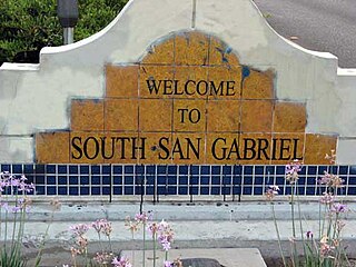
South San Gabriel is a census-designated place (CDP) in Los Angeles County, California, United States. The population was 8,070 at the 2010 census, up from 7,595 at the 2000 census.

<span class="mw-page-title-main">Tamalpais-Homestead Valley, California</span> Census-designated place in California, United States

Tamalpais-Homestead Valley is a census-designated place (CDP) in Marin County, California, United States. The population was 11,492 at the 2020 census.

<span class="mw-page-title-main">Las Lomas, California</span> Census-designated place in California, United States

Las Lomas is an unincorporated community and census-designated place (CDP) in Monterey County, California, United States. Las Lomas is located 7 miles (11 km) north-northwest of Prunedale. The elevation is 43 feet (13 m). The population was 3,046 at the 2020 census.

<span class="mw-page-title-main">Meadow Vista, California</span> Census-designated place in California, United States

Meadow Vista is a census-designated place (CDP) in Placer County, California, United States. It is part of the Sacramento–Arden-Arcade–Roseville Metropolitan Statistical Area. The population was 3,217 at the 2010 census, up from 3,096 at the 2000 census.

<span class="mw-page-title-main">Indian Falls, California</span> Census-designated place in California, United States

Indian Falls is a census-designated place (CDP) in Plumas County, California, United States. The population was 54 at the 2010 census, up from 37 at the 2000 census.

<span class="mw-page-title-main">El Cerrito, Riverside County, California</span> Census-designated place in Riverside County, California, United States

El Cerrito is a census-designated place (CDP) in Riverside County, California, United States. It is an unincorporated area mostly surrounded by the city of Corona. The population was 5,100 at the 2010 census, up from 4,590 at the 2000 census.

<span class="mw-page-title-main">Hidden Meadows, California</span> Census designated place in California, United States

Hidden Meadows is a census-designated place (CDP) near Escondido in San Diego County, California. The population was 3,485 at the 2010 census, up from 3,463 at the 2000 census.

<span class="mw-page-title-main">Taft Mosswood, California</span> Census-designated place in California, United States

Taft Mosswood is a census-designated place (CDP) in San Joaquin County, California, United States. The population was 1,530 at the 2010 census, up from 1,388 at the 2000 census. It comprises an unincorporated "island" within the City of Stockton.

<span class="mw-page-title-main">Mission Hills, Santa Barbara County, California</span> Census-designated place in the U.S. state of California

Mission Hills is a census-designated place (CDP) in Santa Barbara County, California, a short distance north of Lompoc on Highway 1. The population was 3,576 at the 2010 census, up from 3,142 at the 2000 census.

<span class="mw-page-title-main">Stanford, California</span> Census-designated place in Santa Clara County, California, US

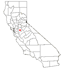
Stanford is a census-designated place (CDP) in the northwest corner of Santa Clara County, California, United States. It is the home of Stanford University. The population was 21,150 at the 2020 census.

<span class="mw-page-title-main">Poplar-Cotton Center, California</span> Census-designated place in California, United States

Poplar-Cotton Center is a census-designated place (CDP) in Tulare County, California, United States. The population was 2,470 at the 2010 census, up from 1,496 at the 2000 census.

<span class="mw-page-title-main">Richgrove, California</span> Census-designated place in California, United States

Richgrove is a census-designated place (CDP) in Tulare County, California, United States. The population was 2,358 at the 2020 United States census, down from 2,882 at the 2010 census.

<span class="mw-page-title-main">China Lake Acres, California</span> Census-designated place in California, United States

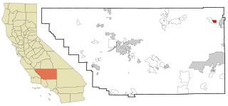
China Lake Acres is a census-designated place (CDP) in Kern County, California, United States. The population was 1,876 at the 2010 census, up from 1,761 at the 2000 census.

References

  1. "2010 Census U.S. Gazetteer Files – Places – California". United States Census Bureau.
  2. "Explore Census Data". data.census.gov. Retrieved May 6, 2023.
  3. "US Gazetteer files: 2010, 2000, and 1990". United States Census Bureau. February 12, 2011. Retrieved April 23, 2011.
  4. "2010 Census Interactive Population Search: CA - Westhaven-Moonstone CDP". U.S. Census Bureau. Archived from the original on July 15, 2014. Retrieved July 12, 2014.
  5. "U.S. Census website". United States Census Bureau . Retrieved January 31, 2008.
  6. "Senators". State of California. Retrieved March 10, 2013.
  7. "Members Assembly". State of California. Retrieved March 2, 2013.
  8. "California's 2nd Congressional District - Representatives & District Map". Civic Impulse, LLC. Retrieved March 1, 2013.