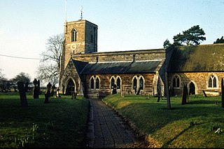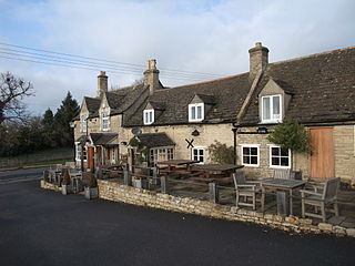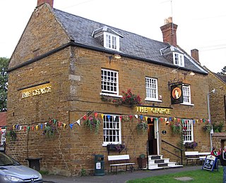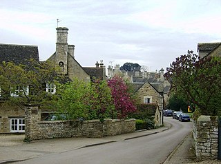
Sibbertoft is a village and civil parish in West Northamptonshire in England. At the time of the 2001 census, the parish's population was 343 people, increasing to 462 at the 2011 Census.

Marston Trussell is a village and civil parish in West Northamptonshire in England. Marston Trussell was first recorded as 'Mersitone', meaning marsh settlement. The parish includes Thorpe Lubenham. At the time of the 2001 census, its population was 163 people, reducing slightly to 157 at the 2011 census but including Lubenham.

Flore is a village and civil parish in West Northamptonshire in England.

Wilbarston is a village and civil parish in the English county of Northamptonshire in the Welland valley. It is administered as part of North Northamptonshire and is five miles east of the Leicestershire town of Market Harborough, via the A427. At the time of the 2001 census, the parish's population was 767 people, including Pipewell but reducing slightly to 753 at the 2011 Census. A Community Governance Review concluded in February 2015 resulted in the ward of Pipewell becoming part of the civil parish of Rushton.

Tixover is a small village and civil parish in Rutland. The population of the civil parish at the 2001 census was 174, falling to 163 at the 2011 census.

Collyweston is a village and civil parish in North Northamptonshire, about three miles southwest of Stamford, Lincolnshire, on the road to Kettering. The population of the civil parish at the 2011 census was 514.

Barrowden is a village in Rutland in the East Midlands of England.

Caldecott is a village in the county of Rutland in the East Midlands of England. The civil parish population was 256 at the 2001 census increasing to 269 at the 2011 census. It is located about four miles (6.4 km) south of Uppingham and about 4 miles north of Corby in Northamptonshire. The A6003 runs through the village; traffic flow on the bridge over the River Welland is controlled by traffic lights.

Old Stratford is a village in the south of the English county of Northamptonshire. The population of the village at the 2011 Census was 1,935. The 'Stratford' part of the village name is Anglo-Saxon in origin and means 'ford on a Roman road'. The Roman road in this sense is the Watling Street that runs through the middle of the village.

Ashley is a village and civil parish in the North Northamptonshire, England, about 4 miles (6.4 km) northeast of Market Harborough, Leicestershire and 5 miles (8.0 km) west of Corby. The population of the civil parish at the 2011 census was 224. The village is near the River Welland, which forms the border with Leicestershire. The Roman road called Via Devana in the part from Ratae to Duroliponte ran just north of the village.

Weekley is a small village and civil parish in the English county of Northamptonshire, on the outskirts of Kettering.

Medbourne is a village and civil parish in the Harborough district, in the county of Leicestershire, England. The population of the civil parish at the 2011 census was 473.

Deeping Gate is a village and civil parish, lying on the River Welland in Cambridgeshire. Traditionally, the area was part of the Soke of Peterborough, geographically considered a part of Northamptonshire; it now falls within the City of Peterborough unitary authority area. With a very small population, void of any major services, including a post office or even a chapel, the community depends on nearby Market Deeping, one and a quarter miles (2.0 km) north of the river in Lincolnshire, for economic and market services. The parish had a population of 258 males and 257 females according to the 2011 Census. Renaissance composer Robert Fayrfax (Fairfax) was a native of the village. Fairfax House, the most prominent and grand property in the village, was home to the Fairfax Family.

Tansor is a village and civil parish in the English county of Northamptonshire. Lying near the River Nene, three miles north-east of the town of Oundle and a mile from the village of Cotterstock, Tansor forms part of North Northamptonshire. At the time of the 2001 census, the parish's population was 185 people, reducing to 172 at the 2011 Census. A notable son of Tansor was the naturalist and writer Horace William Wheelwright, born there in 1815. Attractions are limited; only a church, telephone and phone box and a village hall containing a playgroup.

Harringworth is a village and civil parish in North Northamptonshire, England. It is located close to the border with Rutland, on the southern bank of the River Welland, and around 5.3 miles (8.5 km) north of Corby. At the 2001 Census, the population of the parish was 247, falling to 241 at the 2011 Census.

Little Houghton is a village and civil parish in Northamptonshire, England, located about 2 miles (3.2 km) east of Northampton. At the time of the 2001 census, the parish's population was 367 people, increasing to 412 at the 2011 census.

East Carlton is a village and civil parish in the county of Northamptonshire, on the southern ridge overlooking the Welland valley to the north and covers 1,645 acres (666 ha) on a long strip of land. It is 2 miles (3.2 km) west of the town of Corby and is administered as part of North Northamptonshire but was previously in the Corby borough until 2021. At the time of the 2001 census, the parish's population was 270, reducing to 259 at the 2011 census. East Carlton is one of the Thankful Villages that suffered no fatalities during World War I. Although in Northamptonshire, the village is in the Leicestershire LE16 postcode area.

Theddingworth is a village and civil parish in Leicestershire, England. The population of the civil parish at the 2011 census was 217. The parish includes the neighbouring hamlet of Hothorpe, which lies across the county boundary in Northamptonshire.

Duddington is a small village in Northamptonshire, England. It is by the junction of the A47 and A43 roads, and is 9 kilometres (6 mi) southwest of the town of Stamford. The village is on the east bank of the River Welland which is the county boundary of Rutland.

Easton on the Hill is a village and civil parish at the north eastern tip of North Northamptonshire, England. The village had a population at the 2011 census was 1,015. The village, sited on the A43 road, is compact in form, with the older part of the village located north of the High Street. The parish extends from the River Welland in the north to the western end of RAF Wittering. The village is also on the shortest boundary in England with it being in the northernmost part of Northamptonshire between Stamford and Collyweston.


