Crafton is a borough in Allegheny County, Pennsylvania, United States, west of downtown Pittsburgh. The population was 6,099 at the 2020 census. It is a residential suburb of the Pittsburgh metropolitan area.

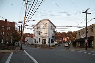
Ingram is a borough in Allegheny County, Pennsylvania, United States. The population was 3,391 at the 2020 census.

Friendship is a neighborhood of large Victorian houses in the East End of the City of Pittsburgh, Pennsylvania, United States, about four miles (6 km) east of Pittsburgh's Golden Triangle. Friendship is bordered on the north by Garfield, on the east by East Liberty, on the south by Shadyside, and on the west by Bloomfield. It is divided into three Pittsburgh City Council districts.
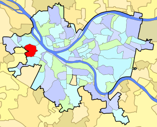
Crafton Heights is a neighborhood in the 28th Ward of the City of Pittsburgh.

Homewood is a predominantly African-American neighborhood of Pittsburgh, Pennsylvania, United States, officially divided into three neighborhoods: Homewood North, Homewood South and Homewood West.
Highland Park is a neighborhood in the northeastern part of Pittsburgh, Pennsylvania. Highland Park, the neighborhood, fully encompasses the park with the same name.
Elliott is a small, hilly neighborhood in Pittsburgh, Pennsylvania, United States' West End Region. Elliott is represented on the Pittsburgh City Council by the council member for District 2, and uses the ZIP code 15220.

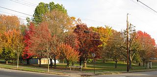
Swisshelm Park is a neighborhood located in the southeast corner of Pittsburgh, Pennsylvania. It is represented on the Pittsburgh City Council by Barbara Warwick. Swisshelm Park houses PBF 19 Engine, and is covered by PBP Zone 4 and the Bureau of EMS Medic 7.

East Carnegie is a neighborhood located in the West End of Pittsburgh, Pennsylvania, United States, adjacent to the neighborhood of Oakwood. It is a "natural area" with large tracts of wooded land.

The South Side Flats is a neighborhood in Pittsburgh, Pennsylvania's South Side area. It is located just south of the Monongahela River. The neighborhood has one of the City of Pittsburgh's largest concentrations of 19th-century homes, which has prompted outsiders to call the neighborhood the City's Georgetown. It includes many bars and restaurants as well as residences. The main throughway in the South Side Flats is East Carson Street. The street is home to a significant portion of Pittsburgh's nightlife.

Carrick is a south neighborhood of Pittsburgh, Pennsylvania in the United States. It is served by two zip codes, 15210 and 15227, and has representation on Pittsburgh City Council by the council member for District 4 with a part in District 3.

Banksville is a neighborhood in Pittsburgh, Pennsylvania. The neighborhood of Banksville is located in the West End of the city and borders the South Hills region. Real estate agencies frequently refer to the Banksville area as Greentree City due to Banksville's shared border with the borough of Green Tree. It has two zip codes of both 15220 and 15216, and has representation in Pittsburgh City Council by the council member for District 2. Theresa Kail-Smith is the current Councilperson for district two. Banksville's primary corridor, Banksville Road, is frequently used as a gateway between the South Hills of Pittsburgh and downtown Pittsburgh via the Fort Pitt Tunnels. Banksville, formerly Union Township, joined the City of Pittsburgh around 1928.

Fairywood is a neighborhood on Pittsburgh, Pennsylvania's West End. It has a zip code of 15205, and has representation on Pittsburgh City Council by the council member for District 2. It is the westernmost neighborhood in the City of Pittsburgh.
North Point Breeze is a mostly residential neighborhood that is located in the East End of Pittsburgh, Pennsylvania. It has a zip code of 15208, and representation on Pittsburgh City Council by the council member for District 9.

Windgap is a neighborhood in the West End of Pittsburgh, Pennsylvania, United States. It has a zip code of 15204, and has representation on Pittsburgh City Council by the council member for District 2.

Oakwood is a neighborhood in the West End of Pittsburgh, Pennsylvania, United States. It has a zip code of 15205, and has representation on Pittsburgh City Council by the council member for District 2.

West End Village is a neighborhood in Pittsburgh, Pennsylvania's west city area. It has a zip code of 15220, and has representation on Pittsburgh City Council by the council member for District 2.

Westview is a historic intown neighborhood located in southwest Atlanta, Georgia. It is named for the Westview Cemetery that borders the neighborhood to the northwest. The neighborhood is made up of a mixture of architectural styles including Arts & Crafts bungalows, Four-Squares, Tudors, Minimal Traditional houses, and Ranch style houses.

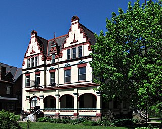
The John Frew House, also or formerly known as the Rachel and Robert Sterrett House, is an historic house in the Westwood neighborhood of Pittsburgh, Pennsylvania.
