
The Isle of Portland is a tied island, 6 kilometres (4 mi) long by 2.7 kilometres (1.7 mi) wide, in the English Channel. Portland is 8 kilometres (5 mi) south of the resort of Weymouth, forming the southernmost point of the county of Dorset, England. A barrier beach called Chesil Beach joins it to the mainland. The A354 road passes down the Portland end of the beach and then over the Fleet Lagoon by bridge to the mainland. The population of Portland is 12,797.

Weymouth and Portland was a local government district and borough in Dorset, England. It consisted of the resort of Weymouth and the Isle of Portland, and includes the areas of Wyke Regis, Preston, Melcombe Regis, Upwey, Broadwey, Southill, Nottington, Westham, Radipole, Chiswell, Castletown, Fortuneswell, Weston, Southwell and Easton; the latter six being on the Isle of Portland.
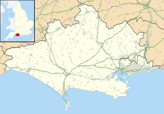
Melcombe Regis is an area of Weymouth in Dorset, England.

South Dorset is a constituency represented in the House of Commons of the UK Parliament since 2010 by Richard Drax, a Conservative. The constituency was created as a consequence of the Redistribution of Seats Act 1885, although the area covered has changed since then.
Weymouth and Melcombe Regis was a borough in England. It was formed by a charter of Elizabeth I, amalgamating the towns of Weymouth and Melcombe Regis in 1571.
Radipole is a part of the district of Weymouth and Portland in the county of Dorset, England.
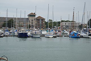
Weymouth Marina occupies most of the inner backwater of Weymouth Harbour, Dorset, England. The marina was refurbished to accommodate more vessels in the 1990s, and today houses hundreds of pleasure cruisers, fishing boats, yachts, dinghies and speedboats. Access to the marina is via a lifting road bridge across the harbour between Weymouth and Melcombe Regis.

The Weymouth Harbour Tramway is a disused heavy rail line running entirely on the streets of Weymouth, Dorset, England from a junction to the north of Weymouth station to Weymouth Quay station at Weymouth Harbour. Built in 1865, it was last used for timetabled British Rail services in 1987 with the last special train running in May 1999.
The Portland Branch railway was a railway line located on the Isle of Portland in the English county of Dorset. The line operated from the late nineteenth century until closing to passengers in 1952 and goods in 1965. For a short line, it had a complex history, built in three separate sections and operated jointly by two rival railway companies. Its construction needed twelve years of blasting through solid rock and three extensions of Parliamentary time.

The Battle of Weymouth and the associated Crabchurch Conspiracy occurred in 1645, during the First English Civil War, when several royalist plotters within the twin towns of Weymouth and Melcombe on the Dorset coast conspired to deliver the ports back into the control of King Charles I.
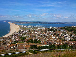
Weymouth is a seaside town in Dorset, England, situated on a sheltered bay at the mouth of the River Wey on the English Channel coast. The town is 11 kilometres (7 mi) south of Dorchester and 8 kilometres (5 mi) north of the Isle of Portland. Weymouth proper has a population of 53,068 (2018), and it is the third largest settlement in Dorset after Bournemouth and Poole.
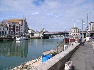
Weymouth Harbour is a picturesque harbour at the seaside town of Weymouth in Dorset, southern England,. It has a 17th-century waterfront.

The Rodwell Trail is a short-distance footpath that runs from Wyke Regis to the town centre of Weymouth in Dorset – a distance of 3.5 kilometres. The trail, opened in 2000, travels along the former route of the Weymouth and Portland Railway and is part of the South West Coast Path. The route follows part of the Jurassic Coast, and Sites of Special Scientific Interest. It is named after a neighbourhood of Weymouth which it passes through.
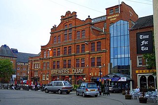
Weymouth Museum is a museum in Weymouth, Dorset, England. It is located within Brewers Quay on the south side of Hope Square near Weymouth Harbour. The museum currently uses temporary space to display a small part of its collection prior to carrying out planned expansion and redevelopment plans.
Cotton Fort was a small fortification in Melcombe, now part of the town of Weymouth, Dorset. No trace of the fort exists today.
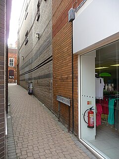
The Block House was an old fort in the town of Melcombe, in Weymouth, Dorset, southern England. There are no visible remains today.
Robert Stone Comben CBE JP, was a British Liberal Party politician who gave over 40 years service to local government in Dorset.

St Mary's Church is a Church of England parish church in Weymouth, Dorset, England. Built of Portland stone in 1815–1817, the church has been described as having an "austere design in Palladian mode". It has been a Grade I listed building since 1953.
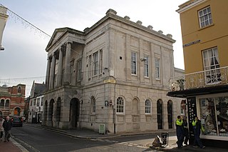
Weymouth Guildhall is a former guildhall at Weymouth, Dorset, England. The building, which was constructed in the 1830s, is a Grade II* listed building.

Weymouth Old Town Hall is a former town hall at Weymouth, Dorset, England. The building, which was built with Portland stone in the 1770s, has been Grade II listed since 1953. The bell turret is believed to date from the 17th century. Since 2009, the hall has been operated for community use by the Guardians of the Old Town Hall.


