Cumbria is a ceremonial county in North West England. It borders the Scottish council areas of Dumfries and Galloway and Scottish Borders to the north, Northumberland and County Durham to the east, North Yorkshire to the south-east, Lancashire to the south, and the Irish Sea to the west. Its largest settlement is the city of Carlisle.

Cumberland is a historic county in North West England, covering part of the Lake District as well as the northern Pennines and the coast of Solway Firth. Cumberland had an administrative function from the 12th century until 1974, when it was subsumed into Cumbria, a larger administrative area which also covered Westmorland and parts of Yorkshire and Lancashire. In April 2023, Cumberland was revived as an administrative entity when Cumbria County Council was abolished and replaced by two unitary authorities, one of which is named Cumberland and includes most of the historic county, with the exception of Penrith and the surrounding area.

Appleby-in-Westmorland is a market town and civil parish in Westmorland and Furness, Cumbria, England, with a population of 3,048 at the 2011 Census. Crossed by the River Eden, Appleby is the county town of the historic county of Westmorland. It was known just as Appleby until 1974–1976, when the council of the successor parish to the borough changed it to retain the name Westmorland, which was abolished as an administrative area under the Local Government Act 1972, before being revived as Westmorland and Furness in 2023. It lies 14 miles (23 km) south-east of Penrith, 32 miles (51 km) south-east of Carlisle, 27 miles (43 km) north-east of Kendal and 45 miles (72 km) west of Darlington.

Penrith is a market town and civil parish in the Westmorland and Furness district of Cumbria, England. It is less than 3 miles (5 km) outside the Lake District National Park and about 17 miles (27 km) south of Carlisle. It is between the Rivers Petteril and Eamont and just north of the River Lowther. The town had a population of 15,181 at the 2011 census. It is part of historic Cumberland.

Earl of Lonsdale is a title that has been created twice in British history, firstly in the Peerage of Great Britain in 1784, and then in the Peerage of the United Kingdom in 1807, both times for members of the Lowther family.

James Lowther, 1st Earl of Lonsdale was an English country landowner and politician who sat in the House of Commons for 27 years from 1757 to 1784, when he was raised to the Peerage of Great Britain as Earl of Lonsdale.

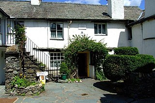
Hawkshead is a village and civil parish in Westmorland and Furness, Cumbria, England. Within the boundaries of the historic county of Lancashire, the parish includes the hamlets of Hawkshead Hill, 1.2 miles (1.9 km) to the north west, and Outgate, a similar distance north. Hawkshead contains one primary school but no secondary school and four public houses.
This is a list of people who have served as Lord-Lieutenant of Westmorland. The office was abolished on 31 March 1974 and replaced by the Lord Lieutenant of Cumbria. From 1751 to 1974, all Lord Lieutenants were also Custos Rotulorum of Westmorland.

Clifton is a small linear village and civil parish in Cumbria, England. Historically part of Westmorland, it lies 3 miles (4.8 km) south east of Penrith.

Lowther is a civil parish in Westmorland and Furness, Cumbria. Within the parish are the settlements of Lowther Village, Newtown or Lowther Newtown, Hackthorpe, Whale, and Melkinthorpe. At the 2001 census the parish had a population of 402, increasing to 465 at the 2011 Census.

Armathwaite Castle is in the village of Armathwaite, Cumbria, England, by the River Eden. Originally built to defend against Scottish raiders in the 15th century, it was converted into a mansion and today is a Grade II* listed building.

Brampton is a village in the Eden district, in the county of Cumbria, England. Before 1974 it was in the county of Westmorland; the nearest town is Appleby-in-Westmorland.

Knock is a small village in the Eden district of Cumbria, England, and 1.9 km northwest of the larger village of Dufton and 3.1 km south of the village of Milburn. It lies midway between Cross Fell to the north and the town of Appleby-in-Westmorland to the south. Knock is situated 1 km east of the small hamlet and farm, Knock Cross.

Melkinthorpe is a hamlet in the civil parish of Lowther, in the Eden district, in the county of Cumbria, England. It is near the villages of Hackthorpe and Cliburn. Circa 1870, it had a population of 99 as recorded in the Imperial Gazetteer of England and Wales.

Hackthorpe is a hamlet in the Eden district, in the county of Cumbria, England. Circa 1870, it had a population of 110 as recorded in the Imperial Gazetteer of England and Wales.

Helton is a village in the Eden district, in the English county of Cumbria. It is about a mile south of the village of Askham. Circa 1870, it had a population of 180 as recorded in the Imperial Gazetteer of England and Wales. The village is situated on a steep slope running down from the limestone fells to the flood plain of the River Lowther. Helton is on Wideworth Farm Road, which forms part of the road north to Penrith, and south towards Bampton. A Wesleyan chapel was built in Helton in c.1857 and is a Grade II listed building, now converted for residential use.

Drybeck is a hamlet in the Eden district in the English county of Cumbria. It is near the town of Appleby-in-Westmorland. It is on Dry Beck and has a hall called Drybeck Hall, there is also a Moor called Drybeck Moor. Circa 1870, it had a population of 87 as recorded in the Imperial Gazetteer of England and Wales.

Carleton is a hamlet on the A6 road, in the Carlisle district, in the county of Cumbria, England. In the Imperial Gazetteer of England and Wales of 1870-1872 it had a population of 181.

Raisbeck is a hamlet in the civil parish of Orton, in the Westmorland and Furness district of Cumbria, England. The surname Raisbeck originates from the hamlet. The name of the hamlet derives from Hrridarr, a personal name and beck, a stream or river. There is also the smaller hamlet of Sunbiggin nearby. Circa 1870, it had a population of 214 as recorded in the Imperial Gazetteer of England and Wales.

Hugill is a civil parish in the South Lakeland district of the English county of Cumbria. Hugill includes the village of Ings and the hamlets of Grassgarth, and Reston plus a large part of the village of Staveley and the west bank of the River Kent north of Barley Bridge. It was formerly a part of the Barony of Kendal. In the 2001 census the parish had a population of 416, increasing at the 2011 census to 446. Approximately 60% of the population live in Staveley or the Kent valley.


