What-A-Burger

Last updated
What-A-Burger
Company typePrivately held
IndustryRestaurant
Founded1957;67 years ago (1957)
FoundersJack Branch and Paul E. Branch Jr.

What-A-Burger is the trading name used by a small group of restaurants which were established by entrepreneur brothers Jack Branch and Paul E. Branch Jr. and members of the Branch family beginning in 1957 though the first What-A-Burger was opened in 1950. [1] With the first location at a busy traffic circle near Newport News, Virginia, in the former Warwick County, they soon established additional locations in the cities of Richmond, Colonial Heights, and Petersburg, Virginia, each along busy through-traffic highway corridors. Another location was opened by a member of the Branch family in the 1950s in Greenville, South Carolina.

Contents

History

What-A-Burger on Jefferson Avenue in Newport News, Virginia, in May 2010. It is located just west of the former Newport News Circle, which was the site of the very first What-A-Burger, which was opened by Jack Branch in 1957 and operated by his brother, Paul E. Branch, Jr. May 2010 photo What-A-Burger Newport News VA 2010-05-19.jpg
What-A-Burger on Jefferson Avenue in Newport News, Virginia, in May 2010. It is located just west of the former Newport News Circle, which was the site of the very first What-A-Burger, which was opened by Jack Branch in 1957 and operated by his brother, Paul E. Branch, Jr. May 2010 photo

The first Virginia store opened in 1957 [1] by entrepreneur Jack Branch near Newport News, Virginia.

Newport News Circle was a busy intersection located at Jefferson Avenue and U.S. Route 258 governed by a traffic circle (aka "rotary") in the former Warwick County. (Warwick County later became politically consolidated with the City of Newport News, assuming the latter's better-known name). U.S. Route 258, later known as Mercury Boulevard in honor of the astronauts of Project Mercury at NASA's center at nearby Langley Air Force Base, led from Fort Monroe to the James River Bridge and has been a major traffic artery in the area for many years. Jefferson Avenue at the time carried Virginia Route 168, which led from Anderson's Corner on U.S. Route 60 west of Colonial Williamsburg to the harbor near Newport News Point, where traffic long crossed Hampton Roads by means of an automobile-carrying ferry (later using the Hampton Roads Bridge-Tunnel). It was a very busy location, especially in the era after World War II and before the U.S. Interstate Highway System was created.

Branch's original location on the traffic circle was operated by his brother, Paul E. Branch, Jr., and was moved some years later to another location slightly west of the former traffic circle after a highway modernization project took place. That store is continuing business as of April 2015.

Founder Branch later was involved in establishing additional stores in the independent cities of Richmond, Colonial Heights and Petersburg, Virginia, as well as one in South Carolina. The other Virginia stores were located along U.S. Route 1 (Virginia), a major through traffic corridor in the years before Interstate 95 was built. In addition to the U.S. Route 1 locations another Richmond location was added on State Route 161 in Richmond. (Route 161 was touted as a western bypass of Richmond's Lee Bridge in its early pre-Interstate Highway years, using the privately owned Boulevard Bridge to cross the James River.

Locations

As noted above, the first What-a-Burger is still in operation at 6117 Jefferson Ave. in Newport News, Virginia, just west of its original location.

Other locations in the Richmond-Petersburg area have closed. The store located at 1018 Boulevard in Colonial Heights, Virginia, closed in 2015. A more modern location was opened off Puddledock Rd. just beyond the city limits of Colonial Heights in Prince George, Virginia, in 2013 and likely contributed to the closing of the older restaurant. One of the oldest locations, at 909 Jefferson Davis Hwy. in Richmond, VA, which in recent years operated under the names "BJ's Big Burger" and "BJ's What-a-Burger," is also closed; however, the locations at 9901 Jefferson Davis Hwy. in Chesterfield County, Virginia, and at 2350 W Washington St. in Petersburg, Virginia, remain open.

A sister restaurant, loosely affiliated with What-a-Burger and serving a similar, if not identical, menu, operates under the name Roy's Big Burger and is located at 5200 Lakeside Ave. in Richmond, Virginia. A Roy's Big Burger also formerly operated at 4108 Jefferson Davis Hwy. in Richmond, Virginia, but is now the location of a Mexican taqueria.

Other What-A-Burgers

What-A-Burger restaurants (as well with other variations of the name) were formed by other entrepreneurs than the Branch family during the post-World War II period. For example, a small chain now based in Concord, North Carolina, was founded by Eb Bost & C.W. Bost, Jr. and operates as What-A-Burger Drive-Ins, Inc. with several locations, are all still under the leadership of members of their families. [2] It also visibly numbered their stores starting from #1 in Kannapolis, North Carolina, to #15 in Concord. [3] [4]

The What-A-Burger restaurants in Virginia, North Carolina and South Carolina are not to be confused with the much larger Whataburger chain based in Texas. Harmon Dobson, a different entrepreneur, established a "Whataburger" restaurant in Texas on August 8, 1950. The Texas Secretary of State granted Dobson a "Whataburger" trademark in 1950, [5] and he registered a federal trademark in 1957. [6] The Texas business eventually became a corporation with as many as 800 "Whataburger" locations across the southern United States. The San Antonio, Texas-based chain's sales hit the $1 billion mark for the first time in 2007. [7] However, notwithstanding the much larger size of the Texas-based chain, the locations of the chain were limited to Texas, Alabama, Arizona, Arkansas, Florida, Georgia, Louisiana, Mississippi, New Mexico, and Oklahoma. [8] The company does not have any locations in the Carolinas [9] or Virginia. [10] However, Whataburger has announced plans for three Charlotte locations, three Triangle locations, and nine South Carolina locations. [9]

Signature food

What-A-Burger locations are notable for their large burgers (in comparison with normal fast-food fare). They offer more limited menus than many larger chains. Food is generally cooked to order within sight of waiting customers.

Despite being largely bypassed by through traffic using the Interstate Highway System, the Branch family locations in the Richmond-Petersburg and Newport News areas thrived, building a local and loyal following, especially at lunch hours. Reviewers commenting online in both the Richmond and Newport News areas noted many years of their patronage. A recent review in the State (Columbia, SC) newspaper's blog, following their local "Cheeseburger crawl" stated "You can order either the regular What-a-burger or the What-a-burger with cheese; ordering it "all the way" comes with mustard, onions, pickles, lettuce and tomato, although you can also add ketchup and mayo, or request grilled onions." [11]

Lawsuit: a larger chain, similar name

During the formative years, neither the Branch family nor Dobson and his associates were apparently aware of the existence of the other. A federal trademark infringement lawsuit between the two Virginia corporations in conflict with the Virginia-based corporations (What-A-Burger of Virginia, Inc. and What-A-Burger of Newport News, Inc.) and the chain based in Texas (Whataburger) was decided in 2004.

Based upon the evidence presented when the lawsuit was brought more than 50 years later, the founders, since deceased, apparently first became aware of each other's businesses in 1970. Representatives of the Texas chain told the courts during the federal lawsuit that the company had no plans for expansion into Virginia. (Neither the North Carolina-based What-A-Burger chain nor any of the many others with similar names was a party to this lawsuit).

At the conclusion of the 2003–2004 legal action, the court found that "no actionable damages had occurred" or were likely to for either party and that there is no reasonable public confusion: "There is no evidence — nor can we imagine any — that consumers are currently likely to be confused about whether the burgers served by Virginia W-A-B come from Texas or Virginia." [12]

See also

Related Research Articles

<span class="mw-page-title-main">Interstate 95</span> U.S. East Coast Interstate Highway

Interstate 95 (I-95) is the main north–south Interstate Highway on the East Coast of the United States, running from U.S. Route 1 (US 1) in Miami, Florida, north to the Houlton–Woodstock Border Crossing between Maine and the Canadian province of New Brunswick. The highway largely parallels the Atlantic coast and US 1, except for the portion between Savannah, Georgia, and Washington, D.C., and the portion between Portland and Houlton in Maine, both of which follow a more direct inland route.

<span class="mw-page-title-main">Interstate 85</span> Interstate Highway across the southeastern US

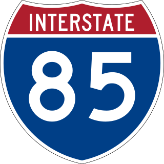
Interstate 85 (I-85) is a major Interstate Highway in the Southeastern United States. Its southern terminus is at an interchange with I-65 in Montgomery, Alabama; its northern terminus is an interchange with I-95 in Petersburg, Virginia, near Richmond. It is nominally north–south as it carries an odd number, but it is physically oriented northeast–southwest and covers a larger east–west span than north–south. While most Interstates that end in a "5" are cross-country, I-85 is primarily a regional route serving five southeastern states: Virginia, North Carolina, South Carolina, Georgia, and Alabama.

<span class="mw-page-title-main">Yorktown, Virginia</span> Census-designated place in Virginia, United States

Yorktown is a census-designated place (CDP) in York County, Virginia. It is the county seat of York County, one of the eight original shires formed in colonial Virginia in 1682. Yorktown's population was 195 as of the 2010 census, while York County's population was 66,134 in the 2011 census estimate.

<span class="mw-page-title-main">Whataburger</span> American fast food restaurant chain

Whataburger is an American regional fast food restaurant chain, headquartered and based in San Antonio, Texas, that specializes in hamburgers. Founded by Harmon Dobson and Paul Burton, it opened its first restaurant in Corpus Christi, Texas in 1950. Family-owned by the Dobsons until 2019, the chain is now managed by the private equity firm BDT & MSD Partners; the Dobson family still holds a small stake.

The Richmond–Petersburg Turnpike was a controlled-access toll road located in the Richmond-Petersburg region of central Virginia, United States.
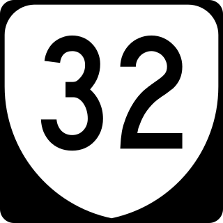
<span class="mw-page-title-main">Jefferson Davis Highway</span> Historic long-distance highway in the United States

The Jefferson Davis Highway, also known as the Jefferson Davis Memorial Highway, was a transcontinental highway in the United States in the 1910s and 1920s that began in Arlington County, Virginia, and extended south and west to San Diego, California; it was named for Jefferson Davis, President of the Confederate States, United States senator, and Secretary of War. Because of unintended conflict between the National Auto Trail movement and the federal government, it is unclear whether it ever really existed in the complete form that its United Daughters of the Confederacy (UDC) founders originally intended.

<span class="mw-page-title-main">Virginia State Route 161</span> Highway in Richmond, Virginia, United States

State Route 161 is a primary state highway in and near Richmond, Virginia, United States. It extends from an interchange with Interstate 95 (I-95) in the independent city of Richmond north to an intersection with U.S. Route 1 in the Lakeside area of central Henrico County.

<span class="mw-page-title-main">Southside (Richmond, Virginia)</span> Neighborhood of Richmond, Virginia, United States

The Southside of Richmond is an area of the Metropolitan Statistical Area surrounding Richmond, Virginia. It generally includes all portions of the City of Richmond that lie south of the James River, and includes all of the former city of Manchester. Depending on context, the term "Southside of Richmond" can include some northern areas of adjacent Chesterfield County, Virginia in the Richmond-Petersburg region. With minor exceptions near Bon Air, VA, the Chippenham Parkway forms the border between Chesterfield County and the City of Richmond portions of Southside, with some news agencies using the term "South Richmond" to refer to the locations in Southside located in the city proper.

<span class="mw-page-title-main">Transportation in Virginia</span> Overview of land sea and air transport systems in Virginia

Transportation in the Commonwealth of Virginia is by land, sea and air. Virginia's extensive network of highways and railroads were developed and built over a period almost 400 years, beginning almost immediately after the founding of Jamestown in 1607, and often incorporating old established trails of the Native Americans.

<span class="mw-page-title-main">Transportation in Richmond, Virginia</span>

Transportation in Richmond, Virginia and its immediate surroundings include land, sea and air modes. This article includes the independent city and portions of the contiguous counties of Henrico and Chesterfield. While almost all of Henrico County would be considered part of the Richmond area, southern and eastern portions of Chesterfield adjoin the three smaller independent cities of Petersburg, Hopewell, and Colonial Heights, collectively commonly called the Tri-Cities area. A largely rural section of southwestern Chesterfield may be considered not a portion of either suburban area.

<span class="mw-page-title-main">Virginia State Route 168</span> State highway in southeastern Virginia, US

State Route 168 is a primary state highway in the South Hampton Roads region of the U.S. state of Virginia. It runs from the border with North Carolina through the independent cities of Chesapeake and Norfolk where it ends in the Ocean View area near the Hampton Roads Bridge-Tunnel.

<span class="mw-page-title-main">Interstate 95 in Virginia</span> Interstate Highway in Virginia

Interstate 95 (I-95) runs 179 miles (288 km) within the commonwealth of Virginia between its borders with North Carolina and Maryland. I-95 meets the northern terminus of I-85 in Petersburg and is concurrent with I-64 for three miles (4.8 km) in Richmond. Although I-95 was originally planned as a highway through Washington, D.C., it was rerouted along the eastern portion of the Capital Beltway concurrent with I-495. From Petersburg to Richmond, I-95 utilized most of the Richmond–Petersburg Turnpike, a former toll road. In addition to Richmond, the route also runs through the medium-sized cities of Emporia, Petersburg, Colonial Heights, Fredericksburg, and Alexandria.

<span class="mw-page-title-main">Virginia State Route 351</span> State highway in Virginia, United States

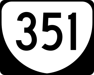
State Route 351 is a primary state highway in the U.S. state of Virginia. Known for most of its length as Pembroke Avenue, the state highway runs 8.81 miles (14.18 km) from U.S. Route 60 in Newport News east to Second Street in Hampton.

<span class="mw-page-title-main">U.S. Route 301 in Virginia</span> Segment of American highway

U.S. Route 301 is a part of the U.S. Highway System that runs from Sarasota, Florida, to Biddles Corner, Delaware. In Virginia, the U.S. Highway runs 142.70 miles (229.65 km) from the North Carolina state line near Skippers north to the Maryland state line at the Potomac River near Dahlgren. US 301 forms the local complement to Interstate 95 (I-95) from Emporia to Petersburg. The U.S. Highway runs concurrently with US 1 between Petersburg and the state capital of Richmond, where the highways form one of the main north–south avenues. US 301 continues north concurrent with Virginia State Route 2 to Bowling Green, forming an eastern alternative to I-95 and US 1 north of Richmond. At Bowling Green, which is connected to I-95 by SR 207, US 301 becomes the primary highway connecting Richmond and the Northern Neck with Southern Maryland. US 301 was constructed in four main segments: as the original SR 24 and then US 17-1 south of Petersburg, as US 1 from Petersburg to Richmond, as SR 2 from Richmond to Bowling Green, and as part of SR 207 toward Dahlgren. US 301 replaced US 17–1 in the early 1930s and was extended from Petersburg north along its current course into Maryland when the Potomac River Bridge was completed in 1940.

<span class="mw-page-title-main">U.S. Route 1 in Virginia</span> Section of United States Numbered Highway in Virginia

U.S. Route 1 (US 1) is a major north–south U.S. Route that serves the East Coast of the United States. In the U.S. state of Virginia, US 1 runs north–south through South Hill, Petersburg, Richmond, Fredericksburg, and Alexandria on its way from North Carolina to the 14th Street bridges into the District of Columbia. It is completely paralleled by Interstate Highways in Virginia—Interstate 85 (I-85) south of Petersburg, I-95 north to Alexandria, and I-395 into the District of Columbia—and now serves mainly local traffic. At its north end, on the approach to the 14th Street bridges, US 1 is concurrent with I-395; the rest of US 1 is on surface roads.

<span class="mw-page-title-main">U.S. Route 60 in Virginia</span> Section of U.S. Numbered Highway in Virginia, United States

U.S. Route 60 (US 60) in the Commonwealth of Virginia runs 303 miles (488 km) west to east through the central part of the state, generally close to and paralleling the Interstate 64 corridor, except for the crossing of the Blue Ridge Mountains, and in the South Hampton Roads area.

<span class="mw-page-title-main">Virginia State Route 144</span> State highway in eastern Virginia, US

State Route 144 is a primary state highway in the U.S. state of Virginia. The state highway runs 13.97 miles (22.48 km) from SR 36 at Fort Gregg-Adams north to SR 145 at Centralia. SR 144's east–west segment is the main highway between Colonial Heights and both Fort Gregg-Adams and Hopewell. The state highway's north–south section connects U.S. Route 1 and US 301 in Colonial Heights with SR 10 in Chester. A section of it was first added to the state highway system in 1930, and it gained its current routing and designation by 1987.

<span class="mw-page-title-main">Interstate 64 in Virginia</span> Highway in Virginia

Interstate 64 (I-64) in the US state of Virginia runs east–west through the middle of the state from West Virginia to the Hampton Roads region, for a total of 299 miles (481 km). From the West Virginia state line to Chesapeake, it passes through the major cities of Lexington, Staunton, Charlottesville, the state capital of Richmond, Newport News, Hampton, and Norfolk. It is notable for crossing the mouth of the harbor of Hampton Roads on the Hampton Roads Bridge–Tunnel (HRBT), the first bridge–tunnel to incorporate artificial islands, concurrent with U.S. Route 60 (US 60). Also noteworthy is a section through Rockfish Gap, a wind gap in the Blue Ridge Mountains, which was equipped with an innovative system of airport-style runway lighting embedded into the pavement to aid motorists during periods of poor visibility due to fog or other conditions.

The city of Williamsburg, Virginia has a full range of transport facilities. Williamsburg is served by the Newport News/Williamsburg International Airport, and by two larger but more distant airports. The city is linked to several Interstate and State highways. A transport hub - the Williamsburg Transportation Center - serves bus and rail passengers. Motor traffic is restricted in the historic area, and the city as a whole is more "walkable" than the US norm. Cycling routes are also being provided.

Hwy 55 Burgers Shakes & Fries is a fast casual restaurant chain that operates primarily in the state of North Carolina and other neighboring states on the east coast of the United States. Founded by Kenney Moore as Andy's Cheesesteaks and Cheeseburgers, the first location opened in Goldsboro, North Carolina, in 1991. In 2012, seeking to expand beyond North Carolina, the company changed their name to Hwy 55 and opened their first out-of-state restaurant in May of that year. As of February, 2022, the chain has a total of 108 locations in the United States, primarily in North Carolina (81) and South Carolina (12), with 15 other locations in the states of Florida, Georgia, Montana, Ohio, Tennessee, Texas, Virginia, and West Virginia. The restaurant serves hamburgers, cheesesteaks, sandwiches, salads, hand-dipped ice cream and milkshakes.

References

  1. 1 2 3 "WHAT-A-BURGER OF VIRGINIA | 256 F.Supp.2d 476 (2003) | pp2d4761678 | Leagle.com". Leagle. Retrieved 2019-07-06.
  2. "What-A-Burger!!! (Concord, Kannapolis, Mooresville: live, food, car) - Page 2 - City-Data Forum". City-data.com. Retrieved 2012-09-12.
  3. Seltzer, Debra Jane. "North Carolina drive-ins". RoadsideArchitecture.com. Archived from the original on 2013-01-13. Retrieved 2012-09-12.
  4. Mason, Sharon (Mar–Apr 2009). "What-A-Place" (PDF). Cabarrus Living. pp. 22–23. Archived from the original (PDF) on 2013-01-13. Retrieved 2012-09-13.
  5. Hlavaty, Craig (2017-06-26). "Whataburger's official trademark turns 67 years old". Houston Chronicle. Retrieved 2023-11-13.
  6. What-A-Burger of Virginia v. Whataburger of Corpus Christi, Texas, 256F.Supp.2d47 (E.D. Va.2003).
  7. San Antonio Business Journal (2009-03-30). "Whataburger buys San Antonio office building for new headquarters - San Antonio Business Journal". Sanantonio.bizjournals.com. Retrieved 2012-09-12.{{cite web}}: |author= has generic name (help)
  8. "Archived copy" (PDF). Archived from the original (PDF) on 2011-07-16. Retrieved 2010-05-01.{{cite web}}: CS1 maint: archived copy as title (link)
  9. 1 2 Muccigrosso, Catherine (2024-04-24). "A third Whataburger in Charlotte? Records show latest expansion for Texas burger chain". The Charlotte Observer . Retrieved 2024-05-24.
  10. Malcolm, Timothy (2024-04-10). "Whataburger looks to stake claim in Carolinas with several openings". Houston Chronicle. Retrieved 2024-05-24.
  11. [ dead link ]
  12. "357 F.3d 441". Bulk.resource.org. Archived from the original on 2013-01-14. Retrieved 2012-09-12.