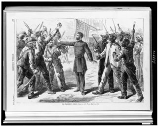
The Bureau of Refugees, Freedmen, and Abandoned Lands, usually referred to as simply the Freedmen's Bureau, was an agency of early Reconstruction, assisting freedmen in the South. It was established on March 3, 1865, and operated briefly as a U.S. government agency, from 1865 to 1872, after the American Civil War, to direct "provisions, clothing, and fuel...for the immediate and temporary shelter and supply of destitute and suffering refugees and freedmen and their wives and children".
Shankleville is an unincorporated community in Newton County, Texas, United States founded by James and Winnie Shankle and Stephen McBride. It was founded as a Freedmen's town, one of over 500 such "freedom colonies" in Texas.
The Pulaski riot was a race riot that occurred in Pulaski, Tennessee, on January 7, 1868. While the riot appeared to be based in a trade dispute of the previous summer between Calvin Lamberth, a white man, and Calvin Carter, an African American, it was provoked when Lamberth shot a friend of Carter's over rumored comments about the former's black mistress.

Fourth Ward is one of the historic six wards of Houston, Texas, United States. The Fourth Ward is located inside the 610 Loop directly west of and adjacent to Downtown Houston. The Fourth Ward is the site of Freedmen's Town, which was a post-U.S. Civil War community of African-Americans.

Barry Farm is a neighborhood in Southeast Washington, D.C., located east of the Anacostia River and bounded by the Southeast Freeway to the northwest, Suitland Parkway to the northeast and east, and St. Elizabeths Hospital to the south. The neighborhood was renowned as a significant post-Civil-War settlement of free Blacks and freed slaves established by the Freedmen's Bureau. The streets were named to commemorate the Union generals, Radical Republicans, and Freedmen's Bureau officials who advanced the rights of Black Americans during the Civil War and Reconstruction: Howard Road SE for General Oliver O. Howard; Sumner Road SE for Massachusetts Senator Charles Sumner; Wade Road SE for Ohio Senator Benjamin Wade; Pomeroy Road SE for Kansas Senator Samuel C. Pomeroy; Stevens Road SE for Pennsylvania Congressman Thaddeus Stevens, and Nichols Road for Danforth P Nichols. The neighborhood name is not a reference to the late former mayor of Washington, D.C., Marion Barry, but coincidentally has the same spelling.
Jewish Texans have been a part of the history of Texas since the first European explorers arrived in the region in the 16th century. In 1990, there were around 108,000 adherents to Judaism in Texas. More recent estimates place the number at around 120,000.

The Clarksville Historic District in Austin, Texas, is an area located west of downtown Austin near Lady Bird Lake and just northeast of the intersection of the Missouri Pacific Railroad and West Tenth Street. Many historic homes and structures are located within the Clarksville Historic District. While Clarksville is geographically part of the Old West Austin Historic District, it is distinct from the two historic neighborhoods of Old Enfield, which lies immediately to the north on the eastern side of Texas State Highway Loop 1, and Tarrytown, which is situated to the west and northwest on the western side of Mopac.
A freedman or freedwoman is a formerly enslaved person who has been released from slavery, usually by legal means. Historically, enslaved people were freed by manumission, emancipation, or self-purchase. A fugitive slave is a person who escaped enslavement by fleeing.
Robert Shaw was an American blues and boogie-woogie pianist, best known for his 1963 album, The Ma Grinder.

Wheatsville Co-op is a community-owned food cooperative in Austin, Texas, near the campus of the University of Texas at Austin. Named after the displaced black neighborhood of Wheatville, it was founded in 1976, and as of December 2022, has over 26,000 owners. It sells a full line of groceries, including organic produce, fresh meats, deli products, dairy products, pet foods and household goods, with an emphasis on local goods.
John Henry "Jack" Yates was an American freedman, minister, and community leader. Born enslaved in Gloucester County, Virginia on July 11, 1828, Yates was taught to read at an early age by his enslaver's child. He married Harriet Willis, who was enslaved on a neighboring farm. When her enslaver moved his plantation to Texas to avoid emancipation, Yates, then a free man, asked to be re-enslaved in order to stay with his family. He joined his family in Matagorda County, Texas until their emancipation in 1865. The family then relocated to Houston, where he helped establish Freedman's Town, purchased property, and began ministering to the community. In 1868, Yates was named the first full-time preacher of the Antioch Missionary Baptist Church, Houston's first Black baptist church. As a community leader, Yates organized Houston Academy, now Booker T. Washington High School; Bethel Baptist Church; and Houston's Emancipation Park. He died in 1897. Yates' original Houston home, the Jack Yates House, was donated to Houston's Heritage Society and first opened to the public in 1996.
Hancock is a neighborhood in Austin, Texas. Located in North Central Austin, Hancock encompasses ZIP code 78751 and 78705.
East César Chávez is a neighborhood in Austin, Texas. It is located in the central-east part of Austin's urban core on the north bank of the Colorado River. The neighborhood encompasses much of ZIP code 78702.

The African American population in Houston, Texas, has been a significant part of the city's community since its establishment. The Greater Houston area has the largest population of African Americans in Texas and west of the Mississippi River. Black Enterprise has referred to Houston as a black mecca.

The history of African Americans in Austin dates back to 1839, when the first African American, Mahala Murchison, arrived. By the 1860s, several communities were established by freedmen that later became incorporated into the city proper. The relative share of Austin's African-American population has steadily declined since its peak in the late 20th century.
Blackland is a historically black neighborhood on the east side of Austin, Texas, located north of Martin Luther King, Jr. Blvd, south of Manor Road, east of I-35, and west of Chestnut Street. The neighborhood was originally known as Blacklands and was settled by Swedish immigrants, but evolved into a predominantly African-American neighborhood following the 1928 Austin city plan, which called for the relocation of non-white residents to the east side of the city. Up until the 1980s, the neighborhood was targeted for demolition to make way for an expansion of the University of Texas campus. In 1983, the Blackland Community Development Corporation was formed to build, purchase and maintain housing for low-income families and special populations.
Jeremiah J. Hamilton was a school founder, carpenter, political organizer, and legislator in Texas.

The 1928 Austin city plan was commissioned in 1927 by the City Council of Austin, Texas. It was developed by consulting firm Koch & Fowler, which presented the final proposal early the next year. The major recommendations of this city plan related to Austin's street plan, its zoning code, and the development of major industries and civic features, but it is most remembered for institutionalizing housing segregation by designating East Austin as the city's negro district.
Quakertown was a freedmen's town located in Denton, Texas.


