Wheel of Mainz

Last updated
Version until 1992 Wappen-Mainz.svg
Version until 1992
Version from 1992-2008 Coat of arms of Mainz.svg
Version from 1992–2008
Version from 2008 Coat of arms of Mainz-2008 new.svg
Version from 2008

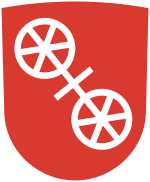
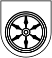
The Wheel of Mainz or Mainzer Rad, in German, was the coat of arms of the Archbishopric of Mainz and thus also of the Electorate of Mainz (Kurmainz), in Rhineland-Palatinate, Germany. It consists of a silver wheel with six spokes on a red background. The wheel can also be found in stonemasons' carvings (e.g. landmarks) and similar objects. Currently, the City of Mainz uses a double wheel connected by a silver cross.

Contents

Origin

The arms of archbishop Johann Schweikhard von Kronberg. Wappen Kurmainz.gif
The arms of archbishop Johann Schweikhard von Kronberg.

The origins of the wheel are not known. One theory traces it back to Bishop Willigis, who was elected Archbishop of Mainz in 975. According to a tale delivered by the Brothers Grimm, his ancestors had been wheelwrights and his adversaries sneered at him for his mean birth. They drew wheels on the walls and doors of his residence, Willigis though made it his personal ensign with the motto "Willigis, remember where you came from". However, this is not proven, and in any case coats of arms only appeared in the 12th century. Most of the archbishops of Mainz used the wheel for the first and third field of their personal coat of arms, using their family's coat of arms for the second and fourth fields.

It is more likely that the wheel refers to Saint Martin, [2] the patron of both the city itself and of Mainz Cathedral. Insignia dating from 1300 depict the saint with both wheels. Moreover, the Archbishops of Mainz were sometimes referred to as the currum dei aurigantes ("Drivers of God's Chariot") and the currum ecclesiae Moguntinae aurigantes ("Charioteers of the Church of Mainz")[ citation needed ], to which the wheels may well also be a reference.

Other theories see the wheel as either:

Dissemination

Dissemination of the Wheel of Mainz Verbreitungskarte Mainzer Rad 2.png
Dissemination of the Wheel of Mainz
Armorial achievement of Kurmainz, mid 18th century (oil on wooden carving) Kurmainzische Wappentafel 1750.jpg
Armorial achievement of Kurmainz, mid 18th century (oil on wooden carving)
Coat of arms of Mainz, Napoleonic era Wappen mainz napoleon.png
Coat of arms of Mainz, Napoleonic era

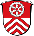
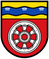
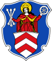
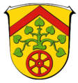
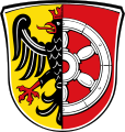
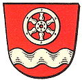
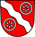
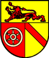
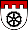
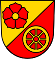
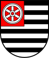
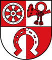
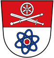
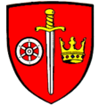
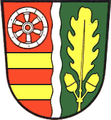
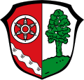
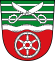
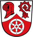
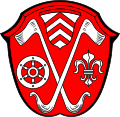
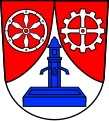
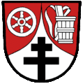
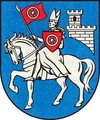
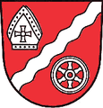
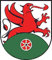
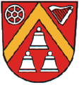
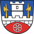
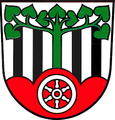
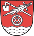
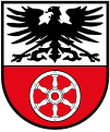
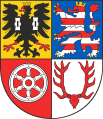
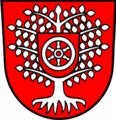
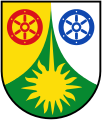
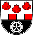
Due to the power wielded by the Elector until 1803, the Wheel of Mainz was recognized across a vast territory, and it can be seen in many coats of arms of towns belonging to the collegiate church, such as Erfurt, which belonged to the archbishopric for centuries. In addition, it is seen in the following coats of arms: Mainz-Hechtsheim, Mainz-Laubenheim, Mainz-Lerchenberg, Mainz-Weisenau, as well as Alzenau, Arenshausen, Bad Hersfeld, Bad Sobernheim, Berlingerode, Biebergemünd, Birkungen in Leinefelde-Worbis, Blankenbach, Bönnigheim, Brehme, Breitenworbis, Bürgstadt, Büttstedt, Cleebronn, Collenberg, Deuna, Dorfprozelten, Dünwald, Effelder, Eichenbühl, Eichsfeld, Elsenfeld, Eltville (ehemalige Residenz), Ortsteil Ershausen der Gemeinde Schimberg, Faulbach, Frammersbach, Frankfurt-Griesheim, Frankfurt-Höchst, Frankfurt-Nied, Freienhagen, Fritzlar, site of an important cathedral chapter, Gau-Algesheim, Geisenheim, Samtgemeinde Gieboldehausen, Gieboldehausen, Goldbach, Großbartloff, Großheubach, Großvargula, Gumbsheim, Haibach (Unterfranken), Hanau-Steinheim, Hausen (bei Aschaffenburg), Heilbad Heiligenstadt, Heppenheim (Bergstraße), Hergenfeld, Heyerode, Hofgeismar, Hofheim am Taunus, Holungen (Landkreis Eichsfeld), Hundeshagen, Johannesberg, Jützenbach, Kahl am Main, Kelkheim (Taunus), Kelkheim-Münster, Kella, Kirchgandern, Kirchheim, Thuringia, Kirchzell (Landkreis Miltenberg), Kleinostheim, Kleinwallstadt, Klingenberg am Main, Krautheim (Landkreis Hohenlohe), Kreuzebra, Langenthal (Hunsrück), Leidersbach, Verwaltungsgemeinschaft Lindenberg/Eichsfeld, Lorch (Rheingau), Mainaschaff, Marth, Miltenberg, Mömbris, Mönchberg, Monzingen, Mühlberg, Thuringia, Naumburg/Hessen, Neudenau (with eight spokes), the former Gemeinde Herbolzheim, since 1973 Herbolzheim, part of the city of Neudenau, Neunkirchen (Unterfranken), Neustadt (Eichsfeld), Niedernberg (Landkreis Miltenberg), Niederwalluf, Nöda, Obergriesheim, Oberlahnstein, Ober-Mörlen, Oberursel (Taunus), Pleitersheim, Rauenthal, Ravenstein, Reinholterode, Rieneck, Rodgau, Rohrberg, Röllbach, Rothenbuch, Sailauf, Schloßböckelheim, Schöllkrippen, Schöneberg (Hunsrück), Seesbach, Seligenstadt, Sömmerda, Sulzbach am Main (Landkreis Miltenberg), Treffurt, Uder, Viernheim, Waldaschaff, Walldürn, Weibersbrunn, Weilbach (Bayern), Weißenborn-Lüderode, Wiesen, Wittighausen, Worbis in Leinefelde-Worbis, and Wüstheuterode.

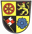
It also occurs in the coats of arms of the following Kreise (districts)

It also features in the arms of Rhineland-Palatinate itself.

Coats of Arms featuring the Wheel of Mainz

Rhineland-Palatinate

Hesse

Baden-Württemberg

Bavaria

Thuringia

Lower Saxony

Bishops

German municipal arms with wheels which have no connection to Mainz

Related Research Articles

Darmstadt-Dieburg is a Kreis (district) in the south of Hesse, Germany. Neighboring districts are Offenbach, Aschaffenburg, Miltenberg, Odenwaldkreis, Bergstraße, Groß-Gerau, and the district-free city of Darmstadt, which it surrounds.

The Odenwaldkreis is a Kreis (district) in the south of Hesse, Germany. Neighboring districts are Darmstadt-Dieburg, Miltenberg, Neckar-Odenwald-Kreis, Rhein-Neckar-Kreis and Kreis Bergstraße. Odenwaldkreis belongs to the Rhine Neckar Area.

The Hochtaunuskreis is a Kreis (district) in the middle of Hesse, Germany and is part of the Frankfurt/Rhine-Main Metropolitan Region. Neighbouring districts are Lahn-Dill, Wetteraukreis, district-free Frankfurt, Main-Taunus, Rheingau-Taunus, Limburg-Weilburg.

Main-Taunus is a Kreis (district) in the middle of Hessen, Germany and is part of the Frankfurt/Rhine-Main Metropolitan Region as well as the Frankfurt urban area. Neighboring districts are Hochtaunuskreis, district-free Frankfurt, Groß-Gerau, district-free Wiesbaden, Rheingau-Taunus. It is the second most densely populated rural district in Germany.

The Wetteraukreis is a Kreis (district) in the middle of Hesse, Germany. Neighbouring districts are Landkreis Gießen, Vogelsbergkreis, Main-Kinzig-Kreis, district-free Stadt Frankfurt, Hochtaunuskreis and Lahn-Dill-Kreis.

Rheingau-Taunus is a Kreis (district) in the west of Hesse, Germany. Rheingau-Taunus-Kreis is part of the Darmstadt region; its main administrative seat is Bad Schwalbach. Outposted sections of the local administration are located in Idstein and Rüdesheim am Rhein.

Limburg-Weilburg is a Kreis (district) in the west of Hesse, Germany. Neighboring districts are Lahn-Dill, Hochtaunuskreis, Rheingau-Taunus, Rhein-Lahn, Westerwaldkreis.

Mainz-Bingen is a district (Kreis) in the east of Rhineland-Palatinate, Germany. Neighboring districts are Rheingau-Taunus, the district-free cities Wiesbaden and Mainz, the districts Groß-Gerau, Alzey-Worms, Bad Kreuznach, and Rhein-Hunsrück.

Rhein-Lahn-Kreis is a district (Kreis) in the east of Rhineland-Palatinate, Germany. Neighboring districts are Westerwaldkreis, Limburg-Weilburg, Rheingau-Taunus, Mainz-Bingen, Rhein-Hunsrück, Mayen-Koblenz, and the district-free city Koblenz.

Neckar-Odenwald-Kreis is a Landkreis (district) in the north of Baden-Württemberg, Germany. Neighboring districts are Main-Tauber-Kreis, Hohenlohe-Kreis, Heilbronn, Rhein-Neckar-Kreis, Odenwaldkreis (Hesse) and Landkreis Miltenberg (Bavaria). The district is part of the Rhine-Neckar Metropolitan Region.

The Hohenlohe is a Landkreis (district) in the north of Baden-Württemberg, Germany. Neighboring districts are Neckar-Odenwald, Main-Tauber, Schwäbisch Hall and Heilbronn.

Main-Tauber-Kreis is a Landkreis (district) in the northeast of Baden-Württemberg, Germany. Neighboring districts are Miltenberg, Main-Spessart, Würzburg, Neustadt (Aisch)-Bad Windsheim and Ansbach, and the districts of Schwäbisch Hall, Hohenlohe and Neckar-Odenwald.

<span class="mw-page-title-main">Eichsfeld (district)</span> District in Thuringia, Germany

Eichsfeld is a district in Thuringia, Germany, and part of the historical region of Eichsfeld. It is bounded by the districts of Nordhausen, Kyffhäuserkreis and Unstrut-Hainich-Kreis, and by the states of Hesse and Lower Saxony.

Sömmerda is a Kreis (district) in the north of Thuringia, Germany. Neighboring districts are the districts Kyffhäuserkreis, the Burgenlandkreis in Saxony-Anhalt, the district Weimarer Land and the district-free city Erfurt, and the districts Gotha and Unstrut-Hainich-Kreis.

Unstrut-Hainich-Kreis is a Kreis (district) in the north of Thuringia, Germany. Neighboring districts are the districts Eichsfeld, Kyffhäuserkreis, Sömmerda, Gotha, Wartburgkreis and the district Werra-Meißner in Hesse.

Miltenberg is a Landkreis (district) in Bavaria, Germany. It is bounded by the city of Aschaffenburg, the districts of Aschaffenburg and Main-Spessart, and the states of Baden-Württemberg and Hesse.

<span class="mw-page-title-main">Eichsfeld</span>

The Eichsfeld is a historical region in the southeast of the state of Lower Saxony and northwest of the state of Thuringia in the south of the Harz mountains in Germany. Until 1803 the Eichsfeld was for centuries part of the Archbishopric of Mainz, which is the cause of its current position as a Catholic enclave in the predominantly Protestant north of Germany. Following German partition in 1945, the West German portion became Landkreis Duderstadt. A few small transfers of territory between the American and Soviet zones of occupation took place in accordance with the Wanfried Agreement.

<span class="mw-page-title-main">Freudenberg (Baden)</span> Town in Baden-Württemberg, Germany

Freudenberg is a town and a municipality in the district Main-Tauber-Kreis, in Baden-Württemberg, Germany. It is situated on the river Main and has a population around 3,700.

References

  1. Siebmacher, Johann (1703). Erneuertes und vermehrtes Wappenbuch... Nürnberg: Adolph Johann Helmers. pp. Part I Table 2.
  2. Rabbow, Arnold, and Gube, Dieter. "Blätter zum Land: Landeswappen Rheinland-Pfalz". Landesregierung Rheinland-Pfalz (1999).
  3. Wappen von GESEKE