North East Hertfordshire is a constituency represented in the House of Commons of the UK Parliament since 2024 by Chris Hinchliff of the Labour Party.

Stevenage is a constituency in Hertfordshire represented in the House of Commons of the UK Parliament since 2024 by Kevin Bonavia, a member of the Labour Party.
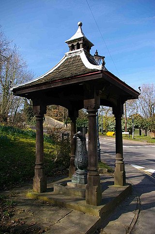
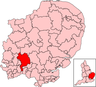
Watton-at-Stone is a village and civil parish in Hertfordshire, England, and is midway between the towns of Stevenage and Hertford in the valley of the River Beane.

Aston is a village and civil parish in the East Hertfordshire district of Hertfordshire, England. According to the 2001 census it had a population of 844, increasing to 871 at the 2011 Census. Located on a ridge between Stevenage and the Beane Valley, Aston is a 10 minutes drive from the A1(M).
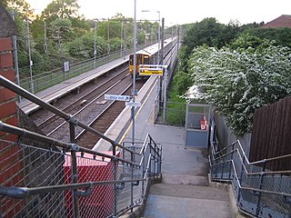
Watton-at-Stone railway station serves the village of Watton-at-Stone in Hertfordshire, England. It is 23 miles 72 chains down the line from London King's Cross on the Hertford Loop Line between Hertford North and Stevenage and is served by trains operated by Great Northern.

Heath Mount School is a Church of England co-educational independent prep school near Watton-at-Stone, Hertfordshire, England. It admits pupils aged 3 to 13. It was founded as Heath Mount Academy in Hampstead in 1796. In 1934 it was relocated to a Georgian mansion on the Woodhall Estate in rural Hertfordshire. For the 2022 academic year, 498 students were enrolled: boarding pupils and day pupils and girls and boys.

Hitchin is a parliamentary constituency in Hertfordshire and Bedfordshire which returned one Member of Parliament (MP) to the House of Commons of the Parliament of the United Kingdom from 1885 until it was abolished for the 1983 general election.

Tonwell is a small village in Bengeo Rural parish, Hertfordshire.
The A602 is a road linking Hitchin in Hertfordshire, England, with A10 at Ware in Hertfordshire, via Stevenage.

The River Beane is a short river in the county of Hertfordshire, England. A tributary of the River Lea, it rises to the south-west of Sandon in the hills northeast of Stevenage and joins the Lea at Hartham Common in Hertford.

Hertford Heath is a village and civil parish near the county town of Hertford in Hertfordshire, England. The population at the 2011 Census was 2,672.

Whelpley Hill is a hamlet in the parish of Ashley Green in Buckinghamshire, England. It is located to the east of Chesham, near the border with Hertfordshire and is the site of an Iron Age hillfort.

Henry fitz Ailwin de Londonstane was an English merchant and landowner who served as the first Lord Mayor of London from 1189 to 1212. In office from about 1189 until his death in 1212, he was the only mayor to hold the post for life.

Hertingfordbury is a small village in Hertfordshire, England, close to the county town of Hertford. It was mentioned in the Domesday Book of 1086. Hertingfordbury is also the name of a neighbouring civil parish, which does not contain the village. Hertingfordbury village is within the Castle ward of Hertford Town Council. The population of the civil parish as of the 2021 census was 689.

Wareside is a small village and civil parish in the East Hertfordshire district, in the county of Hertfordshire, England. The population of the civil parish in the 2011 census was 735. It is approximately 3 miles (5 km) away from the town of Ware and the larger town of Hertford, the county town. Nearby villages include Widford, Hunsdon, Babbs Green and Bakers End. Nearby hamlets include Cold Christmas and Helham Green. The B1004 road linking Ware to Bishop's Stortford goes through the village and the main A10 road can be joined up at Thundridge. Fanhams Hall Road links Wareside back to Ware. Ware railway station on the Hertford East Branch Line is located two and a half miles (4 km) away.

Stapleford railway station was a station on the Hertford Loop Line, and was situated in the village of Stapleford, Hertfordshire, England.

Not to be confused with Stapleford, Nottinghamshire.
Philip Butler or Boteler, of Watton at Stone, Hertfordshire, was an English politician.

Aston Bury is a manor house near Aston, Hertfordshire, England. It is Grade I listed building.
Hopper's Hall is a grade II listed house in Watton Road, Datchworth, Hertfordshire. It dates from around 1640 with minor additions and alterations since. Hoppers End, Hoppers Barn, and Hoppers Lodge are all adjacent.
