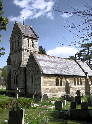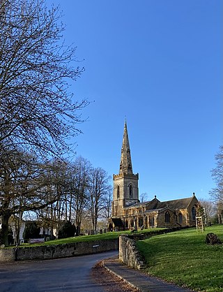
Nether Stowey is a large village in Somerset, South West England. It sits in the foothills of the Quantock Hills, just below Over Stowey. The parish of Nether Stowey covers approximately 4 km2, with a population of 1,482.

New Lanark is a village on the River Clyde, approximately 1.4 miles from Lanark, in Lanarkshire, and some 25 miles (40 km) southeast of Glasgow, Scotland. It was founded in 1785 and opened in 1786 by David Dale, who built cotton mills and housing for the mill workers. Dale built the mills there in a brief partnership with the English inventor and entrepreneur Richard Arkwright to take advantage of the water power provided by the only waterfalls on the River Clyde. Under the ownership of a partnership that included Dale's son-in-law, Robert Owen, a Welsh utopian socialist and philanthropist, New Lanark became a successful business and an early example of a planned settlement and so an important milestone in the historical development of urban planning.

The Three Mills are former working mills and an island of the same name on the River Lea. It is one of London’s oldest surviving industrial centres. The mills lie in the London Borough of Newham, but despite lying on the Newham side of the Lea, access is principally from the western, London Borough of Tower Hamlets, side of the river.

Monkton Combe is a village and civil parish in north Somerset, England, 3 miles (4.8 km) south of Bath. The parish, which includes the hamlet of Tucking Mill, had a population of 554 in 2013. It was formerly known as Combe, owing to its geography, while it was also known as Monckton Combe and Combe Monckton until last century.

Styal is a village and civil parish in Cheshire, England; it is sited on the River Bollin. The village is located 2 miles (3.2 km) north-north-west of Wilmslow and 2.5 miles (4.0 km) south-east of Manchester Airport.

Kingsthorpe is a suburb and civil parish of Northampton, England. It is situated to the north of Northampton town centre and is served by the A508 and A5199 roads which join at Kingsthorpe's centre. The 2011 Census recorded the population of the district council ward as 4,477.

Priston is a civil parish and village 4 miles (6 km) south west of Bath in Bath and North East Somerset, which is within the English ceremonial county of Somerset. The parish includes the hamlet of Wilmington.

Dunster Working Watermill is a restored 18th century watermill, situated on the River Avill, close to Gallox Bridge, in the grounds of Dunster Castle in Dunster, Somerset, England. It is a Grade II* listed building and within the Grade II* registered parkland of the castle.

Wothorpe is a village and civil parish in the Peterborough unitary authority of Cambridgeshire, England. It is in the far north-west of the district, and to the south of Stamford. The parish borders Northamptonshire to the west.

Stanton Drew is a small village and civil parish within the Chew Valley in Somerset, England, lying north of the Mendip Hills, 8 miles (13 km) south of Bristol in the area of the Bath and North East Somerset unitary authority.

Wookey Hole is a village in Somerset, England. It is the location of the Wookey Hole show caves.

The River Whitewater rises at springs near Bidden Grange Farm between Upton Grey and Greywell in Hampshire, England. It flows northeast and is a tributary of the River Blackwater near Swallowfield. Its headwaters flow over chalk and there is little pollution making the River Whitewater rich in wildlife. It was noted on Jansson's map of Hampshire of 1646.

The Underfall Yard is a historic boatyard on Spike Island serving Bristol Harbour in England.

The House Mill is a major Grade I listed building on the River Lea in Mill Meads, and part of the Three Mills complex. The original tidal mills at this site date back to the Domesday book of 1086, and the present structure of the House Mill was built in 1776 by Daniel Bisson. It was damaged by fire in 1802, and then rebuilt by Philip Metcalfe.

Cothelstone Manor in Cothelstone, Somerset, England was built in the mid-16th century, largely demolished by the parliamentary troops in 1646 and rebuilt by E.J. Esdaile in 1855–56.

The Land Yeo is a small river which flows through North Somerset, England. It rises on Dundry Hill and supplies Barrow Gurney Reservoirs before flowing through various villages to Clevedon where it drains into the Severn Estuary. During the past 1,000 years it has powered at least ten watermills, however only one is still functional. Since 2003 initiatives have been undertaken to clean up the river, improving water quality and encouraging wildlife.

Waithe is a hamlet and civil parish in the East Lindsey district of Lincolnshire, England. It is on the A16, 1 mile (1.6 km) south from Holton-le-Clay and 1 mile (1.6 km) north from North Thoresby.

Weoley Castle is the remains of a fortified manor house located in the Birmingham district of Weoley Castle, a primarily residential area, in the English West Midlands. Owned by Birmingham City Council and administered as a community museum by Birmingham Museums Trust, it is a Grade II listed building and a Scheduled monument. The castle was on Historic England's Heritage at Risk Register, but was removed in 2009 following repair work.

Clumber and Hardwick is a civil parish in the Bassetlaw district, in the county of Nottinghamshire, England. The parish includes the settlement of Hardwick Village and Clumber Park, a country park. In the UK census of 2021 the parish had a population of 66. The parish lies in the north west of the county, and south west within the district. It is 125 miles north west of London, 22 miles north of the city of Nottingham, and 3½ miles south east of the market town of Worksop.The parish touches Babworth, Carburton, Elkesley, Perlethorpe cum Budby and Welbeck. The parish was formed on 1 April 1994. The area is within Sherwood Forest and has close historical associations with the Dukes of Newcastle, being part of a wider region known as The Dukeries. There are 26 listed buildings in Clumber and Hardwick.

Charlecote Mill is a watermill in Hampton Lucy, Warwickshire, England, near to Charlecote Park and about 4 miles (6 km) east of Stratford-upon-Avon. It is a Grade II* listed building. Since the 1980s there has been a full-time business producing flour, and there are occasional open days.


