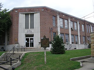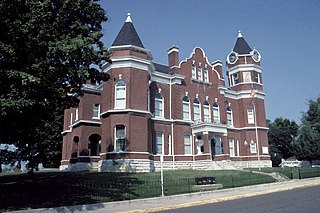
Wayne County is a county located in the U.S. state of Kentucky. As of the 2010 census, the population was 20,813. Its county seat is Monticello. The county was named for Gen. Anthony Wayne. It is a prohibition or dry county.

Logan County is a county located in the southwest Pennyroyal Plateau area of the U.S. Commonwealth of Kentucky. As of the 2010 census, the population was 26,835. Its county seat is Russellville.

Hopkins County is a county located in the western part of the U.S. state of Kentucky. As of the 2010 census, the population was 46,920. Its county seat is Madisonville. The county was formed in 1806 and named for General Samuel Hopkins, an officer in both the American Revolutionary War and War of 1812, and later a Kentucky legislator and U.S. Congressman.

Franklin County is a county located in the U.S. state of Kentucky. As of the 2010 census, the population was 49,285. Its county seat is Frankfort, the state capital. The county was formed in 1795 from parts of Woodford, Mercer and Shelby counties, and was named after the American inventor and statesman Benjamin Franklin.

Breckinridge County is a county located in the Commonwealth of Kentucky. As of the 2010 census, the population was 20,059. Its county seat is Hardinsburg, Kentucky. The county was named for John Breckinridge (1760–1806), a Kentucky Attorney General, state legislator, United States Senator, and United States Attorney General. It was the 38th Kentucky county in order of formation.

Shepherdsville is a home rule-class city on the Salt River in Bullitt County, Kentucky, in the United States. It is the seat of its county, located just south of Louisville. The population was 11,222 during the 2010 U.S. Census.

Hickman is a city in and the county seat of Fulton County, Kentucky, United States. Located on the Mississippi River, the city had a population of 2,395 at the 2010 U.S. census and is classified as a home rule-class city. Hickman is part of the Union City micropolitan area.

Shively is a home rule-class city in Jefferson County, Kentucky, United States, and a suburb of Louisville within the Louisville Metro government. As of the 2010 census, the city's population was 15,264, reflecting an increase of 107 (+0.7%) from 15,157 in 2000.

Taylor Mill is a home rule-class city in Kenton County, Kentucky, in the United States. The population was 6,604 at the 2010 census, down from 6,913 at the 2000 census.

Monticello is a home rule-class city in Wayne County, Kentucky, in the United States. It is the seat of its county. The population was 6,188 at the time of the 2010 U.S. census.

The Clarksville Metropolitan Statistical Area is defined by the United States Census Bureau as an area consisting of four counties – two in Tennessee and two in Kentucky – anchored by the city of Clarksville, Tennessee. A July 1, 2009 estimate placed the population at 268,546. As of 2009, the Clarksville Metropolitan Statistical Area is the 167th largest MSA in the United States.

The Battle of Mill Springs, also known as the Battle of Fishing Creek in Confederate terminology, and the Battle of Logan's Cross Roads in Union terminology, was fought in Wayne and Pulaski counties, near current Nancy, Kentucky, on January 19, 1862, as part of the American Civil War. The Union victory concluded an early Confederate offensive campaign in eastern Kentucky.
Irving Harold Mills was an American music publisher, musician, lyricist, and jazz artist promoter. He sometimes used the pseudonyms Goody Goodwin and Joe Primrose.

The Kentucky Theatre is a historic cinema in downtown Lexington, Kentucky, United States, that first opened in 1922. It is currently owned by the Lexington-Fayette Urban County Government and leased to a private firm that shows films and also hosts concerts. The theatre's schedule emphasizes foreign, independent, and art films, although more typical Hollywood movies are occasionally shown as well. It is one of a few remaining movie palaces in the United States.

Man o' War Boulevard, named after the racehorse Man o' War, is a 17-mile (27 km) urban arterial, circling Lexington, Kentucky to its south. Its western terminus is at US 60 Versailles Road at Keeneland Race Course's main entrance, from which the highway heads southeast, intersecting with US 68, US 27, and other roads. It then turns east and northeast, intersecting KY 1974, Alumni Drive, US 25/US 421, and I-75, before ending at US 60 at Brighton. The majority of the road is a four-lane divided highway with curbs and sidewalks maintained by the Lexington-Fayette Urban County Government, but the 1.429-mile (2.300 km) portion east of I-75 is maintained by the Kentucky Transportation Cabinet as Supplemental Road Kentucky Route 1425, and only carries two lanes.

The Lincoln Heritage Council (LHC) is a local council of the Boy Scouts of America serving 64 counties in four states: Kentucky, Indiana, Illinois, and Tennessee.
White Mill, White Mills and White's Mill may refer to:

The General Felix K. Zollicoffer Monument in Pulaski County, Kentucky, near Nancy, Kentucky, commemorates the death of Confederate Gen. Felix K. Zollicoffer, who died here at the Battle of Mill Springs. A native of nearby Tennessee, he fought for the Confederacy out of loyalty for his state rather than having interest in the Southern cause. Zollicoffer was killed due to not realizing he was approaching Union lines instead of the Confederate line.

Falls of Rough is an unincorporated community mostly located in Breckinridge County, and a smaller part in Grayson County, Kentucky, United States.


