
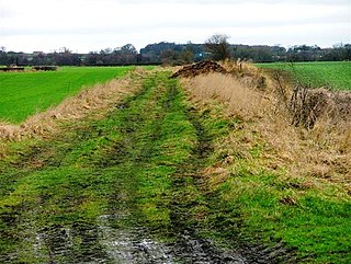
Brearton is a village and civil parish in the Harrogate borough of North Yorkshire, England, situated about 3 miles (4.8 km) north of Knaresborough. The village is mentioned in the Domesday Book and its name derives from the Old English Brer-Tun, which means the town where the briars grew.

Calton is a village and civil parish in the Craven district of North Yorkshire, England, on the River Aire in Airedale. In both the 2001 and 2011 Censuses the population was less than 100, so details were included in the civil parish of Flasby with Winterburn. In 2015, North Yorkshire County Council estimated the population of the village to be 60.

Hood Grange is a hamlet and civil parish in the Hambleton district of North Yorkshire, England. The population was less than 100 in the 2011 Census, so details are included in the civil parish of Sutton-under-Whitestonecliffe. The population of the parish was estimated at 10 in 2015. It is located near Thirsk at the foot of Sutton Bank, south of the larger village of Sutton-under-Whitestonecliffe and next to Hood Hill, which is to the south. It is notable for consisting of only a single household after its population decreased rapidly in the late 19th century. Hood Grange has existed as a civil parish since 1866, prior to which the area was part of Kilburn. A monastery known as Hood Abbey existed here from before 1138 until its dissolution in the 16th century.

Leake is a hamlet and civil parish in the Hambleton district of North Yorkshire, England, about six miles north of Thirsk. The population of the parish was estimated at 10 in 2010. With the population in 2011 being less than 100 information is contained in the civil parish of Borrowby, Hambleton.

Romanby is a village and civil parish in the Hambleton District of North Yorkshire, England. Romanby is situated just south-west of Northallerton, and at the 2001 UK census had a population of 6,051, increasing to 6,177 at the 2011 Census.

Ingleby Arncliffe is a village and civil parish in North Yorkshire, England. It is situated between the A172 and A19 roads, 6.5 miles (10.5 km) north-east from Northallerton and 7 miles (11.3 km) south-east from the small market town of Stokesley, and is on the edge of the North York Moors National Park. The village is conjoined to its smaller neighbour, Ingleby Cross. Ingleby Arncliffe lies in the historic county of the North Riding of Yorkshire.

Thornton Steward is a small village and civil parish in North Yorkshire, England, near Wensleydale, with a population of 100–200, measured at 199 in the 2011 Census. The name derives from Old English relating to a hawthorn tree on a farm and Steward. The village was formerly owned by Wymar, who was the steward of the Earls of Richmond. The village is very similar to the others that dot Wensleydale, but Thornton Steward has a reservoir owned by Yorkshire Water.

Copt Hewick is a village and civil parish in the Harrogate district of North Yorkshire, England. The village lies about two miles east of Ripon. It had a population of 180 in 2004 according to the North Yorkshire County Council, increasing to 253 at the 2011 census.

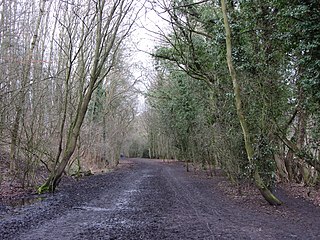
Wass is a village in the civil parish of Byland with Wass, in North Yorkshire, England, in the North York Moors National Park. A short distance from the village lie the ruins of Byland Abbey. Despite the small size of the village there is a pub, the Stapylton Arms. It is at the foot of Wass Bank and has views of the surrounding countryside. From 1974 to 2023 it was in the Ryedale district.

Melmerby is a village and civil parish in North Yorkshire, England. It lies in Coverdale in the Yorkshire Dales about 3 miles (4.8 km) south-west of Leyburn. Its neighbours are the villages of Carlton and Agglethorpe. The population of the civil parish was estimated at 40 in 2015.

Hunton is a village and civil parish about 3 miles (4.8 km) south of Catterick Garrison and 6 miles (10 km) north west of Bedale, in North Yorkshire, England. It is part of the Richmondshire district of North Yorkshire, and at the 2001 census had a population of 420, decreasing to 414 at the 2011 census. The name of the village derives from Old English and means the town of the huntsmen, or where the hunts hounds were kept.

Timble is a village in the Harrogate district of North Yorkshire, England. It is situated on the slopes of the Washburn valley, north of Otley and close to Swinsty and Fewston reservoirs.

Warlaby is a small village and civil parish in the Hambleton District of North Yorkshire, England. The population of the civil parish taken at the 2011 Census was less than 100. Details are included in the civil parish of Ainderby Steeple. In 2015, North Yorkshire County Council estimated the population to be around 50 people. It is near the A684 and Morton-on-Swale. It is 1.6 miles (2.5 km) west of Northallerton.
Howe is a small village and civil parish in the Hambleton District of North Yorkshire, England. It is situated near Ainderby Quernhow and the A61 and 5 miles (8 km) west of Thirsk. The population of the civil parish was estimated at 20 in 2015.

Kirkby is a village and civil parish in Hambleton district of North Yorkshire, England, near Great Busby and 2 miles (3.2 km) south of Stokesley. The village is mentioned in the Domesday Book as belonging to Uhtred. The name of the village derives from the Old Norse kirkju-býr, which means church with a village. At the 2001 Census, the population of the village was recorded at 313, dropping slightly to 309 at the 2011 Census. In 2015, North Yorkshire County Council estimated the population to be 310.
Sexhow is a hamlet and civil parish in Hambleton district of North Yorkshire, England. The name of the hamlet derives from Old Norse of either sexhou or sekkshaughr, which means the hill of Sekk, a personal name. The population taken at the 2011 Census was less than 100, so details of the population are included on the civil parish of Potto. However, in 2015, North Yorkshire County Council estimated the population to be 20. It is on the River Leven and 5 miles (8 km) west of Stokesley.

Rookwith is a hamlet and civil parish in the Hambleton district of North Yorkshire, England, about 4 miles (6.4 km) west of Bedale and near the flow of the River Ure. The hamlet was mentioned in the Domesday Book as belonging to Count Alan and having four ploughlands.
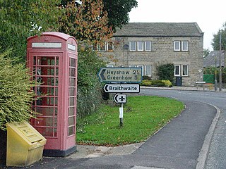
Dacre is a village and civil parish in the Harrogate district of North Yorkshire, England, it is 5 miles south of Pateley Bridge. In the 2001 census the parish had a population of 658, increasing to 764 at the 2011 Census. The village is situated on the crest of a hill overlooking the River Nidd. Infrastructure of the village includes a small chapel and an old single-room schoolhouse which is currently used for community events.
Swinton is a village and civil parish in North Yorkshire, England. It is about 2 miles (3.2 km) west of Malton on the B1257 road, and is on the edge of the Howardian Hills AONB to the immediate north. The village appears in the Domesday Book as 'Swintune' which is derived from 'pig farm'.
St Martin's is a civil parish in North Yorkshire, England. It is located south of the town of Richmond, covering the residential areas south of the River Swale, including the former Richmond railway station and Holly Hill.

