The national parks of New Zealand are protected natural areas administered by the Department of Conservation (DOC). The first national parks established in the country were all focused on mountain scenery. Since the 1980s the focus has been on developing a more diverse representation of New Zealand landscapes. The parks are all culturally significant and many also contain historic features. Tongariro National Park is one of the World Heritage Sites that are of both cultural and natural significance, while four of the South Island national parks form Te Wahipounamu, another World Heritage Site. There are currently 13 national parks; a 14th, Te Urewera National Park, was disestablished in 2014.

Aoraki/Mount Cook National Park is in the South Island of New Zealand. Aoraki / Mount Cook, New Zealand's highest mountain, and the eponymous village lie within the park. The area was gazetted as a national park in October 1953 and consists of reserves that were established as early as 1887 to protect the area's significant vegetation and landscape.

Fiordland National Park occupies the southwest corner of the South Island of New Zealand. It is by far the largest of the 13 national parks in New Zealand, with an area of 12,607 square kilometres (4,868 sq mi), and a major part of the Te Wahipounamu World Heritage Site. The park is administered by the Department of Conservation.

The Mackenzie Basin, popularly and traditionally known as the Mackenzie Country, is an elliptical intermontane basin located in the Mackenzie and Waitaki Districts, near the centre of the South Island of New Zealand. It is the largest such basin in New Zealand. Historically famous mainly for sheep farming, the sparsely populated area is now also a popular tourism destination.
This is a timeline of environmental history of New Zealand. It includes notable events affecting the natural environment of New Zealand as a result of human activity.

Waimakariri District is a local government district, located in the Canterbury Region of New Zealand's South Island. It is named after the Waimakariri River, which forms the district's southern boundary, separating it from Christchurch City and the Selwyn District. It is bounded in the north by the Hurunui District and in the east by the Pacific Ocean.

Lake Sumner, known as Hoka Kura in Māori, is a highland lake situated 100 km (62 mi) northwest of Christchurch in the North Canterbury Region of New Zealand's South Island. Covering an area of 1,373 ha and a maximum depth of 135 m (443 ft), the lake is located in the Lake Sumner Forest Park and on the main stem of the Hurunui River. Several other lakes such as Loch Katrine, Lake Sheppard, Lake Taylor and Lake Mason also lie within the park.

Protected areas of New Zealand are areas that are in some way protected to preserve their environmental, scientific, scenic, historical, cultural or recreational value. There are about 10,000 protected areas, covering about a third of the country. The method and aims of protection vary according to the importance of the resource and whether it is publicly or privately owned.

Conservation in New Zealand has a history associated with both Māori and Europeans. Both groups of people caused a loss of species and both altered their behaviour to a degree after realising their effect on indigenous flora and fauna.

The Hurunui River is the fourth largest of the four principal rivers in north Canterbury, New Zealand, with a catchment area of 2,670 square kilometres (1,030 sq mi). The river flows from the eastern side of the Southern Alps, to the Pacific Ocean.

Wilding conifers, also known as wilding pines, are invasive trees in the high country of New Zealand. Millions of dollars are spent on controlling their spread.

Lake Sumner Forest Park is a 1,051 km2 (406 sq mi) forest park located in the Canterbury region of the South Island of New Zealand. It is centered around Lewis Pass and has a number of access points along State Highway 7. It sits in between Lewis Pass Scenic Reserve and Arthurs Pass National Park.
Hunting is a popular recreational pursuit and a tourist activity in New Zealand with numerous books and magazines published on the topic. Unlike most other developed countries with a hunting tradition, there are no bag-limits or seasons for hunting large game in New Zealand. Hunting in national parks is a permitted activity. The wide variety of game animals and the limited restrictions means hunting is a popular pastime which has resulted in a high level of firearms ownership among civilians.

Cats are a popular pet in New Zealand. Cat ownership is occasionally raised as a controversial conservation issue due to the predation of endangered species, such as birds and lizards, by feral cats.

The Canada goose was introduced to New Zealand as a game bird in 1905. They became problematic because of damage they cause to pastures and crops.

The Murchison Mountains are a group of mountains in Fiordland National Park in New Zealand. It is the location where the South Island takahē, a type of bird presumed extinct, was rediscovered in 1948. The highest mountain is Mount Lyall at 1,892 metres (6,207 ft).

Hanmer Conservation Park is a protected area in the Hurunui District and Canterbury Region of New Zealand's South Island.
Coopers Lagoon / Muriwai is a small coastal waituna-type lagoon in the Canterbury region of New Zealand, located approximately half way between the mouth of the Rakaia River and the outlet of the much larger Lake Ellesmere / Te Waihora. While the present-day lagoon is separated from the nearby Canterbury Bight by approximately 100 metres (330 ft), the water of the lagoon is considered brackish and early survey maps show that, until recently, the lagoon was connected to the ocean by a small channel. The lagoon, along with the surrounding wetlands, has historically been an important mahinga kai for local Māori.
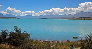
Lake Tekapo Regional Park is a regional park in the Canterbury Region of New Zealand's South Island. It covers 165 hectares at the eastern side of the southern end of Lake Tekapo, east of the Lake Tekapo township. It is the newest of the four Canterbury regional parks managed by Environment Canterbury.
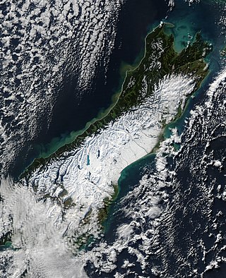
The South Island, with an area of 150,437 km2 (58,084 sq mi), is the largest landmass of New Zealand; it contains about one-quarter of the New Zealand population and is the world's 12th-largest island. It is divided along its length by the Southern Alps, the highest peak of which is Aoraki / Mount Cook at 3,724 metres (12,218 ft), making it 9th-highest island, with the high Kaikōura Ranges to the northeast. There are eighteen peaks of more than 3,000 metres (9,800 ft) in the South Island. The east side of the island is home to the Canterbury Plains while the West Coast is famous for its rough coastlines such as Fiordland, a very high proportion of native bush, and Fox and Franz Josef Glaciers. The dramatic landscape of the South Island has made it a popular location for the production of several films, including The Lord of the Rings trilogy and The Chronicles of Narnia: The Lion, the Witch and the Wardrobe. It lies at similar latitudes to Tasmania, and parts of Patagonia in South America.