William Johnson (surveyor)

Last updated

William H. Johnson (died 3 March 1883 [1] ) was a British surveyor in the Great Trigonometric Survey of India. He is noted for the first definition of the eastern boundary of Ladakh along Aksai Chin in the princely state of Jammu and Kashmir, which has come to be called the 'Johnson Line'. After retiring from the Survey of India, Johnson was appointed as the Governor of Ladakh, in which position he served until his death.

Contents

Early life

Johnson was born in India to an Ordinance officer of the East India Company, who lived in "Deyrah". He was educated at Mussorie and joined the Civil Branch of the Great Trigonometric Survey (the precursor of the Survey of India), where he was trained by Andrew Scott Waugh. [1] [2]

Career

Johnson began his career as a surveyor in 1848 under Captain du Vernet in the North-West Himalayan Survey. After du Vernet moved to Assam in 1852, he worked for some time doing route surveys in Punjab, then the survey of the Chenab River, and the survey of Bhagirathi and Kanawar. In 1854, he ascended the snowy peak near the Néla pass, which was regarded as a considerable accomplishment. [1]

In 1855, he joined the newly formed Kashmir Survey party to survey the princely state of Jammu and Kashmir (created in 1846 under British suzerainty). He was second-in-command to Thomas George Montgomerie but in fact took a leading role on account of Montgomerie being busy in Srinagar. He led the survey of the Pir Panjal range, Kishenganga valley, Chandrabhaga valley, and later the Indus and Shyok river valleys. He ascended some of the tallest peaks in the line of this work. He also connected the Kashmir triangulation with that of the North-West Himalaya. [1] [3]

Starting in 1862, Johnson worked from Leh in Ladakh, surveying all the way to the Chinese frontier. He surveyed the Chang Chenmo valley and the plateau to the north of it. In 1865, he undertook his famous journey to Khotan, which garnered him notability as well as controversy. [1]

Expedition to Khotan and the Johnson Line

The "Johnson Line" marking the boundary of Kashmir. Johnson's 1865 journey to Khotan marked in red. Johnson-journey-ilchi1865-mapa.jpg
The "Johnson Line" marking the boundary of Kashmir. Johnson's 1865 journey to Khotan marked in red.
Boundary of Kashmir in the 1888 Survey of India map of India. The undefined boundary shown in dash line from Malubiting, Raskam, Aktagh to Karakunlun Shan
.mw-parser-output .geo-default,.mw-parser-output .geo-dms,.mw-parser-output .geo-dec{display:inline}.mw-parser-output .geo-nondefault,.mw-parser-output .geo-multi-punct{display:none}.mw-parser-output .longitude,.mw-parser-output .latitude{white-space:nowrap}
35deg16'59''N 80deg15'43''E / 35.28312degN 80.261863degE / 35.28312; 80.261863 Jammu and Kashmir in 1888 Survey of India map.jpg
Boundary of Kashmir in the 1888 Survey of India map of India. The undefined boundary shown in dash line from Malubiting, Raskam, Aktagh to Karakunlun Shan 35°16′59″N80°15′43″E / 35.28312°N 80.261863°E / 35.28312; 80.261863

After the Chinese rule collapsed in Turkestan in 1863, the governor of Ladakh, Mehta Mangal, sent a small force to Shahidullah, a strategic point between the Karakoram range and Kunlun mountains, and constructed a chauki (police post). These developments were likely known to Johnson. [4]

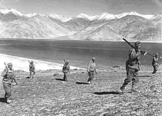
In May 1865, Johnson was commissioned to survey the Kashmir series "beyond and to the north of the Chang Chenmo valley". He set out on his expedition two months later, with a party consisting of fifty coolies (porters), an attendant, five mules, six horses and a state trooper. Governor Mehta Mangal is said to have made all the arrangements for his expedition. Johnson quickly went over to the heretofore unexplored territory of Aksai Chin. According to scholar John Lall, Johnson maintained an average speed of 19.2 miles a day through "barren country at heights between 15,000 to 19,500 feet". He spent twenty days at the source of the Karakash River doing surveys and recording his findings. [5]

From this location, Johnson made a journey to Khotan (referred to as "Ilchi" in British records), spent 18 days there and returned via the Karakoram Pass. Why he went to Khotan remains controversial. Johnson's own statement was that he received an invitation from the Khan of Khotan via a messenger. However, John Lall states that there was not enough time for a messenger to come from Khotan and return within the time frame given by Johnson. He believes that Johnson must have sent a message to the Khan of Khotan and invited himself. He also states that Johnson was censured by the British government for crossing the frontier without permission and that he later changed his story to say that he was forcibly taken to Khotan. [5] [6]

The journey made Johnson's reputation as a traveller. He reported on it to the British Association for the Advancement of Science in 1866, and was elected a Fellow of the Royal Geographical Society in the same year. [7] [8] But the unauthorised journey met with official disapproval; and he resigned from the Survey of India the following year. [9] Nevertheless Johnson's results were highly prized among the British surveyors, and Johnson was reemployed in 1869 on an even higher salary. [10]

Part of Johnson's legacy was the "Johnson Line", or "Ardagh–Johnson Line", the boundary of Ladakh in the north and the northeast, including the entire Aksai Chin plateau and going up to the Kunlun Mountains. It was later endorsed by the Chief of British Military Intelligence Sir John Ardagh as the suitable northern boundary of the British Indian Empire. It assumed later importance in the Sino-Indian border dispute, after China had occupied Tibet. [11]

Jammu and Kashmir

Johnson took up a position for the Maharajah of Kashmir and Jammu in 1871, as the governor (Wazir-e-wazarat) of Ladakh. [12] [13] R. H. Phillimore states that the position earned him three times the salary he had formerly received as a surveyor. [14]

During his tenure as the Wazir, Johnson facilitated the third covert journey of the native explorer Nain Singh Rawat into Tibet. [15]

Death

Johnson died in Jammu, believing he had been poisoned. [1]

His daughter, Teresa Johnson, married Rowland Allanson-Winn, 5th Baron Headley, Irish peer. [16]

Works

Reception

H. H. Godwin-Austen, a distinguished surveyor, has said, "there were few men living who had greater experience of mountain work, and none who had ascended to greater heights, and the work he did was of considerable value and magnitude". He cites Johnson's expedition to Khotan as an example of valuable knowledge that would have been gained had the (British) Government of India encouraged such work. He states that the views of the officers of the Survey of India were disregarded by the government. [1] The official report of the Great Trigonometrical Survey (1865–65) called his explorations "most valuable and important". Johnson was commended for his "great energy and perseverance". The Royal Geographical Society honoured him in 1875 and presented a gold watch for his survey journey of 1865. Frederick Drew, another surveyor and geologist in Jammu and Kashmir called him a "bold and enduring traveller". [17]

Related Research Articles

<span class="mw-page-title-main">Kashmir</span> Former princely state, now a territory disputed between India, Pakistan and China

Kashmir is the northernmost geographical region of the Indian subcontinent. Until the mid-19th century, the term "Kashmir" denoted only the Kashmir Valley between the Great Himalayas and the Pir Panjal Range. Today, the term encompasses a larger area that includes the Indian-administered territories of Jammu and Kashmir and Ladakh, the Pakistani-administered territories of Azad Kashmir and Gilgit-Baltistan, and the Chinese-administered territories of Aksai Chin and the Trans-Karakoram Tract.

<span class="mw-page-title-main">Sino-Indian War</span> 1962 war between China and India

The Sino-Indian War between China and India occurred in October–November 1962. A disputed Himalayan border was the main cause of the war. There had been a series of violent border skirmishes between the two countries after the 1959 Tibetan uprising, when India granted asylum to the Dalai Lama. India initiated a defensive Forward Policy from 1960 to hinder Chinese military patrols and logistics, in which it placed outposts along the border, including several north of the McMahon Line, the eastern portion of the Line of Actual Control proclaimed by Chinese Premier Zhou Enlai in 1959.

<span class="mw-page-title-main">Aksai Chin</span> Disputed region in Xinjiang, Tibet, and Kashmir

Aksai Chin is a region administered by China as part of Hotan County, Hotan Prefecture, Xinjiang and Rutog County, Ngari Prefecture, Tibet. It is claimed by India to be a part of its Leh District, Ladakh Union Territory. It is a part of the eastern portion of the Kashmir region and has been a subject of dispute between India and China since the late 1950s.

Hunza (princely state) Princely state of British India and Pakistan

Hunza, also known as Kanjut, was a principality and then later a princely state in a subsidiary alliance with British India from 1892 to August 1947, for three months was unaligned, and then from November 1947 until 1974 was a princely state of Pakistan. Hunza covered territory now forming the northernmost part of Gilgit-Baltistan, Pakistan.

<span class="mw-page-title-main">Ladakh</span> Region administered by India

Ladakh is a region administered by India as a union territory, which constitutes a part of the larger Kashmir region and has been the subject of dispute between India, Pakistan, and China since 1947. Ladakh is bordered by the Tibet Autonomous Region to the east, the Indian state of Himachal Pradesh to the south, both the Indian-administered union territory of Jammu and Kashmir and the Pakistan-administered Gilgit-Baltistan to the west, and the southwest corner of Xinjiang across the Karakoram Pass in the far north. It extends from the Siachen Glacier in the Karakoram range to the north to the main Great Himalayas to the south. The eastern end, consisting of the uninhabited Aksai Chin plains, is claimed by the Indian Government as part of Ladakh, and has been under Chinese control since 1962.

<span class="mw-page-title-main">Trans-Karakoram Tract</span> Chinese-administered area in the northern half of Kashmir near the Shaksgam River

The Trans-Karakoram Tract, also known as the Shaksgam Tract, is an area of approximately 5,300 km2 (2,050 sq mi) north of the Karakoram watershed, including the Shaksgam valley. The tract is administered by China as part of its Taxkorgan and Yecheng counties in the Xinjiang Uyghur Autonomous Region. Although the Shaksgam tract had been under the control of Pakistan since 1947, in the 1963 Sino-Pakistan Agreement, Pakistan recognized Chinese sovereignty over the Shaksgam tract, while China recognized Pakistani sovereignty over the Gilgit Agency, and a border based on actual ground positions was recognized as the international border by China and Pakistan. It is claimed by India as part of the Union territory of Ladakh.

Hindutash Pass

Hindu-tagh Pass, also known as Hindutash, is a historical mountain pass in the western Xinjiang, China. The pass cuts through the Kunlun Mountains connecting the now-deserted town of Kangxiwar in the Karakash River valley to the town of Pusha in the Pusha Jilga valley. It also connects to the road to the city of Hotan.

<span class="mw-page-title-main">Sino-Indian border dispute</span> Border dispute between China and India

The Sino-Indian border dispute is an ongoing territorial dispute over the sovereignty of two relatively large, and several smaller, separated pieces of territory between China and India. The first of the territories, Aksai Chin, is administered by China as part of the Xinjiang Uygur Autonomous Region and Tibet Autonomous Region and claimed by India as part of the union territory of Ladakh; it is the most uninhabited high-altitude wasteland in the larger regions of Kashmir and Tibet and is crossed by the Xinjiang-Tibet Highway, but with some significant pasture lands at the margins. The other disputed territory is south of the McMahon Line, formerly known as the North-East Frontier Agency and now called Arunachal Pradesh. The McMahon Line was part of the 1914 Simla Convention signed between British India and Tibet, without China's agreement. China disowns the agreement, stating that Tibet was never independent when it signed the Simla Convention.

Daulat Beg Oldi Military Base in Ladakh, India

Daulat Beg Oldi is a traditional campsite and current military base located in the midst of the Karakoram Range in northern Ladakh, India. It is on the historic trade route between Ladakh and Central Asia, forming the last campsite before reaching the Karakoram Pass. It is said to be named after Sultan Said Khan, who died here on his return journey after an invasion of Ladakh and Kashmir. Chip Chap River, the main headwater of the Shyok River, flows just to the south. The Line of Actual Control with Chinese-controlled Aksai Chin is 5 miles to the east.

Xaidulla, also spelled Shahidullah and Shahidula, also Saitula from Mandarin Chinese,, is a historical caravan halting place in the Karakash River valley, close to Khotan, in the southwestern part of Xinjiang Autonomous Region, China. The site contains the ruins of a historical fort which was demolished by the Chinese administration of Xinjiang between 1890 and 1892. The site lies next to the Chinese National Highway G219 between Kashgar and Tibet, 25 km east of Mazar and 115 km west of Dahongliutan.

The Depsang Plains represent a high-altitude gravelly plain at the northwest portion of the disputed Aksai Chin region of Kashmir, divided into Indian and Chinese administered portions across a Line of Actual Control. India controls the western portion of the plains as part of Ladakh, whereas the eastern portion is controlled by China and claimed by India. The Line of Control with Pakistan-administered Gilgit-Baltistan is 80 kilometres (50 mi) west of the Depsang Plains with the Siachen Glacier in-between. Ladakh's traditional trade route to Central Asia passed through the Depsang Plains, with the Karakoram Pass lying directly to its north.

The Sanju, or Sanju-la, with an elevation of 5,364 metres (17,598 ft), is a historical mountain pass in the Kun Lun Mountains in Pishan County, Hotan Prefecture, Xinjiang, China. During ancient times, it was the last on a series of difficult passes on the most common summer caravan route between Ladakh and the Tarim Basin. In recent years, besides being used by the locals, it has also become a trekking route for Chinese trekkers.

<span class="mw-page-title-main">Khurnak Fort</span> Ruined fort in eastern Ladakh

The Khurnak Fort is a ruined fort on the northern shore of the Pangong Lake that spans eastern Ladakh in India and Rutog County in the Tibet region of China. The area of the Khurnak Fort is disputed by India and China, and has been under Chinese administration since 1958.

Lanak La or Lanak Pass is a mountain pass in the disputed Aksai Chin region, administered by China as part of the Tibet Autonomous Region. It is claimed by India as its border pass.

Macartney–MacDonald Line

The Macartney–MacDonald Line is a proposed boundary in the disputed area of Aksai Chin. It was proposed by British Indian Government to China in 1899 via its envoy to China, Sir Claude MacDonald. The Chinese Government never gave any response to the proposal. The Indian Government believed that, subsequently British India reverted to its traditional boundary, the Johnson–Ardagh Line. Independent scholars have not confirmed the claim.

Ardagh–Johnson Line Boundary line in Aksai Chin

The Ardagh–Johnson Line is the northeastern boundary of Kashmir drawn by surveryor William Johnson and recommended by John Charles Ardagh as the official boundary of India. It abuts China's Xinjiang and Tibet autonomous regions.

Jammu and Kashmir may refer to:

Chang Chenmo River or Changchenmo River is a tributary of the Shyok River, part of the Indus River system. It is at the southern edge of the disputed Aksai Chin region and north of the Pangong Lake basin.

The Demchok sector is a disputed area named after the villages of Demchok, Ladakh and Dêmqog, Tibet, situated near the confluence of the Charding Nullah and Indus River. It is a part of the greater Sino-Indian border dispute between China and India. Both China and India claim the disputed region, with a Line of Actual Control between the two nations situated along the Charding Nullah.

References

  1. 1 2 3 4 5 6 7 Godwin-Austen, H. H. (May 1883), "Obituary: Mr. W. H. Johnson", Proceedings of the Royal Geographical Society and Monthly Record of Geography, 5 (5): 291–293, JSTOR   1800115
  2. Rawlinson, H. C. (1866–1867), "On the Recent Journey of Mr. W. H. Johnson from Leh, in Ladakh, to Ilchi in Chinese Turkistan", Proceedings of the Royal Geographical Society of London, 11 (1): 6–15, doi:10.2307/1799154, JSTOR   1799154
  3. Ward, Michael (1999), "The Survey of India and the Pundits", The Himalayan Journal, 55
  4. Lall, Maps and Traditional Boundaries of Ladakh 1989, p. 3.
  5. 1 2 Lall, Maps and Traditional Boundaries of Ladakh 1989, pp. 3–4.
  6. Peter Hopkirk (2011). Foreign Devils on the Silk Road. John Murray. pp. 42–3. ISBN   978-1-84854-632-5.
  7. British Association for the Advancement of Science. Meeting; British Association for the Advancement of Science (1867). Report of the annual meeting. J. Murray. p. 111. Retrieved 25 October 2012.
  8. Proceedings of the Royal Geographical Society of London, Vol. 10, No. 5 (1865 - 1866), pp. 175-177. Published by: Wiley-Blackwell on behalf of The Royal Geographical Society (with the Institute of British Geographers). Article Stable URL: https://www.jstor.org/stable/1799593
  9. Waller, The Pundits 2004, p. 22.
  10. Mehra, John Lall (Book review) 1991, p. 149.
  11. Steven A. Hoffmann (1990). India and the China Crisis. University of California Press. pp. 11–12. ISBN   978-0-520-06537-6.
  12. Ravina Aggarwal (9 November 2004). Beyond Lines of Control: Performance and Politics on the Disputed Borders of Ladakh, India. Duke University Press. p. 34. ISBN   978-0-8223-3414-9 . Retrieved 25 October 2012.
  13. Proceedings of the Tenth Seminar of the IATS, 2003. Volume 11: Tibetan Modernities: Notes from the Field on Cultural and Social Change, BRILL, 2008, p. 171, note 25, ISBN   978-90-04-15522-0 : "For example, with a view to improving the availability of fuel and fodder, the planting of trees was initiated an encouraged by Wazir Mehta Mangal Singh, and further promoted by W. H. Johnson, who served as Wazir of Ladakh for ten years ending in 1881."
  14. Phillimore, Colonel R. H. (1960), "Survey of Kashmir and Jammu, 1855 to 1865", The Himalayan Journal, 22
  15. Waller, The Pundits 2004, p. 119.
  16. The Age (Melbourne), 14 Feb. 1921:5 "About People", accessed through Trove, 28 Apr. 2017, http://nla.gov.au/nla.news-article201698943
  17. Mehra, John Lall (Book review) 1991.

Bibliography