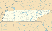
Chattanooga Metropolitan Airport is 5 miles (8 km) east of downtown Chattanooga, in Hamilton County, Tennessee, United States. The airport is owned and operated by the Chattanooga Metropolitan Airport Authority. It is a Class C airport serviced by the Chattanooga Airport Traffic Control Tower. The Federal Aviation Administration (FAA) National Plan of Integrated Airport Systems for 2019–2023 categorized it as a small-hub primary commercial service facility.

Tri-Cities Airport, is in Blountville, Tennessee, United States. It serves the Tri-Cities area of Northeast Tennessee and Southwest Virginia. The airport is governed by the Tri-Cities Airport Authority (TCAA) whose members are appointed by the cities of Johnson City, Kingsport, Bristol (TN), Bristol (VA) and both Washington County (TN) and Sullivan County (TN).
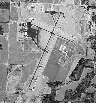
McKellar–Sipes Regional Airport is a public use airport located four nautical miles (7 km) west of the central business district of Jackson, a city in Madison County, Tennessee, United States. It is owned by the city and county. The airport is mostly used for general aviation, and is served by one commercial airline, Southern Airways Express, subsidized by the Essential Air Service program.

Marana Regional Airport, also known as Marana Northwest Regional Airport or Avra Valley Airport, is a non-towered, general aviation airport about 15 miles northwest of Tucson, Arizona in Marana a town in Pima County, Arizona, United States. In 1999, the airport was purchased from Pima County by the town of Marana.

Olympia Regional Airport is a public use airport located four nautical miles (7 km) south of the central business district of Olympia, a city in Thurston County and the capital of the U.S. state of Washington. It is owned by the Port of Olympia. It is about one mile (1.6 km) east of Interstate 5, actually within the boundaries of the city of Tumwater which is south of and adjacent to Olympia. The airport was identified in the Washington State Department of Transportation Long Term Aviation Study as a field that could potentially serve to relieve Seattle-Tacoma International Airport of increasing congestion.

McKinney National Airport, formerly Collin County Regional Airport at McKinney, is a general aviation airport located in McKinney, Texas, United States, about 30 miles north of downtown Dallas.

North Texas Regional Airport / Perrin Field is a county-owned airport in Grayson County, Texas between Sherman and Denison. Formerly Grayson County Airport, the airport was renamed in November 2007. Several buildings are occupied by businesses, Grayson County government agencies, and Grayson County College.
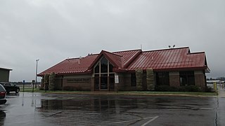
Gaylord Regional Airport is a county-owned, public-use airport located one nautical mile (2 km) southwest of the central business district of Gaylord, a city in Otsego County, Michigan, United States. It is included in the Federal Aviation Administration (FAA) National Plan of Integrated Airport Systems for 2017–2021, in which it is categorized as a local general aviation facility.
Tullahoma Regional Airport, also known as William Northern Field and Soesbe-Martin Field, is a public use airport in Coffee County, Tennessee, United States. It is owned by the City of Tullahoma and located two nautical miles (4 km) northwest of its central business district. This airport is included in the National Plan of Integrated Airport Systems for 2011–2015, which categorized it as a general aviation facility.
South Jersey Regional Airport is a public use airport in Lumberton Township, Burlington County, New Jersey, United States. Owned by the New Jersey Department of Transportation, the airport is located four nautical miles southwest of the central business district of Mount Holly, New Jersey. This facility is included in the National Plan of Integrated Airport Systems for 2011–2015, which categorized it as a general aviation reliever airport.

Morristown Regional Airport is a city-owned public-use airport located four nautical miles southwest of the central business district of Morristown, a city in Hamblen County, Tennessee, United States. It was opened in 1953. The manager of the airport was Evelyn Bryan Johnson until her death on May 10, 2012.
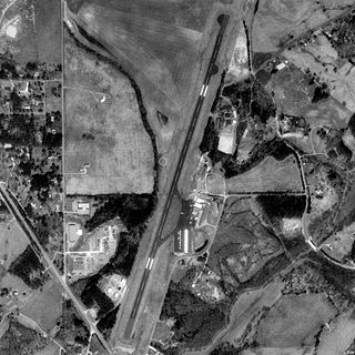
McMinn County Airport is a county-owned, public-use airport located three nautical miles (6 km) southeast of the central business district of Athens, a city in McMinn County, Tennessee, United States.
Dyersburg Regional Airport is two miles south of Dyersburg, in Dyer County, Tennessee, United States. It was formerly Dyersburg Municipal Airport.

Everett–Stewart Regional Airport is in Obion County, Tennessee, five miles southeast of Union City, Tennessee, United States. The National Plan of Integrated Airport Systems for 2011–2015 categorized it as a general aviation facility.

Abernathy Field is a public use airport located three nautical miles southwest of the central business district of Pulaski, a city in Giles County, Tennessee, United States. It is owned by the City of Pulaski and Giles County. According to the FAA's National Plan of Integrated Airport Systems for 2009–2013, it is categorized as a general aviation facility.
Beech River Regional Airport is a public-use airport in Henderson County, Tennessee, United States. It is located five nautical miles northwest of the central business district of Parsons, a city in Decatur County.
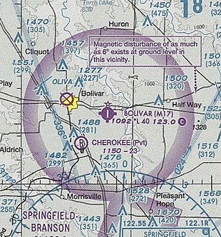
Bolivar Municipal Airport is a city-owned public-use airport located four nautical miles east of the central business district of Bolivar, a city in Polk County, Missouri, United States. It is included in the FAA's National Plan of Integrated Airport Systems for 2011–2015, which categorized it as a general aviation facility.
Springfield Robertson County Airport is a public use airport located three nautical miles (6 km) northwest of the central business district of Springfield, a city in Robertson County, Tennessee, United States. It is owned by the Springfield/Robertson Airport Board. This airport is included in the National Plan of Integrated Airport Systems for 2011–2015, which categorized it as a general aviation facility.
Crawfordsville Regional Airport is a public use airport located 4 miles (6.4 km) south of the central business district of Crawfordsville, a city in Montgomery County, Indiana, United States. The airport was founded in June 1945 and is owned by the city. It is included in the Federal Aviation Administration (FAA) National Plan of Integrated Airport Systems for 2021–2025, in which it is categorized as a local general aviation facility.

James Tucker Airport is a county-owned, public-use airport located three nautical miles (6 km) southwest of the central business district of Linden, a town in Perry County, Tennessee, United States. The airport is located on the Atlanta and Memphis sectional charts. Opened in October, 1962, the airport was originally known as Perry County Airport prior to being renamed in honor of a local citizen in 2016. Efforts to bring an airport to Perry County date back to 1946. A group of students from a local high school petitioned the county to construct a public airport after having been introduced to aviation through the donation of a Link Trainer to the school.

