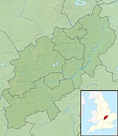
Northamptonshire, archaically known as the County of Northampton, is a county in the East Midlands of England. In 2015, it had a population of 723,000. The county is administered by two unitary authorities: North Northamptonshire and West Northamptonshire. It is known as "The Rose of the Shires".

Corby is a town in North Northamptonshire, England, located 23 miles (37 km) north-east of Northampton. From 1974 to 2021, the town served as the administrative headquarters of the Borough of Corby. At the 2011 Census, the town had a population of 54,927, while the borough had a population of 61,255.
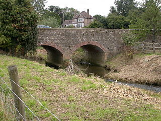
Barnwell is a village in North Northamptonshire in England, 2 miles (3.2 km) south of the town of Oundle, 78 miles (126 km) north of London and 14 miles (22.5 km) south-west of Peterborough. The River Nene runs north of the village, separating it from Oundle.
Rockingham Forest is a former royal hunting forest in the county of Northamptonshire, England. It is an area of some 200 sq mi (500 km2) lying between the River Welland and River Nene and the towns of Stamford and Kettering. It has a rich and varied landscape, with farmland, open pasture, pockets of woodland and villages built from local stone.

Corby is a constituency in Northamptonshire represented in the House of Commons of the UK Parliament since May 2015 by Tom Pursglove of the Conservative Party.

The A43 is a primary route in the English Midlands, that runs from the M40 motorway near Ardley in Oxfordshire to Stamford in Lincolnshire. Through Northamptonshire it bypasses the towns of Northampton, Kettering and Corby which are the three principal destinations on the A43 route. The A43 also links to the M1 motorway.

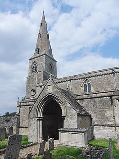
Apethorpe is a village, civil parish, former manor and ecclesiastical parish in Northamptonshire, England, situated 11 miles west of the City of Peterborough. The 2001 census records a population of 130, increasing to 160 at the 2011 census. The manor of Apethorpe is recorded in the Domesday Book of 1086 as Patorp. The village is compact, uniform and centred on Main Street. In the late 15th century the manor of Apethorpe was acquired by Sir Guy Wolston, an officer in the household of King Edward IV, who began the construction of the surviving Apethorpe Palace.

Blatherwycke is a village and civil parish in the North Northamptonshire, England. It is about 6 miles (10 km) north-east of Corby. It is near Blatherwycke Lake, on the Willow Brook.
Bulwick is a village and civil parish in North Northamptonshire, England. According to the 2001 census it had a population of 152 people, including Blatherwycke and increasing to 171 at the 2011 census. It is about six miles north-east of Corby, and is just off the A43 road. The Willow Brook runs through the village.

Islip is a village and civil parish in North Northamptonshire, England. The village is just west of Thrapston and 7 miles (11 km) east of Kettering. The parish is bounded to the east by the River Nene and to the north by Harpurs Brook, a tributary of the Nene. The 2011 Census recorded the parish's population as 829 people.

Pipewell is situated in North Northamptonshire, a mile away from Corby. With 63 inhabitants, it is one of the smallest hamlets in Northamptonshire. The population remained less than 100 at the 2011 Census and the population was included in the civil parish of Wilbarston. A Community Governance Review concluded in February 2015 resulted in the ward of Pipewell becoming part of the civil parish of Rushton.
Harper's Brook is a tributary of the River Nene which runs through Northamptonshire.

King's Cliffe is a village and civil parish on Willow Brook, a tributary of the River Nene, about 9 miles (14 km) northeast of Corby in North Northamptonshire. The parish adjoins the county boundary with the City of Peterborough and the village is about 12 miles (19 km) west of the city centre. The village is not far from the boundary with Lincolnshire and about 6 miles (10 km) south of Stamford.

Great Oakley is an outer suburb of Corby situated approximately two miles south west of the town centre and five miles from Kettering, England. It was represented on Corby Borough Council by one councillor. The population of the Great Oakley Ward of Corby Borough Council at the 2011 Census was 2,248.

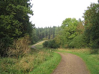
Fineshade Wood is a large wooded area in the county of Northamptonshire in the English East Midlands region. The wood is managed by the Forestry England and is part of the former royal hunting forest of Rockingham Forest.

Irthlingborough Lakes and Meadows is a 117-hectare (290-acre) nature reserve in Northamptonshire, owned and managed by the Wildlife Trust for Bedfordshire, Cambridgeshire and Northamptonshire. The character of the reserve is defined by flooded gravel pits and wet grassland, providing an excellent habitat for large variety of wetland flora and fauna.
Willow Brook may refer to:

Ditchford Lakes and Meadows is a 31.1 hectare nature reserve Northamptonshire. It is managed by the Wildlife Trust for Bedfordshire, Cambridgeshire and Northamptonshire. It is part of the Upper Nene Valley Gravel Pits Site of Special Scientific Interest, Ramsar wetland site of international importance, and Special Protection Area under the European Communities Birds Directive.

Bulwick Meadows is a 4.2 hectare biological Site of Special Scientific Interest in Bulwick, north-east of Corby in Northamptonshire.