Wilmington Island, Georgia

Last updated

Wilmington Island, Georgia
Wilmington Island, GA, US.jpg
Wilmington Island as seen from Skidaway Island - Eureka Club-Farr's Point is on the right, which is on the National Register of Historic Places.
Chatham County Georgia Incorporated and Unincorporated areas Wilmington Island Highlighted.svg
Location in Chatham County and the state of Georgia
Coordinates: 32°0′12″N80°58′31″W / 32.00333°N 80.97528°W / 32.00333; -80.97528
Country United States
State Georgia
County Chatham
Area
[1]
  Total9.65 sq mi (24.99 km2)
  Land8.30 sq mi (21.50 km2)
  Water1.34 sq mi (3.48 km2)
Elevation
[2]
10 ft (3 m)
Population
 (2020)
  Total15,129
  Density1,822.33/sq mi (703.63/km2)
Time zone UTC-5 (Eastern (EST))
  Summer (DST) UTC-4 (EDT)
ZIP code
31410
Area code 912
FIPS code 13-83168 [3]
GNIS feature ID1867248 [2]

Wilmington Island is an unincorporated community and census-designated place (CDP) in Chatham County, Georgia. The population was 15,129 at the time of the 2020 U.S. census. [1] It is part of the Savannah metropolitan area. The communities of Wilmington Island form a large and affluent suburb of Savannah, where most residents work. The island lies east of Savannah between the town of Thunderbolt and the beach community of Tybee Island.

Contents

Geography

Wilmington Island is located at 32°00′12″N80°58′31″W / 32.003463°N 80.975224°W / 32.003463; -80.975224 . [4]

According to the United States Census Bureau, the CDP has a total area of 9.5 square miles (24.7 km2), of which 8.2 square miles (21.2 km2) is land and 1.3 square miles (3.4 km2), or 13.94%, is water. [5]

Demographics

Historical population
CensusPop.Note
1970 3,284
1980 7,546129.8%
1990 11,23048.8%
2000 14,21326.6%
2010 15,1386.5%
2020 15,129−0.1%
U.S. Decennial Census [6]
1850-1870 [7] 1870-1880 [8]
1890-1910 [9] 1920-1930 [10]
1940 [11] 1950 [12] 1960 [13]
1970 [14] 1980 [15] 1990 [16]
2000 [17] 2010 [18] 2020 [19]

Wilmington Island first appeared as a census designated place in the 1970 U.S. Census. [15]

Wilmington Island, Georgia – Racial and ethnic composition
(NH = Non-Hispanic)
Note: the US Census treats Hispanic/Latino as an ethnic category. This table excludes Latinos from the racial categories and assigns them to a separate category. Hispanics/Latinos may be of any race.
Race / EthnicityPop 2000 [20] Pop 2010 [18] Pop 2020 [19] % 2000% 2010% 2020
White alone (NH)12,96913,47713,05291.25%89.03%86.27%
Black or African American alone (NH)5595534063.93%3.65%2.68%
Native American or Alaska Native alone (NH)1532230.11%0.21%0.15%
Asian alone (NH)3553934442.50%2.60%2.93%
Pacific Islander alone (NH)4280.03%0.01%0.05%
Some Other Race alone (NH)2120550.15%0.13%0.36%
Mixed race or Multiracial (NH)1021975990.72%1.30%3.96%
Hispanic or Latino (any race)1884645421.32%3.07%3.58%
Total14,21315,13815,129100.00%100.00%100.00%

As of the 2020 United States census, there were 15,129 people, 6,478 households, and 4,322 families residing in the CDP.

Education

May Howard Elementary School May Howard Elementary School.jpg
May Howard Elementary School

The only public school on Wilmington Island is May Howard Elementary School, [21] run by Savannah-Chatham County Public Schools. [22] Students often attend school on nearby Whitemarsh Island.

The island hosts two private schools, being St. Andrews School, which is an independent college preparatory school and the Catholic Saint Peter the Apostle School, formerly named Nativity of Our Lord School. [23]

See also

Related Research Articles

<span class="mw-page-title-main">Chatham County, Georgia</span> County in Georgia, United States

Chatham County is located in the U.S. state of Georgia, on the state's Atlantic coast. The county seat and largest city is Savannah. One of the original counties of Georgia, Chatham County was created February 5, 1777, and is named after William Pitt, 1st Earl of Chatham.

<span class="mw-page-title-main">Keysville, Georgia</span> Town in Georgia, United States

Keysville is a town in Burke and Jefferson counties in the U.S. state of Georgia. As of the 2020 census, the city's population was 300.

<span class="mw-page-title-main">Midville, Georgia</span> City in Georgia, United States

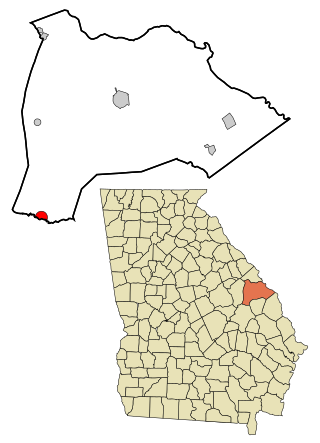
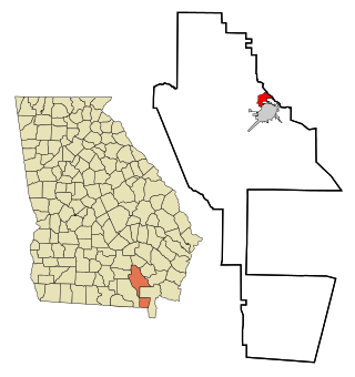
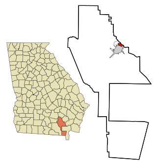
Midville is a city in Burke County, Georgia, United States. The population was 269 at the 2010 census, and 385 in 2020. It is part of the Augusta, Georgia metropolitan area.

<span class="mw-page-title-main">Kings Bay Base, Georgia</span> Place in Georgia, United States

Kings Bay Base is an unincorporated community and census-designated place (CDP) in Camden County, Georgia, United States; it is home to the Kings Bay Naval Submarine Base. The population was 1,777 at the 2010 census, and 2,329 in 2020.

<span class="mw-page-title-main">Georgetown, Chatham County, Georgia</span> Place in Georgia, United States

Georgetown is an unincorporated community and census-designated place (CDP) in Chatham County, Georgia, United States. The population was 11,916 at the 2020 U.S. census. Georgetown lies across the Little Ogeechee River from Savannah, Georgia, and is a suburban "bedroom community" of Savannah, where most of its adult residents work. It is part of the Savannah Metropolitan Statistical Area.

<span class="mw-page-title-main">Whitemarsh Island, Georgia</span> Place in Georgia, United States

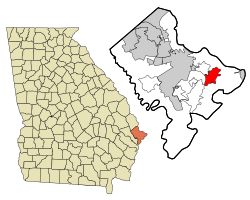
Whitemarsh Island is an unincorporated community and census-designated place (CDP) in Chatham County, Georgia, United States. The population was 6,983 at the 2020 U.S census. It is part of the Savannah metropolitan statistical area. The communities of Whitemarsh Island are a relatively affluent suburb of Savannah.

<span class="mw-page-title-main">Evans, Georgia</span> Place in Georgia, United States

Evans is an unincorporated community and census-designated place (CDP) in Columbia County, Georgia, United States. It is a suburb of Augusta and is part of the Augusta metropolitan area. The population was 29,011 at the 2010 census, up from 17,727 at the 2000 census.

<span class="mw-page-title-main">Martinez, Georgia</span> Place in Georgia, United States

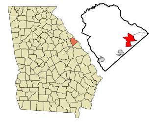
Martinez is an unincorporated community and census-designated place (CDP) in Columbia County, Georgia, United States. It is a northwestern suburb of Augusta and is part of the Augusta, Georgia metropolitan area. The population was 34,535 at the 2020 census.

<span class="mw-page-title-main">Belvedere Park, Georgia</span> Place in Georgia, United States

Belvedere Park is an unincorporated community and census-designated place (CDP) in DeKalb County, Georgia, United States. The population was 15,113 at the 2020 census.

<span class="mw-page-title-main">Hiltonia, Georgia</span> City in Georgia, United States

Hiltonia is a city in Screven County, Georgia, United States. The population was 310 in 2020.

<span class="mw-page-title-main">Deenwood, Georgia</span> Place in Georgia, United States

Deenwood is an unincorporated community and census-designated place (CDP) in Ware County, Georgia, United States. The population was 2,207 at the 2020 census. It is part of the Waycross micropolitan statistical area. Deenwood Baptist Church is named after this geographical area.

<span class="mw-page-title-main">Sunnyside, Georgia</span> Place in Georgia, United States

Sunnyside is an unincorporated community and census-designated place (CDP) in Ware County, Georgia, United States. The population was 1,472 in 2020. It is part of the Waycross micropolitan statistical area.

<span class="mw-page-title-main">Norwood, Georgia</span> City in Georgia, United States

Norwood is a city in Warren County, Georgia, United States. The population was 202 in 2020.

<span class="mw-page-title-main">Eulonia, Georgia</span> Place in Georgia, United States

Eulonia is an unincorporated community and census-designated place (CDP) in McIntosh County in the U.S. state of Georgia. Part of the Brunswick, Georgia Metropolitan Statistical Area, it is in the Low Country between Savannah and Brunswick near Interstate 95.

<span class="mw-page-title-main">Boykin, Georgia</span> Place in Georgia, United States

Boykin is an unincorporated community and census-designated place (CDP) in Miller County, Georgia, United States. The 2020 census listed a population of 151.

Perkins is a census-designated place and unincorporated community in Jenkins County, Georgia, United States. As of the 2010 census it had a population of 91.

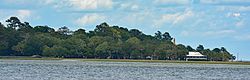
Dutch Island is an unincorporated community and census-designated place (CDP) in Chatham County, Georgia, United States. It is part of the Savannah Metropolitan Statistical Area, and at the 2020 census, its population was 1,238.

Henderson is an unincorporated community and census-designated place (CDP) in Chatham County, Georgia, United States. The population was 2,178 at the 2020 census. It is part of the Savannah metropolitan statistical area.

Talahi Island is a barrier island, unincorporated community, and census-designated place (CDP) in Chatham County, Georgia, United States. The population was 1,247 at the 2020 census. Located between Savannah and the beach resort town of Tybee Island, Talahi Island is part of the Savannah Metropolitan Statistical Area.

Canoochee is an unincorporated community and census-designated place (CDP) in Emanuel County, Georgia, United States. Its population was 70 as of the 2020 census.

References

  1. 1 2 "2020 U.S. Gazetteer Files". United States Census Bureau. Retrieved December 18, 2021.
  2. 1 2 U.S. Geological Survey Geographic Names Information System: Wilmington Island, Georgia
  3. "U.S. Census website". United States Census Bureau . Retrieved January 31, 2008.
  4. "US Gazetteer files: 2010, 2000, and 1990". United States Census Bureau. February 12, 2011. Retrieved April 23, 2011.
  5. "Geographic Identifiers: 2010 Demographic Profile Data (G001): Wilmington Island CDP, Georgia". U.S. Census Bureau, American Factfinder. Archived from the original on February 12, 2020. Retrieved July 24, 2014.
  6. "Decennial Census of Population and Housing by Decade". United States Census Bureau.
  7. "1870 Census of Population - Georgia - Population of Civil Divisions less than Counties" (PDF). United States Census Bureau. 1870.
  8. "1880 Census of Population - Georgia - Population of Civil Divisions less than Counties" (PDF). United States Census Bureau. 1880.
  9. "1910 Census of Population - Georgia" (PDF). United States Census Bureau. 1930.
  10. "1930 Census of Population - Georgia" (PDF). United States Census Bureau. 1930. pp. 251–256.
  11. "1940 Census of Population - Georgia" (PDF). United States Census Bureau. 1940.
  12. "1950 Census of Population - Georgia" (PDF). United States Census Bureau. 1980.
  13. "1960 Census of Population - Population of County Subdivisions - Georgia" (PDF). United States Census Bureau. 1960.
  14. "1970 Census of Population - Population of County Subdivisions - Georgia" (PDF). United States Census Bureau. 1970.
  15. 1 2 "1980 Census of Population - Number of Inhabitants - Georgia" (PDF). United States Census Bureau. 1980.
  16. "1990 Census of Population - Summary Social, Economic, and Housing Characteristics - Georgia" (PDF). United States Census Bureau. 1990.
  17. "2000 Census of Population - General Population Characteristics - Georgia" (PDF). United States Census Bureau. 2000.
  18. 1 2 "P2: Hispanic or Latino, and Not Hispanic or Latino by Race – 2010: DEC Redistricting Data (PL 94-171) - Wilmington Island CDP, Georgia". United States Census Bureau.
  19. 1 2 "P2: Hispanic or Latino, and Not Hispanic or Latino by Race – 2020: DEC Redistricting Data (PL 94-171) - Wilmington Island CDP, Georgia". United States Census Bureau.
  20. "P004 HISPANIC OR LATINO, AND NOT HISPANIC OR LATINO BY RACE – 2000: DEC Summary File 1 – Wilmington Island CDP, Georgia". United States Census Bureau.
  21. "Home". May Howard Elementary School. Retrieved March 19, 2023. 115 Wilmington Island Road Savannah, GA 31410 - Despite the Savannah address, it is in the Wilmington Island CDP.
  22. "2020 CENSUS - SCHOOL DISTRICT REFERENCE MAP: Chatham County, GA" (PDF). U.S. Census Bureau . Retrieved March 19, 2023. - Text list
  23. "Saint Peter the Apostle Catholic School". The Roman Catholic Diocese of Savannah. Retrieved January 17, 2024.