
Weiden an der March is a municipality in the district of Gänserndorf in Lower Austria, Austria.

Grünau im Almtal is a village in the Austrian state of Upper Austria.
Bezirk Waidhofen an der Thaya is a district of the state of Lower Austria in Austria. It is located at the north and north-west of the state.

Götzendorf an der Leitha is a village in the district of Bruck an der Leitha in Lower Austria in Austria.

Trautmannsdorf an der Leitha is a town in the district of Bruck an der Leitha in Lower Austria in Austria.
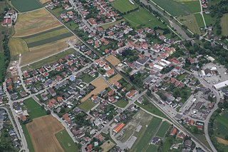
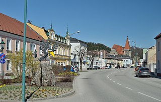
Hofstetten-Grünau is a town in the district of Sankt Pölten-Land in the Austrian state of Lower Austria.
Rabenstein an der Pielach is a municipality in the district of Sankt Pölten-Land in Lower Austria, Austria.

Perschling is a municipality in the district of Sankt Pölten-Land in the Austrian state of Lower Austria.

Karlstein an der Thaya is a municipality and market town in the district of Waidhofen an der Thaya in the Austrian state of Lower Austria.
Ebergassing is a municipality in the district of Bruck an der Leitha in the Austrian state of Lower Austria. It formerly belonged to Wien-Umgebung District which was dissolved at the end of 2016.

Gramatneusiedl is a municipality in the district of Bruck an der Leitha in the Austrian state of Lower Austria.

Himberg bei Wien is a municipality in the district of Bruck an der Leitha in the Austrian state of Lower Austria.

Klein-Neusiedl is a municipality in the district of Bruck an der Leitha in the Austrian state of Lower Austria.

Lanzendorf is a municipality in the district of Bruck an der Leitha in the Austrian state of Lower Austria.

Moosbrunn is a municipality in the district of Bruck an der Leitha in the Austrian state of Lower Austria.

Purkersdorf is a municipality in the district of Sankt Pölten-Land District, in the Austrian state of Lower Austria. The Sandstein-Wienerwald natural park, a part of the Vienna Woods, is situated on its territory. The municipality belonged to Wien-Umgebung District which was dissolved at the end of 2016.
Rauchenwarth is a municipality in the district of Bruck an der Leitha in the Austrian state of Lower Austria. It belonged to Wien-Umgebung District which was dissolved at the end of 2016.

Kennelbach is a community in the district of Bregenz in the westernmost Austrian state of Vorarlberg.

Ulrichsberg is a municipality in the district of Rohrbach in the Austrian state of Upper Austria.
Lichtenberg is a municipality in the district of Urfahr-Umgebung in the Austrian state of Upper Austria.


