
The East Somerset Railway is a 2+1⁄2-mile (4 km) heritage railway in Somerset, running between Cranmore and Mendip Vale. Prior to the Beeching Axe, the railway was once part of the former Cheddar Valley line that ran from Witham to Yatton, meeting the Somerset and Dorset Joint Railway at Wells.

The Wrington Vale Light Railway was a railway from Congresbury on the Cheddar Valley line to Blagdon, and serving villages in the Yeo Valley, North Somerset, England. Construction of the line started in 1897 and it opened in 1901. Never more than a purely local line, it closed to passengers in 1931, and completely in 1963.

Yatton railway station, on the Bristol to Exeter line, is in the village of Yatton in North Somerset, England. It is 12 miles (19 km) west of Bristol Temple Meads railway station, and 130 miles (209 km) from London Paddington. Its three-letter station code is YAT. It was opened in 1841 by the Bristol and Exeter Railway, and served as a junction station for trains to Clevedon and Cheddar, but these lines closed in the 1960s. The station, which has two platforms, is managed by Great Western Railway, the seventh company to be responsible for the station, and the third franchise since privatisation in 1997. They provide all train services at the station, mainly hourly services between Bristol Parkway and Weston-super-Mare, and between Cardiff Central and Taunton.

The Bristol & Exeter Railway (B&ER) was an English railway company formed to connect Bristol and Exeter. It was built on the broad gauge and its engineer was Isambard Kingdom Brunel. It opened in stages between 1841 and 1844. It was allied with the Great Western Railway (GWR), which built its main line between London and Bristol, and in time formed part of a through route between London and Cornwall.
The Cheddar Valley line was a railway line in Somerset, England, running between Yatton and Witham. It was opened in parts: the first section connecting Shepton Mallet to Witham, later extended to Wells, was built by the East Somerset Railway from 1858. Later the Bristol and Exeter Railway built their branch line from Yatton to Wells, but the two lines were prevented for a time from joining up. Eventually the gap was closed, and the line became a simple through line, operated by the Great Western Railway.
The Wilts, Somerset and Weymouth Railway (WS&WR) was an early railway company in south-western England. It obtained Parliamentary powers in 1845 to build a railway from near Chippenham in Wiltshire, southward to Salisbury and Weymouth in Dorset. It opened the first part of the network but found it impossible to raise further money and sold its line to the Great Western Railway (GWR) in 1850.
The Bristol and North Somerset Railway was a railway line in the West of England that connected Bristol with Radstock, through Pensford and further into northern Somerset, to allow access to the Somerset Coalfield. The line ran almost due south from Bristol and was 16 miles (26 km) long.

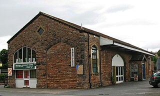
Shepton Mallet was a railway station on the East Somerset Railway, serving the town of Shepton Mallet in the English county of Somerset.

Congresbury railway station was a station located at Congresbury on the Bristol and Exeter Railway's Cheddar Valley line in Somerset and the junction for the Wrington Vale Light Railway to Blagdon.

Sandford and Banwell railway station was a station on the Bristol and Exeter Railway's Cheddar Valley line in Sandford, Somerset, England. The station is a Grade II listed building.

Axbridge railway station was a station on the Bristol and Exeter Railway's Cheddar Valley line in Axbridge, Somerset. Axbridge was one of the principal stations for the transport of strawberries, which led to the line's alternative name as The Strawberry Line.

Draycott railway station was a station on the Bristol and Exeter Railway's Cheddar Valley line in Draycott, Somerset.
Lodge Hill railway station was a station on the Bristol and Exeter Railway's Cheddar Valley line in Somerset, England from 1870 until 1963. The station served the village of Westbury-sub-Mendip, but was not named Westbury because of the potential for confusion with Westbury, Wiltshire.

Wookey railway station was a station on the Bristol and Exeter Railway's Cheddar Valley line in Somerset, England. The site is a 0.04 hectare geological Site of Special Scientific Interest between Wells and Wookey Hole
Wells railway station was the second terminus station on the Bristol and Exeter Railway's Cheddar Valley line in Somerset after the extension from the first terminus at Cheddar was opened. It was the third station on the third railway to reach the city of Wells and proved to be the longest surviving.
Wanstrow railway station was a small station on the East Somerset Railway serving the village of Wanstrow in Somerset.
Wells station in the Somerset city of Wells was the terminus of the East Somerset Railway line from Witham and opened when the line was extended from Shepton Mallet in 1862.

The earliest known infrastructure for transport in Somerset is a series of wooden trackways laid across the Somerset Levels, an area of low-lying marshy ground. To the west of this district lies the Bristol Channel, while the other boundaries of the county of Somerset are along chains of hills that were once exploited for their mineral deposits. These natural features have all influenced the evolution of the transport network. Roads and railways either followed the hills, or needed causeways to cross the Levels. Harbours were developed, rivers improved, and linked to sources of traffic by canals. Railways were constructed throughout the area, influenced by the needs of the city of Bristol, which lies just to the north of Somerset, and to link the ports of the far south-west with the rest of England.

The Reading–Taunton line is a major branch of the Great Western Main Line from which it diverges at Reading railway station. It runs to Cogload Junction where it joins the Bristol to Exeter and Penzance line.
The Yeovil–Taunton line was a railway line in England, built by the Bristol and Exeter Railway (B&ER) to connect its main line with the market town of Yeovil in Somerset. It opened in 1853 using the broad gauge of 7 ft 1⁄4 in and was the first railway to serve Yeovil. It ran from a junction at Durston although in later years passenger trains on the line ran through to and from Taunton where better main and branch line connections could be made.
