Withington, Shropshire

Last updated

Withington
Withington Church - geograph.org.uk - 809876.jpg
St. John the Baptist Church, Withington
Shropshire UK location map.svg
Red pog.svg
Withington
Location within Shropshire
OS grid reference SJ575131
Civil parish
  • Withington
Unitary authority
Ceremonial county
Region
Country England
Sovereign state United Kingdom
Post town SHREWSBURY
Postcode district SY4
Dialling code 01743
Police West Mercia
Fire Shropshire
Ambulance West Midlands
UK Parliament
List of places
UK
England
Shropshire
52°42′47″N2°37′41″W / 52.713°N 2.628°W / 52.713; -2.628

Withington is a village and parish in Shropshire, England.

Contents

The parish is very small (both in area covered and population – 220 people) and is located on the Shropshire Council/Telford and Wrekin Council boundary.

St. John the Baptist Church

St John the Baptist Church, Withington St John the Baptist Church Withington Shropshire.jpg
St John the Baptist Church, Withington

The church in the village today was completely rebuilt in 1874 by G. E. Street, on the site of a much older building. It is built of sandstone with a tiled roof and low stone tower with spire to the west. This tower houses two bells from the 13th and 14th centuries in a frame circa 1800.

Remnants of the furnishings of the earlier church have also survived – the stone reredos depicting the crucifixion, the stone font, stone pulpit, chancel wall and the eagle lectern.

Withington Church is renowned for its 16th century brasses, the oldest has effigies to John Onley, his wife and seven children (1515) The other brass is of Adam Grafton (1530). He was a former vicar of Withington (among many parishes!) and one time chaplain to Edward V and Prince Arthur. [1]

The church contains a wooden war memorial plaque to the two men of the parish who died serving in the First World War and a framed Roll of Honour to those "Belonging to Withington or connected with the parish by ties of family or friendship and who served in His Majesty's Forces" in the same war. [2]

Hare and Hounds public house

The Hare and Hounds is Withington's public house. Located in the centre of the village, the pub serves cooked food on Friday and Saturday evenings as well as a roast at Sunday lunchtimes.[ citation needed ]

History of the village

The following history of Withington, by Mary Macpherson, was first published in the 2003 Withington Parish Plan and updated for the 2008 Parish Plan.

Withington has sat on the sidelines of national history as important events happened nearby, these included the Battle of Shrewsbury at Battlefield and an important civil war siege at High Ercall. It must have seen changes as the Saxon settlement of Wietone, the village in the willows, became part of the lands of the Norman Roger de Montgomery, William I's cousin: later changes brought in land ownership by Haughmond Abbey, the Haughtons, the Corbet and the Tayleur estates. The earliest reference to a church here is 1160.

Little is known about these early times. In the church are brasses, transferred from the previous church, to the memory of John and Johanna Onley and their children. It is believed he was lord of the manor at the old manor at Hunkington. By the choir is a brass to Adam Grafton who was priest of Upton Magna and of the Battlefield College as well as being vicar of Withington. He died in 1530. In the 1480s he was the tutor to the young king Edward V and his brother in Ludlow Castle.

The population of the village was 91 conforming Anglicans over 16 in 1676. That does not allow for any children or members of other denominations but there would have been few of them. Little remains of these times but scattered around the village are eight half-timbered houses, most now beautifully restored and extended, which would have been in existence then. That they have survived and others have been demolished which were in better condition is one of the accidents of history. The blacksmith's shop opposite the pub, featured on postcards in the early years of the 20th century, was demolished in the 1960s. In 1710 a new manor house was built for Illedge and Mary Maddox; following this all future buildings were built in brick. One of the most attractive is the Old Hall, once the vicarage, and before that a gentleman's residence, built in the days of Queen Anne.

Arrival of the canal

Perhaps the biggest change was the coming of the canal, opened in 1797 and used mainly to carry coal from Ketley to Shrewsbury. Coal for Withington was unloaded at a wharf at the Old Post Office as well as farm foodstuffs, oil etc. It traveled alongside the churchyard wall where there was a big pool in front of Church Farm where the boats could turn. There were swing bridges there and by Canal Cottage and humpback bridges over the lanes to Walcot and Rodington where the lanes crossed the canal. Fishermen, skaters and walkers all used the canal and its towpaths. In 1944 the canal was closed and in the 1960s it was offered for sale to the landowners whose land adjoined it but if they did not want it, to the landowner on the other side, by the towpath.

The population of Withington in 1861 was 232; the village boasted a blacksmith, two wheelwrights, a shopkeeper and the landlord of the Hare and Hounds. The vicar's salary was £107 per annum; fortunately the Rev. Halke was a man of means. The majority worked in farming but a few worked on the railway.

After the Great War

A big change came after the First World War when Shropshire County Council bought 400 acres (1.6 km2) of the Manor, bringing its smallholdings scheme to Withington. The original manor was then split into two smallholdings and five new white houses were built for small-holders. There were also three cottage holdings owned by the council. This made the County Council the largest landowner in the village. In 1911 the sale of the Tayleur estate led to changes in the Walcot Lees to Rodington area of Withington. Three farmers operating on a larger scale emerged at this time. The population in 1926 was 235. Again there were craftsmen among the farmers -a blacksmith, a carpenter and a boot and shoe repairer. Village children travelled to Upton Magna or Rodington for state schools but from the 1920s to 1940s there was a small private school in the Shrubbery.

After 1945 for all secondary schools children travelled into Shrewsbury and Wellington but with a limited choice of schools. Children going to private or grammar schools took the train from Walcot or Upton Magna stations whilst pupils at the secondary modern at Harlescott were bused into Shrewsbury. This state of affairs changed with the closing of the stations. As a result of a petition the daily bus service from Shrewsbury to Upton Magna was extended to Withington.

The 1960s and modernisation

Withington remained an agricultural community on this scale until the late 1960s when changes began to occur. The population had become rather elderly, children moved away out of agriculture and, as houses came up for sale, they were bought by people who wanted to live in the country and had the means to modernise them. At the same time agricultural changes meant it was more viable to create bigger holdings. The council began consolidating its holdings into bigger units as tenants retired and later began the process of selling them to the tenants if they wished or to the public. Only two holdings remained in 2003 as council holdings but three former council holdings, which were sold, were still farming.

Services came to Withington slowly. Electricity was pre-Second World War, water in the late 1950s, sewerage in the early 1970s and gas in the early 1990s. These services were a necessary precursor to development. In the 1970s new building took place in gardens along Caernarvon Lane and Sunnyfields was sold to a builder. This eventually resulted in development along Caernarvon Lane. The Woodlands land was sold in the early 1960s and building commenced in Woodlands Close in 1985. The style of houses built reflected the different lifestyles of the new residents and the advances in our expectations. Three Withington house owners had built swimming pools by 1990.

Withington today

Although Withington is a more affluent community than in the 1960s it still retains its village pattern developed around a green central field; this is clearly seen on aerial photos. From the 1960s onwards there were gains and losses in terms of rural life. On the retirement of the last vicar of Withington the parish was joined to the parish of Upton Magna, then to Uffington and is now part of a team ministry. Although these changes work well, it has meant several adjustments for longer stay residents.

In 1982 the shop and post office closed and there have been problems maintaining a bus service to both Shrewsbury and Telford. However, newer residents continue to give new life to the church and take leading roles in it and the wider community through the Parish Council and local societies. They have helped to keep the school open at Upton Magna. The pub, the church and Parish Room still survive and there are local shopping and post office facilities in neighbouring villages.

A major achievement in 2007 was the Parish Council's acquisition of the land in the center of the village to develop into a village green.

Notable people

See also

Related Research Articles

<span class="mw-page-title-main">Newport, Shropshire</span> Human settlement in England

Newport is a market town in the borough of Telford and Wrekin in Shropshire, England. It lies 7 miles (11 km) north-east of Telford town centre, 12 miles (19 km) west of Stafford, and is near the Shropshire-Staffordshire border. The 2001 census recorded 10,814 people living in the town's parish, which rose to 11,387 by the 2011 census.

<span class="mw-page-title-main">Baschurch</span> Large village and civil parish in Shropshire, England

Baschurch is a large village and civil parish in Shropshire, England. It lies in the north of Shropshire. The village had a population of 2,503 as of the 2011 census. Shrewsbury is to the south-east, Oswestry is to the north-west, and Wem is to the north-east of Baschurch. The village is also close to Ruyton-XI-Towns.

<span class="mw-page-title-main">Wem</span> Town in Shropshire founded in the Norman period.

Wem is a market town and civil parish in Shropshire, England, 9 miles (14 km) north of Shrewsbury and 9 miles (14 km) south of Whitchurch.
<span class="mw-page-title-main">Bayston Hill</span> Village and civil parish in Shropshire, England

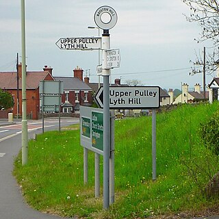
Bayston Hill is a village and civil parish in Shropshire, England. It is 3 miles (5 km) south of the county town Shrewsbury and located on the main A49 road, the Shrewsbury to Hereford road.

High Ercall, also known in the past as Ercall Magna, is a village in the borough of Telford and Wrekin and ceremonial county of Shropshire, England. The civil parish is still called Ercall Magna, and had a total population of 1,679 at the 2001 census, reducing to 1,639 at the 2011 census. The parish includes the villages of Rowton, Ellerdine and Cold Hatton, and a number of hamlets including Cotwall, Osbaston, Poynton and Roden.

<span class="mw-page-title-main">Condover</span> Village and civil parish in Shropshire, England

Condover is a village and civil parish in Shropshire, England. It is about 5 miles (8 km) south of the county town of Shrewsbury, and just east of the A49. The Cound Brook flows through the village on its way from the Stretton Hills to a confluence with the River Severn. Condover is near to the villages of Dorrington, Bayston Hill and Berrington. The population of the Condover parish was estimated as 1,972 for 2008, of which an estimated 659 live in the village of Condover itself. The actual population measured at the 2011 census had fallen to 1,957.

<span class="mw-page-title-main">Upton Magna</span> Human settlement in England

Upton Magna is a village and civil parish in Shropshire, England. Nearby are the villages of Uffington, Rodington and Withington, as well as the wooded Haughmond Hill. The nearest town to Upton Magna is Shrewsbury, just 2.4 miles (3.9 km) to the west.
<span class="mw-page-title-main">Rodington</span> Human settlement in England

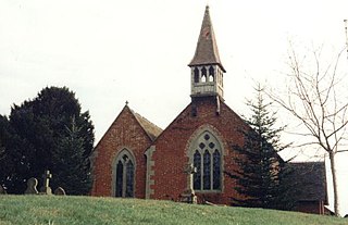
Rodington is a village in Shropshire, England. Situated between the towns of Wellington and Shrewsbury it lies on the relatively level Shropshire plain and just within the borough of Telford & Wrekin.
<span class="mw-page-title-main">Shrewsbury Canal</span> English Canal

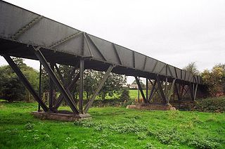
The Shrewsbury Canal was a canal in Shropshire, England. Authorised in 1793, the main line from Trench to Shrewsbury was fully open by 1797, but it remained isolated from the rest of the canal network until 1835, when the Birmingham and Liverpool Junction Canal built the Newport Branch from Norbury Junction to a new junction with the Shrewsbury Canal at Wappenshall. After ownership passed to a series of railway companies, the canal was officially abandoned in 1944; many sections have disappeared, though some bridges and other structures can still be found. There is an active campaign to preserve the remnants of the canal and to restore the Norbury to Shrewsbury line to navigation.

<span class="mw-page-title-main">Longdon-on-Tern</span> Human settlement in England

Longdon-Upon-Tern is a village in east central Shropshire, England. It is in the unitary district of Telford and Wrekin, and is approximately 11 kilometres (6.8 mi) east of Shrewsbury and 11 kilometres (6.8 mi) north-west of Telford. Longdon-Upon-Tern is situated on the River Tern, a tributary of the River Severn.
<span class="mw-page-title-main">Gobowen</span> Human settlement in England

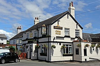
Gobowen is a village in Shropshire, England, about 3 miles north of Oswestry. The population according to the 2011 census was 3,270.

Budbrooke is a village and civil parish in the Warwick district of Warwickshire, England. It is 3 miles west of Warwick and according to the 2001 census the parish had a population of 2,319, reducing to 1,863 at the 2011 Census. Most of the population of Budbrooke live in Hampton Magna, a housing estate built in the late 1960s, with other smaller settlements in Budbrooke Village and Hampton on the Hill.

<span class="mw-page-title-main">Harley, Shropshire</span> Human settlement in England

Harley is a village and civil parish in the English county of Shropshire. The population of the civil parish at the 2011 census was 163.
<span class="mw-page-title-main">Upton Bishop</span> Human settlement in England

Upton Bishop is a small village in Herefordshire, England. The population of the village at the 2011 census was 602.

<span class="mw-page-title-main">Stapleton, Shropshire</span> Human settlement in England

Stapleton is a village and former civil parish, now in the parish of Condover, in Shropshire, England. It neighbours the villages of Exfords Green and Dorrington, and is closely bypassed by the A49. It is near the town of Shrewsbury and near the Shropshire Hills Area of Outstanding Natural Beauty. In Stapleton is an 18th-century church with a cemetery and First World War war memorial site.

<span class="mw-page-title-main">Great Bolas</span> Human settlement in England

Great Bolas, or Bolas Magna, is a small village in rural Shropshire, England. It is situated north-west of Newport, and about eight miles north of Telford. It is part of the civil parish of Waters Upton. It is situated at the confluence of the Tern and the small River Meese. There is a hamlet called Little Bolas a short distance to the west. Another hamlet called Meeson, south of the River Meese, was formerly a separate township of Great Bolas parish.

<span class="mw-page-title-main">Samuel Fisher (died 1681)</span> English Puritan clergyman and ejected minister

Samuel Fisher was an English Puritan clergyman and writer, who was committed to a Presbyterian polity. After serving as a rural rector in Shropshire during the period of Charles I's absolute monarchy, he worked in London and Shrewsbury during the English Civil War and under the Commonwealth and in Cheshire during the Protectorate. After the Great Ejection of 1662 he settled in Birmingham, where he worked as a nonconformist preacher. The precise course of his career is a matter of some controversy.

Rodington is a civil parish in the district of Telford and Wrekin, Shropshire, England. It contains 20 listed buildings that are recorded in the National Heritage List for England. Of these, one is listed at Grade I, the highest of the three grades, two are at Grade II*, the middle grade, and the others are at Grade II, the lowest grade. The parish contains the villages of Rodington and Longdon-on-Tern, and is otherwise rural. The Shrewsbury Canal, now disused, passed through the parish, and a surviving cast iron aqueduct is listed. Most of the other listed buildings are houses and associated structures, cottages, farmhouses and farm buildings, the earliest of which are timber framed. The other listed buildings include a public house, two churches, and two bridges.

Upton Magna is a civil parish in Shropshire, England. It contains 22 listed buildings that are recorded in the National Heritage List for England. Of these, two are listed at Grade II*, the middle of the three grades, and the others are at Grade II, the lowest grade. The parish contains the village of Upton Magna and is otherwise rural. The Shrewsbury Branch of the Shropshire Union Canal ran through the parish. It is now disused but three structures associated with it have been listed, namely a bridge and the entrances to a tunnel. In the village, most of the listed buildings are houses, cottages and associated structures, the earliest of these are timber framed. Also in the village and listed are a church and items in the churchyard. Outside the village, the other listed buildings include farmhouses and associated structures, a house and cottages.

References

  1. Text extracted from the "Saint John the Baptist Church Visitor Guide", written by L. J. Stone and available from the church entrance.
  2. Francis, Peter (2013). Shropshire War Memorials, Sites of Remembrance. Bishop's Castle, YouCaxton. p. 158. ISBN   978-1-909644-11-3.
  3. Baxter, Richard (1696). Sylvester, Matthew (ed.). Reliquae Baxterianae. London: Parkhurst et al. p. 98. Retrieved 6 July 2015.
  4. Page, Thomas Ethelbert (1892). "Kennedy, Rann"  . In Lee, Sidney (ed.). Dictionary of National Biography . Vol. 30. London: Smith, Elder & Co. pp. 433–434.
  5. "Kennedy, Rann". Oxford Dictionary of National Biography (online ed.). Oxford University Press. doi:10.1093/ref:odnb/15390.(Subscription or UK public library membership required.)