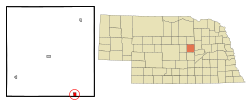
Wolbach, Nebraska

Last updated

Wolbach, Nebraska
Wolbach, Nebraska Center from Kempton 1.JPG
Downtown Wolbach: Center Street
Greeley County Nebraska Incorporated and Unincorporated areas Wolbach Highlighted.svg
Location of Wolbach, Nebraska
Coordinates: 41°24′05″N98°23′39″W / 41.40139°N 98.39417°W / 41.40139; -98.39417
Country United States
State Nebraska
County Greeley
Area
[1]
  Total0.70 sq mi (1.81 km2)
  Land0.69 sq mi (1.78 km2)
  Water0.01 sq mi (0.03 km2)
Elevation
[2]
1,854 ft (565 m)
Population
 (2020)
  Total224
  Density326.53/sq mi (126.07/km2)
Time zone UTC-6 (Central (CST))
  Summer (DST) UTC-5 (CDT)
ZIP code
68882
Area code 308
FIPS code 31-53520 [3]
GNIS feature ID2399726 [2]

Wolbach is a village in Greeley county, Nebraska, United States. [4] (While the community of Wolbach extends south into Howard County, the village limits do not.) The population was 283 at the time of the 2010 census.

Contents

History

Wolbach was established as a town in 1887 when the railroad was extended to that point. [5] It was named for S. N. Wolbach, one of the original owners of the town site. [6] [7]

Geography

According to the United States Census Bureau, the village has a total area of 0.70 square miles (1.81 km2), of which 0.69 square miles (1.79 km2) is land and 0.01 square miles (0.03 km2) is water. [8]

Demographics

Historical population
CensusPop.Note
1910 563
1920 5894.6%
1930 501−14.9%
1940 5234.4%
1950 442−15.5%
1960 382−13.6%
1970 366−4.2%
1980 301−17.8%
1990 280−7.0%
2000 2872.5%
2010 283−1.4%
2020 224−20.8%
U.S. Decennial Census [9]

2010 census

At the 2010 census there were 283 people, 128 households, and 76 families in the village. The population density was 410.1 inhabitants per square mile (158.3/km2). There were 159 housing units at an average density of 230.4 per square mile (89.0/km2). The racial makeup of the village was 97.2% White, 1.1% African American, 0.4% Asian, and 1.4% from two or more races. Hispanic or Latino of any race were 1.1%. [10]

Of the 128 households 26.6% had children under the age of 18 living with them, 51.6% were married couples living together, 5.5% had a female householder with no husband present, 2.3% had a male householder with no wife present, and 40.6% were non-families. 37.5% of households were one person and 20.3% were one person aged 65 or older. The average household size was 2.21 and the average family size was 2.93.

The median age in the village was 45.5 years. 24.4% of residents were under the age of 18; 6.7% were between the ages of 18 and 24; 18.4% were from 25 to 44; 29.3% were from 45 to 64; and 21.2% were 65 or older. The gender makeup of the village was 48.8% male and 51.2% female.

2000 census

At the 2000 census there were 287 people, 128 households, and 77 families in the village. The population density was 421.4 inhabitants per square mile (162.7/km2). There were 140 housing units at an average density of 205.5 per square mile (79.3/km2). The racial makeup of the village was 96.86% White, 2.09% from other races, and 1.05% from two or more races. Hispanic or Latino of any race were 2.09%. [3]

Of the 128 households 30.5% had children under the age of 18 living with them, 49.2% were married couples living together, 10.2% had a female householder with no husband present, and 39.1% were non-families. 37.5% of households were one person and 21.9% were one person aged 65 or older. The average household size was 2.24 and the average family size was 3.00.

The age distribution was 25.4% under the age of 18, 7.0% from 18 to 24, 27.2% from 25 to 44, 17.8% from 45 to 64, and 22.6% 65 or older. The median age was 39 years. For every 100 females, there were 87.6 males. For every 100 females age 18 and over, there were 82.9 males.

The median household income was $25,536, and the median family income was $37,750. Males had a median income of $26,667 versus $16,875 for females. The per capita income for the village was $13,472. About 10.1% of families and 14.7% of the population were below the poverty line, including 23.2% of those under the age of eighteen and 15.6% of those sixty five or over.

See also

Related Research Articles

<span class="mw-page-title-main">Dwight, Nebraska</span> Village in Nebraska, United States

Dwight is a village in Butler County, Nebraska, United States. The population was 204 at the 2010 census.

<span class="mw-page-title-main">Manley, Nebraska</span> Village in Nebraska, United States

Manley is a village in Cass County, Nebraska, United States. The population was 167 at the 2020 census.

<span class="mw-page-title-main">Merriman, Nebraska</span> Village in Nebraska, United States

Merriman is a village in Cherry County, Nebraska. The population was 128 at the time of the 2010 census.

<span class="mw-page-title-main">Richland, Nebraska</span> Village in Nebraska, United States

Richland is a village in Colfax County, Nebraska, United States. The population was 73 at the 2010 census.

<span class="mw-page-title-main">Farnam, Nebraska</span> Village in Nebraska, United States

Farnam is a village in Dawson County, Nebraska, United States. It is part of the Lexington, Nebraska Micropolitan Statistical Area. The population was 171 at the 2010 census.

<span class="mw-page-title-main">Dixon, Nebraska</span> Village in Dixon County, Nebraska, United States

Dixon is a rural village in Dixon County, Nebraska, United States. The population was 87 at the 2010 census. There is a granary at Dixon, a post office, a community center, a small cafe, and a fire and rescue department.

<span class="mw-page-title-main">Waterbury, Nebraska</span> Village in Dixon County, Nebraska, United States

Waterbury is a village in Dixon County, Nebraska, United States. It is part of the Sioux City, IA–NE–SD Metropolitan Statistical Area. The population was 73 at the 2010 census.

<span class="mw-page-title-main">Virginia, Nebraska</span> Village in Nebraska, United States

Virginia is a village in Gage County, Nebraska, United States. The population was 74 at the 2020 census.

<span class="mw-page-title-main">Greeley Center, Nebraska</span> Village in Greeley County, Nebraska, United States

Greeley Center, often shortened to simply Greeley, is a village in and the county seat of Greeley County, Nebraska, United States. The population was 466 at the 2010 census.

<span class="mw-page-title-main">Chambers, Nebraska</span> Village in Nebraska, United States

Chambers is a village in Holt County, Nebraska, United States. The population was 268 at the 2010 census.

<span class="mw-page-title-main">Winnetoon, Nebraska</span> Village in Knox County, Nebraska, United States

Winnetoon is a village in Knox County, Nebraska, United States. The population was 68 at the 2010 census.

<span class="mw-page-title-main">Stapleton, Nebraska</span> Village in and county seat of Logan County, Nebraska, United States

Stapleton is a village in and the county seat of Logan County, Nebraska, United States. The population was 267 at the 2020 census.

<span class="mw-page-title-main">Broadwater, Nebraska</span> Village in Nebraska, United States

Broadwater is a village in Morrill County, Nebraska, United States. The population was 128 at the 2010 census.

<span class="mw-page-title-main">Western, Nebraska</span> Village in Nebraska, United States

Western is a village in Saline County, Nebraska, United States. The population was 224 at the 2020 census.

<span class="mw-page-title-main">Ithaca, Nebraska</span> Village in Saunders County, Nebraska, United States

Ithaca is a village in Saunders County, Nebraska, United States. The population was 160 at the 2020 census.

<span class="mw-page-title-main">Malmo, Nebraska</span> Village in Saunders County, Nebraska, United States

Malmo is a village in Saunders County, Nebraska, United States. The population was 94 at the 2020 census.

<span class="mw-page-title-main">Morse Bluff, Nebraska</span> Village in Saunders County, Nebraska, United States

Morse Bluff is a village in Saunders County, Nebraska, United States. The population was 117 at the 2020 census.

<span class="mw-page-title-main">Weston, Nebraska</span> Village in Saunder County, Nebraska, United States

Weston is a village in Saunders County, Nebraska, United States. The population was 250 at the 2020 census.

<span class="mw-page-title-main">Bartlett, Nebraska</span> Village in and county seat of Wheeler County, Nebraska, United States

Bartlett is a village in, and the county seat of, Wheeler County, Nebraska, United States. The population was 117 at the 2010 census.

<span class="mw-page-title-main">Lushton, Nebraska</span> Village in York County, Nebraska, United States

Lushton is a village in York County, Nebraska, United States. The population was 30 at the 2010 census.

References

  1. "ArcGIS REST Services Directory". United States Census Bureau. Retrieved September 18, 2022.
  2. 1 2 U.S. Geological Survey Geographic Names Information System: Wolbach, Nebraska
  3. 1 2 "U.S. Census website". United States Census Bureau . Retrieved January 31, 2008.
  4. U.S. Geological Survey Geographic Names Information System: Wolbach, Nebraska
  5. "Wolbach, Greeley County". Center for Advanced Land Management Information Technologies. University of Nebraska. Retrieved August 9, 2014.
  6. "Profile for Wolbach, NE". ePodunk . Retrieved August 8, 2014.
  7. Fitzpatrick, Lillian L. (1960). Nebraska Place-Names. University of Nebraska Press. p. 69. ISBN   0-8032-5060-6. A 1925 edition is available for download at University of Nebraska—Lincoln Digital Commons.
  8. "US Gazetteer files 2010". United States Census Bureau . Retrieved June 24, 2012.
  9. "Census of Population and Housing". Census.gov. Retrieved June 4, 2015.
  10. "U.S. Census website". United States Census Bureau . Retrieved June 24, 2012.

Commons-logo.svg Media related to Wolbach, Nebraska at Wikimedia Commons