
Saunderton is a village and former civil parish, now in the parish of Bledlow-cum-Saunderton, Buckinghamshire, England. It is in the Saunderton Valley in the Chiltern Hills. It is 2 miles (3 km) southwest of Princes Risborough, Saunderton Lee, about 2 miles (3 km) further south and a residential area on the A4010 road around Saunderton railway station, it is 5 miles (8 km) northwest of High Wycombe.

Aswarby is a village in the civil parish of Aswarby and Swarby, in the North Kesteven district of Lincolnshire, England. It is 3.5 miles (5.6 km) south of Sleaford and 750 yards (690 m) east of the A15 road, between Sleaford and the point near Threekingham where it crosses the A52 road. In 1921 the parish had a population of 90.

Farleigh Hungerford is a village and former civil parish, now in the parish of Norton St Philip, in the Somerset district, in the ceremonial county of Somerset, England, 9 miles southeast of Bath, 3½ miles west of Trowbridge on A366, between Trowbridge and Radstock in the valley of the River Frome. In 1931 the parish had a population of 98.

Thurgarton is a village and former civil parish, now in the parish of Aldborough and Thurgarton, in the North Norfolk district of the county of Norfolk, England. It lies 6½ miles north of Aylsham and 5½ miles south-west of Cromer, and was once part of the North Erpingham hundred. In 1931 the parish had a population of 186.

Slaughterford is a small village in the civil parish of Biddestone and Slaughterford, about 5 miles (8 km) west of Chippenham, in Wiltshire, England. The village has a crossing point of the Bybrook River, and lies in a wooded valley between Castle Combe and Box. Anciently it was a separate parish.

Saxlingham is a village and former civil parish, now in the parish of Field Dalling, in the North Norfolk district, in the county of Norfolk, England. It lies 13 miles (21 km) west of Cromer, 26 miles (42 km) north-west of Norwich, 3.6 miles (5.8 km) west of the town of Holt and 126 miles (203 km) north-east of London. In 1931 the parish had a population of 122.

Emmington is a village in the civil parish of Chinnor, in the South Oxfordshire district, in the county of Oxfordshire, England. It is about 4.5 miles (7 km) southeast of Thame. In 1931 the parish had a population of 41. On 1 April 1932 the parish was abolished and merged with Chinnor.

East Raynham is a village and former civil parish, now in the parish of Raynham, in the North Norfolk district, in the county of Norfolk, England. It is located on the A1065 some 4 miles (6.4 km) south-west of Fakenham. The River Wensum flows close to the village. The village can trace its origins back and before the Domesday survey of 1086 when it was known as Reinham. Raynham, Massachusetts, took the village's name at its incorporation in 1731 at the time of Charles Townshend, 2nd Viscount Townshend (1674–1738), Leader of the House of Lords. In 1931 the parish had a population of 130.
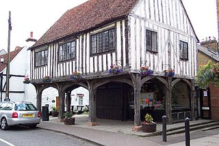
Horndon on the Hill is a village, former civil parish and Church of England parish in the unitary authority of Thurrock, in the county of Essex, England. It is located close to the A13, around one mile northwest of Stanford-le-Hope and around two miles northeast of Orsett. The village area falls within the Orsett ward of Thurrock District Council. In 2019 it had an estimated population of 1517.

East Barsham is a village and former civil parish, now in the parish of Barsham, in the North Norfolk district, in the English county of Norfolk. In 1931 the parish had a population of 144. On 1 April 1935 the parish was abolished to form Barsham.

Sapperton is a village in the civil parish of Braceby and Sapperton, in the South Kesteven district of Lincolnshire, England. The nearest town is Grantham, 6 miles (9.7 km) to the west. Adjacent villages include Braceby, Pickworth and Ropsley. In 1921 the parish had a population of 46. On 1 April 1931 the parish was abolished and merged with Braceby to form "Braceby and Sapperton".

Sharrington is a village and former civil parish, now in the parish of Brinton, in the North Norfolk district, in the county of Norfolk, England. The village is laid out on the southern edge of the A148, 3.5 miles west of Holt. The village is 10 miles east-northeast of the town of Fakenham, 13.4 miles west-southwest of Cromer and 124 miles north-northeast of London. The nearest railway station is at Sheringham for the Bittern Line which runs between Sheringham, Cromer and Norwich. The nearest airport is at Norwich. In 1931 the parish had a population of 195. On 1 April 1935 the parish was abolished and merged with Brinton.

Hunworth is a village and former civil parish, now in the parish of Stody, in the North Norfolk district, in the county of Norfolk, England. The village is 11.5 miles (18.5 km) east-north-east of the town of Fakenham, 12.6 miles (20.3 km) west-south-west of Cromer and 125 miles (201 km) north-north-east of London. The nearest town is Holt which lies 3.4 miles (5.5 km) north of the village. The nearest railway station is at Sheringham for the Bittern Line which runs between Sheringham, Cromer and Norwich. The nearest airport is Norwich International Airport. The village is situated on the road between Holt and Briston. In 1931 the parish had a population of 173.

Cuxwold is a village and former civil parish, now in the parish of Swallow, in the West Lindsey district of Lincolnshire, England. It lies in the Lincolnshire Wolds, 4 miles (6 km) east from Caistor and 10 miles (16 km) south-west from Grimsby. In 1931 the parish had a population of 98. On 1 April 1936 the parish was abolished and merged with Swallow.
Alethorpe is a deserted medieval village site and former civil parish, now in the parish of Little Snoring, in the North Norfolk district, in the county of Norfolk, England. It lies south-east of Little Snoring, around 2 miles (3.2 km) north-east of the town Fakenham and 23 miles (37 km) north-west of Norwich to the north of the A148 road. The village, which is one of around 200 lost settlements in Norfolk, was abandoned in the 16th century, probably as the consequence of the land being enclosed by the landlord of that time. It is occasionally referred to as Althorp in historical literature. In 1931 the parish had a population of 1.
Tibenham is a village and civil parish located in the Depwade district of South Norfolk, England. The parish is 2 miles (3.2 km) north west of Tivetshall railway station. It has a public house called The Greyhound.

Roudham and Larling is a civil parish in the English county of Norfolk. It includes the villages of Roudham and Larling. It covers an area of 15.20 km2 (5.87 sq mi) and had a population of 278 in 119 households at the 2001 census, increasing to a population of 301 in 119 households at the 2011 Census. For the purposes of local government, it falls within the district of Breckland. River Thet flows next to Roudham and Larling.

Letton, a former village civil parish, is now part of the parish of Cranworth, in the Breckland district of Norfolk, England. The settlement is south-east from Shipdham and about 5 miles (8 km) south-west from East Dereham. In 1931 the parish had a population of 83. On 1 April 1935 the parish was abolished and merged with Cranworth.

Limpenhoe is a village and former civil parish, now in the Cantley, Limpenhoe and Southwood, in the Broadland district, in the county of Norfolk, England. It is located on the north bank of the River Yare, between the villages of Cantley and Reedham, 8.2 miles (13.2 km) south-west of Great Yarmouth and 10.8 miles (17.4 km) south-east of Norwich. In 1931 the parish had a population of 156.

West Tofts is a deserted medieval village in the civil parish of Lynford, within the Breckland district, in the county of Norfolk, England. It is within the Stanford Training Area, an army training area. In 1931 the parish had a population of 332. On 1 April 1935 the parish was abolished and merged with Lynford.


