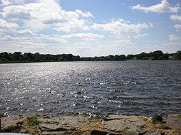
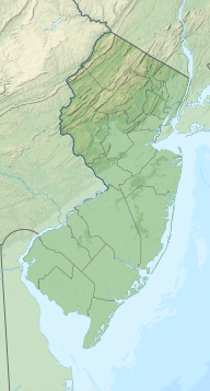
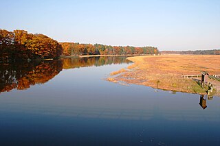
The pond is the center of the Wreck Pond Watershed, which covers about 12 square miles (31km2) in eastern Monmouth County. Its primary feeder streams are Wreck Pond Brook, Hurleys Pond Brook and Hannabrand Brook. Other bodies of water in the watershed include: Hurleys Pond, Osbornes Pond, Albert Pond and Old Mill Pond. It emptied into the Atlantic Ocean through an outfall pipe which regulates the tidal flow in and out of the pond. After Hurricane Sandy, it was discovered that the ocean had restored a natural inlet.[2] An expanded and gated culvert was completed in 2016.[3]
The lower reaches of the pond remain an important spawning ground for anadromous fish species including alewife herrings.
Some of the acres of land surrounding Wreck Pond are under public ownership and are protected from development. Other lands are considered freshwater wetlands and are protected from development by federal and New Jersey laws and regulations. The watershed is part of the South Coast Subwatershed Management Region.
The pond depth has decreased substantially over several years as sediments carried by feeder creeks and increased storm water runoff have settled into it. This has also caused the pond to become choked with fecal coliform bacteria. Much water flowing into the pond from storms causes the pond to flush into the Atlantic Ocean. This, in turn, often causes the closure of ocean beaches in Sea Girt and Spring Lake.
The source of coliform contamination is debated. A recent study conducted by Prof. John Tiedemann of Monmouth University tracked the source of bacterial contaminants in the Wreck Pond Watershed. Tiedemann's group set up and monitored 12 stations throughout the watershed for approximately two years. During this time, they determined that the major source of bacterial coliform contaminants is human waste. These contaminants may be introduced into the waterways via aging sewers, improperly capped septic systems, and illegal sewer connections. Recommendations are being prepared for distribution to municipalities throughout the watershed to assist the governing bodies in remediating problems within their jurisdictions.
The New Jersey Department of Environmental Protection funded a partial dredging of Wreck Pond and the extension of the stormwater runoff pipe about 100 yards (91m) farther into the ocean. While it was hoped this would prevent pollution from affecting beaches in neighboring towns, it has been determined that the effluvium from the pipe still washes up on local beaches. Additionally, Monmouth County has mandated that after a rainfall of 1/4" or more, the beaches are automatically closed.
The Wreck Pond Watershed Preservation Association, a group of residents, environmental activists and government officials interested in preserving Wreck Pond, meets frequently to discuss issues with preserving the area.
Notes
↑ "Wreck Pond". New Jersey Department of Environmental Protection. Archived from the original on January 7, 2017. Retrieved December 30, 2016.
Sea Girt is a borough situated on the Jersey Shore, within Monmouth County, in the U.S. state of New Jersey. As of the 2020 United States census, the borough's population was 1,866, an increase of 38 (+2.1%) from the 2010 census count of 1,828, which in turn had reflected a decline of 320 (−14.9%) from the 2,148 counted in the 2000 census.
Spring Lake is a borough situated on the Jersey Shore in Monmouth County, in the U.S. state of New Jersey. As of the 2020 United States census, the borough's population was 2,789, a decrease of 204 (−6.8%) from the 2010 census count of 2,993, which in turn reflected a decline of 574 (−16.1%) from the 3,567 counted in the 2000 census.
Spring Lake Heights is a borough located in the southern coastal portion of Monmouth County, in the U.S. state of New Jersey. As of the 2020 United States census, the borough's population was 4,890, an increase of 177 (+3.8%) from the 2010 census count of 4,713, which in turn reflected a decline of 514 (−9.8%) from the 5,227 counted in the 2000 census.
Wall Township is a township within Monmouth County, in the U.S. state of New Jersey. Crisscrossed by several different highways within the heart of the Jersey Shore region, the township is a transportation hub of Central New Jersey and a bedroom suburb of New York City, in the New York Metropolitan Area. As of the 2020 United States census, Wall Township's population was 26,525, its highest decennial count ever and an increase of 361 (+1.4%) from the 2010 census count of 26,164, which in turn reflected an increase of 903 (+3.6%) from the 25,261 counted in the 2000 census.
Route 71 is a state highway in New Jersey that runs 16.78 miles (27.00 km) near the shore in Monmouth County. It begins at Route 35 in Brielle just north of the Manasquan River and the Ocean County line and heads north to Route 35 in Eatontown with a four block concurrency with Route 35 in Belmar. Monmouth University is located off Route 71 in West Long Branch.
Water pollution is the contamination of water bodies, usually as a result of human activities, so that it negatively affects its uses. Water bodies include lakes, rivers, oceans, aquifers, reservoirs and groundwater. Water pollution results when contaminants mix with these water bodies. Contaminants can come from one of four main sources: sewage discharges, industrial activities, agricultural activities, and urban runoff including stormwater. Water pollution is either surface water pollution or groundwater pollution. This form of pollution can lead to many problems, such as the degradation of aquatic ecosystems or spreading water-borne diseases when people use polluted water for drinking or irrigation. Another problem is that water pollution reduces the ecosystem services that the water resource would otherwise provide.
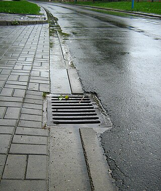
A storm drain, storm sewer, surface water drain/sewer, or stormwater drain is infrastructure designed to drain excess rain and ground water from impervious surfaces such as paved streets, car parks, parking lots, footpaths, sidewalks, and roofs. Storm drains vary in design from small residential dry wells to large municipal systems.
The Jersey Shore is the coastal region of the U.S. state of New Jersey. Geographically, the term encompasses about 141 miles (227 km) of oceanfront bordering the Atlantic Ocean, from Perth Amboy in the north to Cape May Point in the south. The region includes Middlesex, Monmouth, Ocean, Atlantic, and Cape May counties, which are in the central and southern parts of the state. Located in the center of the Northeast Megalopolis, the northern half of the shore region is part of the New York metropolitan area, while the southern half of the shore region is part of the Philadelphia metropolitan area, also known as the Delaware Valley. The Jersey Shore hosts the highest concentration of oceanside boardwalks in the United States.
The Toms River is a 41.7-mile-long (67.1 km) freshwater river and estuary in Ocean County, New Jersey in the United States.
Barnegat Bay is a small brackish arm of the Atlantic Ocean, approximately 42 miles (68 km) long, along the coast of Ocean County, New Jersey in the United States. It is separated from the Atlantic by the long Island Beach State Park, as well as by the north end of Long Beach Island, popular segments of the Jersey Shore. The bay is fed by several small rivers, including the Toms River, the Forked River, the Metedeconk River, Cedar Creek, Oyster Creek, Mill Creek, Westecunk Creek, and Tuckerton Creek, all of which empty into the bay through small estuaries along its inner shore. The communities of Toms River, Silverton, and Forked River sit along the river estuaries on the bay.
The Anacostia River is a river in the Mid Atlantic region of the United States. It flows from Prince George's County in Maryland into Washington, D.C., where it joins with the Washington Channel and ultimately empties into the Potomac River at Buzzard Point. It is about 8.7 miles (14.0 km) long. The name "Anacostia" derives from the area's early history as Nacotchtank, a settlement of Necostan or Anacostan Native Americans on the banks of the Anacostia River.
Cape Cod Bay is a large bay of the Atlantic Ocean adjacent to the U.S. state of Massachusetts. Measuring 604 square miles (1,560 km2) below a line drawn from Brant Rock in Marshfield to Race Point in Provincetown, Massachusetts, it is enclosed by Cape Cod to the south and east, and Plymouth County, Massachusetts, to the west. To the north of Cape Cod Bay lie Massachusetts Bay and the Atlantic Ocean. Cape Cod Bay is the southernmost extremity of the Gulf of Maine. Cape Cod Bay is one of the bays adjacent to Massachusetts that give it the name Bay State. The others are Narragansett Bay, Buzzards Bay, and Massachusetts Bay.
The Manasquan River is a 26.5-mile-long (42.6 km) waterway in central New Jersey.
The Squamscott River is a 6-mile-long (10 km) tidal river in southeastern New Hampshire, in the United States, fed by the Exeter River. The first 33 miles (53 km) of freshwater river from Chester to downtown Exeter is known as the Exeter River, and the subsequent 9 miles (14 km) of saltwater from downtown Exeter to the Great Bay tidal estuary is known as the Squamscott River.
The Shark River is a river in eastern New Jersey that rises in eastern Monmouth County and flows southeast for 11.7 miles (18.8 km), continuing through Neptune Township and Wall Township. The river continues towards the Shark River Inlet, an estuary that feeds into the Atlantic Ocean between Belmar and Avon-by-the-Sea.
The Sea Girt Light is a decommissioned lighthouse marking the inlet leading to the Wreck Pond in Sea Girt, New Jersey, United States. It is located on a stretch of the New Jersey shore between the Barnegat and Navesink lighthouses. It hosted the first radio beacon mounted in a shore installation in the United States.
Great Egg Harbor Bay is a bay between Atlantic and Cape May counties along the southern New Jersey coast. The name derives from Dutch explorer Cornelius Jacobsen May's description of the plentiful birds laying eggs, naming the waters Eyren Haven, which translates to Egg Harbor in English. The bay has a total area of 8.5 sq mi (22 km2). Its depth ranges from shallow waters in the southern extension, called Peck Bay, to a 33 ft (10 m) deep channel.
The members of the New Jersey Legislature are chosen from 40 electoral districts. Each district elects one Senator and two Assemblymen.
Shrewsbury Inlet was an inlet connecting the Shrewsbury River with the Atlantic Ocean in Monmouth County, New Jersey. The inlet is now closed and the Shrewsbury River connects to Sandy Hook Bay.
This page is based on this Wikipedia article Text is available under the CC BY-SA 4.0 license; additional terms may apply. Images, videos and audio are available under their respective licenses.